
MNstorms
-
Posts
446 -
Joined
-
Last visited
Content Type
Profiles
Blogs
Forums
American Weather
Media Demo
Store
Gallery
Everything posted by MNstorms
-
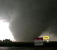
Radar confirmed tornado 20 miles away and I decided not to chase today. 0 CAPE btw. That's why I didn't chase.
-

2025 Short Range Severe Weather Discussion
MNstorms replied to Chicago Storm's topic in Lakes/Ohio Valley
Wow. -
Well then...
-
Summer 2025 Medium/Long Range Discussion
MNstorms replied to Chicago Storm's topic in Lakes/Ohio Valley
Dew points in recent years peak 80F+ in July in Minnesota. -
Summer 2025 Medium/Long Range Discussion
MNstorms replied to Chicago Storm's topic in Lakes/Ohio Valley
Imagine if storms develop in Minnesota on Tuesday. -
Wow! That's crazy.
-
When was the last time the tornado probabilities maxed out?
-
2024 Short/Medium Range Severe Weather Discussion
MNstorms replied to Chicago Storm's topic in Lakes/Ohio Valley
Holy CAPE. 6000 - 8000.This is forecasted for me. I've never seen helicity tracks like this. Meanwhile the HRRR went back to being dry. Derecho? -
Yikes. The rain is starting earlier and harder tonight then first forecasted. This could be the worst flooding event ever here. HRRR went up 2'' in the last 5 runs. The lowest part of the levee is 743'' in Henderson. I can't find anything on other towns along the Minnesota River.
-
I know it's early and it's the overexcited NAM 3k but if this happens or even close it could be the worst flooding ever around here. The rivers are really high from previous rainfalls and forecast don't include the rain tomorrow night and Friday. The record flooding came from just one storm. This is that and more. Current record flooding from September 2010:
-
2024 Short/Medium Range Severe Weather Discussion
MNstorms replied to Chicago Storm's topic in Lakes/Ohio Valley
I'm getting June 17, 2010 vibes 14 years later to the date. -
2024 Short/Medium Range Severe Weather Discussion
MNstorms replied to Chicago Storm's topic in Lakes/Ohio Valley
I was starting to get disappointed today with the early convection runs. I'm hoping this last one isn't a tease. -
What's this white stuff falling from the sky? First actual snowfall of the season. Nothing has lasted more than a day here. Largest snowfall was in October. Beaten tonight.
-
-
This may be the worst start to a winter here since 2006-2007. It didn't snow until January. Only 1.5'' total so far. No snow in sight.
-
Weather.gov showed 92F for max.
-
It's 75F here on an October midnight. I've never seen that before. 75F at midnight in the summer is even rare.
-
2023 Short/Medium Range Severe Weather Discussion
MNstorms replied to Chicago Storm's topic in Lakes/Ohio Valley
HRRR looks hopeful for tomorrow. -
Looked outside as this front went by and there's 100s to 1000s of dragonflies flying about.
-
The GFS is terrible in the Midwest. Every summer it fails to take in humidity from corn sweat and even regular humidity. Last heat wave it showed 40F dew points here. It was 80F. The model is a long term outlook model, not a pinpoint accurate one.
-
94F 81F, 115F heat index today. Probably the seconded highest ever heat index here. 120F back in July 2011.
-
Amazing sounding outside of the cap.
-
After no severe weather warnings all year I actually got 2 today along with brief hail and wind. I thought I was going the whole summer without a good storm for the first time.
-
2023 Short/Medium Range Severe Weather Discussion
MNstorms replied to Chicago Storm's topic in Lakes/Ohio Valley
-
2023 Short/Medium Range Severe Weather Discussion
MNstorms replied to Chicago Storm's topic in Lakes/Ohio Valley
This storm has constant flickering. Seeing probably 5-10 a second. Not sure if I've seen so much lightning.

