jrips27
-
Posts
3,462 -
Joined
-
Last visited
Content Type
Profiles
Blogs
Forums
American Weather
Media Demo
Store
Gallery
Everything posted by jrips27
-
Sheesh that’s a lot of rain
-
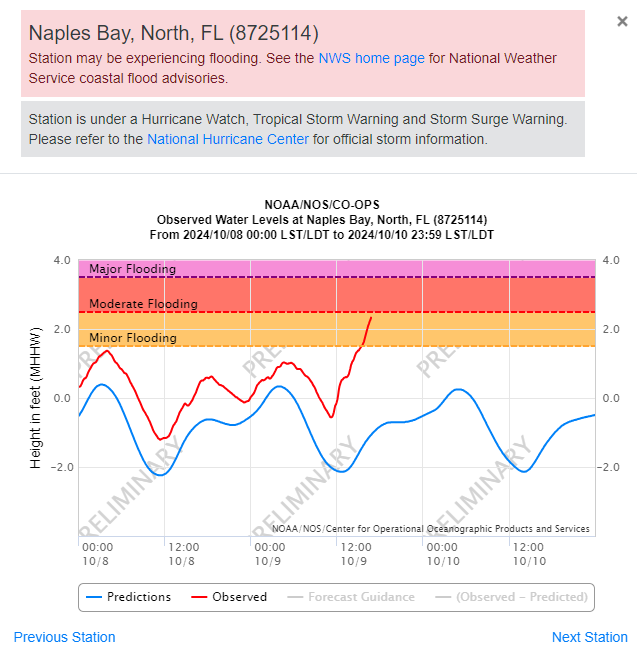
Naples gauge about to go into Moderate flooding
-
-
Beginning, even
-
Eye is begging to show up on Key West radar
-
One to save for the record books
.thumb.png.9480ac5eca77009d807a4c8821cb70b5.png)
-
Should have it in the next 10-20 minutes

-
NHC website appears to be offline momentarily
-
Mandatory viewing from Levi
-
I know we don’t focus on exact track this far out, but this has to be one of the most devastating hypothetical tracks ever put out by NHC
-
Hail in the eyewall https://x.com/mikefischerwx/status/1843258778403377483?s=46
-
7:00 AM CDT Mon Oct 7 Location: 21.8°N 92.2°W Moving: ESE at 8 mph Min pressure: 945 mb Max sustained: 125 mph
-
10:00 PM CDT Sun Oct 6 Location: 22.4°N 93.1°W Moving: E at 7 mph Min pressure: 977 mb Max sustained: 90 mph
-
Definitely looks ahead of schedule
-
Pretty jarring 511 PM EDT Wed Sep 25 2024 ...TROPICAL STORM WARNING IN EFFECT... A Tropical Storm Warning means tropical storm-force winds are expected somewhere within this area within the next 36 hours * LOCATIONS AFFECTED - Atlanta * WIND - LATEST LOCAL FORECAST: Equivalent Strong Tropical Storm force wind - Peak Wind Forecast: 45-60 mph with gusts to 85 mph - Window for Tropical Storm force winds: early Friday morning until Friday afternoon
-
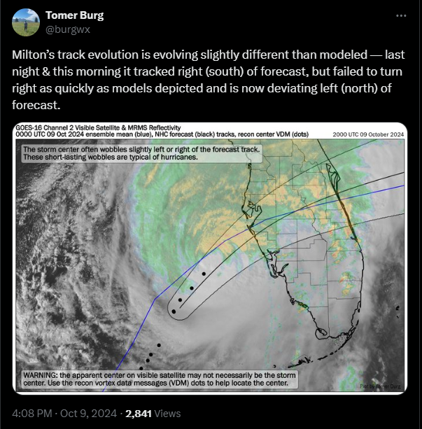
No east shift to my eye
-
The NHC intensity forecast now shows an intensity of 115 kt (Category 4) at 24 hours, which is mirrored by several of the regional hurricane models and the SHIPS guidance. It should be noted that additional strengthening is possible beyond 24 hours before Helene makes landfall Thursday evening.
-
Hey everyone! Just finally logged back in after lurking the past several days. I'm in downtown Atlanta where heavy rain looks like it's really going to start to pile up over the next few hours. Commute home back to the northern suburbs looks pretty miserable. Have tried to get the word out today that people need to be prepared for something possibly extraordinary. Hard to imagine the rain totals NWS FFC is spitting out. There's going to be considerable urban flash flooding downtown as there are parking lots that flood when we get a heavy summer thunderstorm. Agree with most everyone on here that a little shift east would allow Atlanta to avoid the worst case scenario tomorrow night with winds. Stay safe everyone!
-
 https://x.com/lookner/status/1810214777286754638?s=46
 -
https://x.com/nhc_atlantic/status/1810162221357707685?s=46
-
Got some lightning increasing in that northern eyewall. Recon just made a pass through, waiting on the data
-
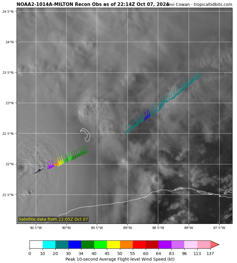
Some hurricane force flight-level winds found well away from the center
-
Already running northeast of the 11am track
-
11pm EST update. Watches extended east


.png.dbf17ef0a007807fe510c622f0e3fb39.png)