LWX updated forecast discussion …
Winter Storm Watches coming shortly South of I66/Rt 50
.SHORT TERM /MONDAY THROUGH TUESDAY NIGHT/...
Benign weather conditions expected Monday as an area of surface high
pressure over the OH Valley slides east across PA/NJ, and into the
western Atlantic. On and off clouds throughout the day, though dry
conditions prevail. Highs in the 40s, with 30s in the mountains.
An active weather pattern ensues for the middle portion of the week
as several waves of low pressure bring wintry precipitation to the
area starting Tuesday.
From a synoptic look, flow aloft remains purely zonal over the
eastern CONUS. The confluence of the northern and southern branch
jet streams will create an impressive jet stream over the OH Valley
to PA/NY/southern New England. Several fast moving waves of low
pressure aloft ride along just south of the jet streak. At the
surface, several associated areas of low pressure move from the Deep
South to the lower Mid-Atlantic, then out to sea.
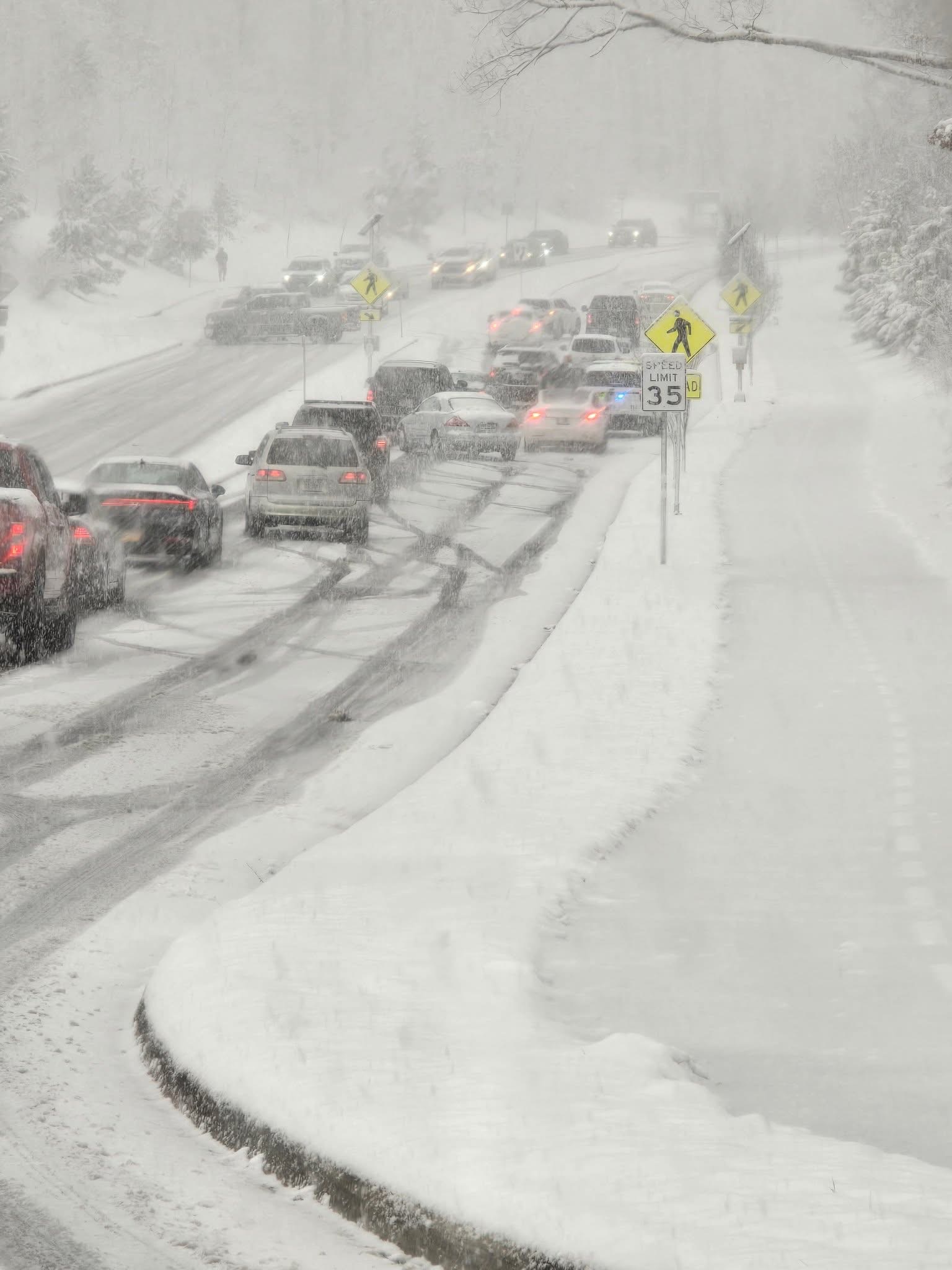
The main concern on Tuesday will be the temperatures, which are
currently forecast to be in the mid to upper 30s. The surface high
to our north falls apart as it moves into the Atlantic, weakening
the source region of cold air into our area. This makes the p-type
forecast tricky for daytime Tuesday. It is possible that snow
struggles to accumulate over most of the area, unless marginal temps
are overcome by high precip rates. This seems most likely along the
I-64 corridor, but model guidance is still uncertain on where the
high precip rates occur Tuesday. Nonetheless, precipitation is
forecast to begin as all snow Tuesday morning over the southwest
CWA, then spread northeast through the afternoon.
Cooling temperatures Tuesday evening into Tuesday night, combined
with steady precipitation, is forecast to produce accumulating snow
across the entire area. Warm air advection aloft along and south of
the surface frontal zone could cause p-type to transition to
freezing rain (possibly mixed with snow) over the central Shenandoah
Valley and parts of Central VA.
Through Tuesday night, the current forecast is for 3-5" of snow,
with higher totals up to 6-7 possible". Where confidence is highest,
a Winter Storm Watch will be issued shortly, along/south of I-66/US-
50. Additional considerations for Watch expansion, and issuances of
Winter Weather Advisories is expected tonight into tomorrow. Stay
tuned to the latest updates at weather.gov/lwx/winter.