JetsPens87
-
Posts
1,105 -
Joined
-
Last visited
Content Type
Profiles
Blogs
Forums
American Weather
Media Demo
Store
Gallery
Everything posted by JetsPens87
-
It's such a deep 500mb system that it's likely if there was a true arctic airmass in place we would have snow in Jan. At the current setup now translated into Jan...still unlikely on the Coastal Plain.
-
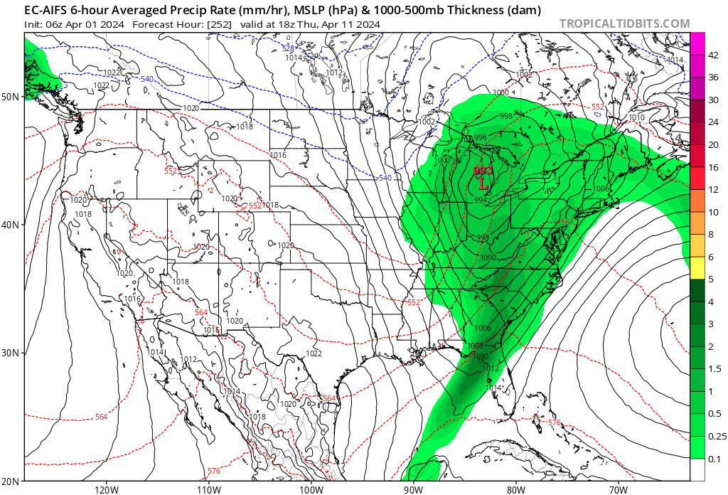
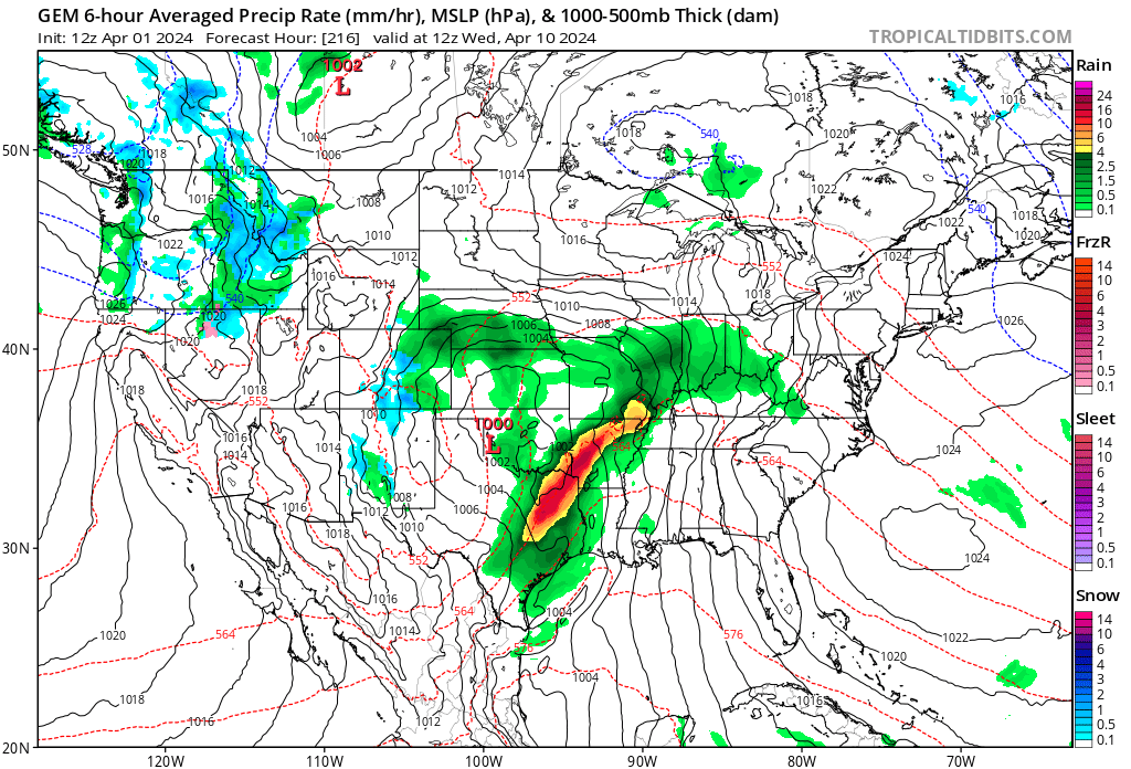
Those CMC runs that showed the fantasy snow over NY metro had the primary as far E as Cleveland. It's winding up over Green Bay. This was recognizable with the models keying in on a stronger WAR (as they had all season long). That primary had no route to come further E at that point...and that's not a recipe for snow around here in January let alone April.
-
Extended summer stormlover74 future snow hole banter thread 23
JetsPens87 replied to BxEngine's topic in New York City Metro
Cohen had gone from a promising owner with some really strong plans to a greedy buffoon with zero strategy other than money grabbing in about 2 seasons. -
Never entertained it once
-
The low level jet underneath the inversion. And...cold temps? Not sure where that comes into play honestly.
-
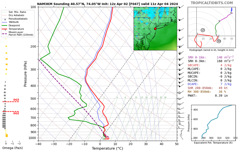
Agreed. The Erly jet is sitting just below that inversion. With the ever increasing convective look we will have to pay attention to how much can we pulled down. I wasn't (and still not entirely) thrilled about the wind potential but like you said despite that inversion there is a jet sitting there.
-
Quite a strong inversion though...
-
The only sub freezing temps are the peaks of the Greens Whites and Daks. The NAM is also quite good at scouring out mid level warm pushes...its having some even in NNE sweating bullets looking at 700mb layer...
-
Extended summer stormlover74 future snow hole banter thread 23
JetsPens87 replied to BxEngine's topic in New York City Metro
2 things here... First is an absolute LOL at him still refusing to give up on BN temps Second is...where is that for and how is March 2012 not first? -
Yup. Nam has quite a strong mid and lower level warm push.
-
Even if it did its white rain. Just because it bombs further south and east doesn't automatically mean snow here.
-
It's time to stop lol
-
Lol come on man even if it did...
-
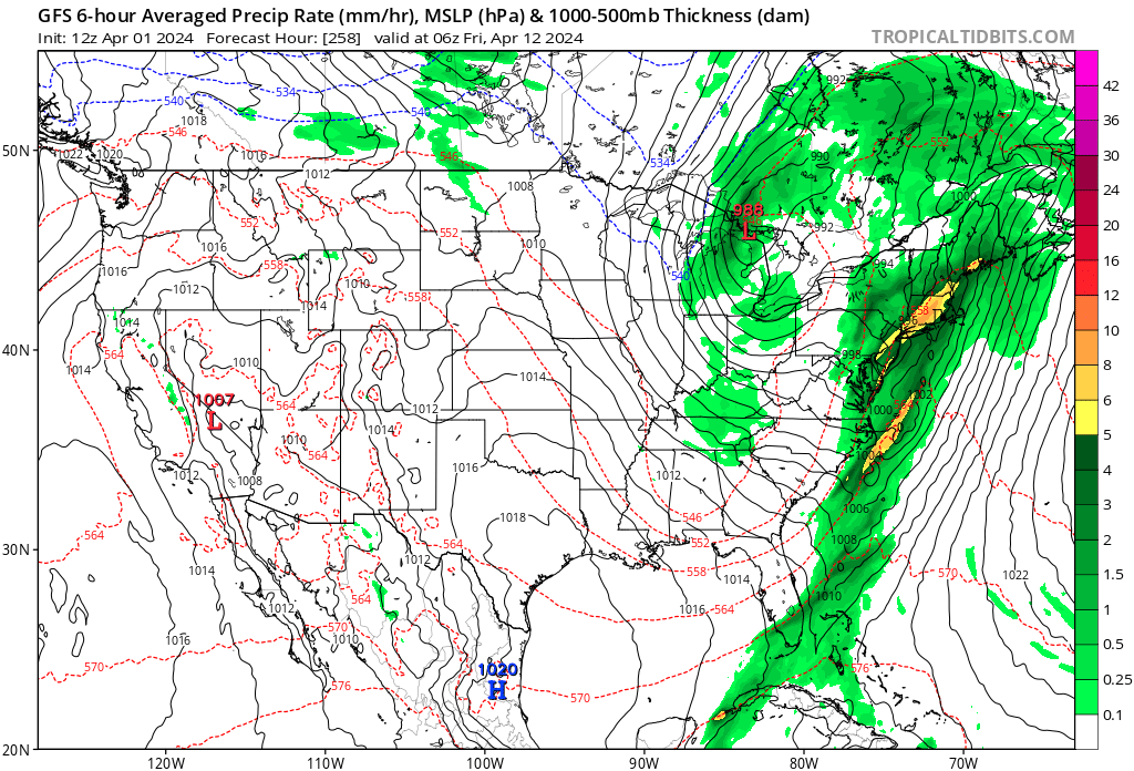
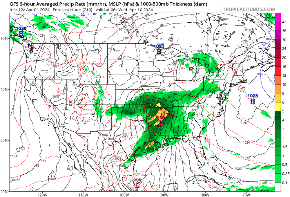
It's waaaaaay out in la la land but some pretty good consensus and signals for a strongish mid lattitude cyclone mid month moving NE from the lower plains. With the anticipated breakdown in blocking and a stronger SE ridge/War signal, it is possible that this is a significant severe weather setup for the central US and quite possibly the Ern seaboard. It's not worth putting details to paper yet but it's likely the first opportunity at a true Springtime severe weather cyclone. As a severe weather enthusiast myself, I'm always looking for that first opprtunity of the season.


-
Unfortunately this IS the storm to end this garbage and misery lol
-
This setup as modeled now wouldn't work in January let alone April
-
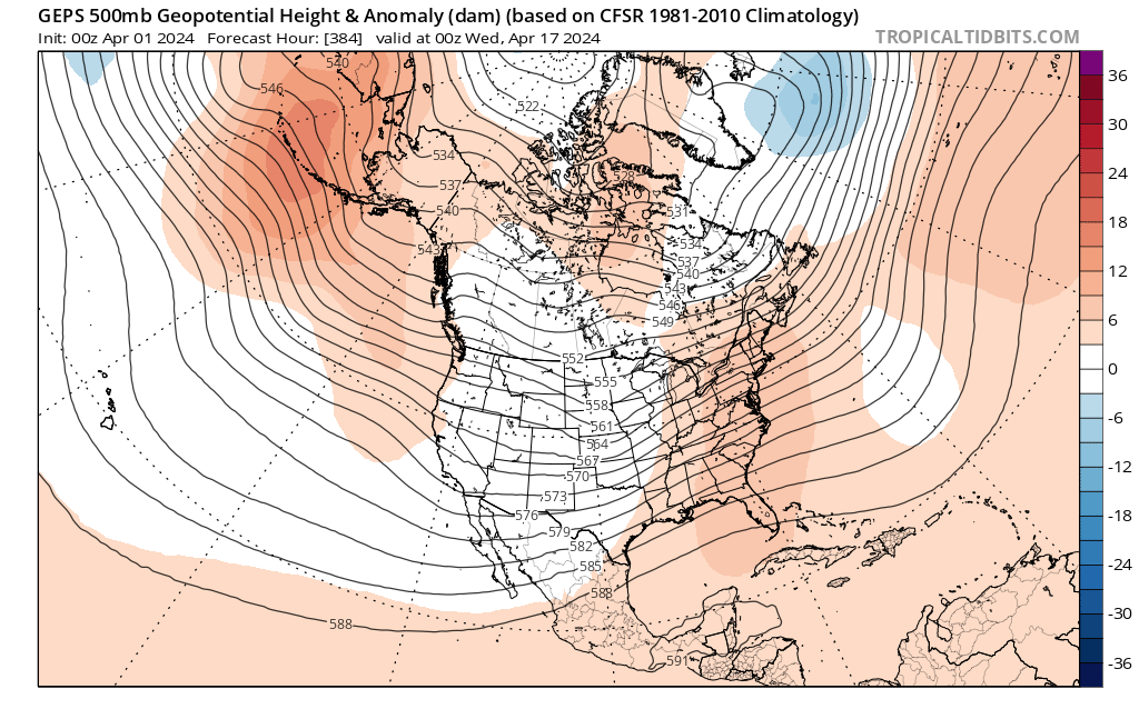
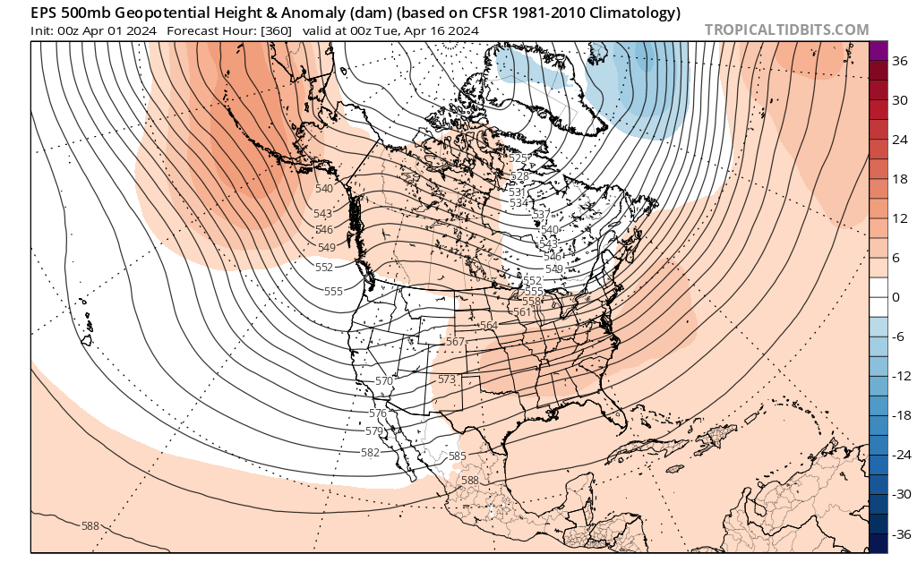
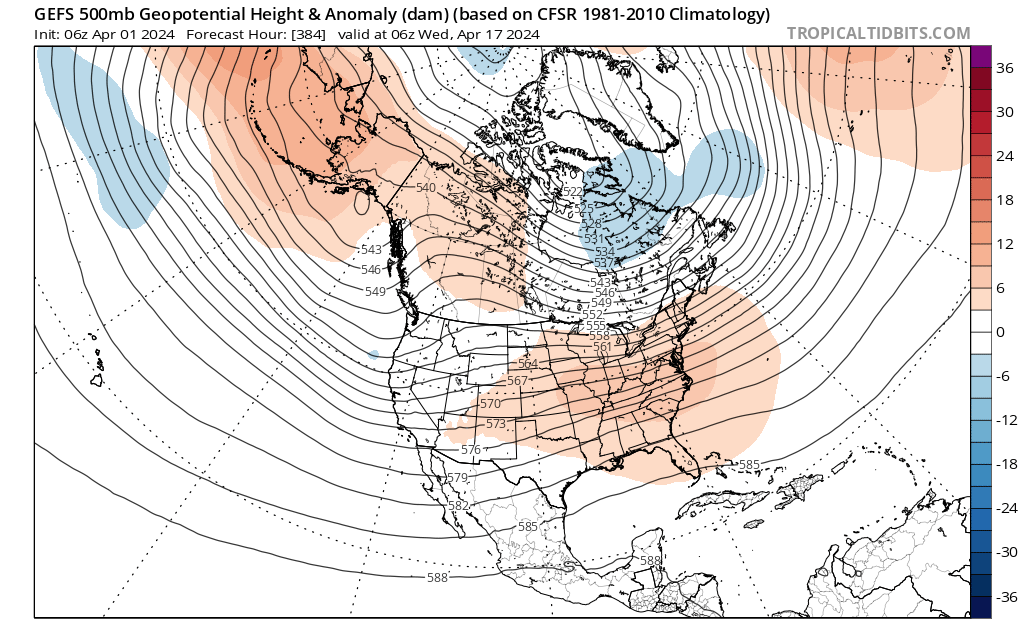
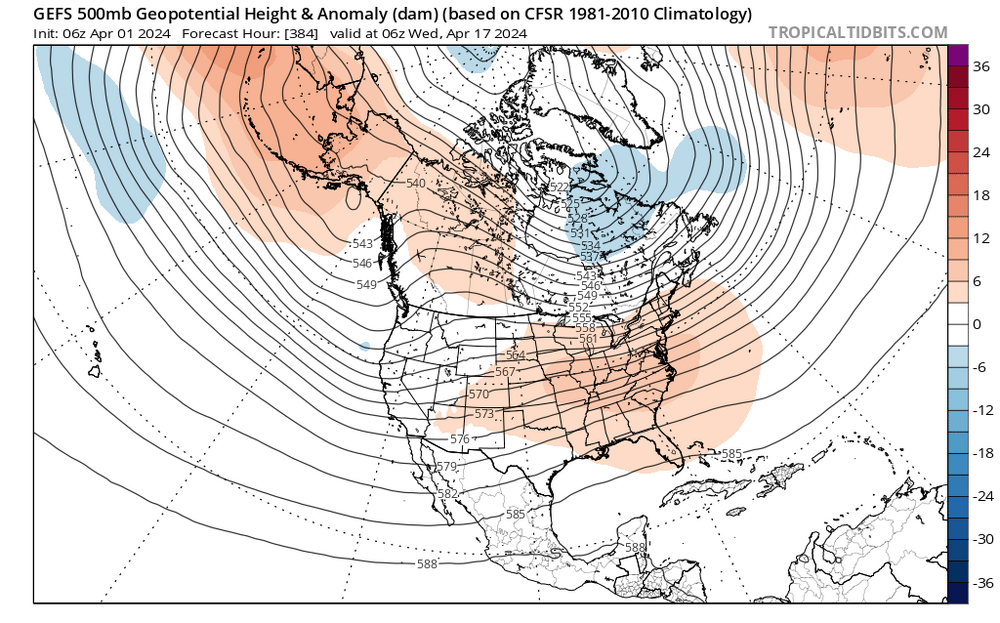
If it's any consolation...beyond this week the ensembles are in near unanimous agreement on a more seasonal and dry pattern evolving as blocking breaks down. While this doesn't look like a torch signal...it is certainly warmer and drier.


-
Good. The new river running through my backyard was getting a little low.
-
Great question but yes it's a combo of both. The PAC directly influences CONUS because our primary airmasses come right off the PAC. The ATL doesn't directly influence Japan because you have a whole continent in between but the ATL certainly influences European weather for instance.
-
Big inversion being shown in the Skew Ts. You'll see that reflected in the 10m Wind products which are not thrilled at all. Though once again there is potential for stronger CAA winds which usually wind up overperforming.
-
Persistent troughing in the SW near Baja has been a big thorn in the side of Ern snowlovers this winter. Anytime you have that feature there you should expect a more potent SE ridge. The case is no different with this storm. Ill also mention it's worth noting that since the EPO regime of years ago...another problem has been consistent energy coming into the PAC NW/swrn Canada which has consistently allowed the PNA ridge to rollover almost trapping the Baja trough underneath. What it boils down to is that I've always been a believer of PAC over ATL. If your PAC is crap the ATL will respond in kind despite an anomalous NAO episode.
-
I disagree based on recent model performances. Back on the day...absolutely But if we're going the Gung ho route then sure you can do it without much model guidance to begin with. If you want a smarter look at what the models are thinking then blending works.
-
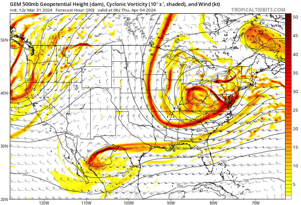
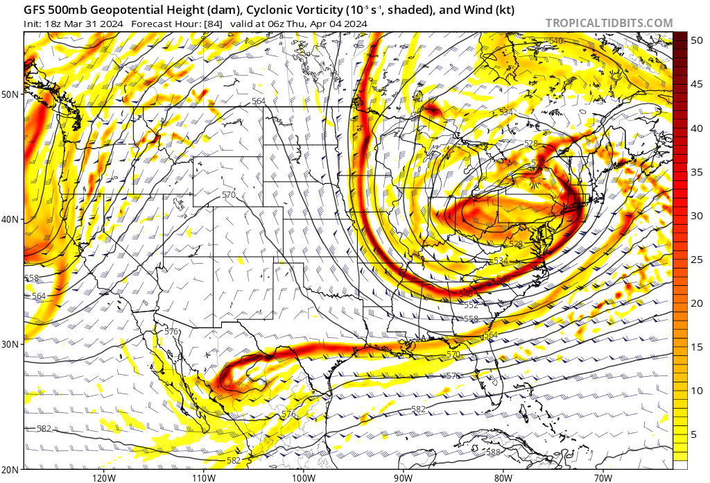
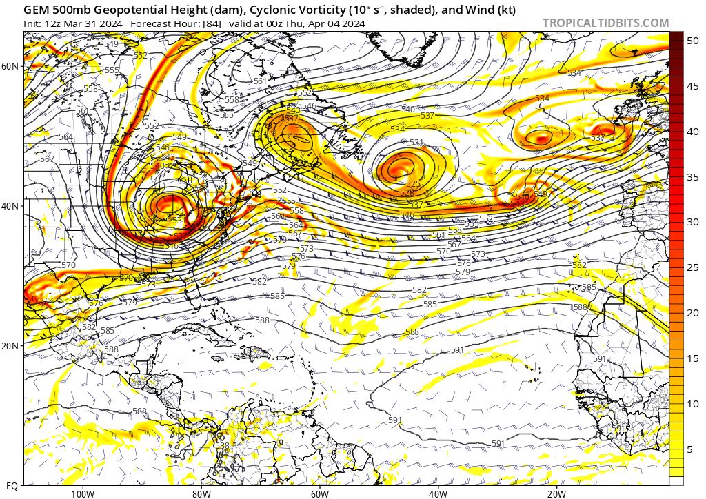
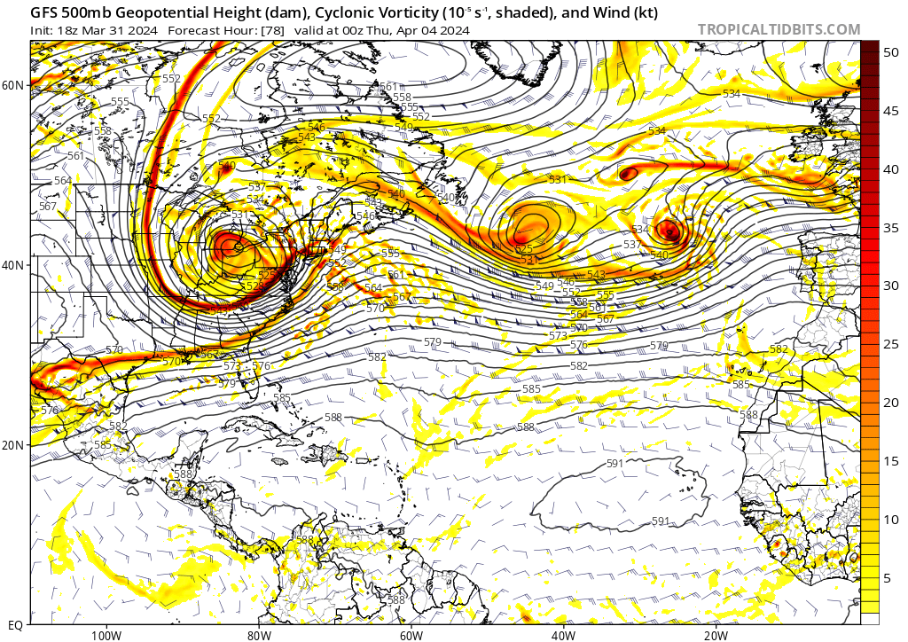
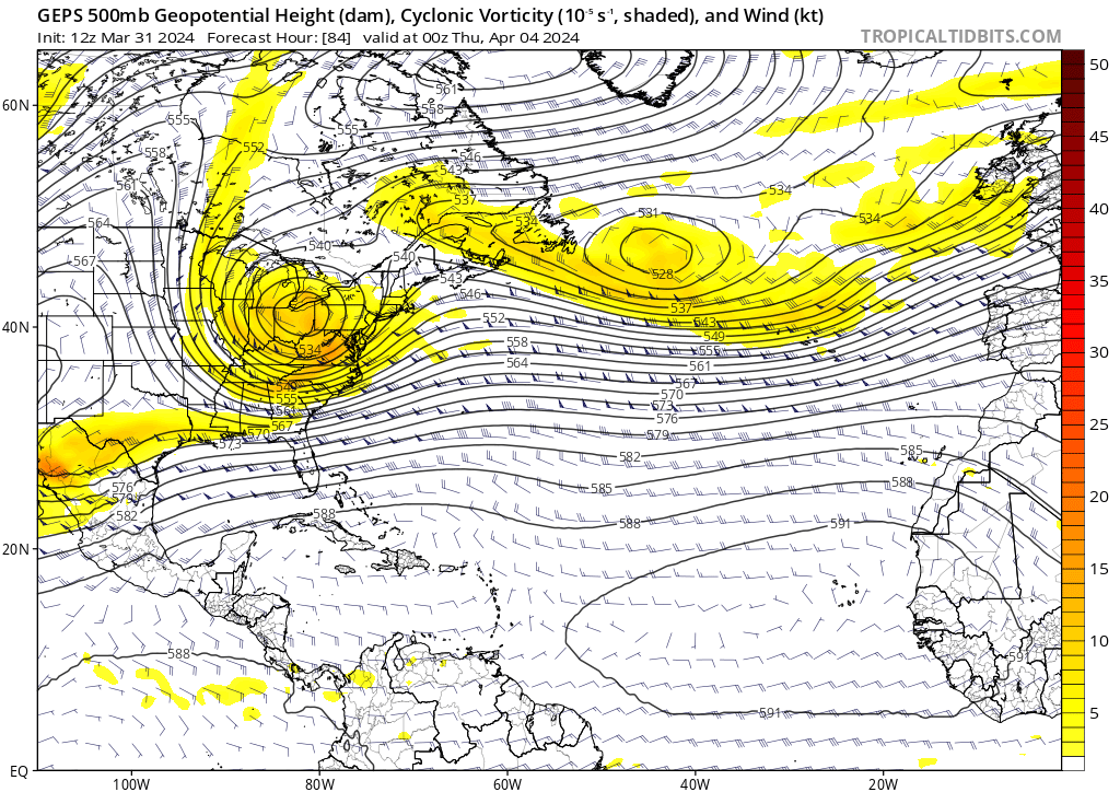
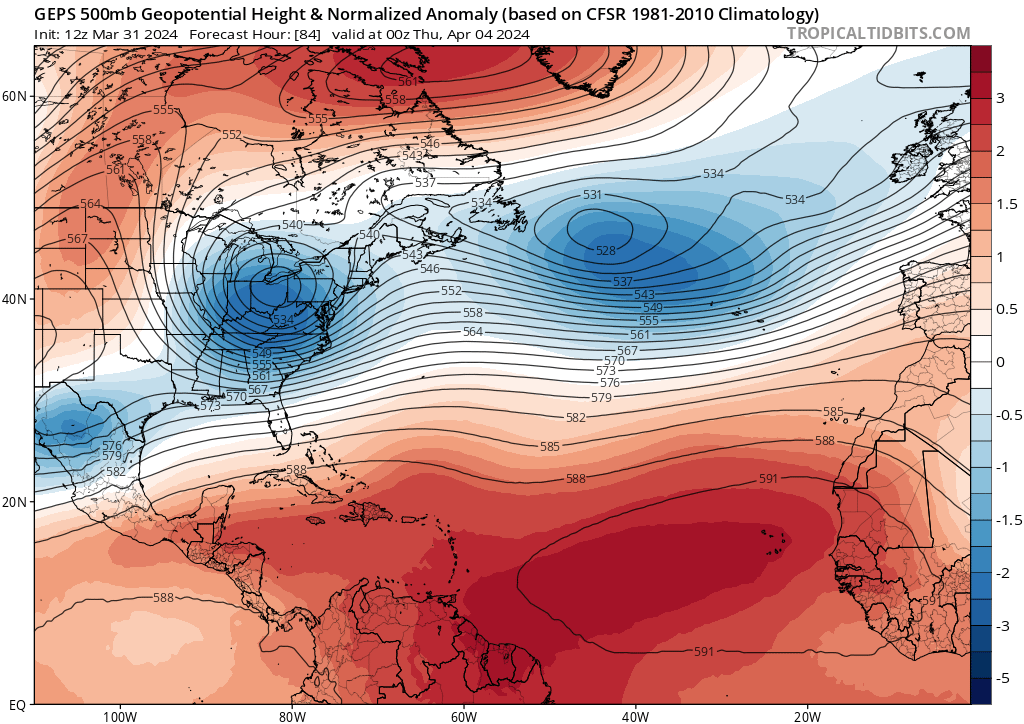
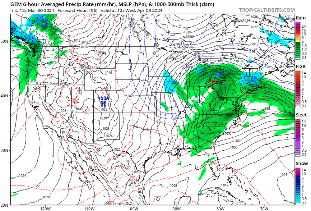
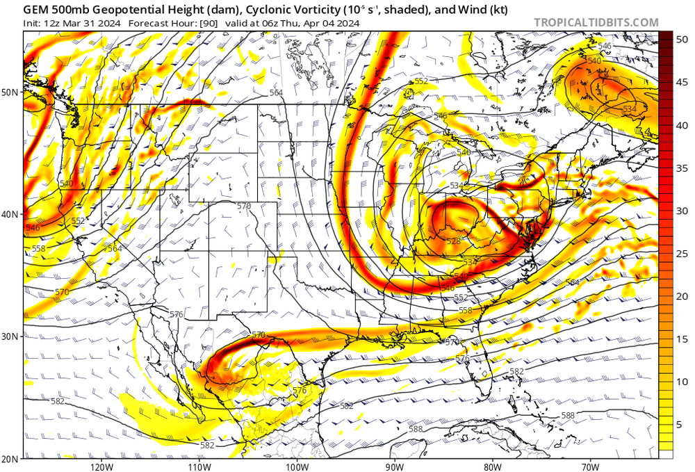
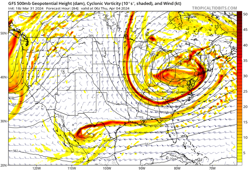
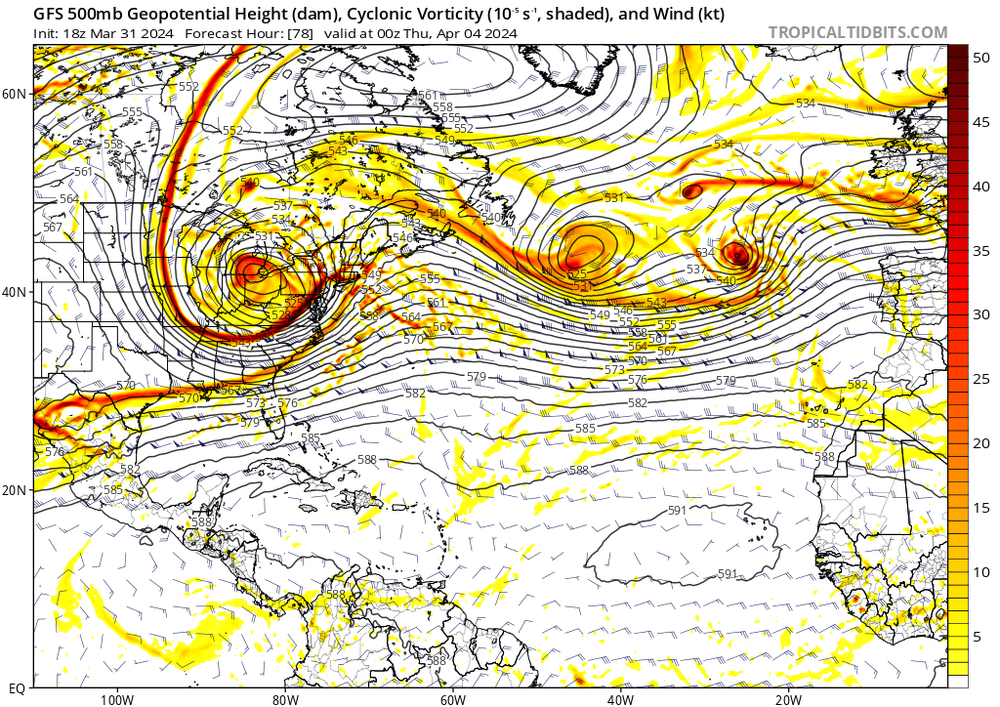
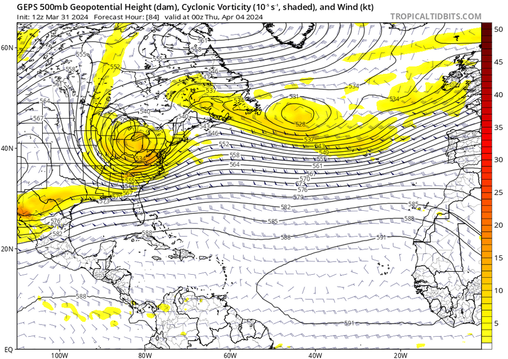
An interesting piece in why the CMC and GFS are so different... Note the distinct lobe over Maine that exists on the CMC (and ironically the also Srn RGEM). This piece gets absorbed on the GFS and stays in tact on the CMC. Keeping that piece intact flattens the WAR a bit and consequential the block is allowed to act upon the primary driving it to a transfer quicker than the GFS which has a stronger WAR. It's an interesting battle to watch as the model runs keep coming in. Its an anomalous blocking episode vs the pattern of a stronger WAR. I'd wager somewhere in between at this juncture. That's because even though yes the ensembles are smoothing this piece a bit by nature, it's noteworthy that the GEPS themselves aren't nearly as pronounced with that lobe of energy. In that regard the GEPS and GEFS handle the Wrn Atlantic situation quite similarly so one must then reasonably come in with a surface prediction somewhere in between.

-
It's not the worst model but I don't see it as a leading tool. These days the only option is a blend of everything and especially favoring ensembles.
-
Yes but much more humid days.