JetsPens87
-
Posts
1,105 -
Joined
-
Last visited
Content Type
Profiles
Blogs
Forums
American Weather
Media Demo
Store
Gallery
Everything posted by JetsPens87
-
 X 100
X 100 -
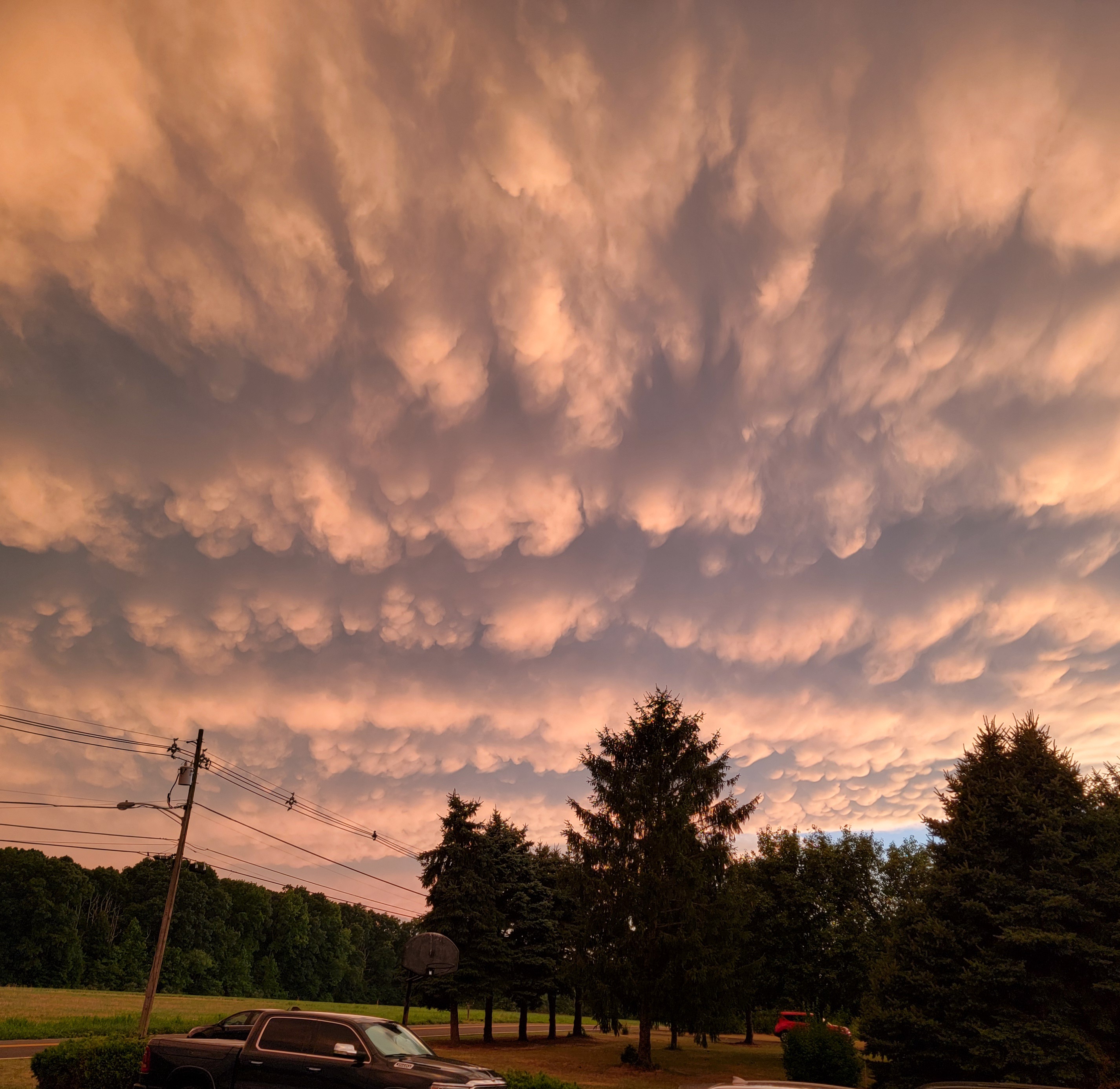
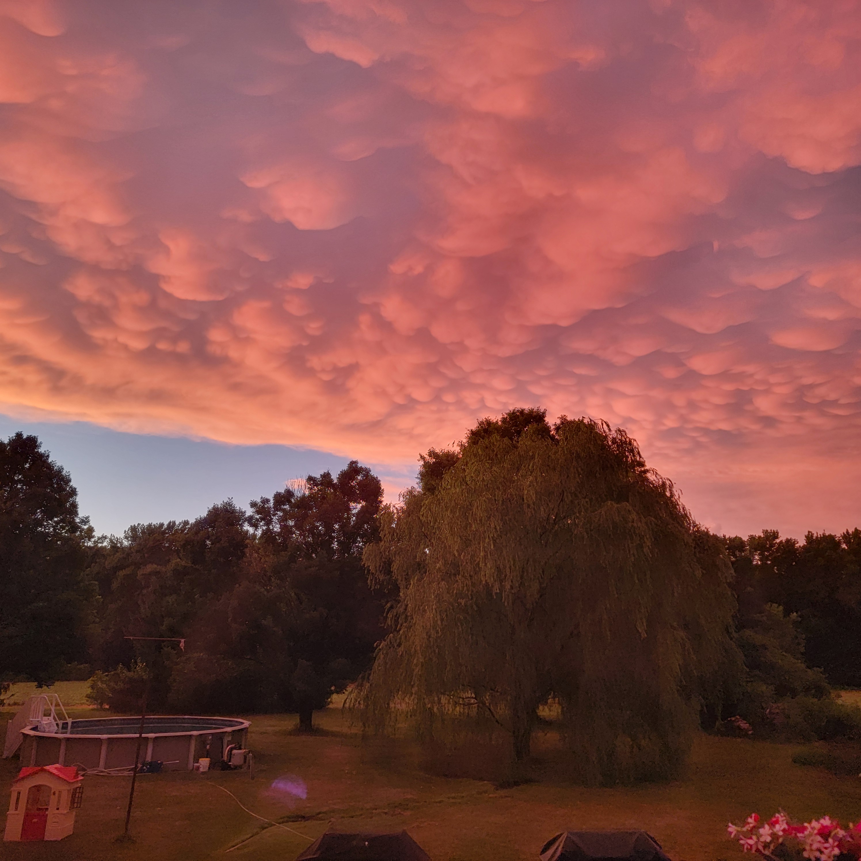
Good luck all Total accums ceiling step back slightly but general 2 to 5 across the board with 6 plus (if it's gonna be anywhere) NWNJ into New England. Fast moving storm. Banding dependent. Think highest accums will follow where initial axis of snow is setting up now. Possible second maxima S and E of 95 with coastal development. Screw area if any could be along and just NW of 95 (still 2 to 3) with squeeze in between initial finger and coastal banding later. Models playing around with this and that's a nowcast but just alerting.
-
Freezing fog here
-
This is solid and in line with my thinking though 12z suite gives higher confidence in higher ceiling along 95 and SE. I like the fresh bleed of true arctic air (notably the coldest in years) approaching in conjunction with a potent developing coastal. 850 fronto lines CNJ NWNJ 700 fronto lines NWNJ Poconos. Overlap area of those to from CNJ to NWNJ makes for 6 plus potential.
-
It's coming
-
Extended summer stormlover74 future snow hole banter thread 23
JetsPens87 replied to BxEngine's topic in New York City Metro
It's been one of the hottest summers on record here. -
Little cell. Deluge On and off rain all day here so far.
-
Slow moving front as @bluewave called out butted up against record WAR was an easy recipe for this.
-
Wouldn't be surprised to see some training convection in this instance
-
I mean if even JB is going above normal then you pretty much know lol...
-
Virtually every signal headed into this summer pointed to a well above normal season with extended and frequent big heat. To forecast against that was....risky...
-
WAR driven pattern with trough through MW funnels HHH conditions right up to us. It's not 100 degree weather but it is consistent upper 80s into 90s and high dews throughout. Along with that comes numerous thunderstorm chances.
-
Thanks for the thorough analysis Virtually every piece of guidance disagrees with you
-
Why are you so creepy
-
If the timing was earlier in the day this would have been a great event.
-
This is very true
-
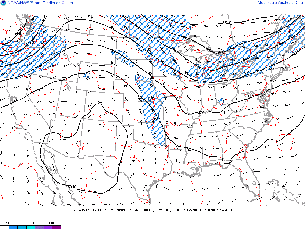
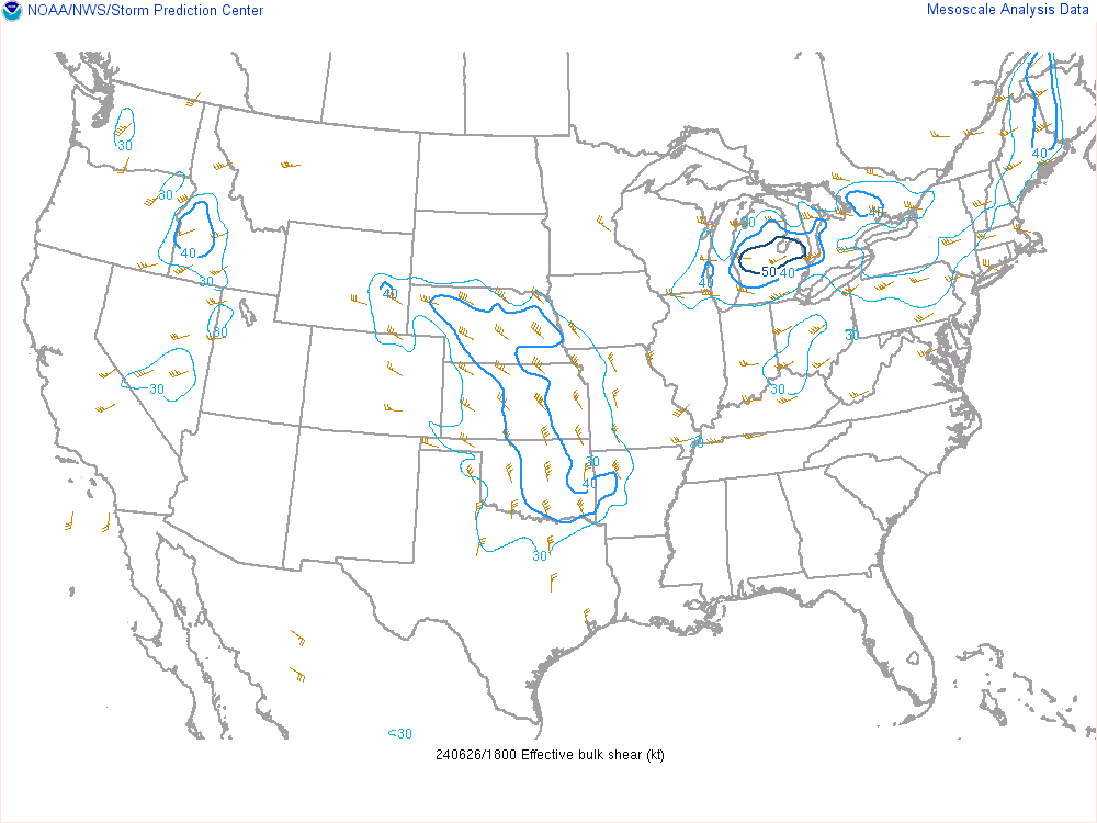
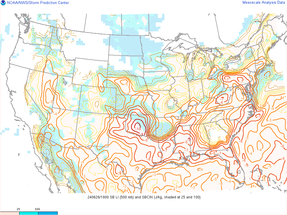
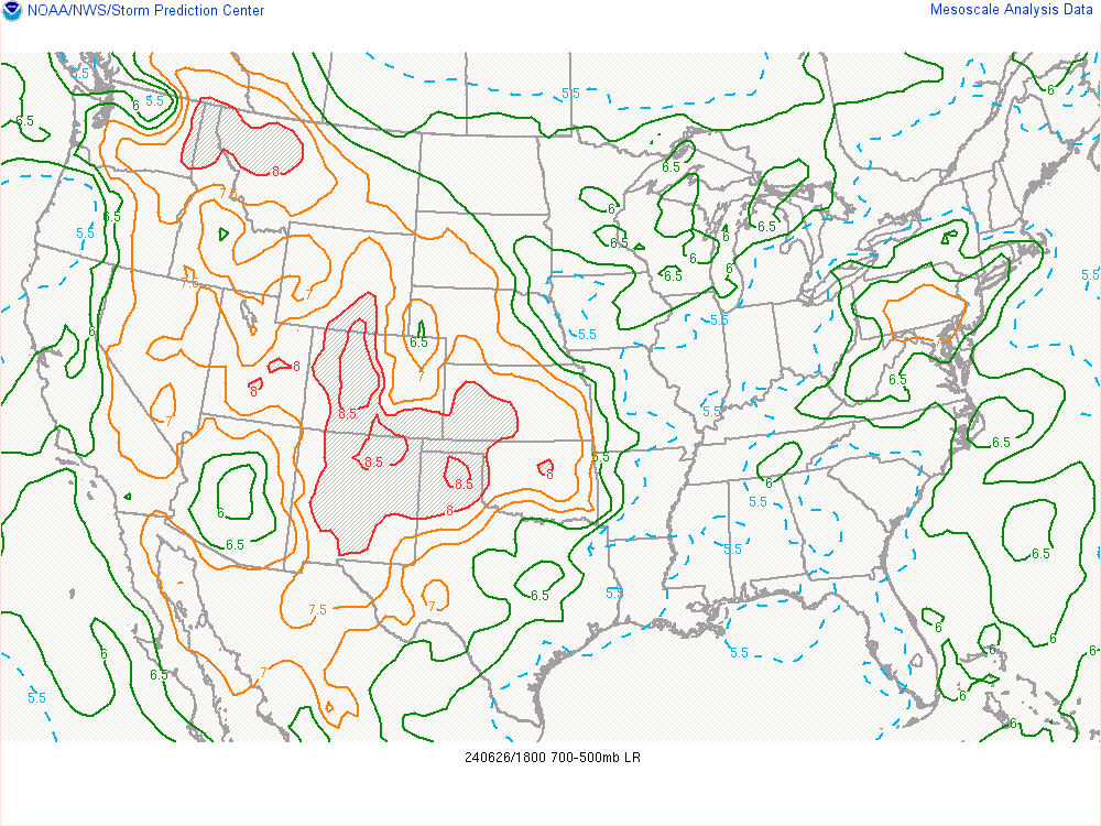
Perhaps the most clustered action will be N of here as the storms fire along the front and primarily look to march E driven by weak/moderate steering. However...I'd be careful to totally dismiss the action further S where we should see some individual cells and less overall/but perhaps stronger storms where you have more favorable lift and steeper mid level lapse rates. The only drawback is there's just not much of a trigger with the light shear. Of course timing will play a role in strength of any storms here as well....and that unfortunately isn't on our side if the lapse rates/Cape etc. begin to diminish later on.
-
Sheesh! 33 days a year average last 10 years? Crazy.
-
Wow 9 days already...7 of those in a row. Impressive for June. I'm assuming that Monday 90 was the first 90 of the season?
-
All your posts are off topic hoodie boy. Get over it.
-
Yet another 90 at NYC
-
You didn't even think this one would happen. Please stop.
-
It's embarrassing honestly
-
This is wrong