It's Always Sunny
-
Posts
1,945 -
Joined
-
Last visited
Content Type
Profiles
Blogs
Forums
American Weather
Media Demo
Store
Gallery
Everything posted by It's Always Sunny
-

Dec 5/6th major coastal/ west Atlantic cyclogenesis ...?
It's Always Sunny replied to Typhoon Tip's topic in New England
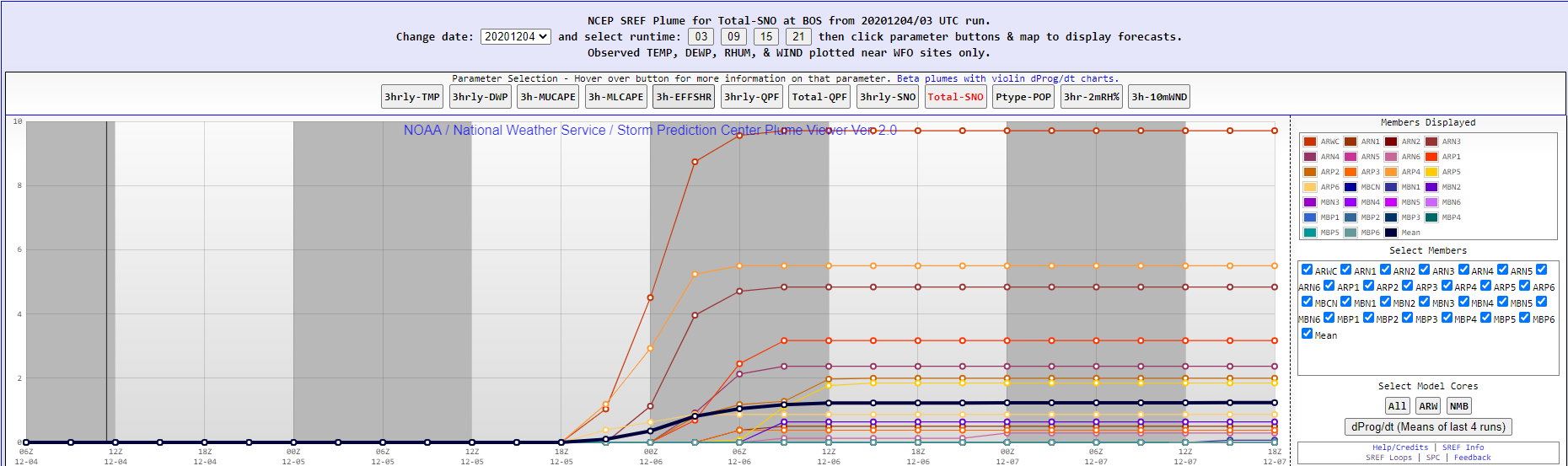
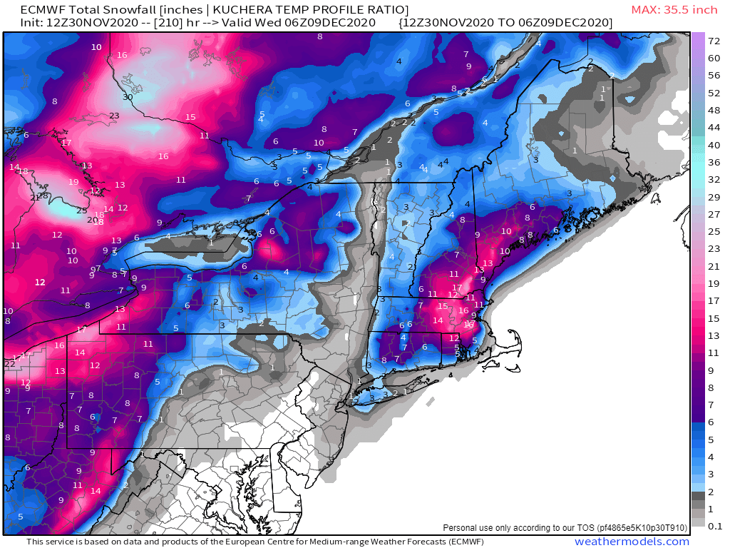
I think 2" could be well underdone. All models have them getting between 1.25-1.50" liquid when it potentially flips to snow. Valley could be warmer but GFS is the only one keeping them above mid-30's at this point. And if they band then evap cooling will do the rest. Idk I see bust potential there. I think 3-6" is more realistic imo. Just curious to see what others think. -
Dec 5/6th major coastal/ west Atlantic cyclogenesis ...?
It's Always Sunny replied to Typhoon Tip's topic in New England
Anyone else think NWS is underdoing BDL? -
Dec 5/6th major coastal/ west Atlantic cyclogenesis ...?
It's Always Sunny replied to Typhoon Tip's topic in New England
03Z run but what a spread...
-
Dec 5/6th major coastal/ west Atlantic cyclogenesis ...?
It's Always Sunny replied to Typhoon Tip's topic in New England
May come down strength/speed of mid-level s/w over TN Valley. NAM more progressive with it which allows it to phase with nrn stream while GFS spins its wheels and misses that train.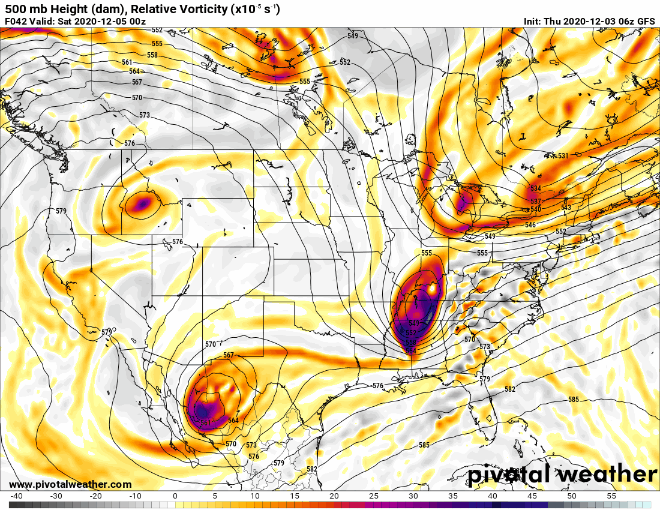
-
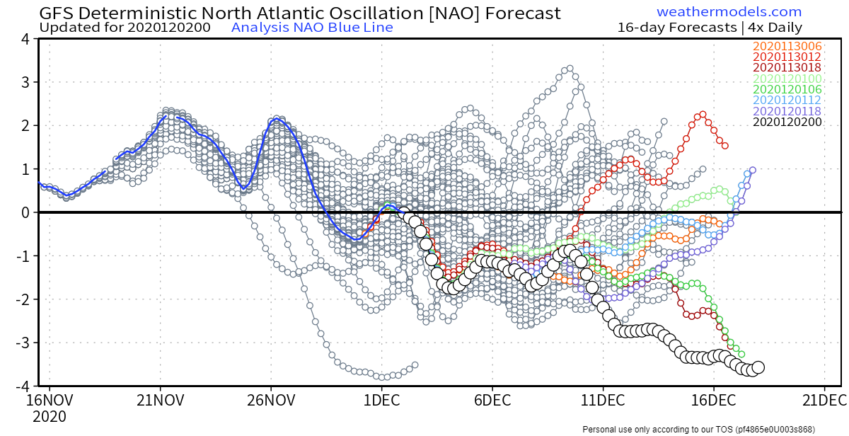
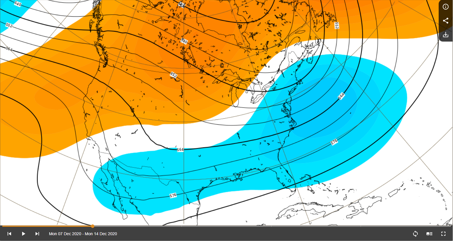
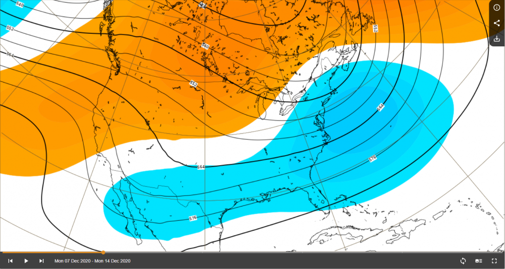
Otoh, NAO goes all Ying-Tang Twin mid-month which is good to see for the latter half of the month.

-
Tough break for SNEers with this weekend's upcoming storm. Ridging out west is usually welcomed but in my personal opinion it's almost too much (amplified). It's to the point where it breaks anticyclonically and "pinches off" the mid level low currently over TX Panhandle, preventing it to dig further south which is what needs to happen at this point to get any sort of favorable track to get that cold air to fill in NW of the surface low. I was looking even beyond that and around Dec.13-14th timeframe another massive low develops but it's behind the remnants of a deteriorated Rex Block which slides east and gives ya'll a cutter. You'll need the umbrella more than the shovel. I'm not completely throwing in the towel on these two events for SNE yet but definitely concerned about the synoptic setup. I may end up with more snow than some of you up there
-
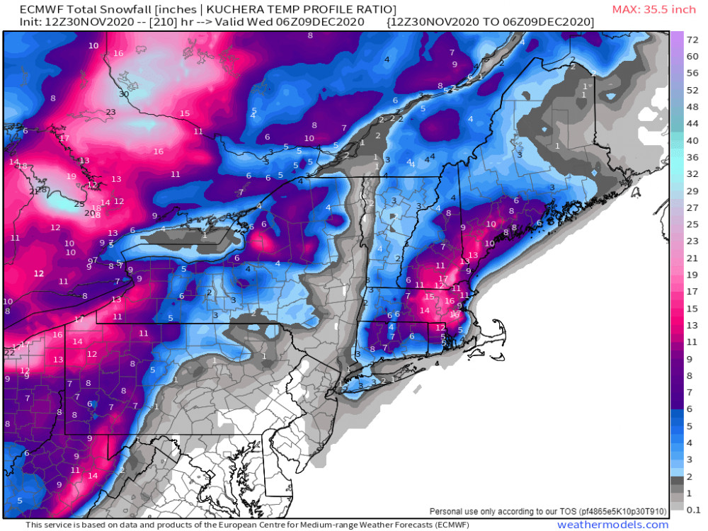
FWIW 00Z EPS has higher snowfall for upstate NY, nrn VT, nrn NH, and far nrn ME compared to 12Z. GEFS solution still on low end for areas mentioned.
-
00Z Euro is better for nrn NH
-
I even think Dec.9 coastal has a chance to tick further west that s/w tugging it south and east appears a bit wonky.
-
Yeah 00Z GFS looks much better for nrn NH....much further east with LP.
-
He gone.
-
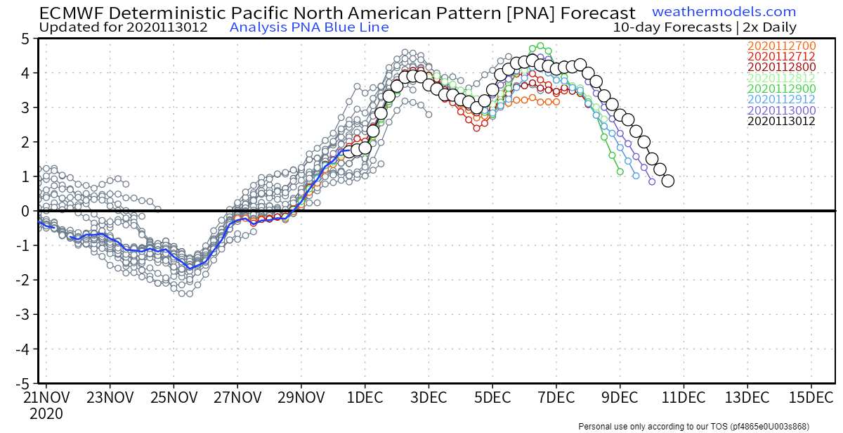
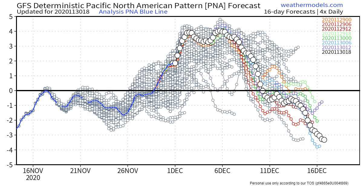
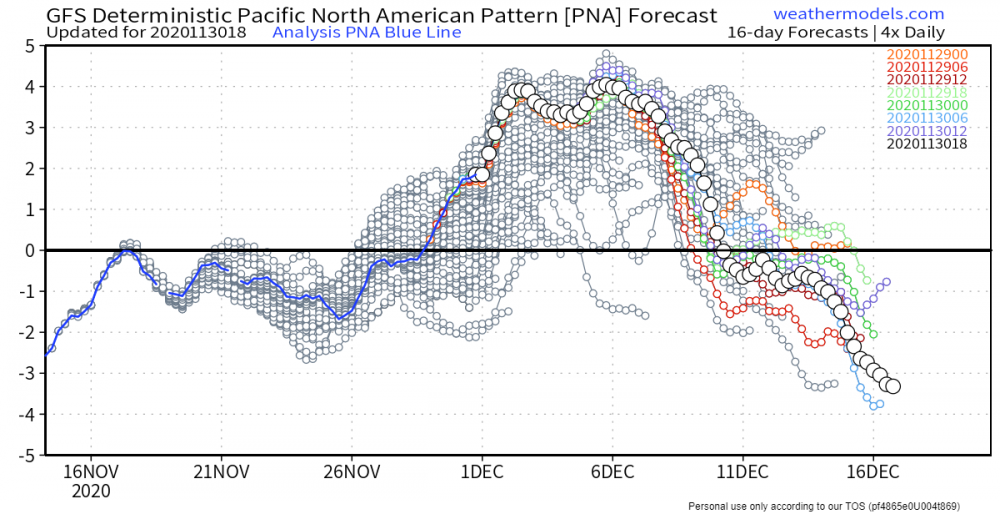
Absolute needle in chest PNA outlook through first couple weeks of December which bodes well. NAO also looks to continue its negative trend which is good.

-
They completely nuked but still held onto snow for that long. Impressive. 21F increase since 1pm ET lol
-
That and I was thinking it could depend on how far out ahead rain bands are in relation to strongest pressure gradients or anything katafrontal where stronger winds generally occur after precip has passed.
-
Really rooting for you guys up that way. Those along 495 & Worcester Hills have potential to do really well if this were to materialize. EPS members still have large spread so keeping expectations in check but synoptic pattern is there for sure.
-
Lock it in.
-
Blue Hill (MQE) gusted SSE 83 mph at 4:40 PM...dang
-
Starting to see some pictures of likely tornadic damage there. Love Field was under a tornado warning for some time too but no tornado (thankfully).
-
Curious to see the westward extent of that band. I think the NAM is on the high end but I think areas that do get banding could definitely see 5"+.
-
Even with resultant east coast troughing still showing cutters. Has potential though...
-
Euro not so much. Upper level jet face plants over the west coast lol
-
Lol just trying to reel in a few snow weenies on the edge.
-
A new hope:
-
November 2020 General Discussion
It's Always Sunny replied to SchaumburgStormer's topic in Lakes/Ohio Valley
Just wow...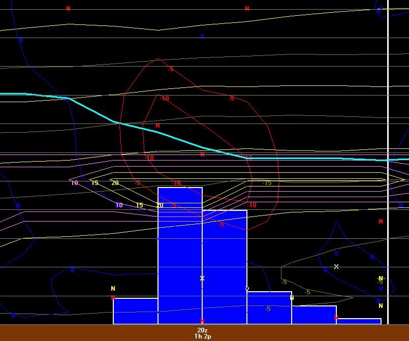
-
November 2020 General Discussion
It's Always Sunny replied to SchaumburgStormer's topic in Lakes/Ohio Valley
Buffalo, MN reporting 2.5". So cool!