

Toro99
-
Posts
49 -
Joined
-
Last visited
Content Type
Profiles
Blogs
Forums
American Weather
Media Demo
Store
Gallery
Posts posted by Toro99
-
-
Probably a bit early, but calling this a massive bust for Southwest Michigan. I have about 5 inches measured, starting at about 2 PM, and now we’re dry slotted. We’ve been under a warning since 10 AM. Not a meteorologist, but just looking at the radar presentation throughout this event so far, it looks like a splotchy disorganized mess, and it has never gotten his act together. If you want to see how the storm was forecasted, look north of Toronto on radar currently, that’s how it was supposed to be here all day and through the night. I know it’s a bit cliché, but I have to believe the southern convection stole a lot of moisture and led to the splotchy precipitation throughout the event so far.
-
 2
2
-
-
33 minutes ago, frostfern said:
Its finally coming down at a decent rate here. Its a little granular though. Not really sleet but small grainy flakes.
Had that the last hour or so, flake size starting to improve and stick a bit just to your SW. Dry air finally saturating, I trust this is just getting going for SW MI
-
1 hour ago, WestMichigan said:
GRR reported 4.1" of snow with 0.94" of precipitation. Talk about some heart attack shoveling.
Not sure, but seemed like an over performer here in West Michigan in general. All schools cancelled today, 2nd round really produced here in Jamestown (se Ottawa county). I’ve easily got 4-6 on my deck railing/grill, and most of that was after a brief bit of rain early afternoon. Models seemed to catch on to SE/flatter evolution which helped keep the rain/snow line further south. Beautiful out right now.
-
Posting 384hr maps should be banned, or suspended for a month. Maybe suspend for the number of hours on the posted map
-
 2
2
-
-
On 10/31/2023 at 12:58 PM, BYG Jacob said:
This one has way too much time under little shear and very high OHC. I don't know what the models are seeing.
Models (at times) are irrelevant post Otis. One of the many lessons learned the hard way.
-
26 minutes ago, NorthHillsWx said:
Once again, historic rainfall over the “perma” drought. Get away from the runoff areas and waterways and let this storm fix 15 years of drought in a few days. This is the absolute best thing that could have happened for the southwest, I’m tired of everyone putting a negative spin on something that (when the rain ends) will be the best thing that’s happened in a decade to help the local environment
Lake Mead ftw
-
17 minutes ago, frostfern said:
It will fill in once it gets east of me. Watch.
Gapped, guaranteed
-
1
-
-
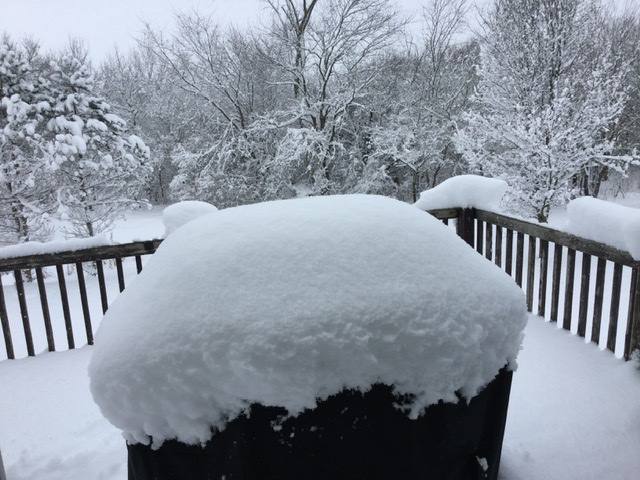
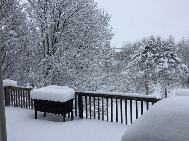
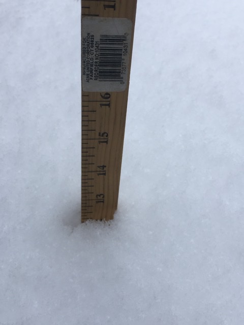
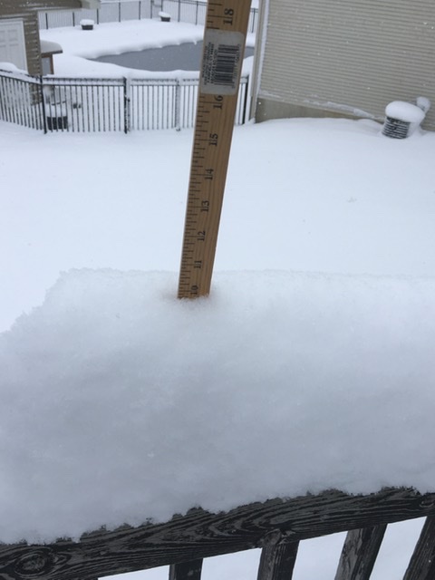
Probably the most gorgeous snowfall we’ve had in as long as I can remember here in Hudsonville, southwest of Grand Rapids. Incredible flake stacking, what an over performer! Over a foot and counting on an elevated deck, and I’ve never seen 10 inches stack on a 1 inch wide deck railing!
I am making a mental note of the storm, to remind myself that not every storm underperforms. Should help with my psychological state moving forward.
-
10
-
-
Trends die hard
-
1
-
-
Jaded board = no thread courage
-
1
-
1
-
-
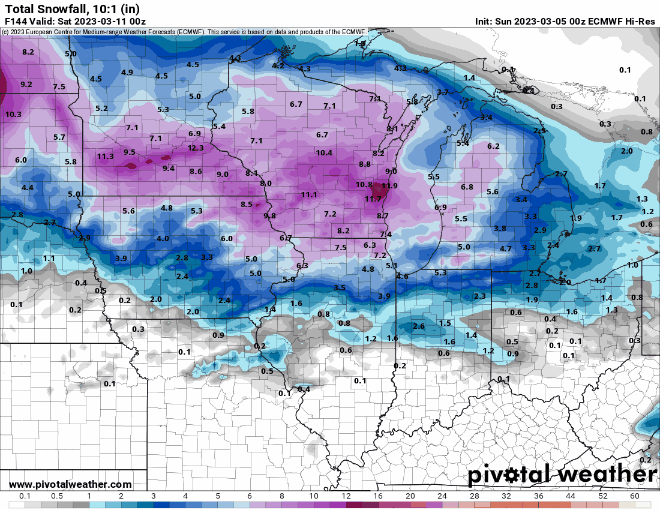
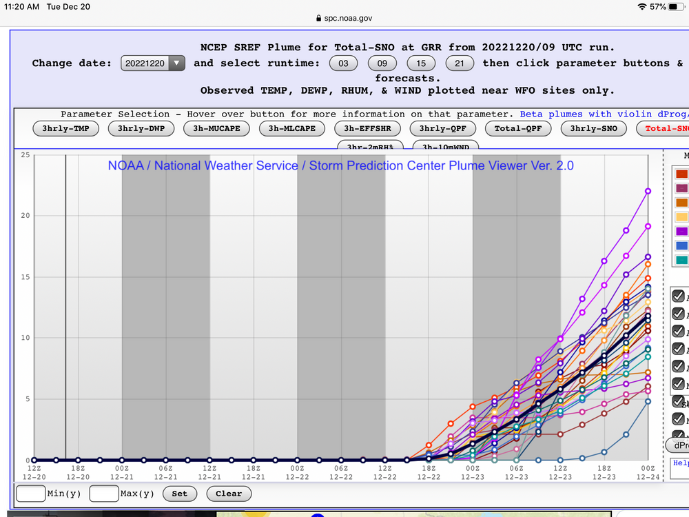
Don't ever remember seeing a plume spread like this (GRR) at the start of the event: 0" - 17.5", with everything in-between
-
2
-
-
3 hours ago, WestMichigan said:
Not sure who is writing the GRR AFDs lately but they have had some good ones.
Seriously, borderline theatrical. Chat gpt writing AFDs
-
1
-
-
Omg, the overnight GRR write up is worth a read
-
1
-
-
The number of rain events forecast by the Euro and GFS in the extended range is utterly flabbergasting for this time of year. So disappointing, when a lot of us were counting on February to be our month. Did I just type the word flabbergasting? Good grief, that’s how bad it is
-
1
-
1
-
-
Val-d’Or is the place to be
-
Plumes at the end of their range for GRR are still fun. You know, the office that refuses to issue a wsw.
-
2
-
-
58 minutes ago, frostfern said:
I notice it's very cellular like we sometimes get in the afternoon during March/April cold unstable spells.
Yeah, I had had high hopes when I was in one of those cells this morning, but they don’t last and have been very spotty. Accumulations are probably still on track, but it doesn’t feel like a “warning” type event. Not sure I can remember a long-duration-super-spotty/choppy LES storm. Hoping for more consistency through tomorrow/sat. I mean going from 4”/hr rates with dendrites the size of quarters, to nothing for a couple hours in the heart of a WSW is actually brutal for some reason
-
Absolute rip city as these cells come through in SW Kent (Byron Center). A. lot of superintendents going to get caught with their pants down brining students to school in the middle of a WSW. One district in SW MI cancelled (Constantine).
-
Pulling so hard for small chain failures in Cantore broadcast
-
Strangest and weakest thunderstorm warnings ever in sw MI
-
14 hours ago, frostfern said:
Grand Rapids MI is a general thunder graveyard.
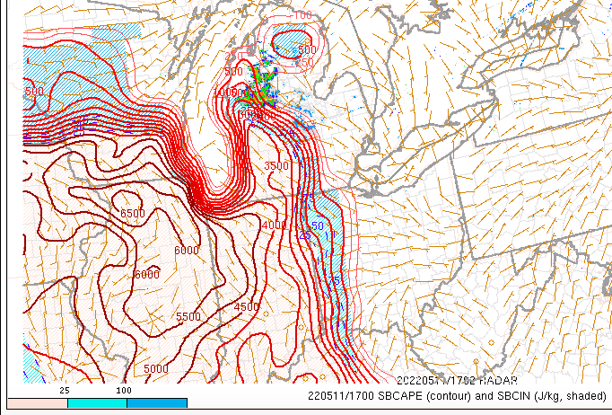
Hoping we pull something out of this sliver of high cape in SW MI, strange setup for sure. Storms back-building west across the state and moving S-SW
-
1
-
-
20 min fropa burst just now might have been the best quality snowfall of the entire season
-
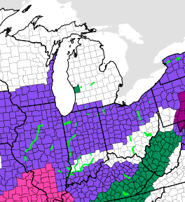
Michigan offices are over winter. No advisory needed for widespread 2-5
-
2
-
2
-
-
Patiently waiting for the board to explode as the massive shifts NW begin, like the good old days.

Sorry, this should have gone in the banter thread....

March 2024 General Discussion
in Lakes/Ohio Valley
Posted
GRR doing its Braveheart thing as usual.....