

Upstate Tiger
-
Posts
702 -
Joined
-
Last visited
Content Type
Profiles
Blogs
Forums
American Weather
Media Demo
Store
Gallery
Everything posted by Upstate Tiger
-

2024-2025 Fall/Winter Mountain Thread
Upstate Tiger replied to Buckethead's topic in Southeastern States
Roads, parking lots, and grass covered in Sapphire Valley. Light snow continues at 18 degrees. Should be beautiful drive home tomorrow. -
GFS with 2 EC storms before mid week. Mid Atlantic and northeast in line for 2 hits.
-
Man that’s some heavy snow in Southern La breaking out on the GFS.
-
Now we know we really have a legitimate winter storm on the way.
-
For those who’ve not read the GSP AFD. About as good of an explanation as you will see on the potential https://forecast.weather.gov/product.php?site=NWS&issuedby=GSP&product=AFD&format=ci&version=1&glossary=1&highlight=off
-
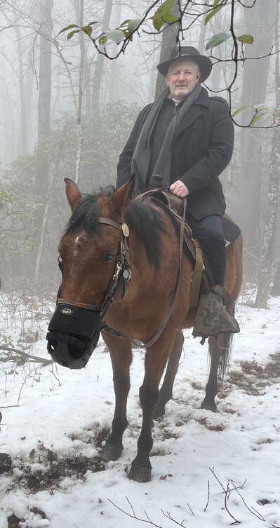
Aww Guys you shouldn’t have. My wife takes me to Cashiers Sapphire Valley for the weekend for my birthday. A nice relaxing horse ride in the snow through the Nantahala along the Horse Pasture River. And I get back to the room and find you all ordered me 1” of snow IMBY on the 12z Euro. Really, you guys are too much.
-
Would love to see that radar become reality.
-
Yep. Very similar to 18z so far.
-
Good streak of snow into north central Ga.
-
Early on GFS precip doesn’t look as widespread in Texas as 18z but too early to see any trends.
-
Precipitation shield further north on the GFS
-
I have digested all the models over the last 24 hours... I am now prepared to predict that someone north of I-10, south of I-40, and east of I-75 will see wintry precipitation between Sunday and Friday. Can I get my red tag?
-
Let's both out together in a blaze of glory...
-
While we wait for the Euro to finish... Looking long range, there is a slight relaxation after next weekend and then another couple of dumps of cold air to through the end of the month. Looks like no golf until February.
-
Ya'll have broke the GFS at day 7. This is why we can't have nice things.
-
Through 96, GFS shows a full blown n'or easter hamerring MId Atlantic and EC.
-
Yes!!
-
Euro says hold your tears...
-
One thing from overnight that is a bit bothersome is the delay showing up in the last few runs. Would really like to see that wave follow the 19th storm 24-48 hours later versus 96 hours. Nevertheless, still have a signal and models likely don’t have a handle on timing of the specific pieces of energy.
-
I am just glad that the 12z suite was awesome and happy hour was not too happy. When it’s the opposite, we never seem to score.
-
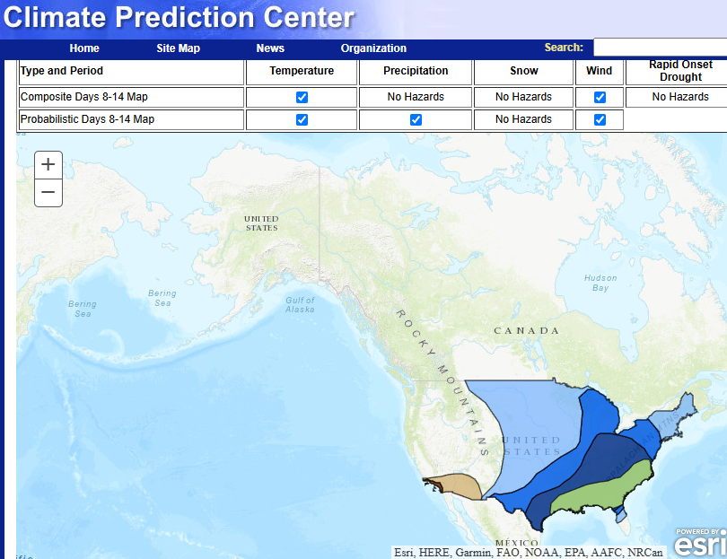
Nice hazard map from the CPC this afternoon for next week.
-
Proabably Saturday 1/17/92. Did not get a drop in the upstate while central Ga got 5"
-
That was the overruning storm I alluded to yesterday. Was in the teens in the Carolinas during the storm with record snow and stayed cold for about a week afterword.
-
Somebody's in for a nice surprise on Sunday
-
Would love to see another January 88 overrunning storm with an arctic front draped across the south. 14” of snow and temps in the mid teens. It was one for the ages.


