-
Posts
970 -
Joined
-
Last visited
Content Type
Profiles
Blogs
Forums
American Weather
Media Demo
Store
Gallery
Everything posted by Upstate Tiger
-

Mid to Long Range Discussion ~ 2024
Upstate Tiger replied to buckeyefan1's topic in Southeastern States
I think you make some valid points. I have been closely following the winter weather in this area since 76/77 when I was 12. There were some epic winters from 76/77 - 82/83. After that, it seemed winter storms became less frequent throughout the remainder of the 80's. Yes we had the epic cold snap in January of 85 and the big dogs in Janaury of 87 & 88, but that was about it. I kept thinking this is just a pattern change like the 50's and it would snap back like it did in the 60's. But, it didn't happen in the 90's either. We had the Super Storm in 93. 95/96 was very reminicent of the "old pattern" Anyway, the climate, as it always has, is changing and is not the same as 50 years ago. -

Mid to Long Range Discussion ~ 2024
Upstate Tiger replied to buckeyefan1's topic in Southeastern States
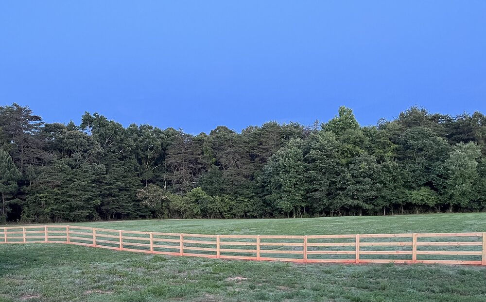
I posted in obs that it was 47 this morning in West Lincoln County. Pretty amazing to be less than 5 weeks from July 4. Love it. Pic from last evening sitting on deck waiting on deer. Almost needed a sweater. -
47 this morning in West Lincoln county. Wow.
-
Probably just click bait but at least something to read during these rainy spring days... https://www.einpresswire.com/article/685988510/2025-winter-outlook-united-states-and-canada
-

Mid to Long Range Discussion ~ 2024
Upstate Tiger replied to buckeyefan1's topic in Southeastern States
For a 40% chance of rain, there sure was a lot of thunder, lightening, and flooding over the last 4 hours. -

Mid to Long Range Discussion ~ 2024
Upstate Tiger replied to buckeyefan1's topic in Southeastern States
Let Nina begin. -

Mid to Long Range Discussion ~ 2024
Upstate Tiger replied to buckeyefan1's topic in Southeastern States
We should never have been the ones to start the Civil War. I knew it would catch up to us one day. -

Mid to Long Range Discussion ~ 2024
Upstate Tiger replied to buckeyefan1's topic in Southeastern States
I’m 59 and I remember knee deepers in March of 71 and February of 79. Some other notable ones were January 87 and 88. -

Mid to Long Range Discussion ~ 2024
Upstate Tiger replied to buckeyefan1's topic in Southeastern States
Cool story. Thanks for sharing. That’s the thing about big snowstorms, especially in the south, is we can connect them to some special people and times in our lives. -

Mid to Long Range Discussion ~ 2024
Upstate Tiger replied to buckeyefan1's topic in Southeastern States
I hate you youngons missed some of the monsters from the 70s and 80s. 93 is in a category of its own though. -

Mid to Long Range Discussion ~ 2024
Upstate Tiger replied to buckeyefan1's topic in Southeastern States
Very disappointing winter for sure. Thought we’d get at least 1 event. Hopefully this summer is not a dry scorcher. -
CPC predicting rapid return to Nina conditions this summer and increasing through fall. That makes 4 out of 5 right? Can we ever get a neutral anymore?
-

Mid to Long Range Discussion ~ 2024
Upstate Tiger replied to buckeyefan1's topic in Southeastern States
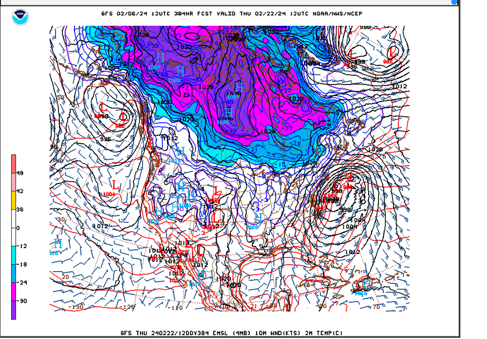
LOL...I had this copied and ready to paste! Love seeing the purple over the SE... -

Mid to Long Range Discussion ~ 2024
Upstate Tiger replied to buckeyefan1's topic in Southeastern States
We won in Chapel Hill last night for the second time in 62 years. At this point, I believe anything is possible. -

Mid to Long Range Discussion ~ 2024
Upstate Tiger replied to buckeyefan1's topic in Southeastern States
Wished you were right. Has been no time fittin for golf on the weekends since November but it looks like plenty of cold to me. -

Mid to Long Range Discussion ~ 2024
Upstate Tiger replied to buckeyefan1's topic in Southeastern States
That analogy certainly makes sense and I do not get paid to forecast the weather. However, looking beyond the 7-10 range looks like there is plenty of arctic air in Canada, northern tier, and this side of the hemisphere. Guess I am a little puzzled what he is looking at to completely call off winter? -

Mid to Long Range Discussion ~ 2024
Upstate Tiger replied to buckeyefan1's topic in Southeastern States
That's all we've got ATM. It's kinda like at the end of the night when you know the bar is going to close soon and the only girl left in the place is one who looks pretty good sitting way down at the other end of the bar. -

Mid to Long Range Discussion ~ 2024
Upstate Tiger replied to buckeyefan1's topic in Southeastern States
This winter really blows. Can't believe we are going to be shut out again. It's never going to snow in the SE again. There, that should help. -

Mid to Long Range Discussion ~ 2024
Upstate Tiger replied to buckeyefan1's topic in Southeastern States
78 and 83 were pretty memorable in the upstate of SC -

Mid to Long Range Discussion ~ 2024
Upstate Tiger replied to buckeyefan1's topic in Southeastern States
71 forecast here for Super Bowl Sunday. Maybe we'll finally get some decent weather for our annual Super Bowl Sunday backwards par 3 tournament. May have to break out shorts and sunscreen. -

Mid to Long Range Discussion ~ 2024
Upstate Tiger replied to buckeyefan1's topic in Southeastern States
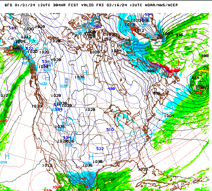
LOL...The Rio Grande, Corpas Christi, and South Padre Island are the places to be! Plenty of time for this to trend north and east -

Mid to Long Range Discussion ~ 2024
Upstate Tiger replied to buckeyefan1's topic in Southeastern States
In all seriousness I think we will start seeing fantasy storms showing up over the next several days for this period. -

Mid to Long Range Discussion ~ 2024
Upstate Tiger replied to buckeyefan1's topic in Southeastern States
There's been some talk about the correlation and timing of cold in the SE to winter storms. Just for fun, I went back and looked at some memorable winter storms to see what temps looked like in the days leading up to these storms. This is for the Greenville, SC area. The far right column is new snow depth. With the exception of 1982, the cold air arrives within 24 hours of the onset of the storm. February 2014 January 2011 February 2004 January 1996 March 1993 January 1988 January 1987 January 1982 March 1980 February 1979 -

Mid to Long Range Discussion ~ 2024
Upstate Tiger replied to buckeyefan1's topic in Southeastern States
Brick. Have you tried to play golf in March the last few years? I swear I saw that mammoth from Ice Age walking across the 6th fairway last year. Good to hear from you BTW. -

Mid to Long Range Discussion ~ 2024
Upstate Tiger replied to buckeyefan1's topic in Southeastern States
Agree. Orientation of the cold in February is much more conducive to winter weather on this side of the apps. Of course it changes every 24 hours which is probably a good sign.


