Upstate Tiger
-
Posts
984 -
Joined
-
Last visited
Content Type
Profiles
Blogs
Forums
American Weather
Media Demo
Store
Gallery
Everything posted by Upstate Tiger
-
Still looks to me like another round of really cold air pushing south from Canada into the US at the end of the 1st week of February. Looking forward to playing a round of golf after church Sunday for the first time in weeks. Hoping for sunny skies and low 50s. It will seem like summer.
-
GSP reached 59 one day this month. Will we reach 60? Puts this month in pretty rare company if we do not...
-
Yep. Who would have predicted 2 weeks ago a blizzard in Louisiana and all time record snow in Florida?
-
Good news for winter weather lovers is that arctic air remains in Canada and even rebuilds and expands in February. Won't take much to buckle the jet and get a CAD event. On the other hand, the NAO is headed into positive territory and the PNA is moving down toward neautral. At some point, one would guess Nina climatology would exert it's influence.
-
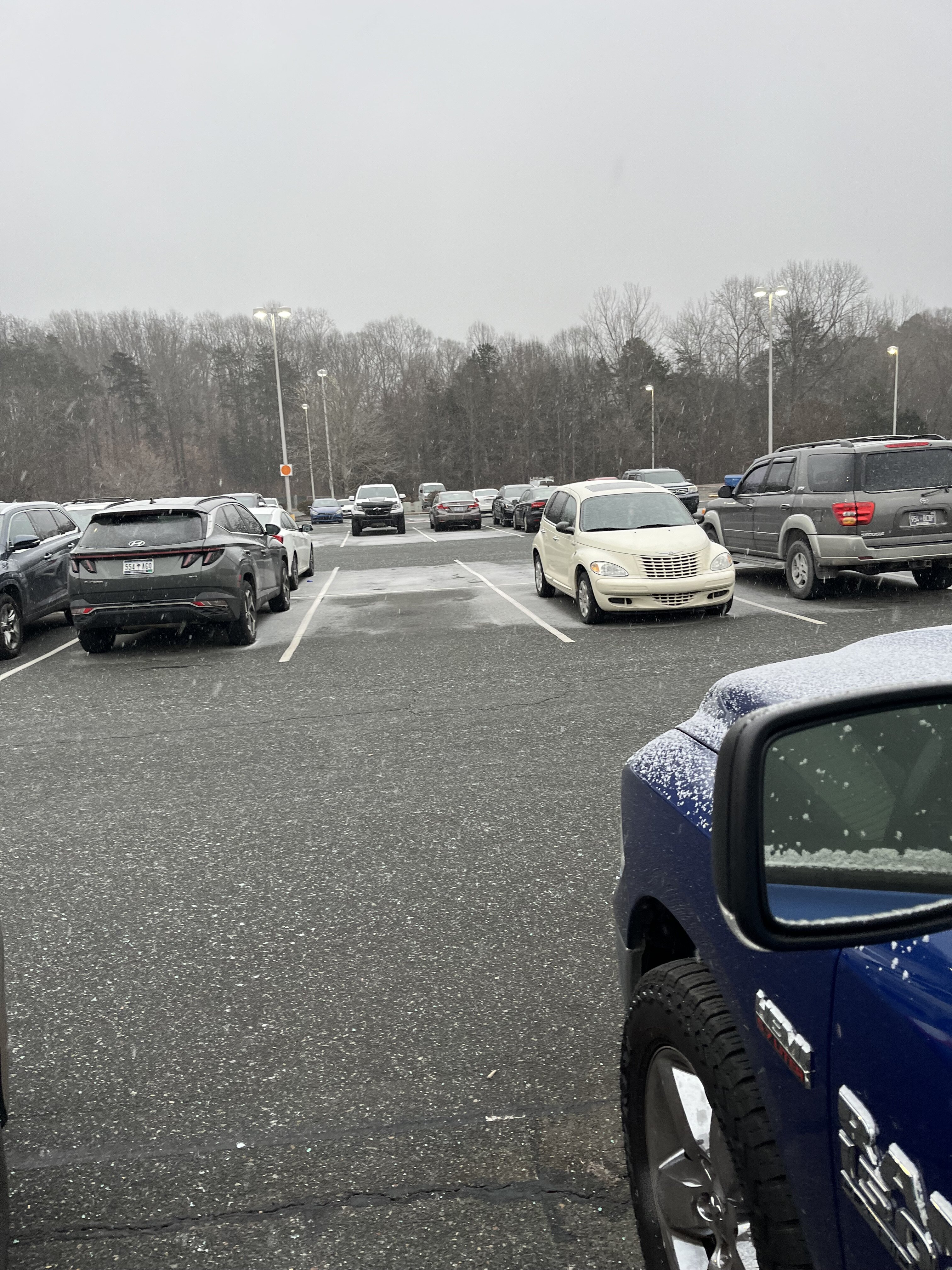
Leaving work in Gastonia and we already have a car topper and quickly sticking on roads. Brick you magnificent bastard.

-
If someone just pulled up the radar and saw this with temps in the 20's across the region, he would be pretty impressed.
-
Hell knoweth no fury like a SE weenie scorned by suppression.
-

2024-2025 Fall/Winter Mountain Thread
Upstate Tiger replied to Buckethead's topic in Southeastern States
Roads, parking lots, and grass covered in Sapphire Valley. Light snow continues at 18 degrees. Should be beautiful drive home tomorrow. -
GFS with 2 EC storms before mid week. Mid Atlantic and northeast in line for 2 hits.
-
Man that’s some heavy snow in Southern La breaking out on the GFS.
-
Now we know we really have a legitimate winter storm on the way.
-
For those who’ve not read the GSP AFD. About as good of an explanation as you will see on the potential https://forecast.weather.gov/product.php?site=NWS&issuedby=GSP&product=AFD&format=ci&version=1&glossary=1&highlight=off
-
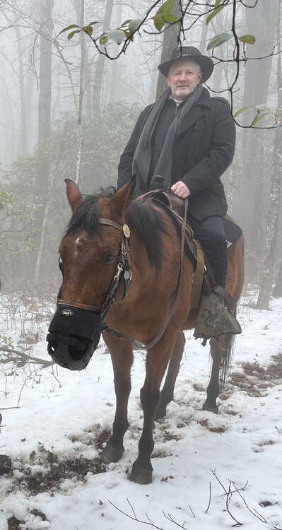
Aww Guys you shouldn’t have. My wife takes me to Cashiers Sapphire Valley for the weekend for my birthday. A nice relaxing horse ride in the snow through the Nantahala along the Horse Pasture River. And I get back to the room and find you all ordered me 1” of snow IMBY on the 12z Euro. Really, you guys are too much.
-
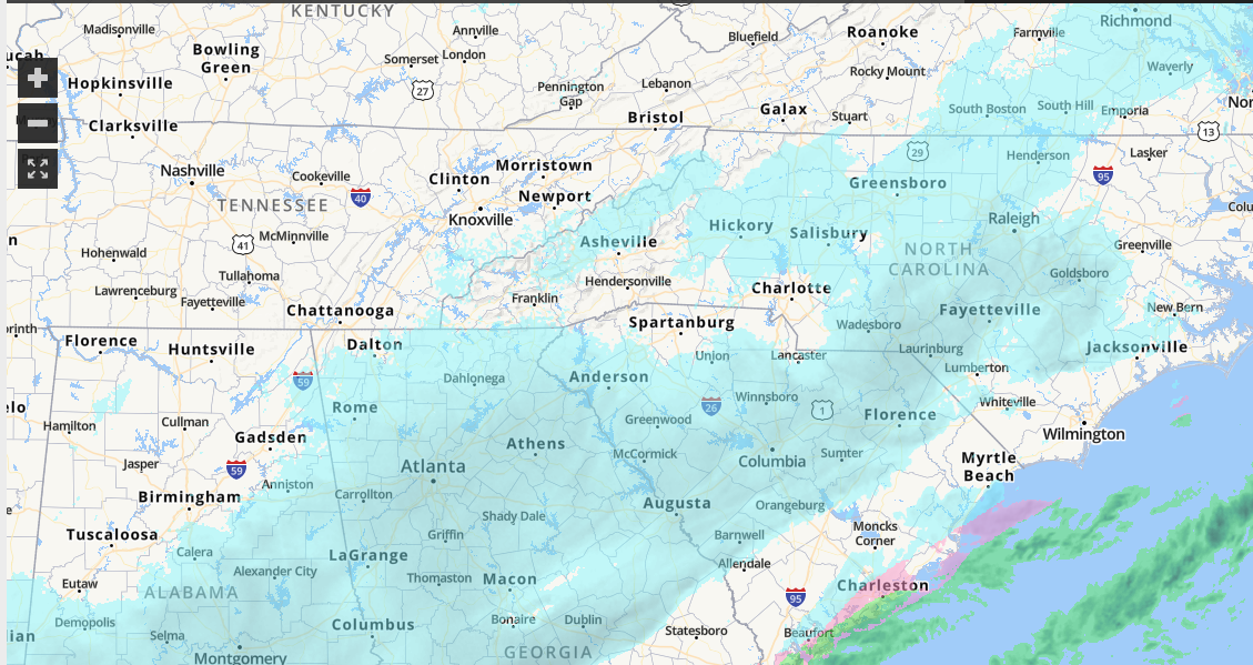
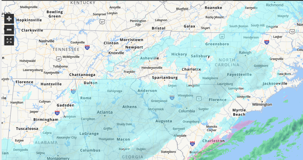
Would love to see that radar become reality.
-
Yep. Very similar to 18z so far.
-
Good streak of snow into north central Ga.
-
Early on GFS precip doesn’t look as widespread in Texas as 18z but too early to see any trends.
-
Precipitation shield further north on the GFS
-
I have digested all the models over the last 24 hours... I am now prepared to predict that someone north of I-10, south of I-40, and east of I-75 will see wintry precipitation between Sunday and Friday. Can I get my red tag?
-
Let's both out together in a blaze of glory...
-
While we wait for the Euro to finish... Looking long range, there is a slight relaxation after next weekend and then another couple of dumps of cold air to through the end of the month. Looks like no golf until February.
-
Ya'll have broke the GFS at day 7. This is why we can't have nice things.
-
Through 96, GFS shows a full blown n'or easter hamerring MId Atlantic and EC.
-
Yes!!
-
Euro says hold your tears...