Upstate Tiger
-
Posts
703 -
Joined
-
Last visited
Content Type
Profiles
Blogs
Forums
American Weather
Media Demo
Store
Gallery
Everything posted by Upstate Tiger
-

Mid to Long Range Discussion ~ 2023
Upstate Tiger replied to buckeyefan1's topic in Southeastern States
Sure! After all, this winter storm is looking more probable than us beating the Heels in Chapel Hill this weekend. -
Mid to Long Range Discussion ~ 2023
Upstate Tiger replied to buckeyefan1's topic in Southeastern States
KGSP AFD for the weekend .LONG TERM /FRIDAY NIGHT THROUGH TUESDAY/... As of 215 pm EST Tuesday: Considerable uncertainty remains over the handling of the upstream trough axis crossing the Mid-Mississippi River Valley Friday night. The 12Z GFS continues to feature a 500 mb low center cutting off and migrating over the Deep South on Saturday. The GEFS spread is quite large, however, and the NAM/CMC feature either a more northerly track of the low or an open wave. Until recently, the ECMWF runs have had a much more progressive, positive tilt, open wave moving through the Appalachians. Recent ECM trends, however, have been slightly toward the deeper and more dynamic operational GFS, and this has some implications for wintry weather potential over our area this weekend. For now, the forecast has been nudged slightly wetter through the Saturday night/Sunday morning period. This keeps mountain northwest flow snow showers solidly in the forecast Friday night through Saturday night, but also creates low end potential for a wintry mix east of the mountains through Sunday morning. Confidence remains very low on this and ensemble mean solutions still do not support much of any accumulating snow east of the mountains over the weekend. -
Mid to Long Range Discussion ~ 2023
Upstate Tiger replied to buckeyefan1's topic in Southeastern States
Euro trended better for sure. Still did not go full GFS. -
Mid to Long Range Discussion ~ 2023
Upstate Tiger replied to buckeyefan1's topic in Southeastern States
Yep. Curious to see the Euro shortly. It had this setup a couple of days ago but backed off. -
Mid to Long Range Discussion ~ 2023
Upstate Tiger replied to buckeyefan1's topic in Southeastern States
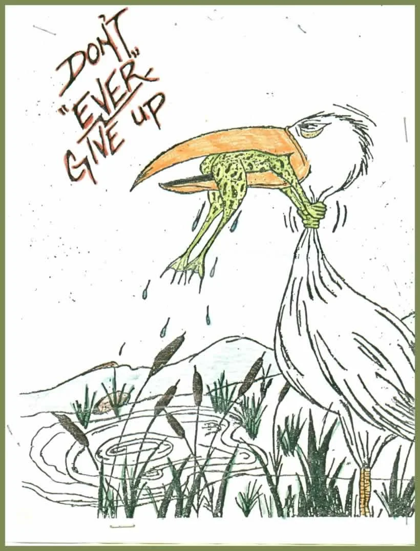
2 Sundays in a row! I am ashamed that some of you people have already thrown in the towel!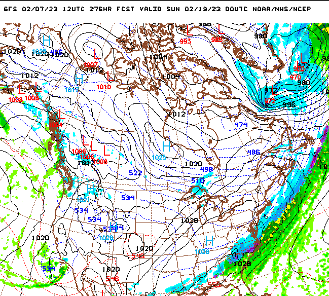
-
Mid to Long Range Discussion ~ 2023
Upstate Tiger replied to buckeyefan1's topic in Southeastern States
I'll start a thread...The Great 2023 Valentines Weekend Blizzard -
Mid to Long Range Discussion ~ 2023
Upstate Tiger replied to buckeyefan1's topic in Southeastern States
Would love to see another March 2009 event. We got 8" of heavy wet snow in the upstate with very intense thundersnow. I was driving back from Columbia that Sunday evening and it was blinding. Thankfully I had 4WD. That was a ULL event. -
Mid to Long Range Discussion ~ 2023
Upstate Tiger replied to buckeyefan1's topic in Southeastern States
Does next weekend have legs???....Probably more like a toenail but both GFS and Euro show something to watch at least.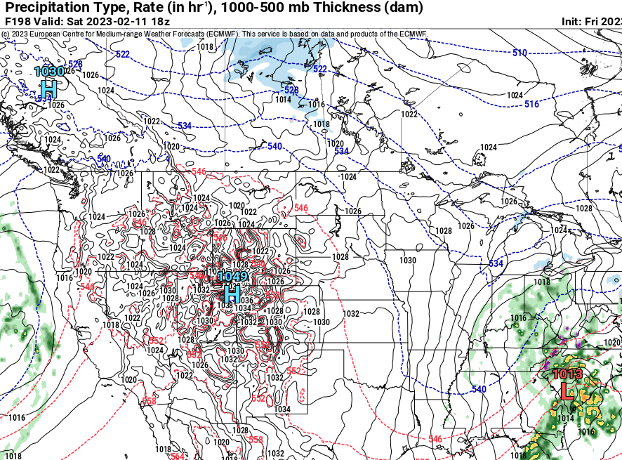
-
Mid to Long Range Discussion ~ 2023
Upstate Tiger replied to buckeyefan1's topic in Southeastern States
We’ve had a lot of cold dreary days this winter. Very few golfing days since November and when we did, the course was very wet -
Mid to Long Range Discussion ~ 2023
Upstate Tiger replied to buckeyefan1's topic in Southeastern States
I swore this winter if I caught myself relying on SSW, I’d throw in the towel but here I am! GW is that the reason we’re seeing those crazy HP readings in Canada on the GFS starting mid-month? I’m seeing highest I’ve seen all winter. -
Mid to Long Range Discussion ~ 2023
Upstate Tiger replied to buckeyefan1's topic in Southeastern States
I know, I know, why keep torturing myself with hope?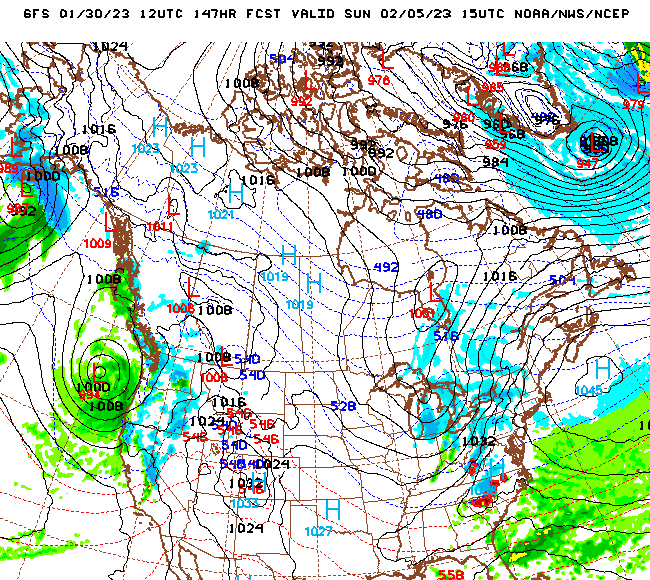
-
Mid to Long Range Discussion ~ 2023
Upstate Tiger replied to buckeyefan1's topic in Southeastern States
One thing that is consistent on the GFS runs is really cold air dropping back into central and eastern Canada just prior to mid February after our warmup. It would only take a slight buckle in the jet stream to bring it south. Wouldn’t be surprised to see a CAD event or two mid month onward. -
Mid to Long Range Discussion ~ 2023
Upstate Tiger replied to buckeyefan1's topic in Southeastern States
yep. Happy hour again. Drinks half price. This model reminds me of my ex wife (who was not a model). -
Mid to Long Range Discussion ~ 2023
Upstate Tiger replied to buckeyefan1's topic in Southeastern States
As Dawg mentioned we need the HP to come in faster or the system to slow down on the GFS. Still a lot of possibilities on the table. The model inconsistency is comical at this point, especially the GFS. The CMC and Euro have been a little more consistent. -
Mid to Long Range Discussion ~ 2023
Upstate Tiger replied to buckeyefan1's topic in Southeastern States
Who knows. I think all solutions are still on the table. European has cold chasing rain so that’s probably the most likely scenario but we could get a surprise. -
Mid to Long Range Discussion ~ 2023
Upstate Tiger replied to buckeyefan1's topic in Southeastern States
Got to run to a meeting 's. Euro is cold and suppressed. Right where we want it at 7 days LOL! Let me know how rest of run goes... -
Mid to Long Range Discussion ~ 2023
Upstate Tiger replied to buckeyefan1's topic in Southeastern States
Yep. Will be interesting to see how Euro handles this. CMC is further south and thus more snow. -
Mid to Long Range Discussion ~ 2023
Upstate Tiger replied to buckeyefan1's topic in Southeastern States
Snow followed by epic ice storm...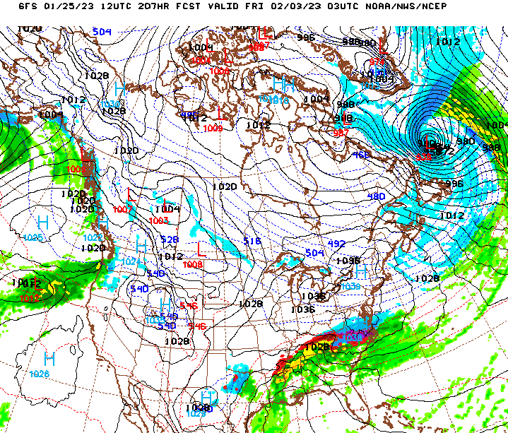
-
Did anyone in the Piedmont of NC get snow about 300AM? My security camera was triggered and it looked like a flizzard.
-
Mid to Long Range Discussion ~ 2023
Upstate Tiger replied to buckeyefan1's topic in Southeastern States
The 18z came back to reality but the same features are still there including the weakening of the SER. Wouldn’t totally laugh off the time frame. Heck, it’s Jan 21 and Clemson’s in first place in the ACC. If hell can freeze over, anything’s possible. -
Mid to Long Range Discussion ~ 2023
Upstate Tiger replied to buckeyefan1's topic in Southeastern States
Yeah, 4 winter events for my area over 1 week like 2014. LOL. Would take it and call it a winter. At least we’re seeing fantasy storms now. -
Mid to Long Range Discussion ~ 2023
Upstate Tiger replied to buckeyefan1's topic in Southeastern States
Euro a week from tomorrow. Potential...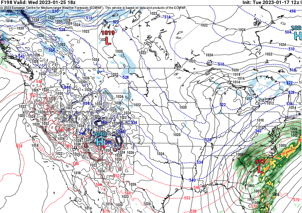
-
Mid to Long Range Discussion ~ 2023
Upstate Tiger replied to buckeyefan1's topic in Southeastern States
At least 2 events showing up on the GFS 12Z that could turn into opportunities with slight adjustments. Lots of energy flying around so anything could happen: 1/25-27 and 1/29-1/31. https://mag.ncep.noaa.gov/model-guidance-model-parameter.php?group=Model Guidance&model=gfs&area=namer&cycle=20230117 12 UTC¶m=sim_radar_comp&fourpan=no&imageSize=M&ps=area&fhr_mode=image&loop_start=-1&loop_end=-1&skip_num=1# -
Mid to Long Range Discussion ~ 2023
Upstate Tiger replied to buckeyefan1's topic in Southeastern States
Don’t know about that, you guys got the best of us. All joking aside, things can change quickly in winter and we’re only mid January. Hopefully February is our month in the SE. -
Mid to Long Range Discussion ~ 2023
Upstate Tiger replied to buckeyefan1's topic in Southeastern States
NEVER!!!