wxmeddler
-
Posts
7,033 -
Joined
-
Last visited
Content Type
Profiles
Blogs
Forums
American Weather
Media Demo
Store
Gallery
Everything posted by wxmeddler
-
What is a warm front?
-
Haha... yes... yes... come to the dark grey side...
-
ECMWF made the 6z/18z runs open access early last year I believe.
-
It would have worked this morning. Just the very tops.

-
BDCF / CAD wedges are one of the few areas in which I'd take the NAM over the Euro. Early March is peak BDCF Wedge season.
-
One day of heavy fog is really neat. Whole world looks different. Two days, ok, getting boring. Three or more, let me out.
-

Outta gas and Outta Time: Early March Winter Storm finale
wxmeddler replied to Ji's topic in Mid Atlantic
Down to 29.5 in College Park with 1/2 mi VIS reported at KCGS. May have about an inch, going to go out and measure at 3p. -
Outta gas and Outta Time: Early March Winter Storm finale
wxmeddler replied to Ji's topic in Mid Atlantic
Cartopper criteria in College Park now. Good SnowTV. -
Outta gas and Outta Time: Early March Winter Storm finale
wxmeddler replied to Ji's topic in Mid Atlantic
Biggy Flakes on Campus. Love it! -
Outta gas and Outta Time: Early March Winter Storm finale
wxmeddler replied to Ji's topic in Mid Atlantic
Winchester reporting between 1 and 5 mile visibility. -
Centerville (Queen Anne's Co) Prince Frederick (Calvert) Lusby (Calvert) Whiteford(Hartford) Would love to meet up! We're only down the street. Yes, I know the person you're talking about. I call dibs on being her employer when she graduates.
-
We have 4 on the docket once we dry out a bit.
-
I just want 50's not 80's.
-
Feb 22nd/23rd "There's no way..." Obs Thread
wxmeddler replied to Maestrobjwa's topic in Mid Atlantic
5" Snow Depth gain at the Berlin MD mesonet station from 11p to 12a -
Feb 22nd/23rd "There's no way..." Obs Thread
wxmeddler replied to Maestrobjwa's topic in Mid Atlantic
The snow depth sensor also recorded a 3" gain from 10p to 11p during the same time. -
Feb 22nd/23rd "There's no way..." Obs Thread
wxmeddler replied to Maestrobjwa's topic in Mid Atlantic
Picture I just sent to my met forecasting students at UMD. "How to Spot a Norlun" The analysis way: The cheating way:

-
That would be +RASN
-
Haven't talked to him but he would say the lack of a coupled jet preceeding the amplification doesn't bode well for getting the cold air in place (Which of know). I think he'd say that there's a higher than normal bust potential given the lack of a incipient cold wedge. But the dynamics are really high, so it should overcome.
-
I think even with the less than optimal surface temperatures the NAM give the I-95 corridor north of Fredericksburg 6-8" system total. Edit: But it's gonna be slop.
-
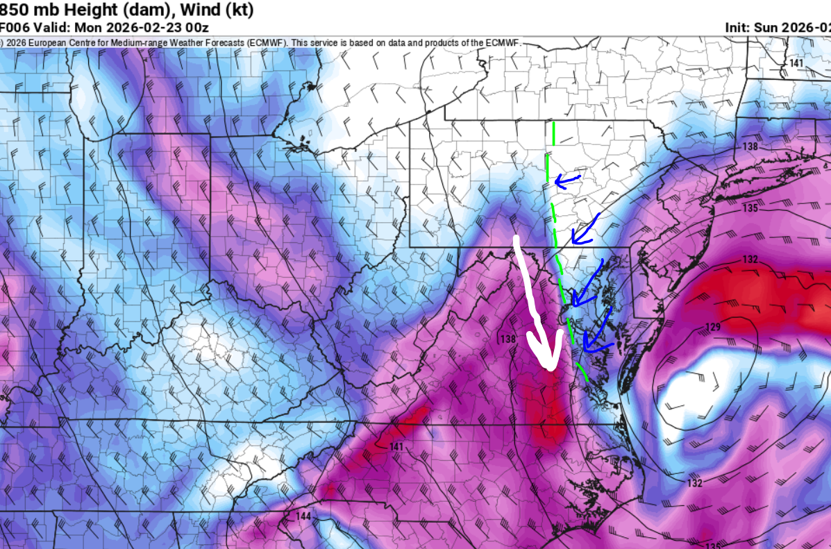
Stronger and further west at H5 coming out from the northern plains
-
I got woken up by the sound of heavy rain. I went to go see and just after I opened the door I saw a flash of light. I thought to myself “no, can’t be” then boom. Yep! What a surprise that is!
-
Feb 22nd/23rd "There's no way..." Storm Thread
wxmeddler replied to Maestrobjwa's topic in Mid Atlantic
Cut-Off's (especially decaying ones) suck to forecast man... -
Feb 22nd/23rd "There's no way..." Storm Thread
wxmeddler replied to Maestrobjwa's topic in Mid Atlantic
Need the Alberta s/w to either show up in the OHV 12 hrs earlier or just not show up at all. Euro has the messiest of both. -
Feb 22nd/23rd "There's no way..." Storm Thread
wxmeddler replied to Maestrobjwa's topic in Mid Atlantic
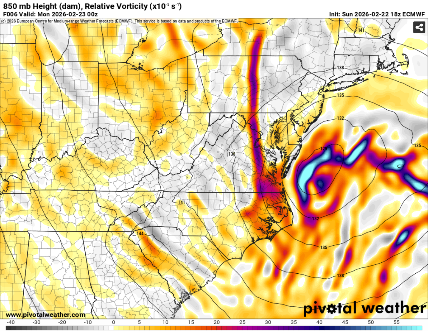
I'm at H42, southern stream s/w looks slightly deeper and a tad west. The alberta s/w is very strung out over the dakotas. The "middle stream" s/w is getting ahead of the southern s/w. Looks messy. -
Feb 22nd/23rd "There's no way..." Storm Thread
wxmeddler replied to Maestrobjwa's topic in Mid Atlantic
AIFS brings in the Alberta s/w faster and thus is later with the phase. It takes longer / further east to go negative tilt. Ironically, the opposite of the direction of the trends with the GFS/NAM with the alberta s/w lagging behind and not interacting with the southern stream, and acting as more like a kicker.