wxmeddler
-
Posts
6,558 -
Joined
-
Last visited
Content Type
Profiles
Blogs
Forums
American Weather
Media Demo
Store
Gallery
Everything posted by wxmeddler
-
As the cold front aloft moves in, should rapidly squeeze out any remaining moisture into snow.
-
Oh look, UMD closed. Final domino to fall in the PG/MoCo area.
-
Rates weren't high enough to compensate. As far as "powder", really need to have temps in the teens for that kind of stuff.
-
Rain (Freezing) in Silver Spring.
-
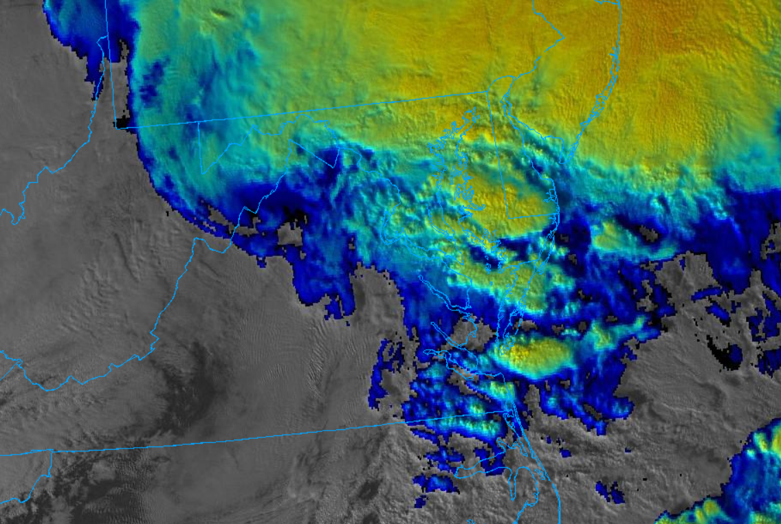
The "yellows" are definitely pockets of enhanced lift that are pushing higher RH's into the DGZ. Congrats to anyone who can get in one and stay in it..
-
Just a warning on Kuchera, it's not going to do well with the incoming dry slot. This sugar powder stuff is quite good at creating 9:1 to 11:1 SLR's. Seeing a lot of malformed plates and needles outside. Very inefficient snowmaking going on upstairs.
-
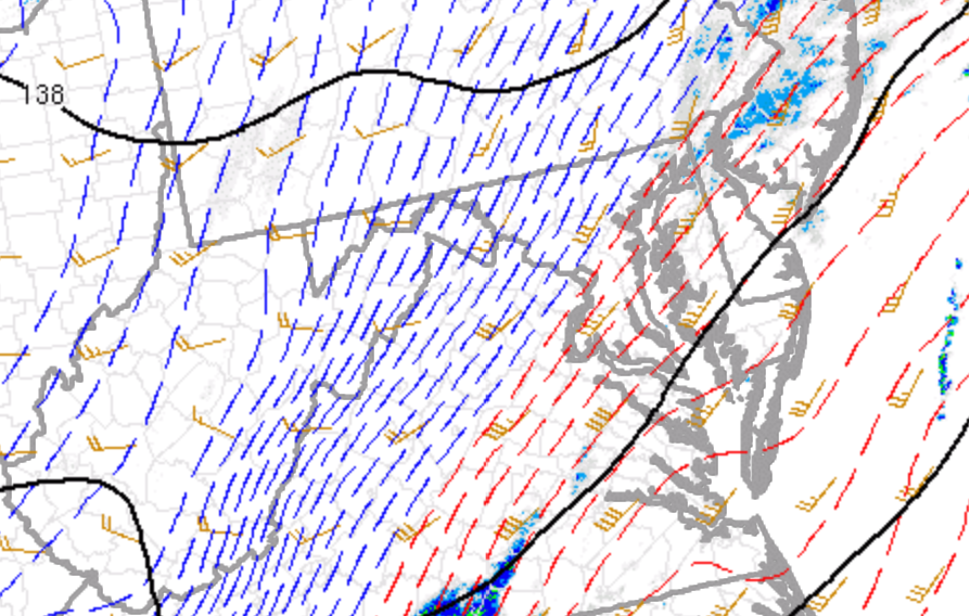
500mb dry slot coming in and killing the DGZ RH. Plates and columns rather than dendrites.
-
Roads caved around 4:30 in Silver Spring, right on time with the sunset.
-

Jan 15-16 Storm Threat Thread: The Return of Hope??
wxmeddler replied to stormtracker's topic in Mid Atlantic
Should be pretty easy to keep up with too, -SN at >.03"/hr liquid. Snow TV for everyone is a good time. -
SnowTV on today in Silver Spring. Beautiful.
-
I only have the ancillary data to support this but soil moisture percentages within the saturation runoff region was around 80% prior to the rain falling. As predicted, the creeks/streams are responding quickly.
-
Just for you Jeb
-
Agreed, surface inversion is going to hold tight. Bay is pretty cold as well, that should discourage mixing the bigtime gusts. Straight pressure gradient is going to still kick it to gale force though (35 kts). Need an anemometer on top of the bay bridge.
-
Friends don't let friends use the 3KM NAM for Wind Gusts
- 585 replies
-
- 10
-

-

-
Wow, actual high wind watch for Somerset and VA Eastern Shore counties
-
Gonna be done here shortly... Comma head is going by and dryslot incoming.

-
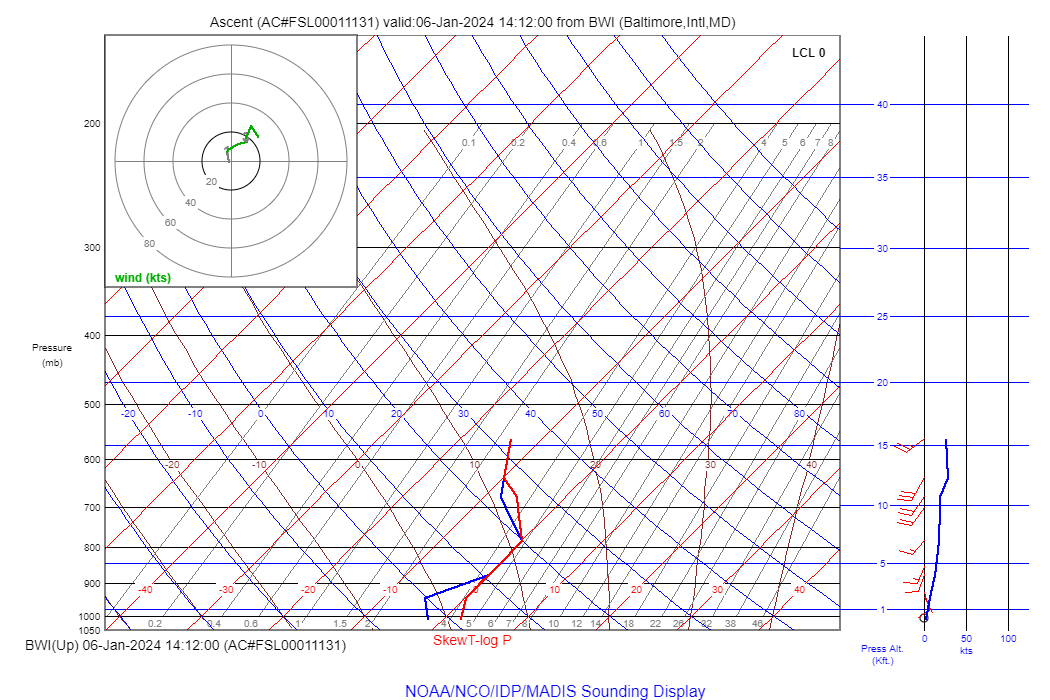
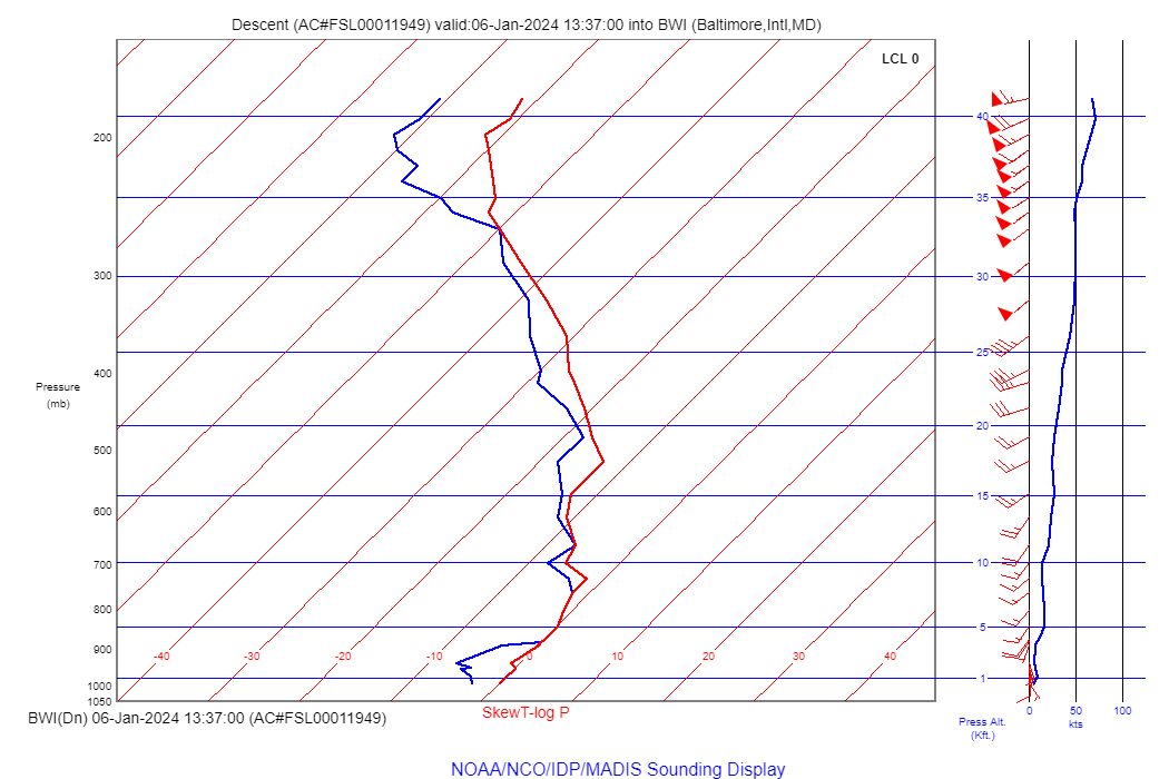
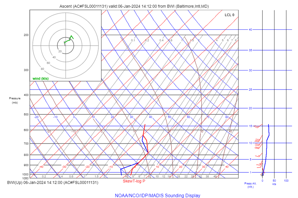
Newest aircraft departure sounding 20 min ago. Still could wetbulb in the lowest levels but saturated around 850 would be sleet/rain mix
-

-
It's pretty clear from the depth of the warm layer that most if not all of the snow east of I-81 is going to be 8:1 slop. The depth also throws out any elevation advantages in the Piedmont out the window. Best we can hope for is rates and dynamic cooling overcome.
-
It used to, it doesn't much anymore in the past 5 years or so. DMV Winds from GOES and NPP-Era sounders do most of the heavy lifting these days. Balloons are good for calibration and reality check.
-
I "like" the RGEM take on things, probably a bit too wet but good representation of what we're thermally dealing with.
-
Wow, that's a really flat wave from the NAM. Way outside the consensus.
-
It probably will. This is a N MoCo / Carroll and west event. Will probably even get tricky with RA/SN in the lower elevations the Monocacy River Valley.
-
This is what I'd call a "High Chance of Disappointment" Profile. Even higher elevation won't save you from the mixed bag possibility. Go west young man!
-
Almost no change to the overall look between 12z and 18z over mid-atl. Might be settling in. GFS still wiggling around. Looks like a solid hit to the classic northern/higher elevation spots (Fredrick/Carroll/ WV PH / MD PH)