wxmeddler
-
Posts
6,576 -
Joined
-
Last visited
Content Type
Profiles
Blogs
Forums
American Weather
Media Demo
Store
Gallery
Everything posted by wxmeddler
-
Fri,Sat,Sun nights look about equally trash. Friday night maybe has slightly less mid-level cloudiness? My suggestion would be to look at infrared satellite as the sun goes down each night and try to time a break in it. Wish I had better news.
-
Hate to say it but with the trough sitting out west and ridge pumping moisture into it, that's a classic combination of persistent high clouds in this area.
-
I love wind, these are my favorite kind of days. Everyday should be 50-70 deg, partly cloudy and winds 10-20.
-
There is levels of wind. 15-20 is annoying. 35-40 is "Woah" "40-50" is "Oh Crap". 55+ is "dammit" 70+ is "$%^, !@^*,@^&*#"
-
These showers should do good work. Ride the wind baby.
-
Whichever model has the precip hole over my house is correct.
-
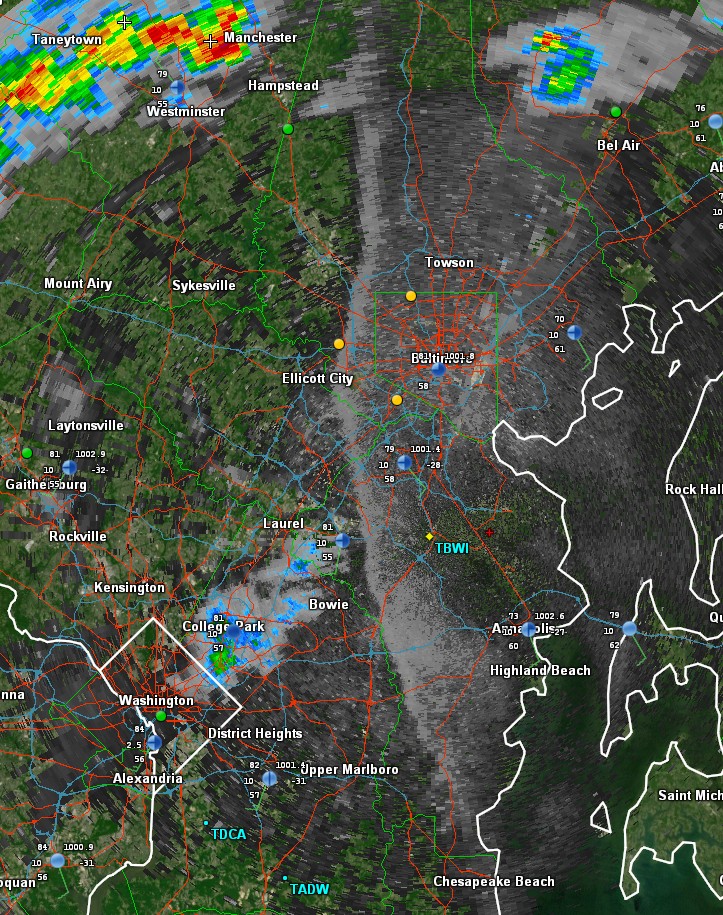
Wow that Bay Breeze boundary is sharp.

- 450 replies
-
- 6
-

-
- severe
- thunderstorms
- (and 2 more)
-
I predict thunder and a smattering of downed bradford pears that will verify base level svr. t-storm warnings.
- 450 replies
-
- 4
-
-
- severe
- thunderstorms
- (and 2 more)
-
Pyranometer cable was/went bad. We're thinking that when it rained last night water got into the cable somehow and was either shorting it or causing a ton of noise on the rail. Our tech went up and replaced the cable and everything came back as normal.
-
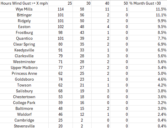
You absolutely nerd sniped me. Here's how many hours a wind gust has been recorded at a Maryland Mesonet station over a certain value so far this month. Most of the state has had gusts>= 30 mph at least 5-10% of the time this month.
-
Finally. A good hard rain.
-
The 3km NAM seems to promote the idea of the convergence boundary storms producing strong cold pools which moves the convergence boundary eastward. Which, is definitely a possibility. Edit: Strong cold pools would limit the tornado threat save minor QLCS kinks on the front end.
- 450 replies
-
- 3
-
-
- severe
- thunderstorms
- (and 2 more)
-
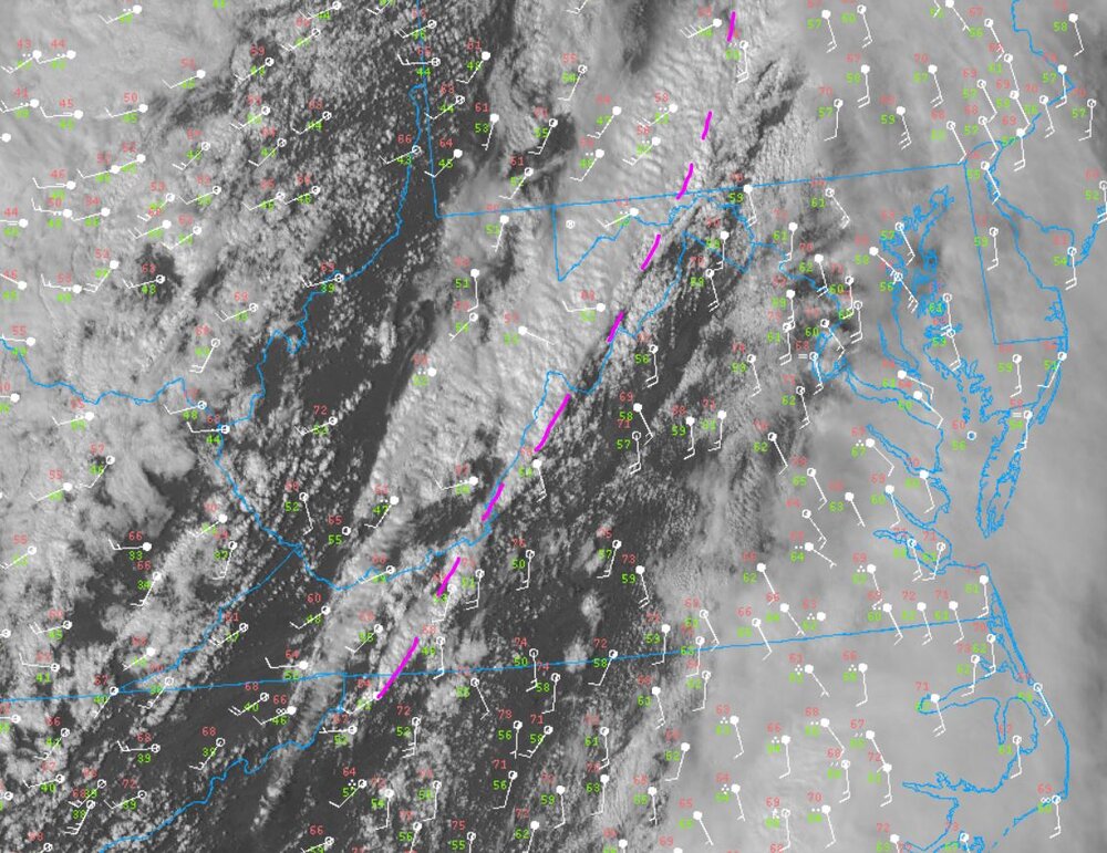
The 'line' that's sitting out in the Allegheny Front is actually a convergence boundary that is taking advantage of the upslope topography. There isn't a synoptic impetus to move it off until the actual cold front arrives, which is still back in Ohio.
- 450 replies
-
- 4
-

-
-
- severe
- thunderstorms
- (and 2 more)
-
The wind profile / hodograph dictates that isolated supercells would be the dominant mode of producing tornadoes. There doesn't seem to be much appetite from CAM's to pop cells in the open warm sector despite temperatures nearing / at convective temperature. Best bet is perhaps if the main line downscales into more isolated segments, and end up with a QLCS type threat.
- 450 replies
-
- 4
-
-
- severe
- thunderstorms
- (and 2 more)
-
All the dynamic parameters are screaming tornado potential. The thermo's are a bit lacking but if we get some sunshine.... All we need is storm mode. I mean... this is damn good looking (boxed average for MoCo/Howard/Frederick/Caroll

- 450 replies
-
- 4
-
-
- severe
- thunderstorms
- (and 2 more)
-
This is amazing. I've missed this community when I was away.
- 450 replies
-
- 3
-
-
- severe
- thunderstorms
- (and 2 more)
-
C+ MD/PA line B- at I-70 B between I-70 and US50 B+ US50 and south Lower eastern shore I'd call this an A- season. Overall B for Garrett County / WV Highlands.
-
If you are in the lower elevations near the choptank or you are surrounded by fields you could make up that 3F easy with just radiational cooling.
-
This back door font originating air mass is so dry that while it's temperature was modified by the sea, the dew point was not raised high enough to condense into the normal back-door effect.
-
I got a tiny burn on my neck but I had that sweatshirt on, had nothing else. First burn of the season! Station coming "online" later today!
-
Fresh (ie. still fluffy) snow is way more effective at longwave radiation emission than hardpack snow.
-

January Medium/Long Range: A snowy January ahead?
wxmeddler replied to mappy's topic in Mid Atlantic
Even if Feb is normal, we would still be way below normal for DJF. -
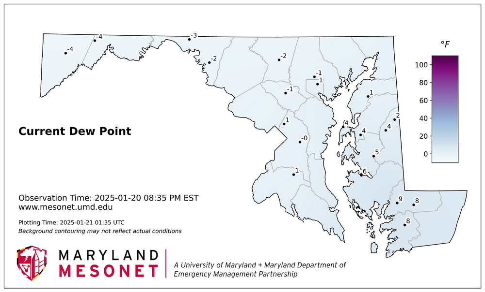
The dew points would indicate most of the area above the fall line could get to zero by morning if you have good snow cover.
-
January Medium/Long Range: A snowy January ahead?
wxmeddler replied to mappy's topic in Mid Atlantic
Hi. I actually do meteorological instrumentation as my profession. Temperature measurement is are actually very reliable and is the easiest of the weather parameters to measure. The mercury thermometers made 100-200 years ago were very accurate (to within 1°F). As far as calibration, traditional ice water and a boiling water stove provide an accurate 2 point calibration that is still used today. Now is is true that modern thermometers are more precise. We can reliably measure temperatures to 0.01°F in laboratory settings and 0.1°F in natural settings. But for climatology that is all you need. -
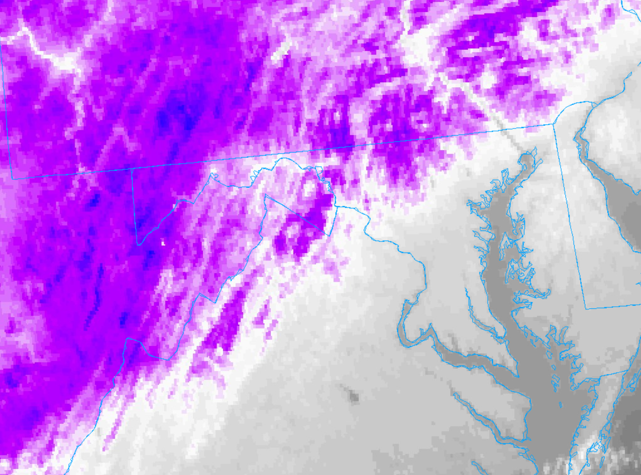
Really obvious where the heavier snow fell: