wxmeddler
-
Posts
7,020 -
Joined
-
Last visited
About wxmeddler

Recent Profile Visitors
7,576 profile views


-
The smoke today smells worse than usual. The smoke I remember out west was a straight campfire smell. This smells like campfire mixed with New Jersey (a mix of burning rubber and bad BO).
-

2026 Mid-Atlantic Severe Storm General Discussion
wxmeddler replied to Kmlwx's topic in Mid Atlantic
Smoke can do a bunch of stuff but the two things that you see most often are: 1. Smoke can create differential heating on smoke vs. non smoke areas. Causing pseudo surface cold fronts. 2. Mid/Upper level smoke can absorb sunlight and transfer that energy to the surrounding environment; creating warmer mid-levels while also reducing surface heating. Both combined makes caps more robust than would otherwise be expected.- 1,072 replies
-
- 5
-

-

-
- severe
- thunderstorms
- (and 7 more)
-
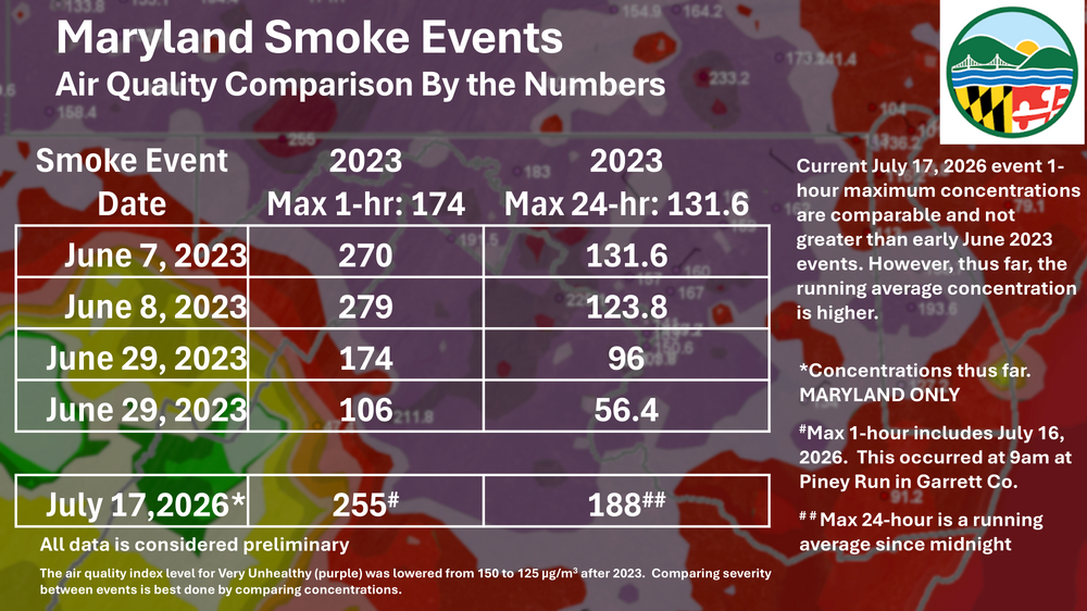
Spreading the word from our friends over at MDE.
-
New AQ alert levels for MD.
-
I've seen / been in worse when I was in North Dakota directly down range... but not much worse. This is crazy for this area.
-
One of the downsides of the smoke is that it has reduced the surface heating and therefore boundary layer depth. The high dews are not being mixed out as they would on a day without smoke.
-
The smoke from this event are actual wildfires caused by lightning in the past week. The peat fires you talk about are real but cannot produce this much smoke.
-
I was out on the Allegany / Garrett county border today, the smoke was definitely noticeable between the ridges.
-
We created this animation / video of the heat indices over the heatwave. 380,000 data points in 5 minutes. https://drive.google.com/file/d/1reTXiqRwfQw1g8udC0H29Po6FsajkJVt/view?usp=sharing
-
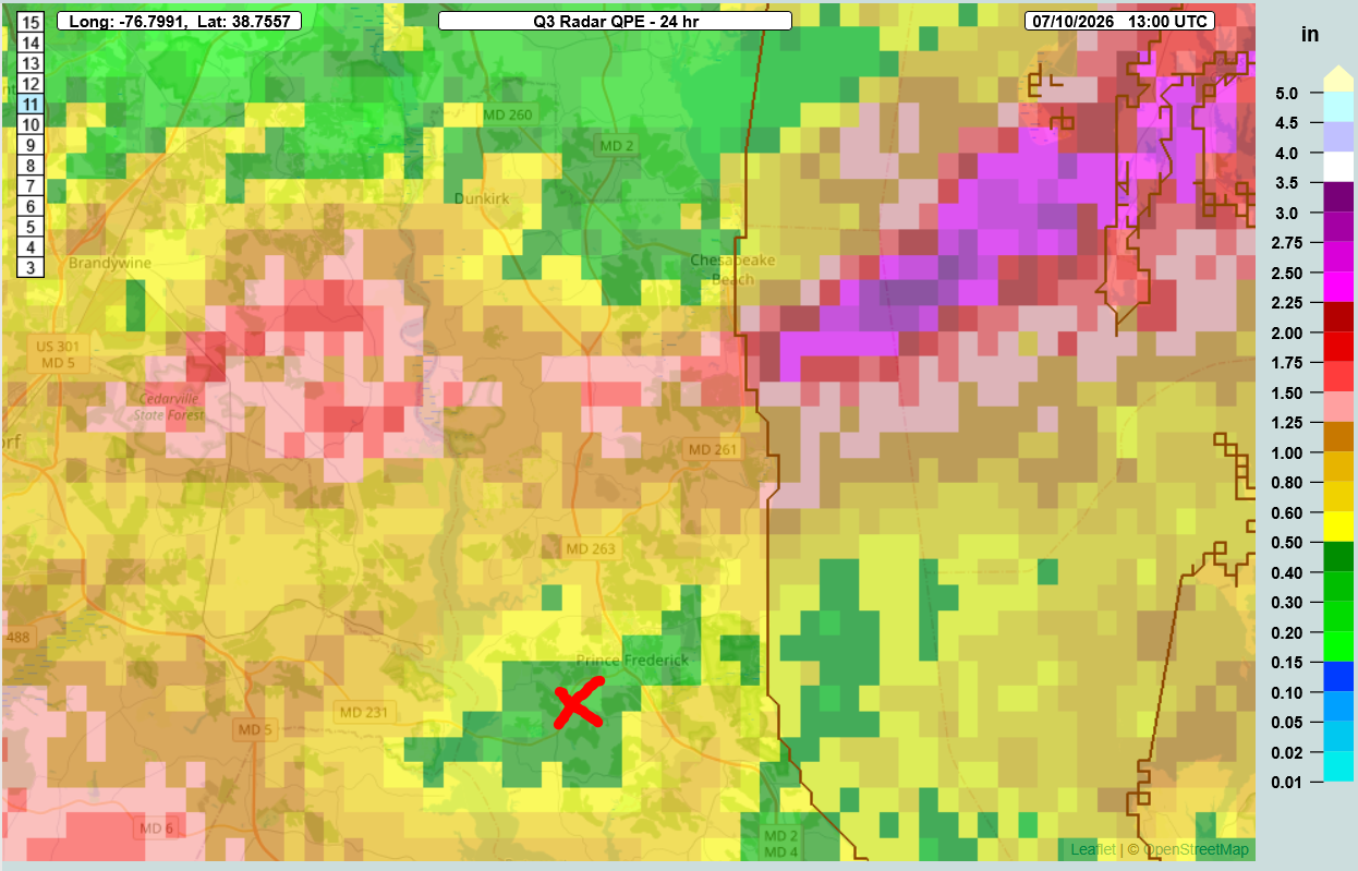
There was a sharp cut-off there. The Red X is where the Prince Frederick mesonet site is. It got the short end of the stick.

-
@Mrs.J Can I send this into the NWS and the county EM?
-
Looks like you're getting your wish.
-
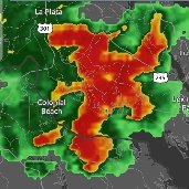
Concerning...Severe potential...Watch likely Valid 091805Z - 092000Z Probability of Watch Issuance...80 percent SUMMARY...Damaging wind gusts are possible as convection continues to intensify and move eastward this afternoon. A watch is likely. DISCUSSION...Convection along a stationary boundary has shown modest intensification over the last hour near the MD/PA border. Additional convection is developing along the Blue Ridge. Sufficiently strong westerly winds across the Ridge will eventually move convection to the east. Furthermore, around 30 kt of effective shear will be present allowing for stronger storm cells and linear structures. Low-level lapse rates will continue to steepen this afternoon, though cloud cover has been greater in the vicinity of the Chesapeake Bay. Given the potential for one or more clusters to evolve this afternoon, a watch is likely to address the threat for damaging wind gusts. ..Wendt/Hart.. 07/09/2026
-
Baseline SVR T-Storm for Northern Loudoun / Southern Frederick Edit: FFW for southern Frederick suburbs now.
-
I think given the heatwave and the 4th holiday weekend is over it's transitioned back to the July Obs thread.