hawkeye_wx
-
Posts
6,259 -
Joined
-
Last visited
Content Type
Profiles
Blogs
Forums
American Weather
Media Demo
Store
Gallery
Everything posted by hawkeye_wx
-
I use Tropical Tidbits for the hurricane models.
-
The Canadian is, very oddly, two days slower than the other models. Throw it out.
-
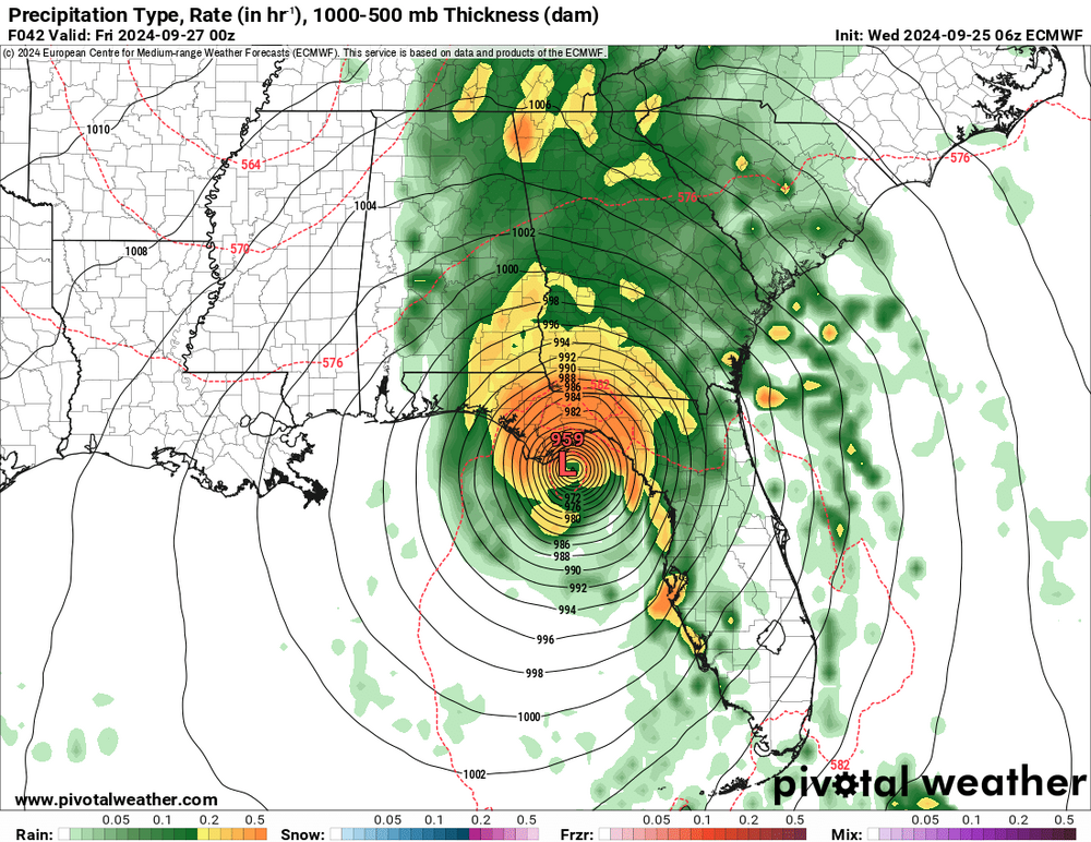
While this system is already looking good, with persistent deep convection near the center, models really start to blow it up Sunday morning as it begins its eastward track.
-
As of now, the first recon flight is not scheduled until 12z Sunday.
-
Yeah, this system has come together more quickly than models and the NHC suggested/expected. It appears to already be a TD with a well-defined surface circulation and central convection.
-
Now that this is an invest, the hurricane models are running. The HWRF, HMON, and HAFS-A are bombing it out pretty quickly, but are also suggesting possible rapid weakening upon approach to Florida as the structure deteriorates. The HAFS-B, oddly, struggles to ever strengthen it much.
-

2024 Atlantic Hurricane Season
hawkeye_wx replied to Stormchaserchuck1's topic in Tropical Headquarters
The ICON is also becoming more bullish in the gulf over the last few runs. -
It appeared Cedar Rapids was a lock to reach at least second place on the longest precip-less-stretch-on-record list. However, tonight's showers and storms popped just a hair farther north than models suggested and the Cedar Rapids airport picked up 0.05".
-
The extreme dryness is putting stress on trees. I'm seeing a lot of leaf drop around town. The city planted a bunch of new trees last year along a nearby road. Some of them are not looking good because they never get water. The city has been planting a lot of new trees along roads across the city because of the 2020 derecho. Unfortunately, a not-insignificant percentage of these trees end up dying because we keep getting bad drought every year and rain is the only way these trees get watered.
-
Cedar Rapids finished September with 0.00" of rain. At my house I got 0.11".
-
2024 Atlantic Hurricane Season
hawkeye_wx replied to Stormchaserchuck1's topic in Tropical Headquarters
The Euro has a storm in the gulf, but there is strong shear -
The new center dropsonde says 943 mb (with 9 kt wind).
-
The new recon plane is coming from Houston. It just passed the mouth of the Mississippi river. It should be in the eye in a couple hours.
-
The pressure is still 962 mb. Overnight into this morning is when the aggressive hurricane models had Helene bombing, but it didn't happen.
-
If Helene is going to jump to the next level, it needs to be able to wrap the deep convection all the way around the center, which it is having trouble doing this morning.
-
The current recon plane's final pass found 978-979 mb.
-
The center is now past the Yucatan.
-
Recon is making one final pass through the center and it has found a solid nw wobble since the last pass.
-
The latest dropsonde pressure is still 981 mb, so it has plateaued for now. Radar and satellite show a bit of a dry slot has wrapped up the east and north sides of the core. I think at least a couple models hinted at this happening this morning.
-
Solid west shift from the 06z Euro.
-
The center took the expected right turn over the last few hours. It does not appear it will interact much with the tip of the Yucatan. The latest extrap pressure is 981 mb.
-
It appears Cedar Rapids will officially end up with a trace of rain in September. Models show nothing until at least mid October.
-
It seems a new recon plane has taken off from Biloxi and is on its way, so we won't have to wait til morning.
-
It says the next recon is scheduled to take off around 4am EDT, so we won't get more data until morning.
-
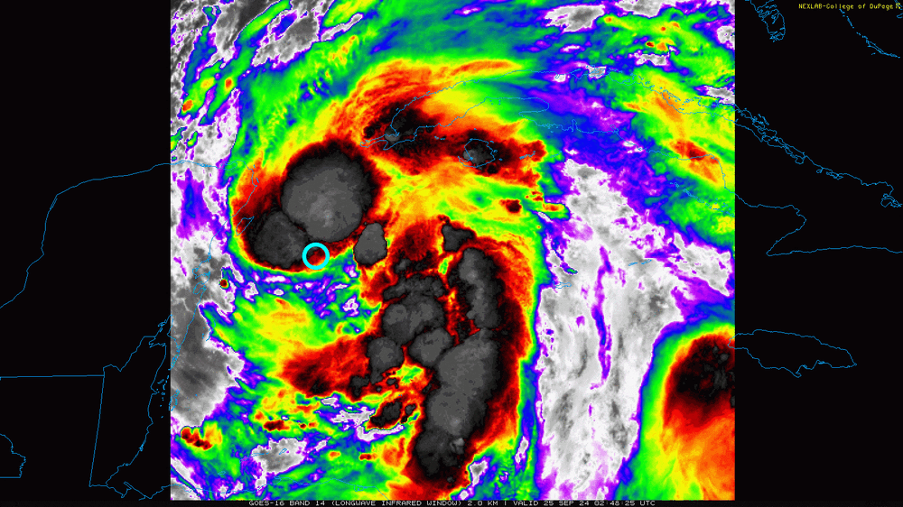
According to recon and satellite, the surface center is about where the blue circle is.