hawkeye_wx
-
Posts
6,277 -
Joined
-
Last visited
1 Follower

About hawkeye_wx

- Birthday 10/10/1974
Recent Profile Visitors
8,691 profile views


.thumb.png.991e09c19c25af7391ed569a205a5136.png)

-
A few of the meso models are suggesting a few spots around here could get 2-4" of rain today. A 2" soaker would be great. The soil is pretty dry.
-
A big ol' goose-egg here overnight.
-

Spring 2025 Medium/Long Range Discussion
hawkeye_wx replied to Chicago Storm's topic in Lakes/Ohio Valley
The pattern is looking pretty wet and stormy late this week through week two. -
I lost a strip of shingles from the corner of my roof yesterday during the howling wind. The forecast had 20 gusting to 35, but we got 30 gusting to almost 50.
-
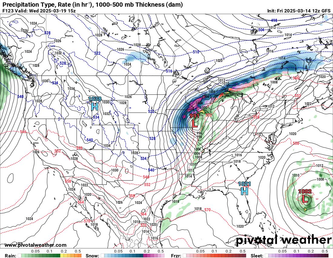
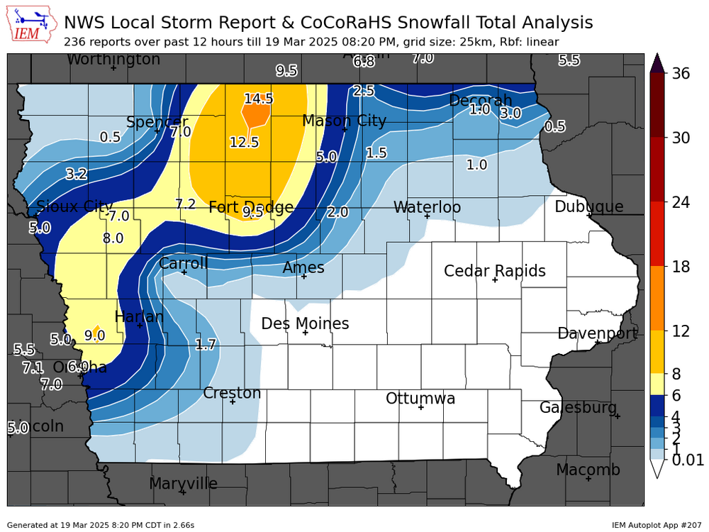
Some real nice snow totals in Iowa.
-
There was a nw trend with the snow band a day or two ago. Over the last few model runs, it has reversed and is trending back southeast, away from MSP.
-
2-4" of snow fell overnight in the southeast corner of Iowa.
-
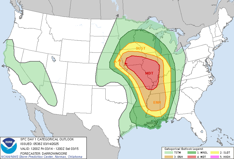
March 14-15 Severe Weather Outbreak
hawkeye_wx replied to HillsdaleMIWeather's topic in Lakes/Ohio Valley
I'm on the west side. The red cell moved right over my house, but it didn't produce anything noteworthy... maybe 50 mph? with some decent lightning and not much rain. -
March 14-15 Severe Weather Outbreak
hawkeye_wx replied to HillsdaleMIWeather's topic in Lakes/Ohio Valley
Really? Here in the city it was no big deal. -
March 14-15 Severe Weather Outbreak
hawkeye_wx replied to HillsdaleMIWeather's topic in Lakes/Ohio Valley
I got some lightning, thunder and some gustiness, but overall a big dud for much of eastern Iowa. -
March 14-15 Severe Weather Outbreak
hawkeye_wx replied to HillsdaleMIWeather's topic in Lakes/Ohio Valley
For a week all models have shown a strong line moving through eastern Iowa this evening. So far, the line approaching my area is weak crap. The 40s dews are not helping. -
March 14-15 Severe Weather Outbreak
hawkeye_wx replied to HillsdaleMIWeather's topic in Lakes/Ohio Valley
The Weather Channel has a Torcon of 9 out of 10 for Jackson, MS tomorrow. -
Cedar Rapids is up to 81º.
-
Spring 2025 Medium/Long Range Discussion
hawkeye_wx replied to Chicago Storm's topic in Lakes/Ohio Valley
The GFS looks nearly identical to the Euro, with this morning's run being a bit farther south.
-
March 14-15 Severe Weather Outbreak
hawkeye_wx replied to HillsdaleMIWeather's topic in Lakes/Ohio Valley
v