-
Posts
5,185 -
Joined
-
Last visited
Content Type
Profiles
Blogs
Forums
American Weather
Media Demo
Store
Gallery
Posts posted by mahantango#1
-
-
1 hour ago, Jns2183 said:
I sit at a dismal 9.74" of rain for the year which puts me at about the 21st percentile
Sent from my SM-S731U using Tapatalk
I got 12.40 rain for the year. And 1.70 for the month of May.
-
6 minutes ago, pasnownut said:
My wifes family is 2 generation farming family (Pine View Dairy for those that know the area).
They told me many moons ago that safe bet was memorial day for planting. I think because of the many warm springs that've been sprinkled in, it has moved up the planting timeframe, but to the peril of the planter. Spring hasnt changed that much, that its worth the gamble imo. I see sweet corn already 4-6" tall near my house, but thats much smaller scale gamble than a few hundred acres of regular corn. Fruit folks, totally diff ballgame (and not a good one this year).
Hope yall are doing well.
Yea I was talking about field corn and soybean planting. As far as planting my garden. I planted my potatoes about 2 weeks ago. There not up yet. Just planted stringbeans and peas e days ago. I should have some sweet corn planted by now, but that ground is too cold yet. And now just had .88 rain last night. And my garden is in the bottom land next to a creek. Last night during the thunderstorm my garden was basically underwater. If it would be a sunny day today and temps in the 70's I could get in the garden later today. But with a completely overcast sky and cool temps that won't be the case today. Hopefully it warms up soon and stays.
-
 1
1
-
-
Another cloud filled sky day, temp 51. another dismal day. Talked to someone that helps farmers out planting an harvesting crops. He said planting is running behind schedule with this cold May.
-
-
We see more temperature ups and downs on the way for Pennsylvania over the next 5 weeks with frequent frontal passages. Despite the fronts, the pattern may not be excessively wet, meaning that drought conditions are likely to persist for SEPA


-
 1
1
-
-
My rain rate was 2.03in. hr. during the thunderstorm last night. It's been awhile since I think last July that my rain rate was that high.
-
 4
4
-
-
Good thunderstorm we had here. Heavy rain some wind and pea size hail. Continuous thunder and lightning. And .87 rain.
-
 2
2
-
-
-
-
Hazardous Weather Outlook
National Weather Service State College PA
335 AM EDT Wed May 13 2026

PAZ004>006-010>012-017>019-024>028-033>037-041-042-045-046-049>053-
056>059-063>066-140745-
Warren-McKean-Potter-Elk-Cameron-Northern Clinton-Clearfield-
Northern Centre-Southern Centre-Cambria-Blair-Huntingdon-Mifflin-
Juniata-Somerset-Bedford-Fulton-Franklin-Tioga-Northern Lycoming-
Sullivan-Southern Clinton-Southern Lycoming-Union-Snyder-Montour-
Northumberland-Columbia-Perry-Dauphin-Schuylkill-Lebanon-Cumberland-
Adams-York-Lancaster-
335 AM EDT Wed May 13 2026

This Hazardous Weather Outlook is for central Pennsylvania.

.DAY ONE...Today and tonight.

A few thunderstorms with isolated strong to marginally severe wind
gusts are possible this afternoon and evening.

.DAYS TWO THROUGH SEVEN...Thursday through Tuesday.

The probability for widespread hazardous weather is low.

.SPOTTER INFORMATION STATEMENT...

Spotters are encouraged to report significant hazardous weather.
-
3 minutes ago, Blizzard of 93 said:
37 low in Marysville
It gets any colder you'll be posting snow maps.
-
 2
2
-
-
31.6 this morning with frost and ice on the vehicles. This upcoming warmup can't get here soon enough. Covering up plants to protect them from frost is starting to get old.
-
 1
1
-
 1
1
-
-
14 hours ago, canderson said:
F the heat! It’s why I left Texas.
Your going to Alaska, right? Maybe you should seek a residence there to escape most of the heat. Anyway It might not be that hot here this summer.
-
 1
1
-
-
1 hour ago, Voyager said:
Well, this escalated quickly!
SaturdayMostly sunny, with a high near 77.Saturday NightPartly cloudy, with a low around 55.SundaySunny, with a high near 82.Sunday NightPartly cloudy, with a low around 56.MondayMostly sunny, with a high near 87.Bring on the heat!
-
 1
1
-
-
Frost advisory's and freeze warnings are out for tonight.
-
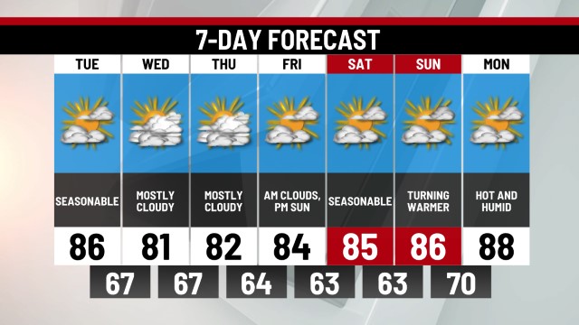
Starting this weekend, we turn a corner & highs in the 70s and 80s will be the norm for the rest of May. local21news.com/weather
-
 1
1
-
-
We have certainly been surprised and truly grateful at the overwhelming support, concern and prayers on behalf of our family. We greatly appreciate the people who come each summer to our orchard!
It was a pleasure to have CBS 21 news come and interview us concerning the impact of the April 21st freeze. The CBS team was both genuine and professional as they assembled the points of interest for the news segment.
The value of the potential crop loss, as reported, was accurate. As with most farms, every spring brings fresh hope for a potentially good year. But as farming is very weather dependent events like frosts, freezes, insects, or markets can really take a toll on expected income, as we well know. However, whether it’s a great year, average year, or poor year, input costs remain the same. This is a management scenario most farms take very seriously as we do, and prepare for it financially through rainy day funds, insurance, diversity in crops, etc.
Coping with the emotional aspect of something like this can be difficult and at times discouraging. But regardless weather God choses to prosper us or God choses to shape us through adversity our desire is to honor God in our lives as we move forward. So, as God gives us health and strength we will try again next year (2027) to produce our crops of fresh fruits and vegetables for you, our valued customers!
With much love,
Your Honey Bear Family and Staff
(Including Juliet and Georgia, our granddaughters, who are excited to be old enough to wait on customers next year!)
-
 1
1
-
-
3 minutes ago, canderson said:
I forget the name, but a Lancaster County one is closed for the season.
Yes I seen that too and there was one in Lebanon County also. Shame as most of these orchards these people own are their only source of income.
-
 1
1
-
-
Heard yesterday a local orchard very near me had significant damage from the frost and freeze a few weeks ago.
-
 1
1
-
-
KEY MESSAGE 2: Frost/freeze risk Monday night/Tuesday morning
over the western and central Alleghenies

Almost a slam dunk for a widespread frost for more than half the
CWA tomorrow night (N and W) - and a freeze in the nrn mtns.
Dewpoints will be 25-30F - just low enough to allow the temps to
be able to drop, but not too dry to keep frost away. Confidence
in frost is near 100 pct, but for freeze is about 49 pct. Due
to increasing confidence, frost advy and freeze warnings seem
likely, but the consensus among the regional offices on this
(midnight) shift was to allow at least one more forecast cycle
for that to happen.
-
.33 rain today, was more than I was expecting.
-
2 hours ago, Blizzard of 93 said:
I realized that I never put out my Winter grade for this past season…so here we go, better late than never…
Overall Grade: B+
Each met Winter month at MDT had well below normal temperatures. We had sustained deep Winter feel, with minimal breaks. The cold began right around Thanksgiving & lasted through early March.
Monthly Average Temps at MDTDecember -4.8
January -4.2
February -4.4
Snow total at MDT for the season ended up at 23.8 , which is 6.1 below seasonal average of 29.9. We got off to a really good snow start in December & January. Then in February, we couldn’t get any storms of note until the February 23rd storm, which then unfortunately under performed & only produced 3 inches at MDT while Philly, NYC & eastern New England cashed in with double digit amounts. The main issue in Each Winter month was the overall lack of precipitation. We had temperatures cooperate most of the time, but could not get the storm chances to provide more snow. The other issue is that yet again, we got no measurable snow in March. When we were sitting at 20 inches at the end of January, I thought that we were well on our way to an above normal season, but the end game was disappointing.
Monthly snow totals at MDT
December 5.0
January 15.2
February 3.6
If we would have reached climo average for the snow total, this Winter would have gotten an A from me, thanks to the sustained cold & snow/sleet cover lasted for over a month.
This Winter provided several “What ifs” that could have made this season even more memorable with slightly better storm tracks or air mass cooperation.
Here are a few “What Ifs”:
-The Boxing Day ice storm tracked just 50 to 75 miles further southwest, we could have got the 3 or 4 inches of snow that Allentown & NYC received.
-The mid January trough that set up that produced a couple of inches of snow at MDT with a few rounds of light precip, what if it consolidated into 1 significant snow event or if the track was more favorable with the actual events that produced 6 inches or more in Allentown & northeast PA.
-The major snow/sleet storm in late January that produced 12 inches at MDT… what if the sneaky marginal warm layer that caused the flip to sleet due to the weak primary low that tracked into WV was offset by an earlier or stronger coastal low that could have reduced or eliminated the sleet mix…This storm was the only heavy precip producer of the season. It would not have taken much to get a widespread 18 inches of snow in the LSV.
-the February storm that gave us 3 inches from the late developing Miller B… what if it developed just 100 miles further southwest… we could have received the 10 to 20 inch amounts that Philly & NYC scored.
There are a few more chances that ended up not in our favor, especially in the first half of March, but no such luck.
Overall, there was non stop Winter storm tracking from Thanksgiving to mid March. I was satisfied with this Winter, but also frustrated, mainly due to all of the what ifs that I mentioned. If one or two of those broke in our favor, this Winter would have been great.
This Winter was our best season since 20–21 & much better than the last few seasons.I wonder what the upcoming winter will bring? Knowing our luck maybe several freezing rain events.
-
20 minutes ago, Voyager said:
Yup. It's getting quite old...
And yet ANOTHER semi crappy weekend day today. Chilly, damp and drizzly.

-


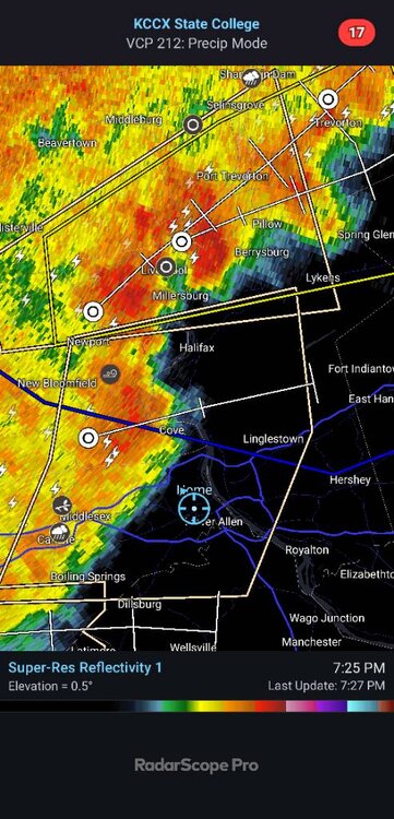
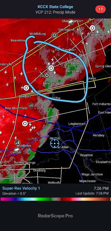
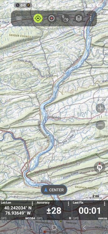

Central PA Spring 2026 Discussion/Obs Thread
in Upstate New York/Pennsylvania
Posted
Was mowing for 2hrs. On the riding mower this afternoon. I got cold out there. It felt like I was mowing in November with a temp of 53. Then got a surprise rain shower which put down .02 rain. Have to finish mowing tomorrow since the grass got all wet.