

Met1985
-
Posts
15,298 -
Joined
-
Last visited
Content Type
Profiles
Blogs
Forums
American Weather
Media Demo
Store
Gallery
Everything posted by Met1985
-

2023-2024 Fall/Winter Mountain Thread
Met1985 replied to The Alchemist's topic in Southeastern States
12z euro this evening. Sent from my SM-G998U using Tapatalk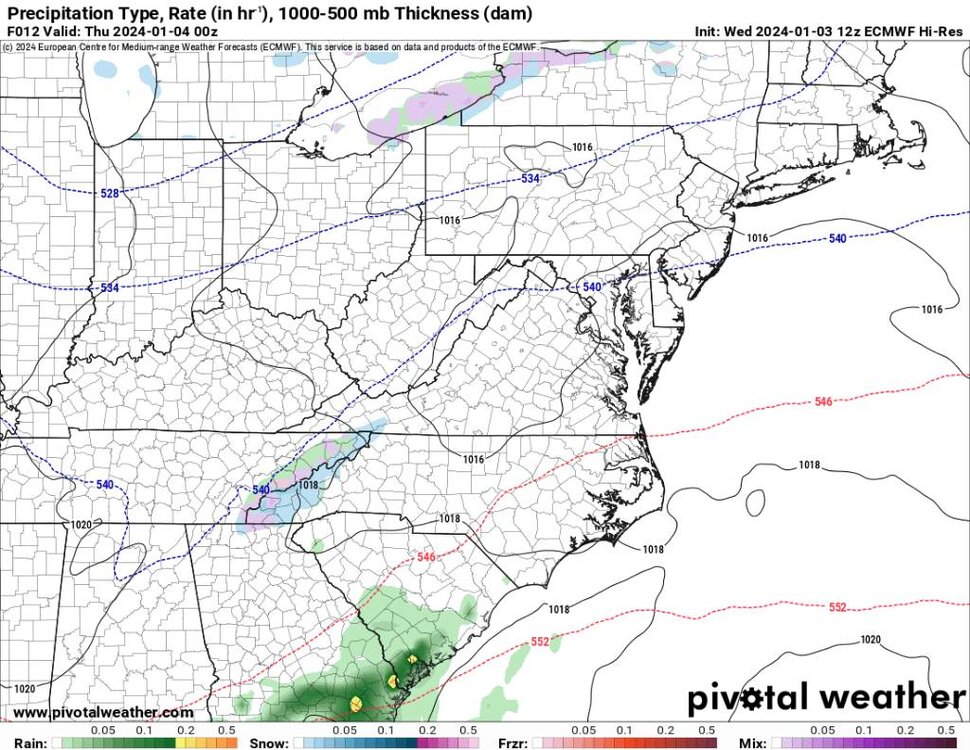
-
2023-2024 Fall/Winter Mountain Thread
Met1985 replied to The Alchemist's topic in Southeastern States
The third storm has a significant icing signature to it currently... Sent from my SM-G998U using Tapatalk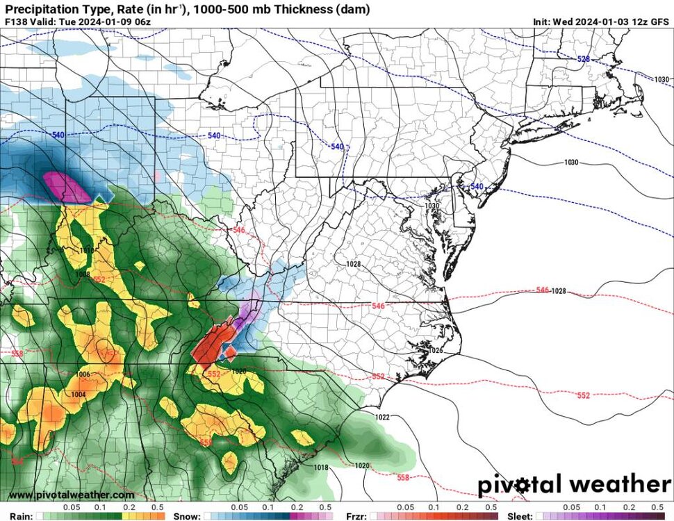
.thumb.jpg.0b2bafd70714ba7cc77cd294047dc656.jpg)
-
2023-2024 Fall/Winter Mountain Thread
Met1985 replied to The Alchemist's topic in Southeastern States
12z gfs for second storm. Seems colder at the onslaught. Sent from my SM-G998U using Tapatalk.thumb.jpg.0a2cae35327bf0ec8fb87920cb995cd8.jpg)
.thumb.jpg.0be7956c435cd6b4f125c5fb77a56135.jpg)
-
2023-2024 Fall/Winter Mountain Thread
Met1985 replied to The Alchemist's topic in Southeastern States
Precipitation is way north of what ANY model has been showing. Actually most models overnight had dropped the Precipitation further south... Again model fail in like 12 hours from the event. -
2023-2024 Fall/Winter Mountain Thread
Met1985 replied to The Alchemist's topic in Southeastern States
We've seen this several times we're the models underestimate a wave and it's energy. We will see but could be a surprise in the southern mountains and foothills this evening and tonight. -
2023-2024 Fall/Winter Mountain Thread
Met1985 replied to The Alchemist's topic in Southeastern States
We don't start storm threads for the mountains. This is a catch all. We just roll with one long thread through the winter. -
January Medium-Long Range Discussion
Met1985 replied to Holston_River_Rambler's topic in Tennessee Valley
Holston great input. The models have handled energy and the strength pretty poorly in my opinion. Our so called torch in December really never materialized in my opinion. Sure we could see the SER rear it's head but I think the models are having a tough time currently. Even the ensembles are flip flopping. Cold one day and warm the next... -
2023-2024 Fall/Winter Mountain Thread
Met1985 replied to The Alchemist's topic in Southeastern States
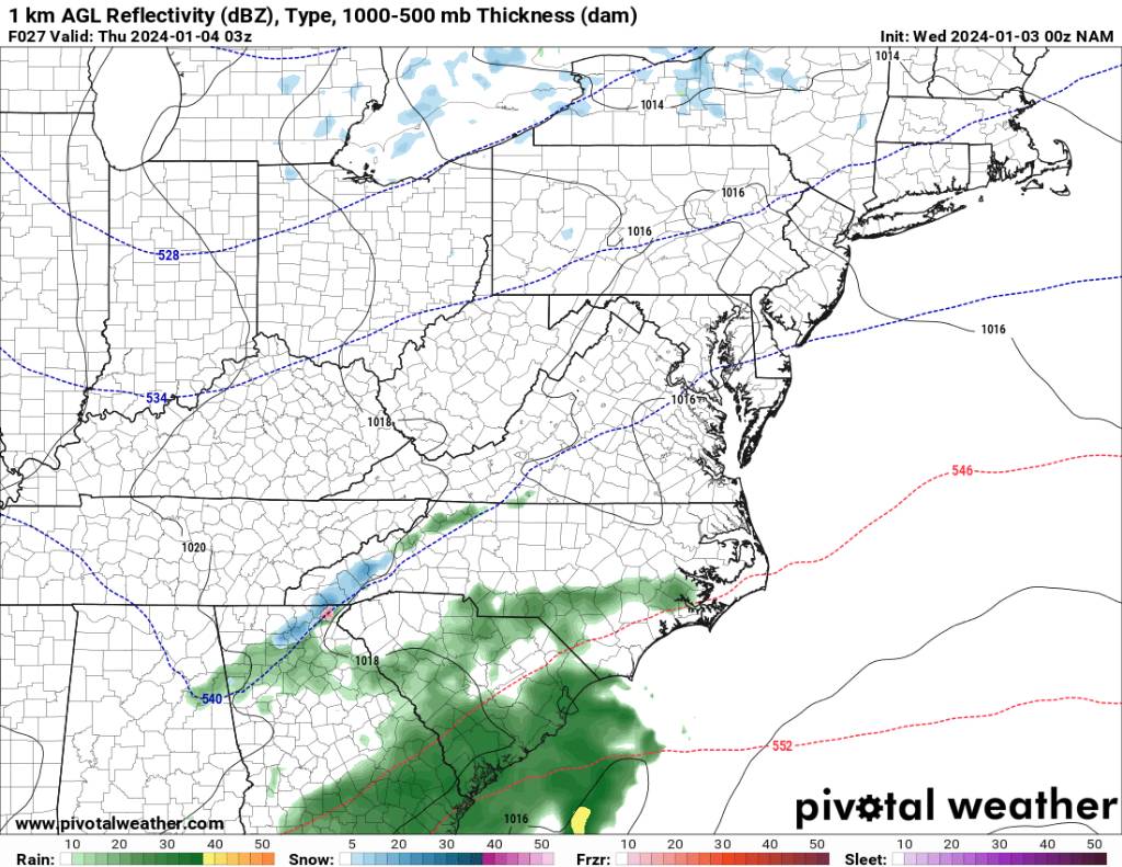
Second system looks like a mess on the 6z gfs. Sent from my SM-G998U using Tapatalk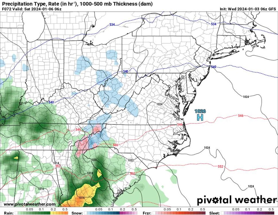
.thumb.jpg.15da225cbe558fb23ee23f831c246443.jpg)
-
2023-2024 Fall/Winter Mountain Thread
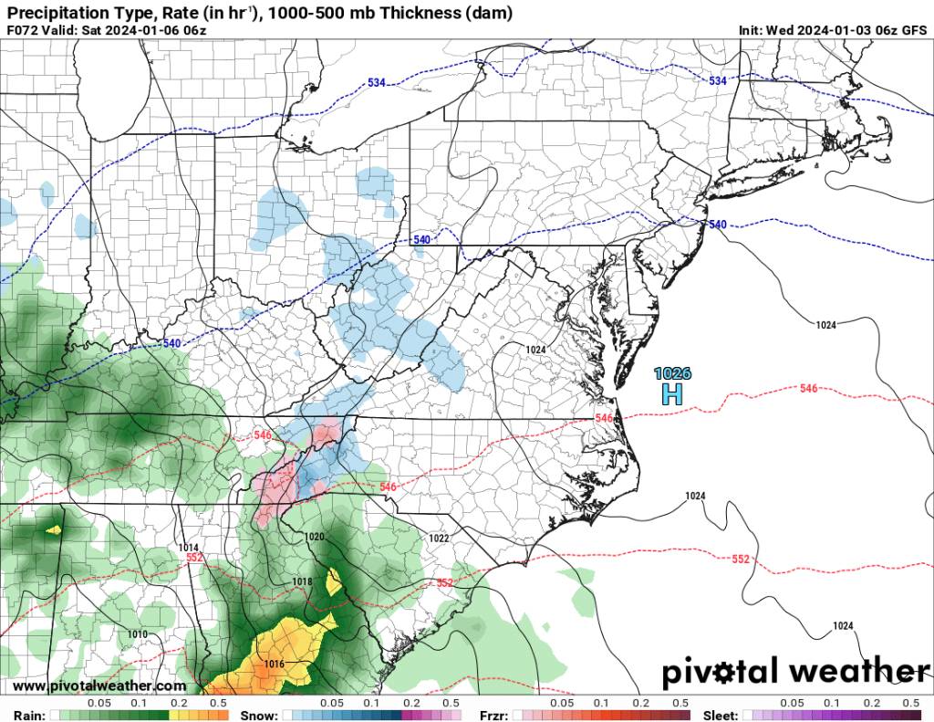
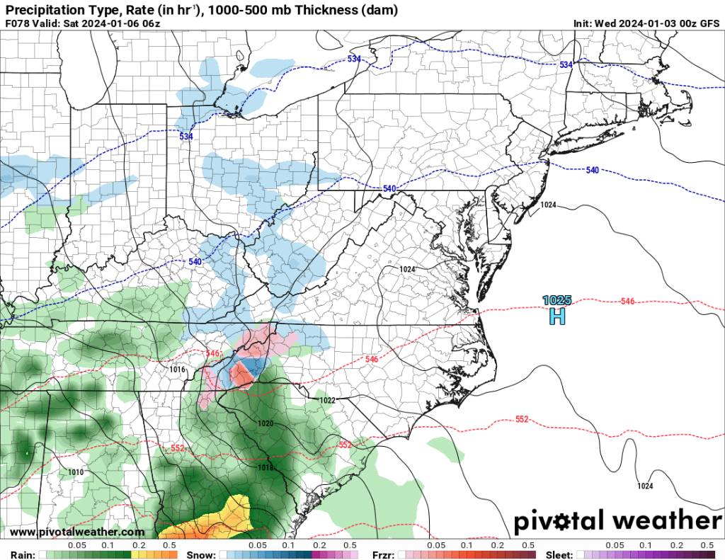
Met1985 replied to The Alchemist's topic in Southeastern States
Third system now looks more wintery. Sent from my SM-G998U using Tapatalk.thumb.jpg.eb36556e21a9a5d52eb60b647e74150a.jpg)
.thumb.jpg.5ab1ff2e423e47d9b9cbe141d719119b.jpg)
.thumb.jpg.e8b117373440983f419f2e1aada8d757.jpg)
.thumb.jpg.e8aaffcb972eabbcb16d50336951a8aa.jpg)
.thumb.jpg.88760444a9d5eca2f45b63a9edd0abb5.jpg)
-
2023-2024 Fall/Winter Mountain Thread
Met1985 replied to The Alchemist's topic in Southeastern States
So far the 00z euro is south and weaker. Looks wintery. Sent from my SM-G998U using Tapatalk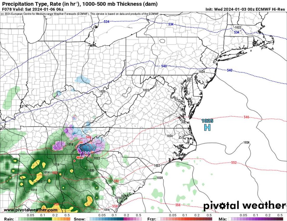
.thumb.jpg.c3b27c02cf117475ebc75d8341dd178f.jpg)
-
2023-2024 Fall/Winter Mountain Thread
Met1985 replied to The Alchemist's topic in Southeastern States
Also the third system looks 10 times better for our area. Sent from my SM-G998U using Tapatalk
.thumb.jpg.52429e02c5115ff2aac53d8ab694ba55.jpg)
.thumb.jpg.72ad6f9c0c2b2b2abab2df5583d739e5.jpg)
.thumb.jpg.ea30066fc1429dfeb3b2135bea2e817c.jpg)
-
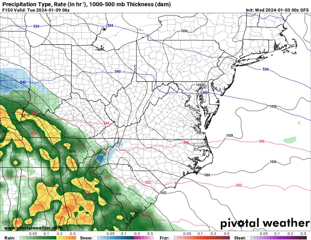
2023-2024 Fall/Winter Mountain Thread
Met1985 replied to The Alchemist's topic in Southeastern States
Just getting around to looking at the 00z suites. As wncsnow as mentioned the gfs looks lots better. I think is eroding the CAD too fast but that is the norm. Sent from my SM-G998U using Tapatalk
.thumb.jpg.20b4bcf305664e8075244857ae8e5f7d.jpg)
.thumb.jpg.2cd6a6ddb4a3665683aaa175a3dd243b.jpg)
-
2023-2024 Fall/Winter Mountain Thread
Met1985 replied to The Alchemist's topic in Southeastern States
We need weaker and less amped. It'll let the system come further south. Stronger will mean more north. -
2023-2024 Fall/Winter Mountain Thread
Met1985 replied to The Alchemist's topic in Southeastern States
00z NAM says there might be some flakes in the southern mountains. Sent from my SM-G998U using Tapatalk
-
The mountains and piedmont can work with that. Really any of us. That tells me there will be bouts of cold and a bit warm but no torch.
-
2023-2024 Fall/Winter Mountain Thread
Met1985 replied to The Alchemist's topic in Southeastern States
As we have seen several times this season so far are changes in the pattern post 5 days. We've seen the models want to shunt storms through the middle of the country only to correct and swing all the way through to the coast. Just be patient and we will see things develop. This is not last year. -
2023-2024 Fall/Winter Mountain Thread
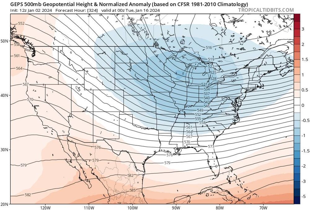
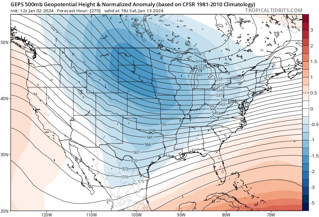
Met1985 replied to The Alchemist's topic in Southeastern States
This look from the GEPS is something we can definitely work with also. Sent from my SM-G998U using Tapatalk
-
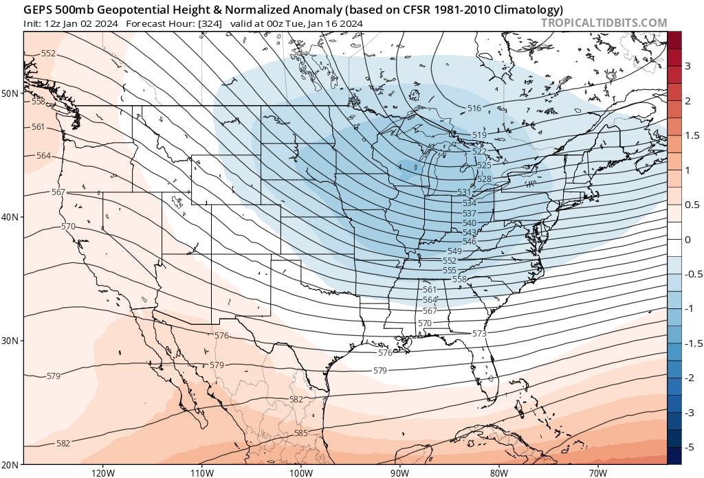
2023-2024 Fall/Winter Mountain Thread
Met1985 replied to The Alchemist's topic in Southeastern States
Just some insight for you guys and maybe we will make it through this with a decent snowfall. -
2023-2024 Fall/Winter Mountain Thread
Met1985 replied to The Alchemist's topic in Southeastern States
Hey guys it's only January 2nd. Keep your heads on and look at the big picture. I know we all want snow. Winter is just getting started. -
2023-2024 Fall/Winter Mountain Thread
Met1985 replied to The Alchemist's topic in Southeastern States
Huge differences with the pattern from the gfs and the Euro with the pattern. The Euro matches up very well with the eps, weeklies and monthlies. Sent from my SM-G998U using Tapatalk.thumb.jpg.00b49288d9a1c12aea167aef41e67a7b.jpg)
.thumb.jpg.4bcab364de866cbd52fc8f9661ff4cee.jpg)
-
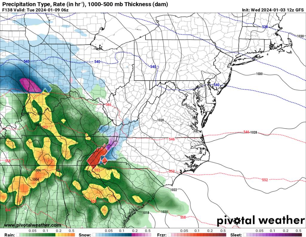
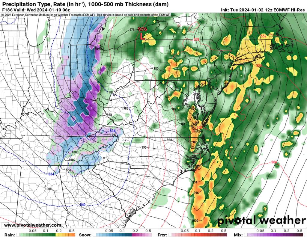
2023-2024 Fall/Winter Mountain Thread
Met1985 replied to The Alchemist's topic in Southeastern States
Look at the 18z gfs. Still has the wound up storm cutting. Who is right? My bets are on the Euro and eps. Gfs is out to lunch. There are going to be some changes in the pattern moving forward. Sent from my SM-G998U using Tapatalk.thumb.jpg.f57ea30a63c154b0fb6a65e69a44a25f.jpg)
-
2023-2024 Fall/Winter Mountain Thread
Met1985 replied to The Alchemist's topic in Southeastern States
Today 12z eps supports my case above. Looks damn good. Sent from my SM-G998U using Tapatalk
.thumb.jpg.1b119f50bf4c8edc6eef2f841c04b8f9.jpg)
-
2023-2024 Fall/Winter Mountain Thread
Met1985 replied to The Alchemist's topic in Southeastern States
Upslope event on euro. Sent from my SM-G998U using Tapatalk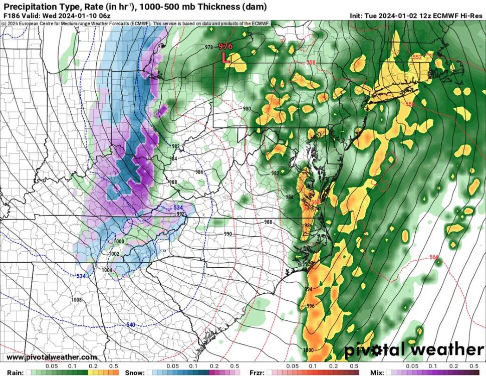
-
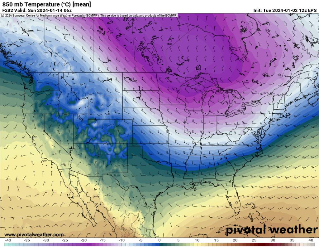
2023-2024 Fall/Winter Mountain Thread
Met1985 replied to The Alchemist's topic in Southeastern States
Big changes on the Euro with the third system. It doesn't cut into Arkansas but rather straight through us which gives us a great upslope signature. Also the end of the run you can see a ridge building out West and a Canadian high coming down on this side of the Rockies. That's what we want. Sent from my SM-G998U using Tapatalk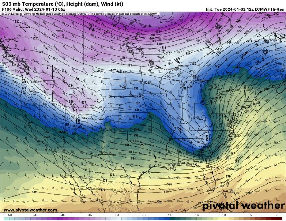
.thumb.jpg.0421b75b8168b0952df591e6cfc09b53.jpg)
-
2023-2024 Fall/Winter Mountain Thread
Met1985 replied to The Alchemist's topic in Southeastern States
Because of the NPAC. That shouldn't have staying power though.


.jpg.23619f9822c7c740d60c27698d9748d5.jpg)
.jpg.b11bb54d45ce06b75f8e1a9e0cc769ac.jpg)
.jpg.58e4e30a66fb76075fc0081aa4f36248.jpg)
.jpg.6accd7e5d115faacaf32f24452baed34.jpg)
.jpg.3c172afbf4159071ff159992cb76e1a5.jpg)
.jpg.dea291c8e563d5856c93d7bbb9ed9c1e.jpg)
.jpg.7730b7501580748cadd0cb10ba16d6c8.jpg)
.jpg.acf911d5d3536f6ee96784d6cfe892bf.jpg)
.jpg.d5ed5aff495d7356334bc8f29c484c42.jpg)

.jpg.e2272ac0333ee2630c7f81ad49e26917.jpg)
.jpg.0052f290a186cb3985ba84af8819587b.jpg)
.jpg.175e0f4b613670ff1a7c7805570499c8.jpg)
.jpg.b7afcb4b8900b4a5715d6d3d25a61fca.jpg)
.jpg.0845fdc0910b1fa6aad37fabde33203d.jpg)
.jpg.9ae8b43dfdada77f109b0a8d244edb1d.jpg)

.jpg.6b980acd965edd62b564c811479f9b1b.jpg)
.jpg.72090704107d3acbbf6c09055834e0a7.jpg)
.jpg.b2fad0d2c9e2ae9e94d6fcc902fad19a.jpg)
.jpg.078e1b17aade5d015a2e9c02eaf567b4.jpg)

.jpg.f38cc6748e3618f9726fd7e270f6f053.jpg)