

Met1985
-
Posts
16,974 -
Joined
-
Last visited
Content Type
Profiles
Blogs
Forums
American Weather
Media Demo
Store
Gallery
Everything posted by Met1985
-

2025 Spring/Summer Mountain Thread
Met1985 replied to Maggie Valley Steve's topic in Southeastern States
Yep was a beautiful day with temps right around 70 today. Tomorrow more of the same. -
Did a front come through today's because I shot up to 60 degrees around noon then the wind really kicked up and I've fallen all the way back to 48 currently.
-
Yeah we aren't done along the border at all let alone 4k feet.
-
Was a cold day today. Had a high of only 36 with a current temp of 30.
-
I'd say not. I've literally seen it 80 one week and snow the next.
-
Surprisingly there is a dusting of snow on Long Shoals rd.
-
23 degrees and still snowing here this morning. Was very surprised even though the flow was not optimal but the moisture feed was decent.
-
24 degrees with moderate snow. 1 inch on the ground but blowing all over.
-
Yep deck is covered along with the top of the truck. Coming down moderately.
-
I'm right on your heels.
-
Moderate snow at me Casa. Sent from my SM-G998U using Tapatalk
-
Rain snow mix in downtown Canton now.
-
Rain with a temp of 41. Lol the flow currently is coming from the SW.
-
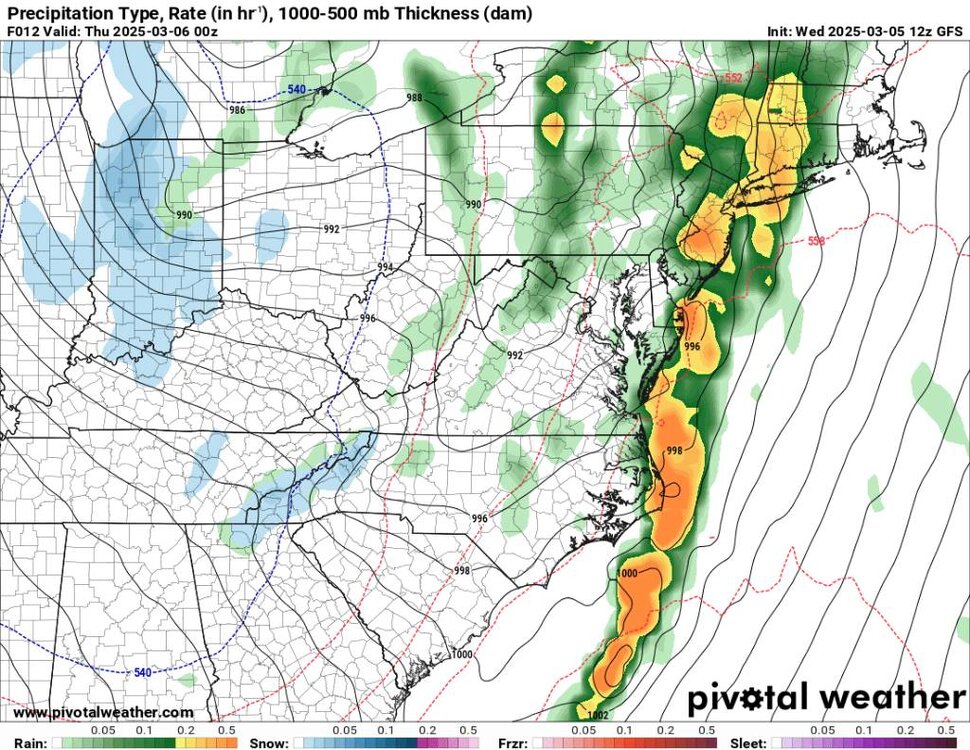
12z gfs looks decent. Looks like the flow will start WNW but then overnight will turn to a more NW flow in my opinion. Sent from my SM-G998U using Tapatalk
.thumb.jpg.e44e130bad641e1416cc64c1004cf488.jpg)
.thumb.jpg.adc37b9f9dcc806dad2ed29a0a920442.jpg)
.thumb.jpg.b3182d2a98612ad354bbbcee041820b3.jpg)
-
Yeah got a lot of rain and storms overnight. The power was knocked out for a bit. Very windy and the wind should blow snow in this evening and tonight.
-
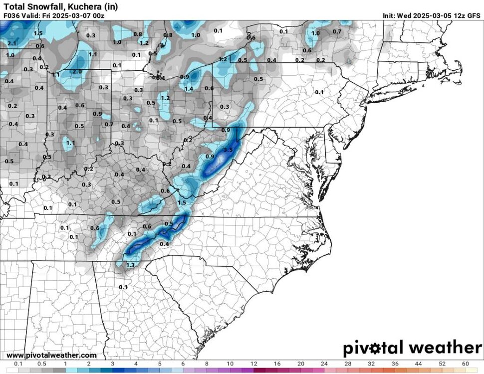
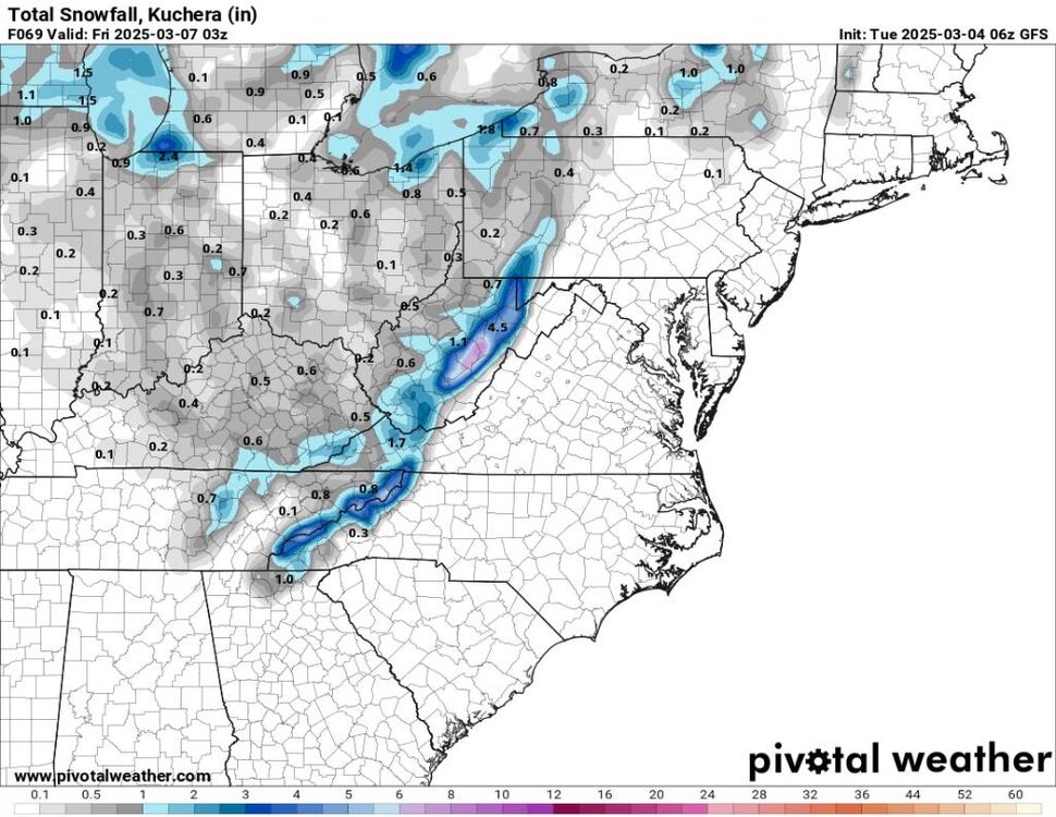
The models have been going back and forth with this system around the 9th but this is what we have this morning. Not as amped but brings in snow instead of rain. Sent from my SM-G998U using Tapatalk
.thumb.jpg.6a11d4149e01f51f2197fa076631eb91.jpg)
.thumb.jpg.4768cb267e3870411f1a4d8f350c42ad.jpg)
.thumb.jpg.b16c1bbf0dd5488fa159bb1d7261a08b.jpg)
-
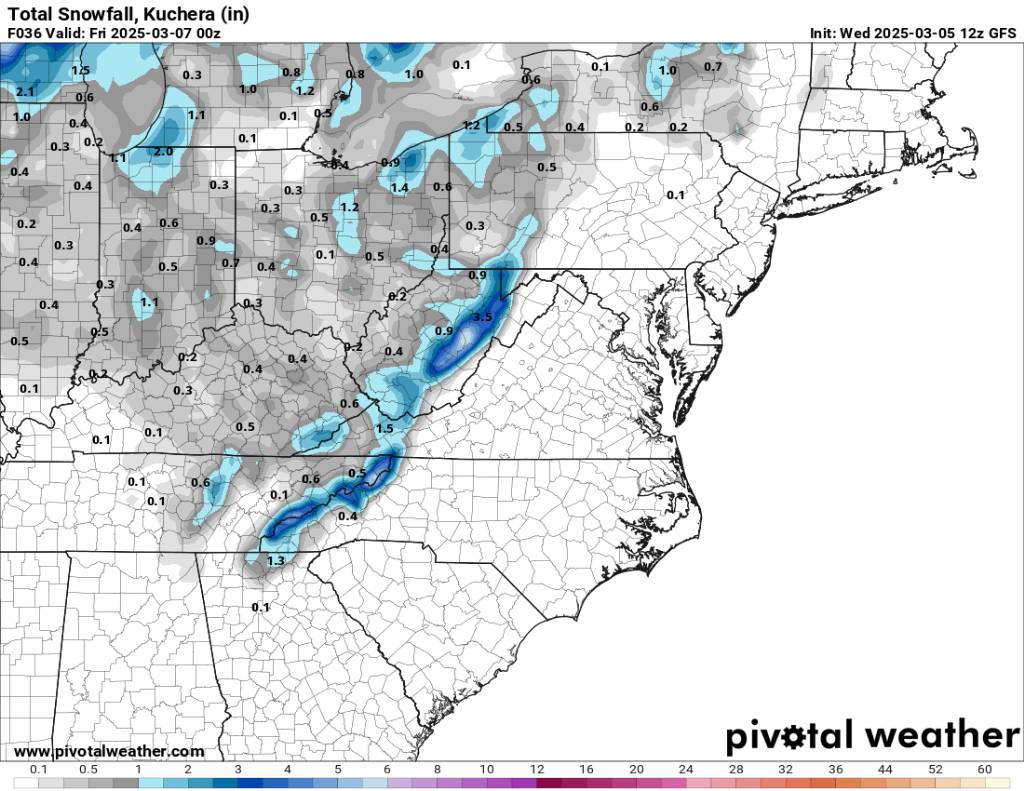
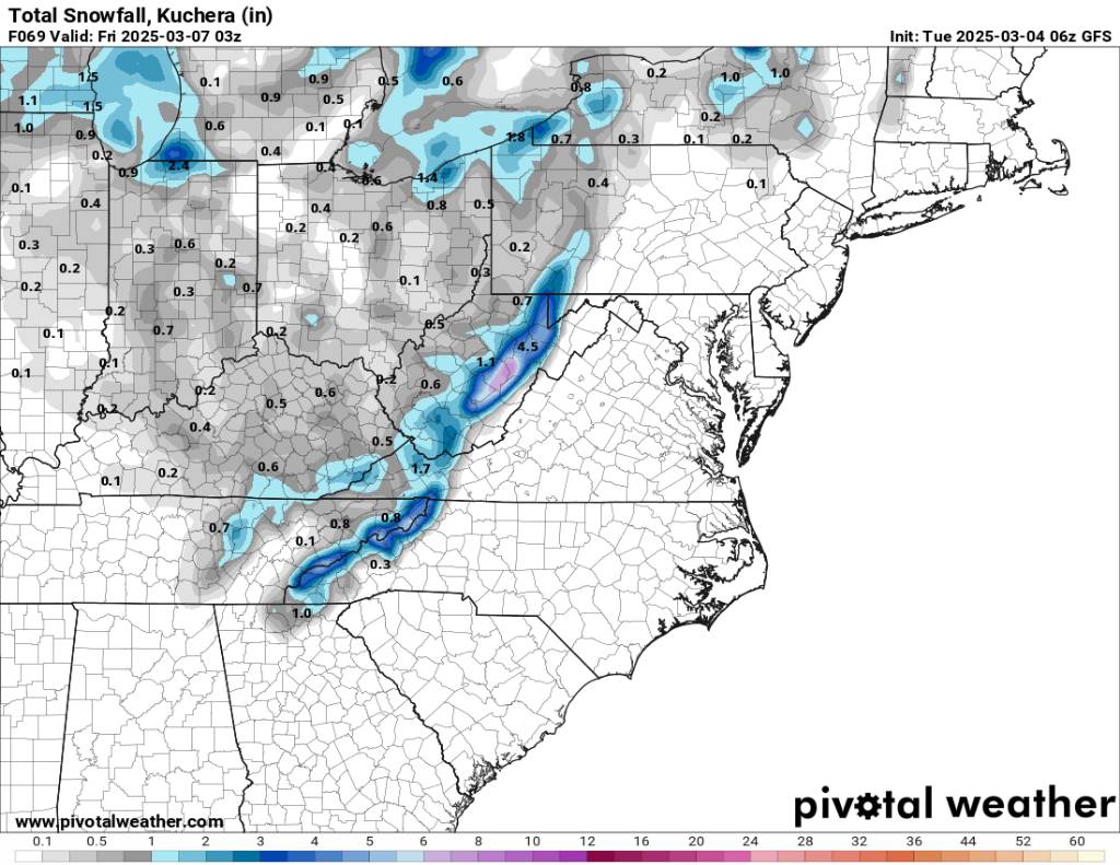
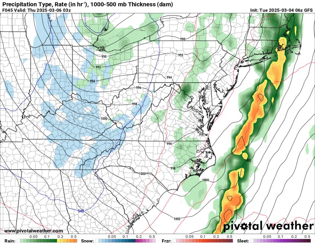
Looking decent for the 6th with the flow snow coming in. Sent from my SM-G998U using Tapatalk

.thumb.jpg.552ce10daae4d2055b1a31f5844a37af.jpg)
.thumb.jpg.de42da2b72a3bd5dbaf75fb1397cba7c.jpg)
.thumb.jpg.1ca5f5e83a93a2aad53e1cb6e0315408.jpg)
-
18 degrees here this morning. Currently looks like we could see snow on the 6th and the 9th on the short range models.
-
Low of 18 degrees this morning. Looks like the flow snow will kick in this week.
-
Temp down to 36 currently with a forecast low of 17 degrees but tonight will be about the fires popping up. Fires near Newfound mountain and down into Leicester along Hookers Gap and Fires down near MM 12 near the interstate.
-
Wildfires popping up all over the area tonight. A Wildfire near MM 12 going into the Gorge on I40 near where the interstate just reopened.
-
Back to reality tonight.
-
Yeah multiple events showing up on the Euro and gfs.
-
Yall want to start the spring/summer thread in March or in April?
-
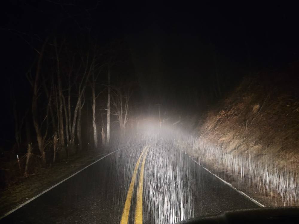
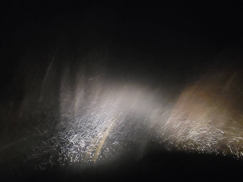
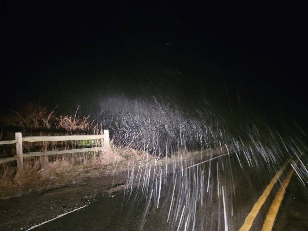
Stunning


.jpg.2bb15af8a33bb029dbb2e5bc2b635e85.jpg)
.jpg.6600b202d593a340b32afa8e5e54133b.jpg)
.jpg.fe3b73985ad923f48964982359f9b153.jpg)
.jpg.e251ad8a1ca04fb8a498c2ce7a8efea5.jpg)
.jpg.60e9b392377335614b2c927bbfecd420.jpg)
.jpg.a8794f53e36215687779a12190dcac5d.jpg)
.jpg.744be1d366ae575f03fe8f5713ed8674.jpg)
.jpg.6c2863f7b388d07d9d7d230b2353c853.jpg)
.jpg.57a2202a72726b01220290a8561af816.jpg)

