

Met1985
-
Posts
15,299 -
Joined
-
Last visited
Content Type
Profiles
Blogs
Forums
American Weather
Media Demo
Store
Gallery
Everything posted by Met1985
-
Also an EF0 struck Black Mountain. Extremely rare for us but possible.
-
Confirmed Tornado in Jackson County. https://wlos.com/news/local/tornado-jackson-county-national-weather-service-confirms-glenville-area-ef-1-survey-severe-storm-damage-western-north-carolina#
-
Was humid and very warm today in Buncombe. Finally got home to low humidity with a temp of 57 degrees. Going to be a beautiful weekend.
-
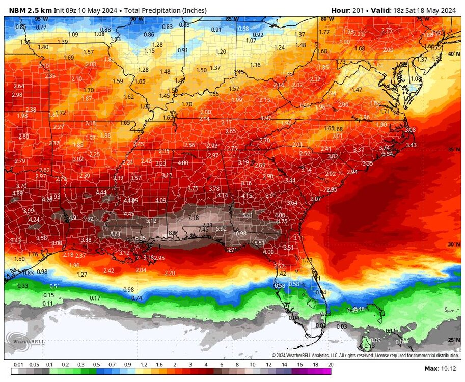
Going to be another wet week. Sent from my SM-G998U using Tapatalk
-
This is the start of an unsettled period.
-
Yeah a real treat for May.
-
Today's high was supposed to be 78... Currently at almost 2pm it's 59 degrees...
-
The storms last night meant business! Impressive wind and thunder and lightning.
-
It's gotten eerily still before the main line hits.
-
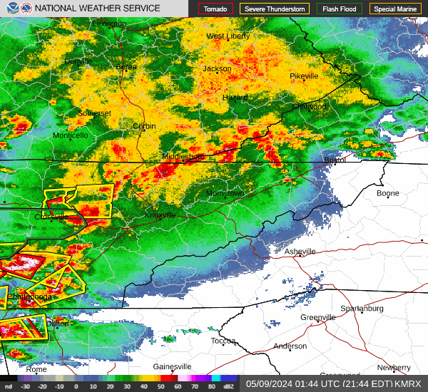
The main line isn't here yet but it's popping off individual localized cells out in front of it.
-
House shaking thunder.
-
Heavy rain coming in now...
-
Radar is popping off! Sent from my SM-G998U using Tapatalk
.gif.9631da112fc22f424c3e19335023728b.gif)
-
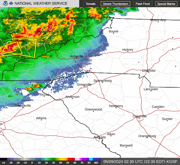
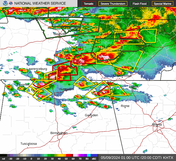
Everyone is going to get nailed. Severe Thunderstorm Warning for... Western Macon County in western North Carolina... Northwestern Jackson County in western North Carolina... Madison County in western North Carolina... Swain County in western North Carolina... Graham County in western North Carolina... Haywood County in western North Carolina... Northern Buncombe County in western North Carolina... * Until 1215 AM EDT. * At 1114 PM EDT, severe thunderstorms were located along a line extending from 13 miles south of Greeneville to 17 miles southeast of Maryville to 12 miles northwest of Robbinsville to 11 miles north of Murphy, moving southeast at 35 mph. HAZARD...60 mph wind gusts. SOURCE...Radar indicated. IMPACT...Expect damage to trees and power lines.
-
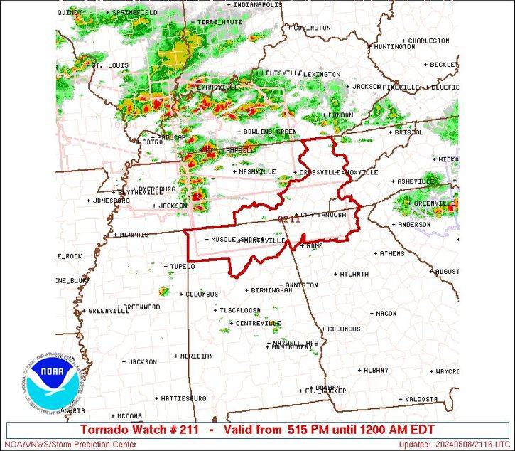
Big time! TORNADO WATCH OUTLINE UPDATE FOR WT 214 NWS STORM PREDICTION CENTER NORMAN OK 1110 PM EDT WED MAY 8 2024 TORNADO WATCH 214 IS IN EFFECT UNTIL 400 AM EDT FOR THE FOLLOWING LOCATIONS NCC039-043-075-087-099-113-173-175-090800- /O.NEW.KWNS.TO.A.0214.240509T0310Z-240509T0800Z/ NC . NORTH CAROLINA COUNTIES INCLUDED ARE CHEROKEE CLAY GRAHAM HAYWOOD JACKSON MACON SWAIN TRANSYLVANIA $$
-
Good Lord look at all the warnings. Sent from my SM-G998U using Tapatalk
-
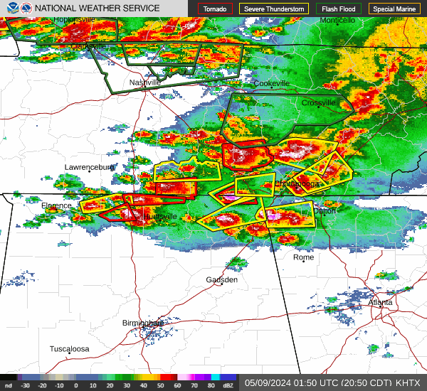
Then there are even more cells to the NW that will be affecting us tomorrow morning. Sent from my SM-G998U using Tapatalk
-
Looks like we have a squall line forming a bit. Some nasty cells especially to the south. Sent from my SM-G998U using Tapatalk
-
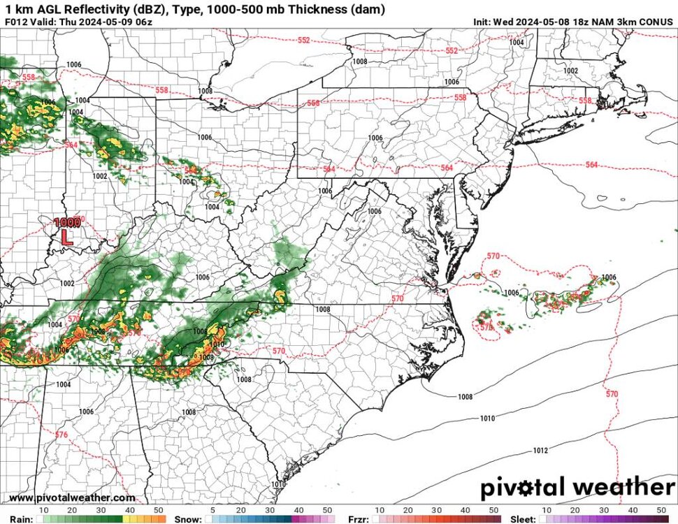
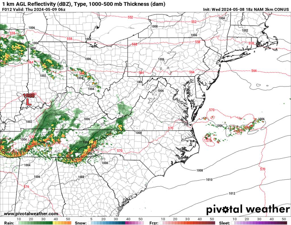
Yeah the 3k NAM is showing this current round then another round later on the morning.
-
This is nasty tonight! Sent from my SM-G998U using Tapatalk
-
Looks like we have 2 more rounds of severe weather to go. Sent from my SM-G998U using Tapatalk
.thumb.jpg.fb14c9eb1c488d229c0646e92314452a.jpg)
-
Very impressive for sure.
-
Nothing yet. We are actually in a lull on the grounds. Has some high wind though.
-
Shits fixing to hit the fan in Buncombe
-
Yeah cloud deck coming down at Biltmore.


.jpg.7e1bbced9cd2fb2a7b3970cbbcaa08b2.jpg)