Met1985
-
Posts
16,974 -
Joined
-
Last visited
Content Type
Profiles
Blogs
Forums
American Weather
Media Demo
Store
Gallery
Everything posted by Met1985
-
Euro finally running.
-
Yeah they do. I've seen Franklin go from snow to rain we stay snow and Asheville mixes. Can get crazy in these setups.
-
I don't even look at the UK anymore.
-
This could be a real mess and Asheville will not be prepared if this comes.
-
Pretty good this far out.
-
A lot to workout still. The Euro is leading the way on this.
-
Long duration event. Sent from my SM-G998U using Tapatalk

-
Decent... Sent from my SM-G998U using Tapatalk
-
High pressure is stronger this run.
-
12z GFS has this starting Friday night now...
-
Exactly.
-
I wouldn't Bank anything on the AI models currently. They've not done well at all.
-
I'd be very hesitant with the AI models. They really haven't done well. A tool but I wouldn't lean heavily on anything they spit out.
-
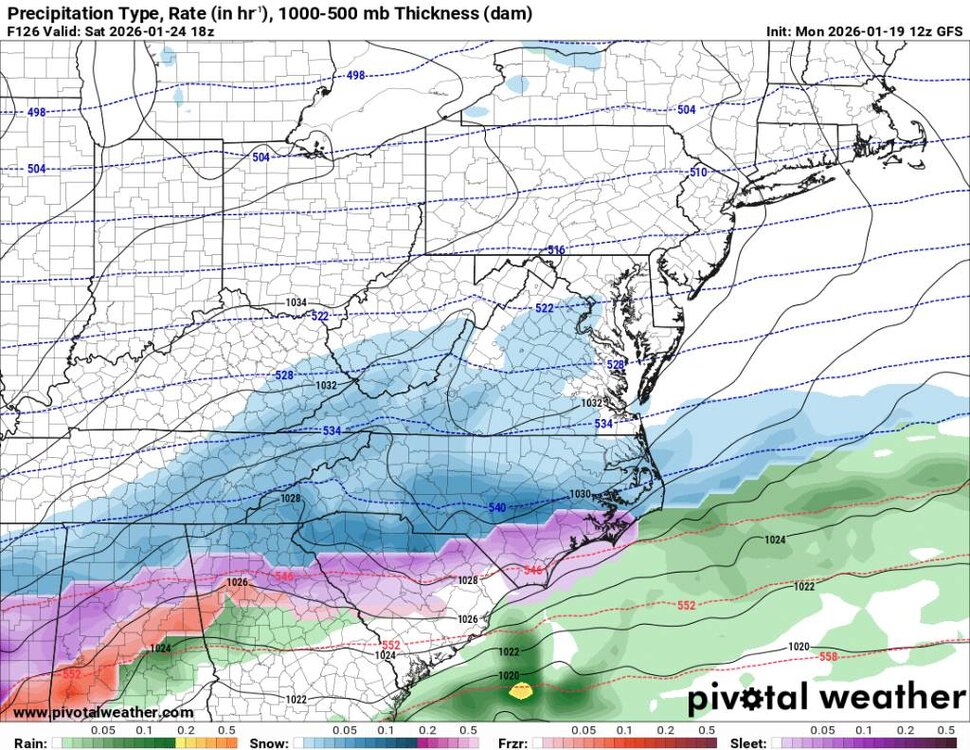
An overrunning event would be a classic winter storm for the region. I think it would be best case scenario with what's being shown.
-
Low of 16 and current temp of 19. Currently their may or may not be a significant system this weekend. We've got the Euro and GFS showing something. That's about all im going to bite on Currently. The mountain crew will monitor the situation but we won't get into a frenzy....
-
More like 48 hours before.
-
Another solution by the gfs. Who's surprised. Hopefully the Euro leads us on this which it should. This is definitely it's wheelhouse.
-
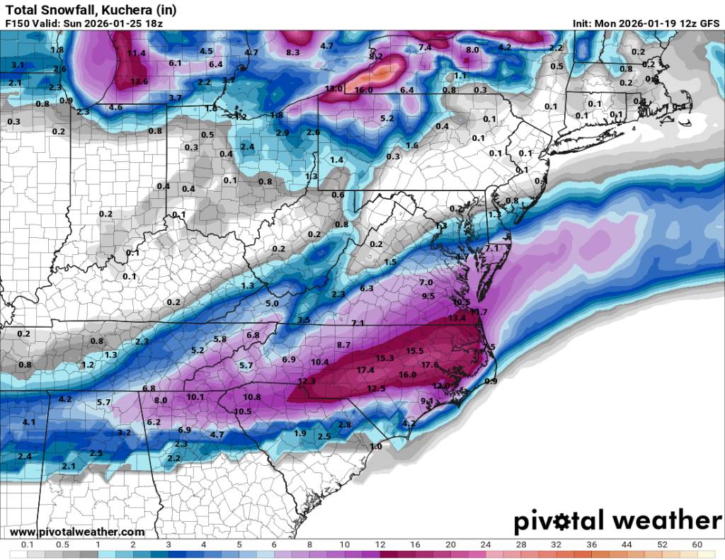
What the 12z euro depicted would be a classic winter storm of old for the southeast. We haven't seen something modeled like that for years honestly and not within 6 days. Now as exciting as things are yall know the 72 hour rule although this last storm crapped the bed on that but it's nice to look at. The pattern screams something like this. This is a stable cold pattern for sure and I'm not surprised this kind of just appeared with a reasonable range.
-
It will come eventually. Just have to be patient.
-
For sure Ward. Seems like this winter and last winter we have no problem getting the cold but the moisture is either north of us or south of us. I saw where even down into Destin FL saw flakes this morning. We will get ours. This pattern of misses won't continue. Great job friend.
-
Always a NW trend.
-
Heck yeah bro! Congratulations! A small victory.
-
Hopefully someone will still score. Maybe Larry lol.
-
Tough crowd lol.
-
Brick you remember the 3 day rule?