Met1985
-
Posts
15,303 -
Joined
-
Last visited
Content Type
Profiles
Blogs
Forums
American Weather
Media Demo
Store
Gallery
Everything posted by Met1985
-
Light snow here currently. Temp a bally 32 degees.
-
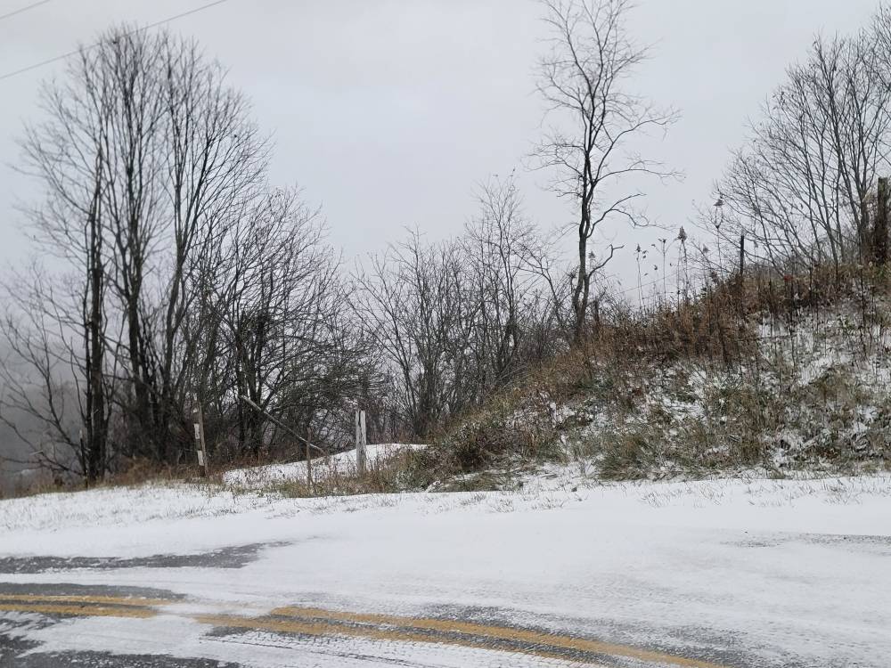
A great dang start to the season in my opinion! It was 60 plus two days ago and now we have anywhere from a half inch to over 7 inches in the mountains! Looks like about 3 here it's so freaking windy though it's blowing everything around.
-
A few pics Sent from my SM-G998U using Tapatalk
-
Hate that because we are seeing some great snow this morning.
-
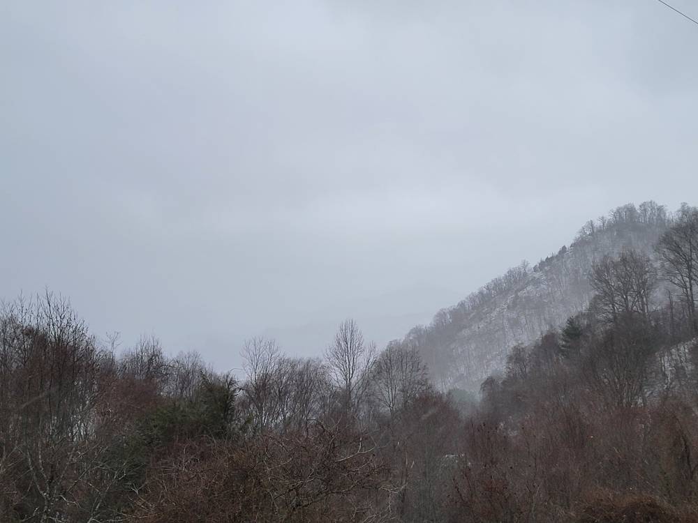
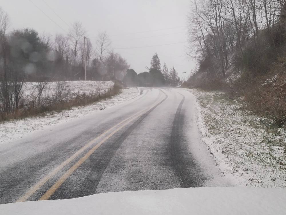
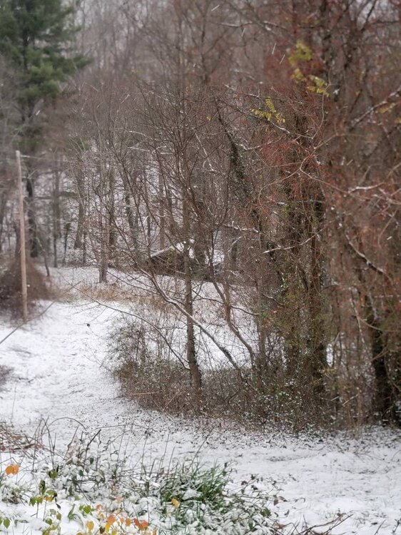
Looks like several more hours of snow. Woke up at 3 and was snowing. It's hammering currently and doesn't look to stop. Current temp is 27 degrees with what looks to be maybe 2 to 3 inches on the ground. Also look at the moisture all the way down to SC. That is rare in flow snow. Sent from my SM-G998U using Tapatalk
-
Glad a lot of people are seeing snow in November! Still steady snow with an inch on the deck. Current temp is 26 degrees. This has already been an awesome event!
-
Temp down to 28 also.
-
Just got home and it's pouring! Road is covered along with grass. Probably about a half inch currently. I'll take it!
-
Getting into Canton and it's hammering.
-
Snowing at at exit 44 at the Enka Candler exit.
-
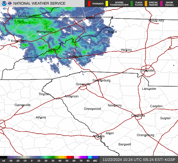
The moisture upstream looks fantastic! Get ready folks!
-
Got the official word that we got snow on Crabtree! Hell yeah!
-
Yes sir! The pattern change is here!
-
Temps dropped from 47 to 43 in about 10 minutes with the wind cranking!
-
The way things look some might see some snow tonight. These temps are crashing hard.
-
Freaking a! Temp has gone from 62 at 3pm to currently at 47 degrees with mist!
-
The front is through here and it's blowing 90! Stiff gusts with a lowering cloud deck. Not sure what the temp is currently.
-
You definitely should. Lift and moisture look great for this early season upslope event.
-
Make no mistake about the up coming pattern change. This is legit and you can tell. The whole northern hemisphere is changing for the better.
-
Here we go! Swain-Haywood- 315 PM EST Wed Nov 20 2024 ...WINTER WEATHER ADVISORY IN EFFECT FROM 1 PM THURSDAY TO 7 AM EST SATURDAY ABOVE 3500 FEET... * WHAT...Snow expected above 3500 feet. Total snow accumulations mainly of 2 to 4 inches with 4 to 7 inches on the highest ridgetops generally above 5000 feet. Winds gusting as high as 45 mph. * WHERE...High elevations above 3500 feet in Haywood and Swain Counties. * WHEN...From 1 PM Thursday to 7 AM EST Saturday.
-
Avery-Madison-Yancey-Mitchell- Including the cities of Ramseytown, Newland, Luck, Mars Hill, Burnsville, Ingalls, Faust, Hot Springs, Celo, Allenstand, Micaville, Spruce Pine, Poplar, Swiss, Walnut, Busick, Marshall, and Banner Elk 315 PM EST Wed Nov 20 2024 ...WINTER WEATHER ADVISORY IN EFFECT FROM 1 PM THURSDAY TO 7 AM EST SATURDAY... * WHAT...Snow expected. Total snow accumulations mainly of 1 to 2 inches in lower elevations, and 2 to 4 inches on ridgetops, with a few isolated ridgetop locations seeing 4 to 6 inches. Winds gusting as high as 50 mph. * WHERE...Avery, Madison, Mitchell, and Yancey Counties. * WHEN...From 1 PM Thursday to 7 AM EST Saturday.
-
Latest globals looks good. Even shows flakes for the Valley. Sent from my SM-G998U using Tapatalk
-
Everything looks great for an upslope event. Gonna be some snow flying in the air for sure!
-
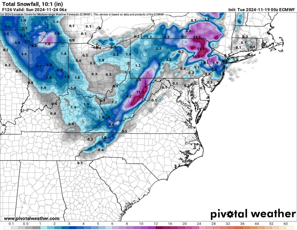
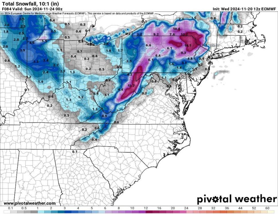
06z gfs pretty similar as the Euro. Going to be freaking windy and cold for sure. Sent from my SM-G998U using Tapatalk
.thumb.jpg.fa89bd0d68f70241e15d659226495e6b.jpg)
-
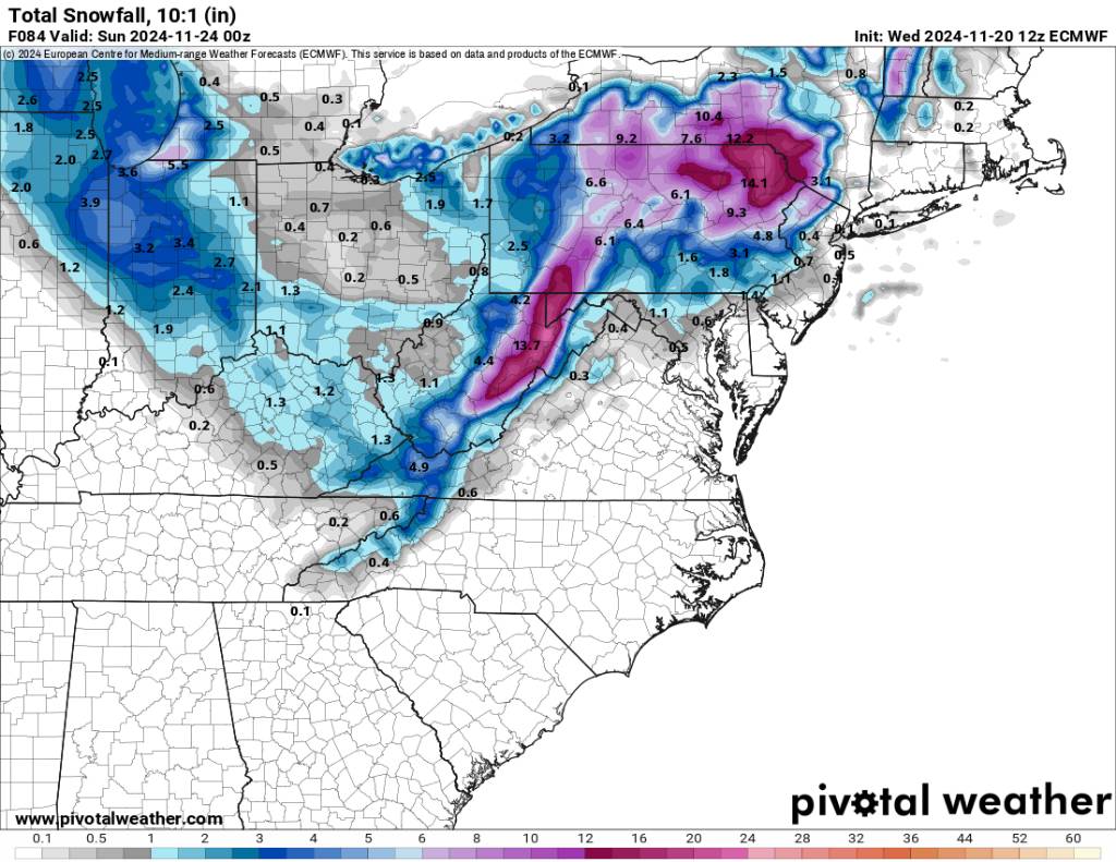
Overnight Euro back to looking decent for upslope snow. Sent from my SM-G998U using Tapatalk


.jpg.fd377004ef0433da963a809da378da18.jpg)