Met1985
-
Posts
17,147 -
Joined
-
Last visited
Content Type
Profiles
Blogs
Forums
American Weather
Media Demo
Store
Gallery
Everything posted by Met1985
-
What little rain we got was beneficial for the forrest fires.
-
Where's the north trend?
-
Heck of an inversion.
-
Heck of a temp rise overnight from 32 degrees at about 2am to 43 currently.
-
False spring will be. We will have a late spring that really sets in this year.
-
GFS showing a lot of love to the CAD region next weekend.
-
Boozer was held down the last possession he had but no foul call. UNC only commits 1 foul the second half? Yeah bought and paid for by the refs
-
Clean game? Cam Boozer got bulldozed and nothing was called. Absolute bullshit.
-
Flurries here this morning.
-
Temp down to 31 with light snow starting.
-
Just got home. Temp is 41 but the wind is cranking.
-
Yeah so they put out the special weather statement but don't even issue an advisory? I mean they have northern Haywood under like 4 to 6 inches but just issue a special weather statement... Makes no damn sense to me. And I think the northern counties should be under a warning...
-
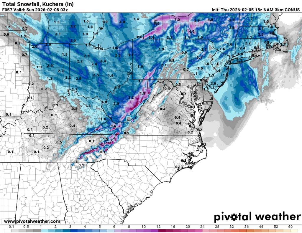
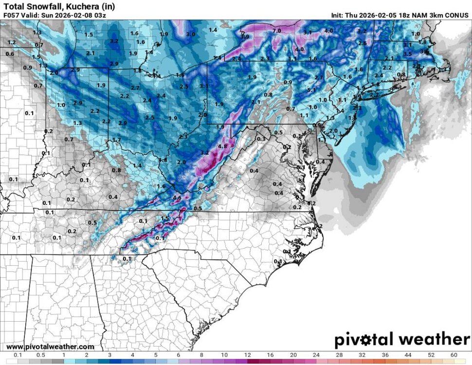
Swain-Haywood-Graham- Including the cities of Alarka, Almond, Bryson City, Luada, Wesser, Waynesville, Waterville, Canton, Cruso, Cove Creek, Robbinsville, and Stecoah 301 PM EST Fri Feb 6 2026 ...SNOW EXPECTED OVER THE HIGH ELEVATIONS OF THE SMOKIES TONIGHT AND EARLY SATURDAY... Snow showers will develop across the high elevations of the Smokies this evening and then will continue through the early morning hours on Saturday, and finally tapering off by mid- morning. Elevations above 3500 feet right near the Tennessee border could get as much as 4-8 inches of snow by the time it ends, which would result in dangerous travel conditions on US Highway 441 across Newfound Gap. More populated areas of Graham, Swain, and Haywood counties may only get a dusting of snow, with maybe up to an inch around Balsam Gap and Soco Gap.
-
Rain/sleet mix near sky lanes bowling near Enka/Candler.
-
Rain/snow mix near Biltmore.
-
Sleet and snow now.
-
Rain/snow mix here in Weaverville.
-
Clouds are thickening up here in Weaverville area. I can see back towards @Bucketheadway and it's dark.
-
Yeah temps keep getting revised down.
-
I know. You did.
-
These torches are getting muted on the EURO. What looked like a solid ridge now looks to be pretty flat until the next significant cold front next weekend.
-
GSP really should extended advisory down further so this doesn't catch people off guard. The ground is prime for this to be a mess on the roads and temps keep trending downwards.
-
Sunny here in Weaverville.
-
Looks great. Sent from my SM-G998U using Tapatalk
-
Mid to north mountain special Madison-Yancey-Mitchell- Including the cities of Faust 102 PM EST Thu Feb 5 2026 ...WINTER WEATHER ADVISORY IN EFFECT FROM 1 PM FRIDAY TO 7 AM EST SATURDAY ABOVE 3500 FEET... * WHAT...Snow expected above 3500 feet. Total snow accumulations between 1 and 3 inches with some locations up to 6 inches along the Tennessee border. Winds gusting as high as 65 mph. * WHERE...Madison, Mitchell, and Yancey Counties. * WHEN...From 1 PM Friday to 7 AM EST Saturday.