Met1985
-
Posts
15,284 -
Joined
-
Last visited
Content Type
Profiles
Blogs
Forums
American Weather
Media Demo
Store
Gallery
Everything posted by Met1985
-
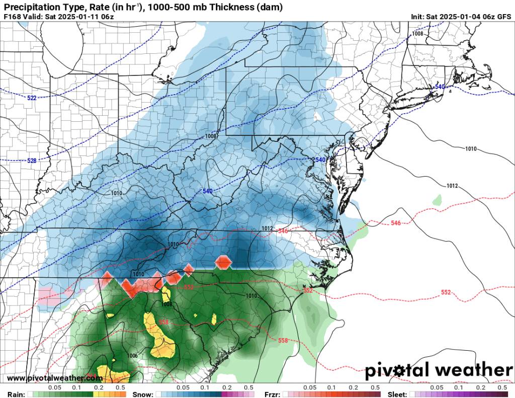
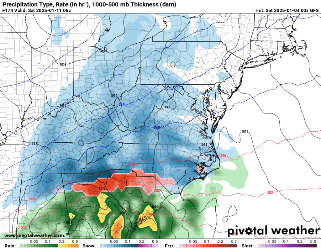
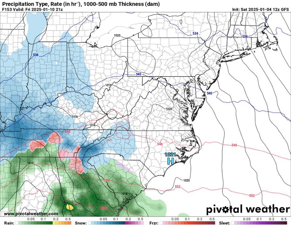
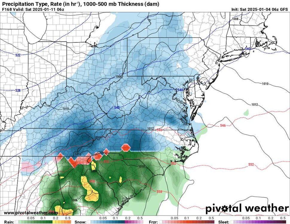
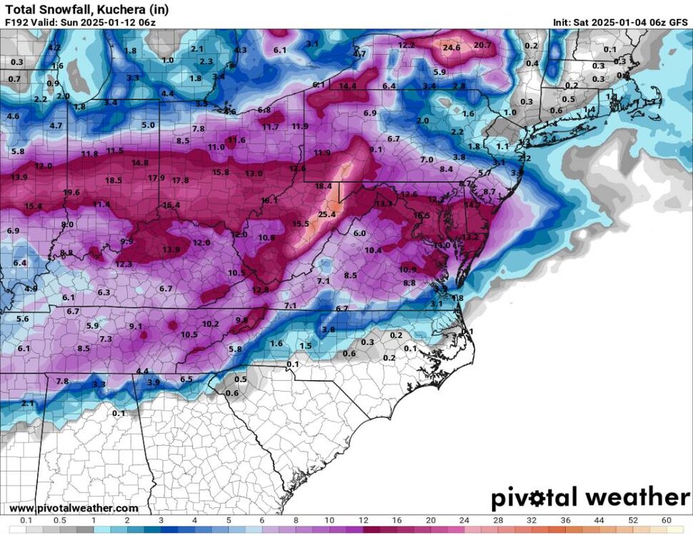
Yeah another weird solution. On to the next model run lol.
-
This run is a mess.
-
The beginning Sent from my SM-G998U using Tapatalk
-
Yeah I still think we see some more major changes to this system.
-
The more separation the worst the temps will be unless we have the cold high pressing further south...
-
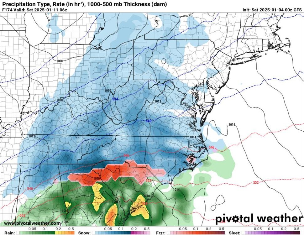
Gfs has been coming in colder for the onslaught of precipitation tomorrow afternoon. Looks like more ice.
-
Good luck up there in the Mid Atlantic!
-
Oh yeah looks promising. Just the lead up hopefully to a bigger system.
-
Yeah this whole setup is far from being hammered down. I still don't like the low kind of being buried and delayed. But color me skeptical on that.
-
Also got down to 17 this morning.
-
This could be a mountains special. Still a ways to go. The old saying get this in the range of 48 to 72 hours. Sent from my SM-G998U using Tapatalk
.thumb.jpg.5941d0f7d50945aff645dfd47b8238ec.jpg)
-
That's what I'm hear for. We've got some great looks coming up. An exciting pattern ahead.
-
Temps are trending colder and longer. Heck we may even see some ice early on down here now....
-
Ashe-Watauga-Tazewell-Smyth-Grayson-Mercer-Summers- Including the cities of Tazewell, Independence, Flat Top, Whitetop, Hinton, Marion, Troutdale, Hix, Boone, Volney, West Jefferson, and Bluefield 302 AM EST Sat Jan 4 2025 ...WINTER WEATHER ADVISORY REMAINS IN EFFECT UNTIL 4 AM EST EARLY THIS MORNING... ...WINTER STORM WATCH REMAINS IN EFFECT FROM SUNDAY MORNING THROUGH MONDAY EVENING... * WHAT...For the Winter Weather Advisory, an additional half an inch of snow is possible. Winds gusting as high as 35 mph. For the Winter Storm Watch, heavy mixed precipitation possible. Total snow accumulations of one to two inches and ice accumulations of one tenth to three tenths of an inch possible. * WHERE...Portions of northwest North Carolina, southwest Virginia, and southeast West Virginia. * WHEN...For the Winter Weather Advisory, until 4 AM EST early this morning. For the Winter Storm Watch, from Sunday morning through Monday evening.
-
Can't ask for a better scenario for the region.
-
Snapshot Sent from my SM-G998U using Tapatalk
-
Hell yeah!
-
Just got home from a loong day. Canton is dusted, iv got about a quarter inch of snow and the temp is 23 with the wind howling. Must be winter....
-
I still don't buy this solution. I just don't agree with the low being buried in the SW.
-
Flurries at me casa.
-
Was just going to say milky clouds have rolled in.
-
To me I just see the volatility of the pattern and I do try to hedge on the optimistic side. There has been no run to run continuity on any model for the 10th storm. So why start now with it being a week away.
-
Year area looks like it's going to get nailed. May start out at snow then sleep then to freezing rain. Definitely going to be interesting up that way for most of Virginia. I know yall kind of feel like most do down here with hardly getting any snow the past several winters.
-
What are you talking about? You talking about this weekends storm? The models have trended colder because you have that lob up in Maine pressing further south and the models are just now seeing it. That's why yall can't live and die every 6 hours...
-
Really good trends overnight and this morning. Yall have to look at the bigger picture. If you think the models have nailed this down 7 days before then you're a newb. Heck there has even been some sizable shifts for this weekends system but if you want to give yourself a heart palpitations go ahead lol.


.jpg.7af1bae6a88cadc1c941207691efaf29.jpg)