

Met1985
-
Posts
16,970 -
Joined
-
Last visited
Content Type
Profiles
Blogs
Forums
American Weather
Media Demo
Store
Gallery
Everything posted by Met1985
-
This would be impressive for this time of the year. Sent from my SM-G998U using Tapatalk

-
Thats a heck of a look on the 12z cmc Sent from my SM-G998U using Tapatalk
-
Todays 12 euro. Sent from my SM-G998U using Tapatalk
-
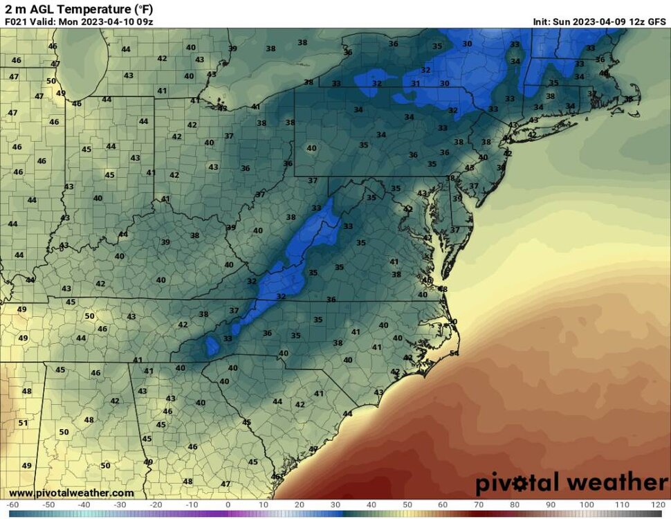
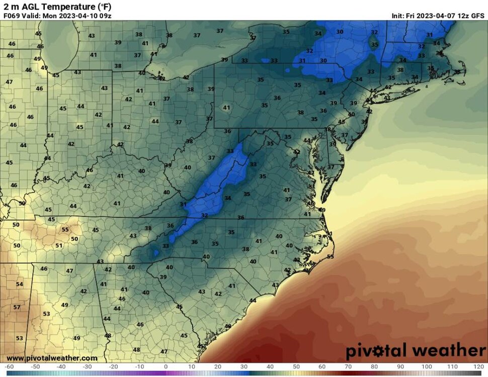
Today's 12z gfs is showing multiple cold air intrusions into the area. Sent from my SM-G998U using Tapatalk
-
Of course we get this in April.... Sent from my SM-G998U using Tapatalk
-
Was a bit frosty this morning with a low of 33 degrees and there is a bite in the air today.
-
You've been radiating nice the past few nights.
-
Another frosty morning with a low of 30 degrees.
-
A nice frosty morning this morning. When I left it was down to 27 this morning.
-
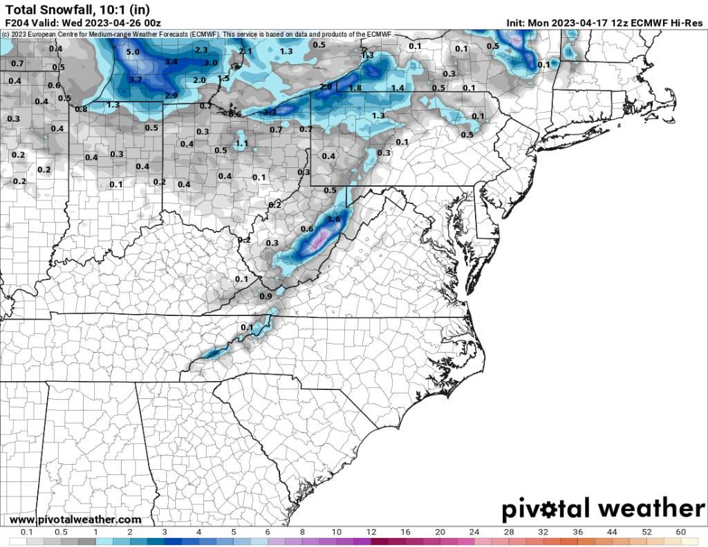
Last is the potential cold blast coming our way towards next weekend. Both the gfs and the euro have had this and it is very impressive for this time of the year. This could also bring some snow for the higher elevations. Sent from my SM-G998U using Tapatalk
-
Secondly is the cutoff that could affect us towards Thursday and Friday of this next week. Temps will be very cool and we could see another good dose of rainfall also. Sent from my SM-G998U using Tapatalk
-
Im going to go over several things today to outline from tonight through the next 10 days. First is tonight is going to be cold. Lows in the 20s and 30s area wide. Sent from my SM-G998U using Tapatalk
-
Happy Eastern guys! Going to be a beautiful day!
-
Down to 33 here as well. Temps been slowly dropping all evening. Today was absolutely impressive for highs. We where some 25 to 30 degrees below normal.
-
35 here and absolutely raw.
-
That's impressive after the warmth we've seen.
-
Oh yeah I definitely understand that. It's a amazing the turnaround we've had in the weather this week.
-
Yeah we can deal with moderate but a super Nino and we will be extremely warm once again.
-
Too bad it's not cold enough for snow up your way.
-
Looking a bit ahead it doesn't look like we really go hot because of the cutoff meandering around in the SE and then there looks to be a cold front that slides through. So who knows.
-
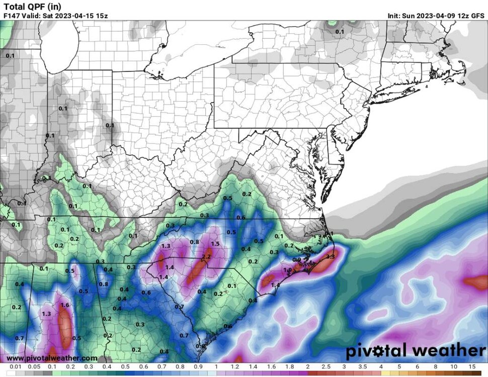
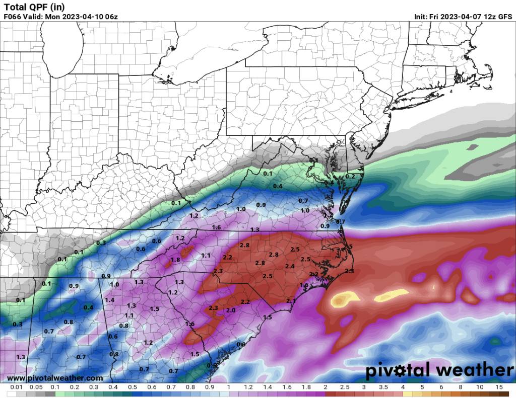
A lot more rainfall on the way. Sent from my SM-G998U using Tapatalk

-
This would be a kick in the pants for sure. Sent from my SM-G998U using Tapatalk
.thumb.jpg.2358dff6af8ecf46210aadc32d42262b.jpg)
-
We are going to see several nights in the 30s and possibly the 20s in the higher elevations coming our way. Sent from my SM-G998U using Tapatalk
-
Yeah today has been absolutely a soaker of a day.
-
Yeah power has been flickering here all morning due to the storms. Man it is nasty out. Bye bye to those 70s for a bit and another chance for a frost and freeze also.


.jpg.09adc8c9006a886806fefa9563cf480d.jpg)
