Met1985
-
Posts
16,974 -
Joined
-
Last visited
Content Type
Profiles
Blogs
Forums
American Weather
Media Demo
Store
Gallery
Everything posted by Met1985
-
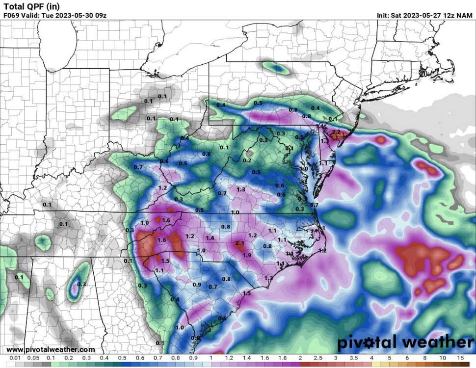
12 NAM honing in on the middle to southern mountains. Sent from my SM-G998U using Tapatalk
-
Yeah was a cold start this morning at the house with a low of 48.
-
HRRR is pretty widespread Sent from my SM-G998U using Tapatalk
.thumb.jpg.024b02a35e3eed3835c11f3042b5bd0c.jpg)
-
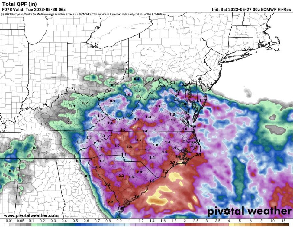
NAM is super concentrated. Sent from my SM-G998U using Tapatalk
-
Euro still going widespread. Sent from my SM-G998U using Tapatalk
-
A sharp cutoff on the south side of precipitation on the gfs. Sent from my SM-G998U using Tapatalk
.thumb.jpg.8c9bb485658fee6060f17d42cae2b871.jpg)
-
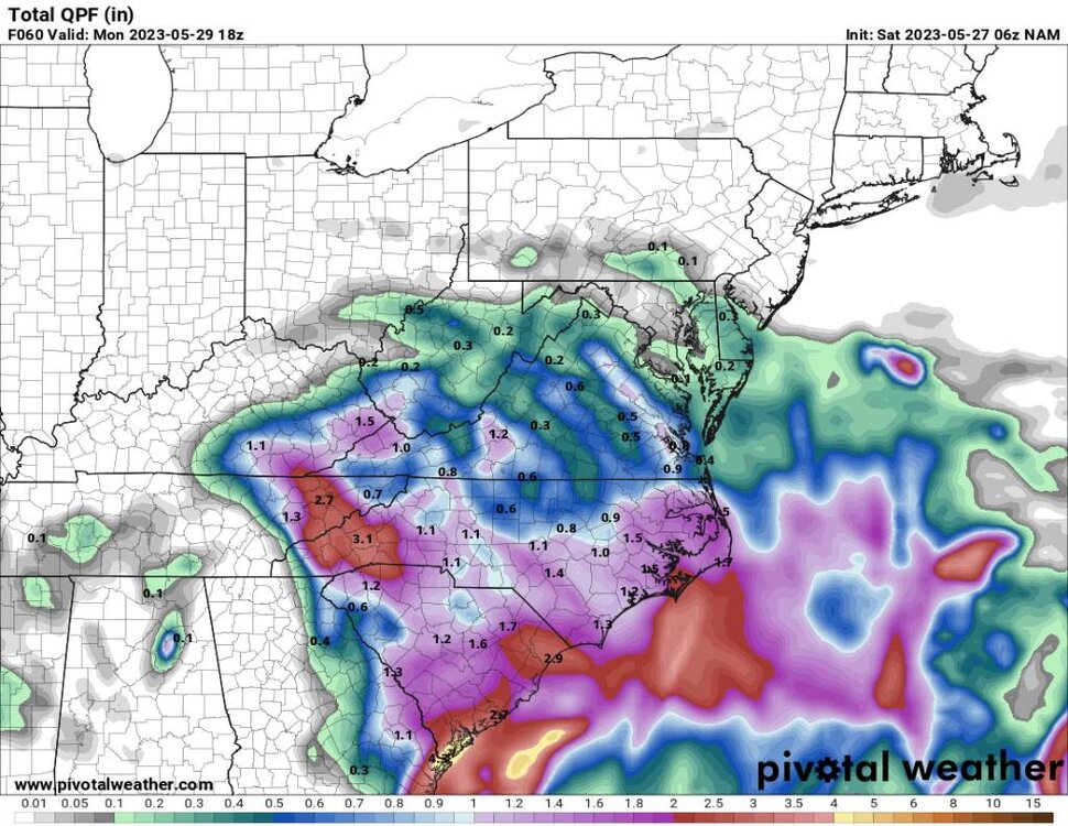
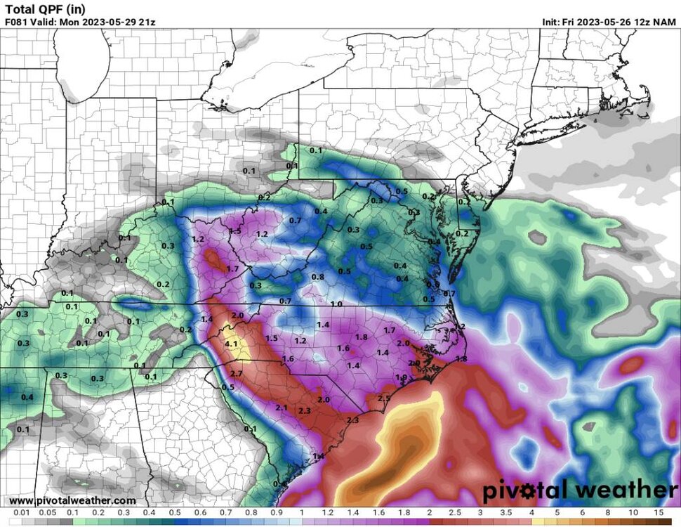
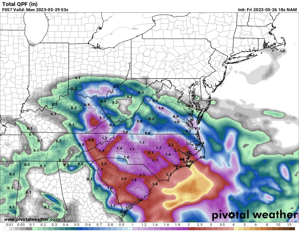
18z NAM Sent from my SM-G998U using Tapatalk

-
The models are still jumpy with this event so who knows. I do think from I40 north is a soaker.
-
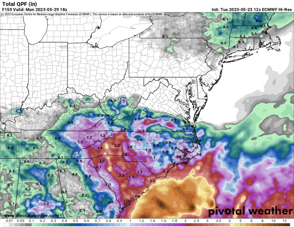
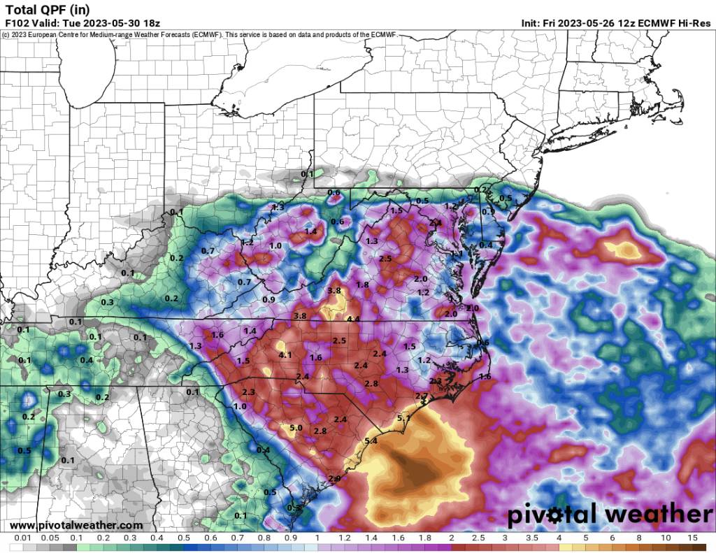
12z euro Sent from my SM-G998U using Tapatalk

-
Yeah definitely flooding down that way for sure. Even after being a bit dry. That much rain would cause flooding down along the river.
-
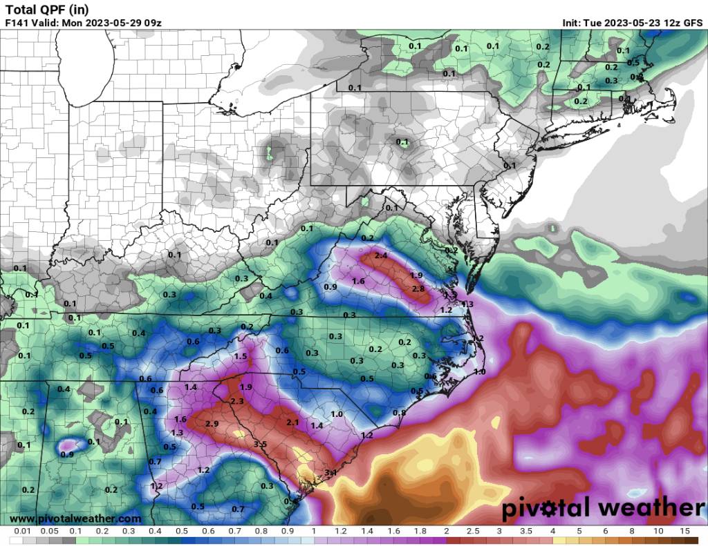
12z NAM has come back south a lot. Sent from my SM-G998U using Tapatalk
-
Congratulations brother!
-
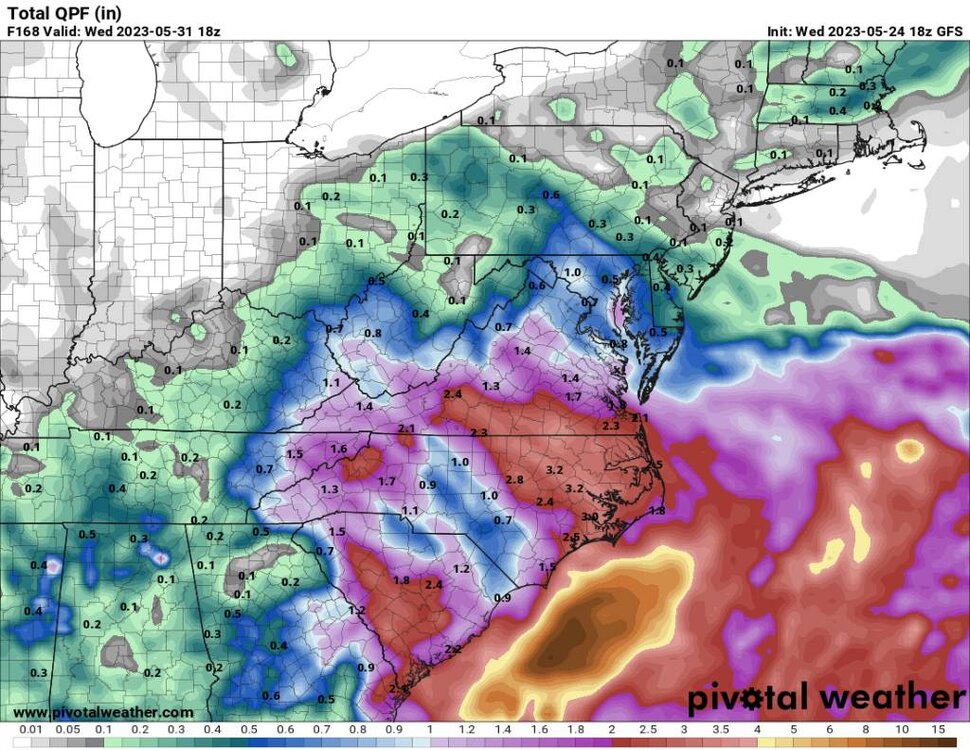
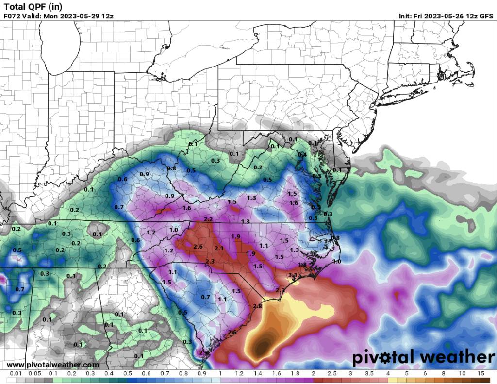
12z gfs Sent from my SM-G998U using Tapatalk

-
Looks like the northern mountains and piedmont will see the majority of the rainfall this weekend.
-
Was a very cool morning here with a low of 42 degrees.
-
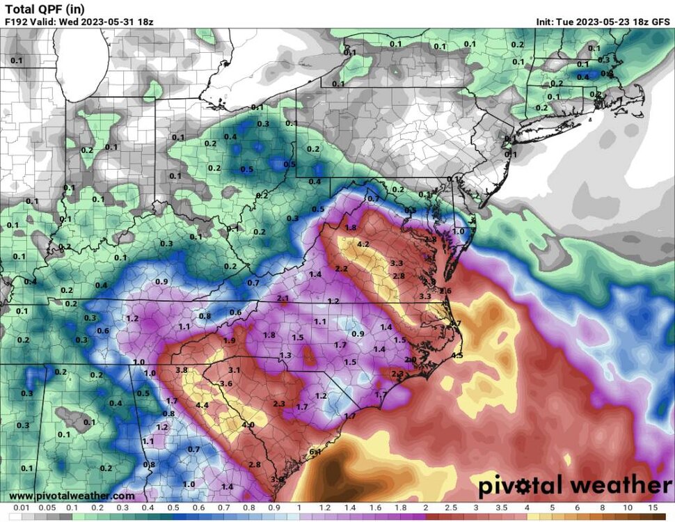
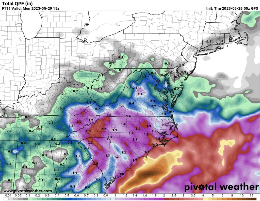
00z gfs Sent from my SM-G998U using Tapatalk

-
18z gfs. Sent from my SM-G998U using Tapatalk
-
What happened to this?
-
We are starting to see some consistency. Sent from my SM-G998U using Tapatalk
.thumb.jpg.a07c5f712655f4a411a1a206b0c333ea.jpg)
-
A beautiful morning low of 45 this morning. This weekend looks wet still.
-
Looks wet. Sent from my SM-G998U using Tapatalk
-
12z euro. Massive difference from the 00z. Sent from my SM-G998U using Tapatalk

-
A huge jump is precipitation from last night. It's night and day.
-
12z gfs shifted again. Sent from my SM-G998U using Tapatalk

-
Yeah that's a big shift.


.jpg.9f2d16cac0ee3cac47f9a7101522ad73.jpg)


.jpg.e54fc0f175badfd2f1f2fc961c9ac07d.jpg)


.jpg.86c2143c6bccd4446e088603a032d42c.jpg)