

Met1985
-
Posts
15,284 -
Joined
-
Last visited
Content Type
Profiles
Blogs
Forums
American Weather
Media Demo
Store
Gallery
Everything posted by Met1985
-
I'd say in about 3 hours flurries and clouds will come back in.
-
Well and really no one else has pulled the trigger on warnings either.
-
They are generally very conservative anyways.
-
Yeah ground is frozen with snow still. This is basically the perfect setup.
-
This looks good. Sent from my SM-G998U using Tapatalk
-
Yeah I feel this as well.
-
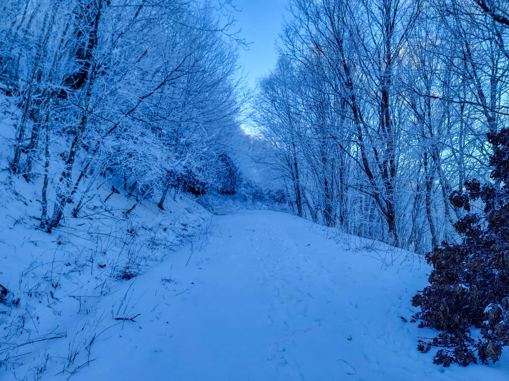
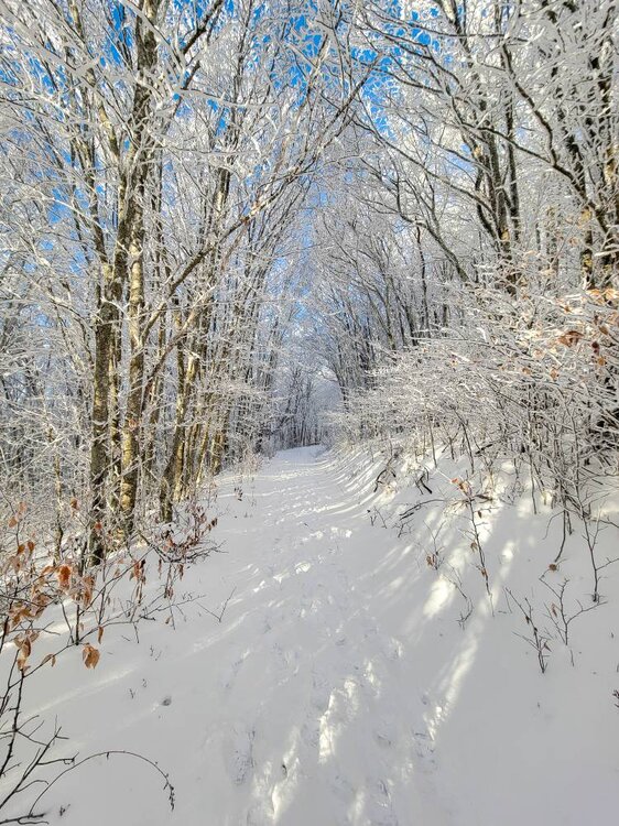
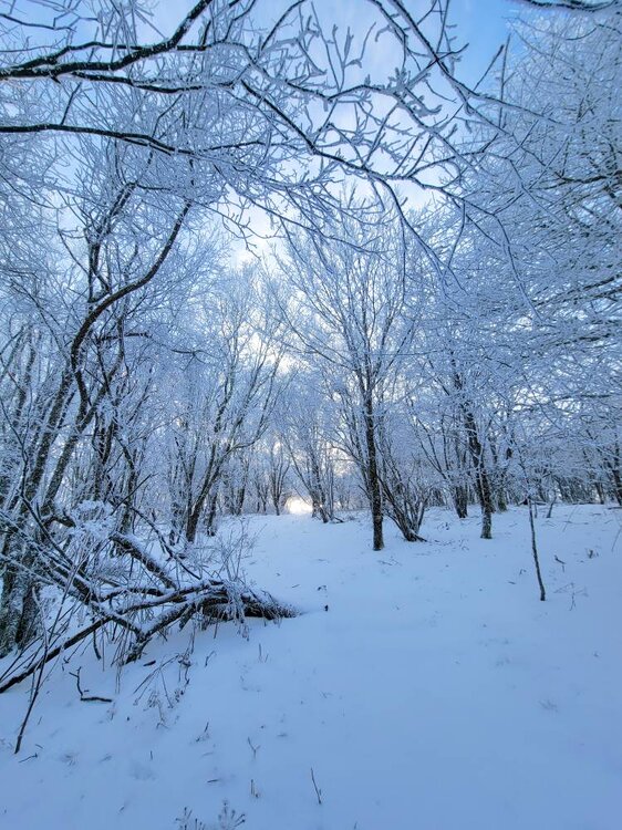
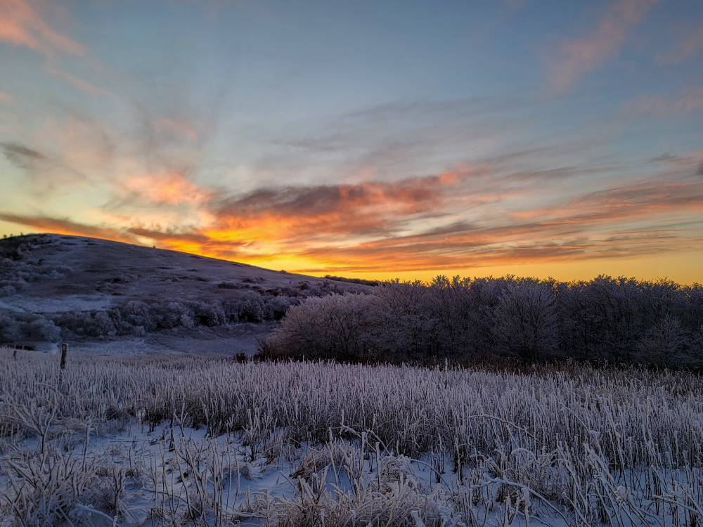
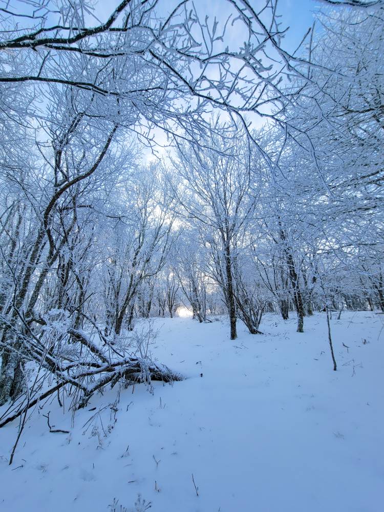
This was up near Wolf Laurel. Was absolutely amazing up there yesterday at sunset. Yeah I'd be down for exploring that area. Winter hiking is amazing especially in the snow.
-
Yeah the gfs run was amusing. Snow, sleet, freezing rain back to snow. That would be something else...
-
A lot can change with the models from now to then. We've seen it happen.
-
Got down to 13 clouds rolled in and we are currently at 15 with light snow in Haywood. Another deck duster this morning.
-
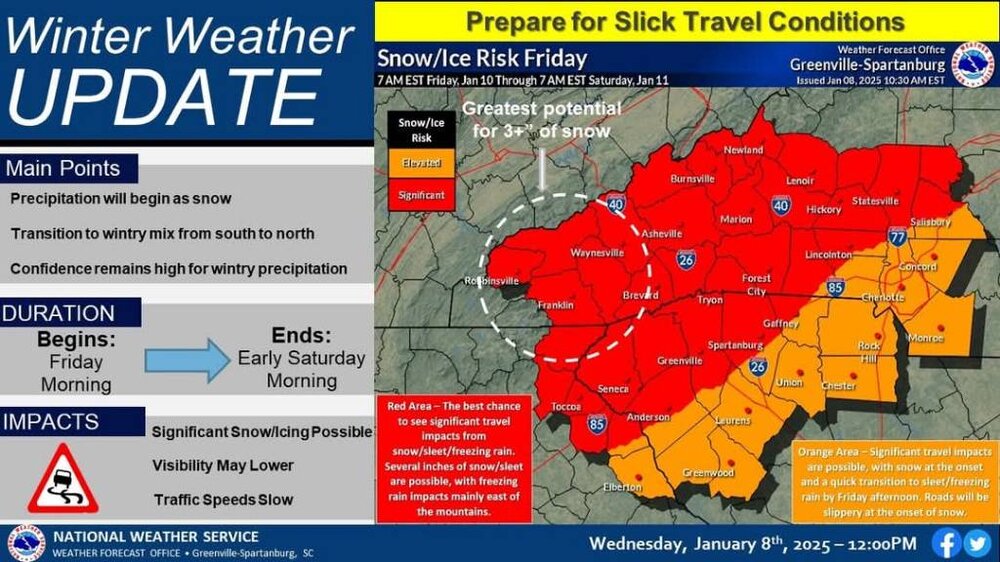
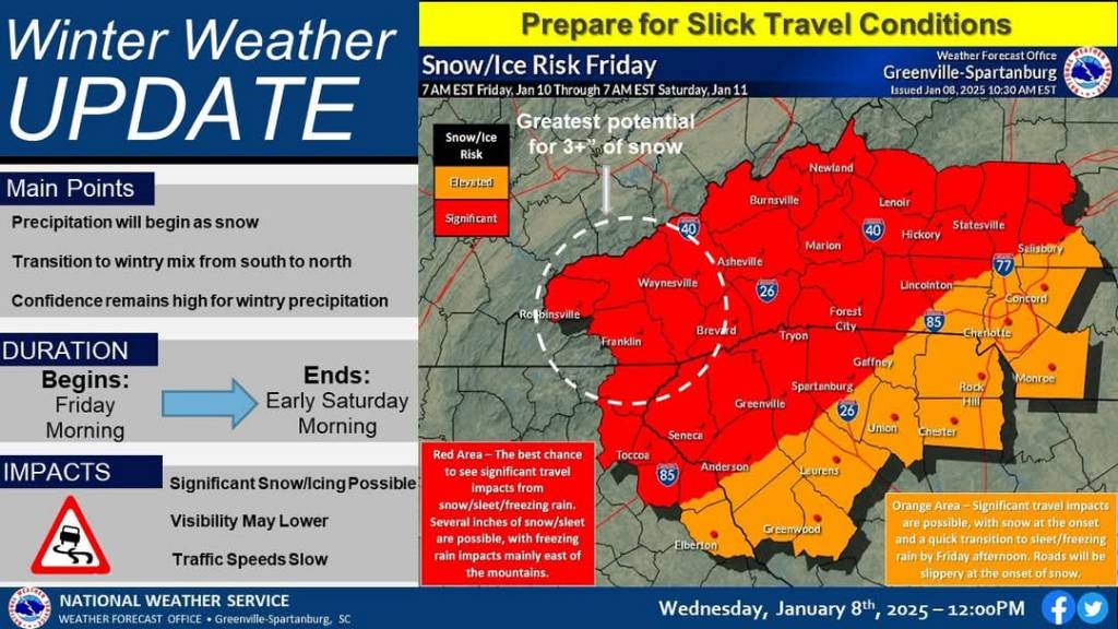
Yup! Here we go! Rabun-Habersham-Madison-Swain-Haywood-Graham-Northern Jackson- Macon-Southern Jackson- Including the cities of Hot Springs, Clarkesville, Canton, Cruso, Wolf Mountain, Luada, Mars Hill, Sylva, Highlands, Mountain City, Waterville, Kyle, Alarka, Faust, Demorest, Stecoah, Cove Creek, Pine Mountain, Franklin, Tuckasegee, Cashiers, Cornelia, Luck, Allenstand, Almond, Waynesville, Rainbow Springs, Marshall, Bryson City, Cullowhee, Walnut, Wesser, Hollywood, Clayton, Robbinsville, and Baldwin 346 AM EST Wed Jan 8 2025 ...WINTER STORM WATCH IN EFFECT FROM FRIDAY MORNING THROUGH SATURDAY MORNING... * WHAT...Heavy snow possible. Total snow accumulations between 3 and 6 inches possible. * WHERE...The mountains of northeast Georgia and southwest North Carolina. * WHEN...From Friday morning through Saturday morning. * IMPACTS...The heavy snow will make many roads impassable and may produce widespread power outages due to the weight of the snow on tree limbs and power lines. The hazardous conditions could impact the Friday morning and evening commutes.
-
This morning model runs have looked better than the overnight runs. Good stuff. Still fill very confident about this.
-
This was never going to be a moisture rich system. That was pretty much set from day one. We always new that things had to happen just perfect for anyone to get significant accumulations. It is what it is. We will see how today goes.
-
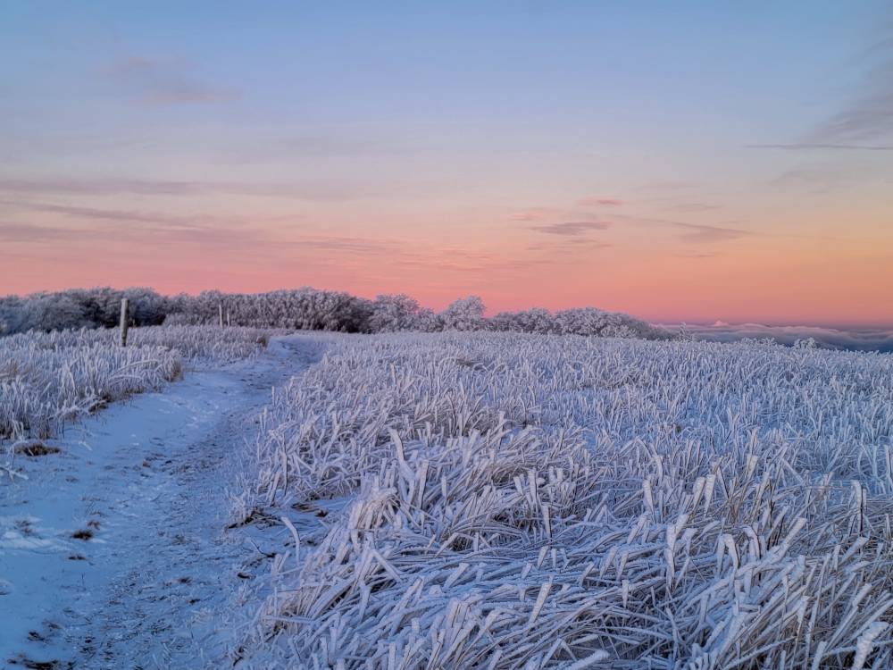
Saw a beautiful sunset this evening with Buckethead. Was cold as freaking could be but was worth it! Sent from my SM-G998U using Tapatalk
-
 We toss the UK.
 -
This is great news for us up here.
-
All in all good trends so far today. Got to feel good about this at this point.
-
Yeah still some tweaks and improvements coming and I do think you are right with how the low tracks up the coast.
-
This is looking more and more like a classic setup.
-
12z gfs looks dang good boys and girls! Sent from my SM-G998U using Tapatalk
-
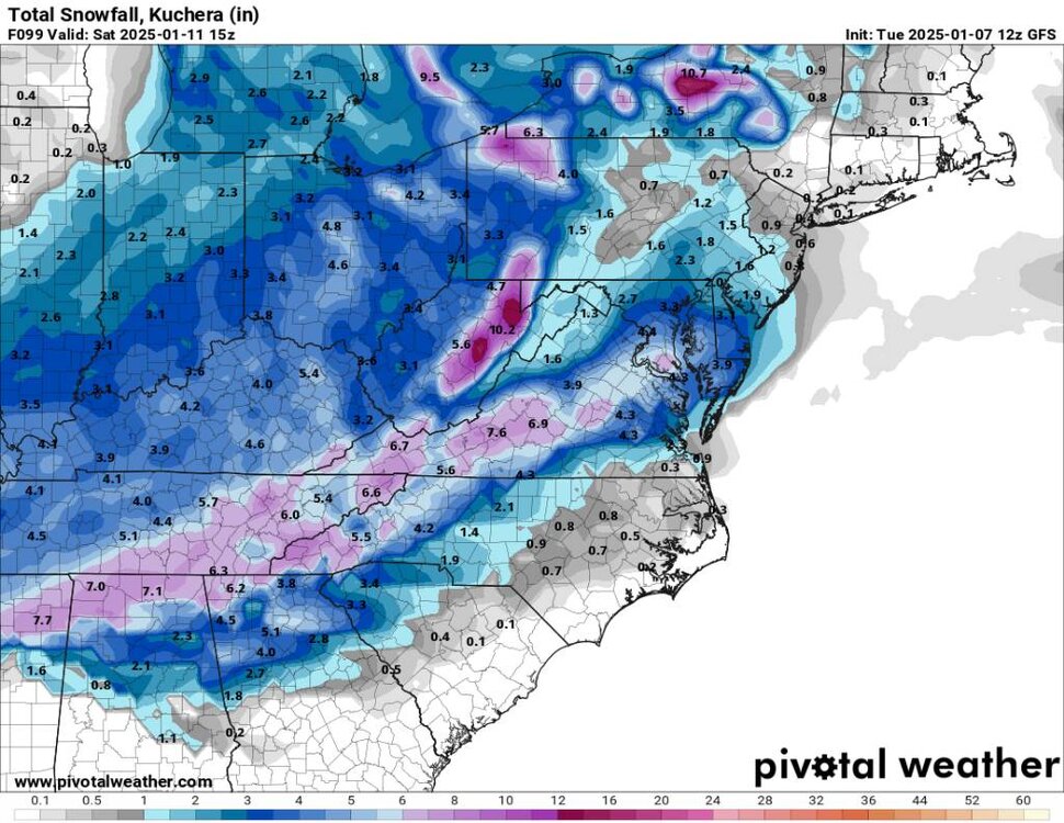
12z gfs snowfall. Sent from my SM-G998U using Tapatalk

-
12z gfs Sent from my SM-G998U using Tapatalk
.thumb.jpg.3c6e2eb66895bc1f99e026c96d928cb1.jpg)
.thumb.jpg.bb743b240a64c702287d249e67362f8d.jpg)
.thumb.jpg.8c7f9816e3f0362a48822f4b83f81277.jpg)
-
12z gfs Sent from my SM-G998U using Tapatalk
.thumb.jpg.9282908dcdad66f7ab22739f50d9523e.jpg)
-
This is going to be a great run region wide.
-
Yeah I am really hoping for a region wide snow.


.jpg.3604564f0991f3dae24c8268d5d1c71e.jpg)
.jpg.642cd38fd2e69cfcb2199da7d4a093c6.jpg)
.jpg.07b42d6bf7e379670262b8eb63cb6b6e.jpg)
.jpg.42e99a3a2bb00f50858cc74bfa64f1e5.jpg)
