

Met1985
-
Posts
16,969 -
Joined
-
Last visited
Content Type
Profiles
Blogs
Forums
American Weather
Media Demo
Store
Gallery
Everything posted by Met1985
-

2023-2024 Fall/Winter Mountain Thread
Met1985 replied to The Alchemist's topic in Southeastern States
The by gosh frozen tundra of Haywood just hit 33. You will keep the cold air a lot longer than me though. -
2023-2024 Fall/Winter Mountain Thread
Met1985 replied to The Alchemist's topic in Southeastern States
Dang that looks ominous. -
2023-2024 Fall/Winter Mountain Thread
Met1985 replied to The Alchemist's topic in Southeastern States
Yes sir it is. -
2023-2024 Fall/Winter Mountain Thread
Met1985 replied to The Alchemist's topic in Southeastern States
Too dang funny man! I swear the weather here in Haywood literally changes every quarter of a mile! -
2023-2024 Fall/Winter Mountain Thread
Met1985 replied to The Alchemist's topic in Southeastern States
Heck im still at 16. -
2023-2024 Fall/Winter Mountain Thread
Met1985 replied to The Alchemist's topic in Southeastern States
Lol the freaking frozen tundra bro. You know how I roll. -
2023-2024 Fall/Winter Mountain Thread
Met1985 replied to The Alchemist's topic in Southeastern States
Yeah I was thinking the same thing. A very cold start, a frozen ground. This week has been pretty dang chilly and I think a pretty strong CAD signal especially with the temps and dry air we've seem this week. -
2023-2024 Fall/Winter Mountain Thread
Met1985 replied to The Alchemist's topic in Southeastern States
11 degrees this morning at my casa. A dang cold start to the day. -
2023-2024 Fall/Winter Mountain Thread
Met1985 replied to The Alchemist's topic in Southeastern States
The second storm is mostly all rain. Maybe some brief ice for the favored CAD regions. Then it's a rain to some upslope snow on the backside. Sent from my SM-G998U using Tapatalk.thumb.jpg.6bfbdea3f8629543c4e36e9643d4d280.jpg)

-
2023-2024 Fall/Winter Mountain Thread
Met1985 replied to The Alchemist's topic in Southeastern States
06z gfs is a snow to ice to rain back to snow for this weekend. Sent from my SM-G998U using Tapatalk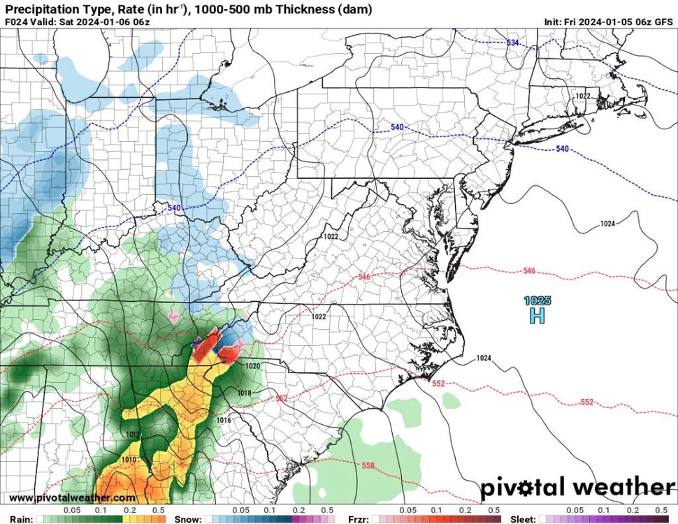
.thumb.jpg.bb98f599d9e1cede23eeb8fc13b8ae24.jpg)
.thumb.jpg.56416a5e253b25423c720ce483d6bf02.jpg)
.thumb.jpg.17cd24ddc8d2a1f8d8c8b5d8db9b65ac.jpg)
.thumb.jpg.8cae486cc137b3b81faf0a16c1170caa.jpg)
-
2023-2024 Fall/Winter Mountain Thread
Met1985 replied to The Alchemist's topic in Southeastern States
I joined November of 2011. Crazy its been that long I've been on here. I've made 13,247 posts to current. I'd like to think I founded the mountains thread when I got brave enough to start a new thread lol. It's been a great journey. Teaching and learning on here a ton. It's been a pleasure posting with everyone. -
2023-2024 Fall/Winter Mountain Thread
Met1985 replied to The Alchemist's topic in Southeastern States
Temps nose diving this evening. Temp already down to 23. -
2023-2024 Fall/Winter Mountain Thread
Met1985 replied to The Alchemist's topic in Southeastern States
Yep the same here. A high of 34 and current temp at 30 already. Been a cold week. -
2023-2024 Fall/Winter Mountain Thread
Met1985 replied to The Alchemist's topic in Southeastern States
Cmc precipitation values. A ton of ice on the cmc also. Sent from my SM-G998U using Tapatalk
-
2023-2024 Fall/Winter Mountain Thread
Met1985 replied to The Alchemist's topic in Southeastern States
Yeah I was very surprised coming into Haywood this morning and seeing snow hanging on the mountains. Absolutely nothing in Buncombe. -
2023-2024 Fall/Winter Mountain Thread
Met1985 replied to The Alchemist's topic in Southeastern States
Light snow this morning on Crabtree. -
2023-2024 Fall/Winter Mountain Thread
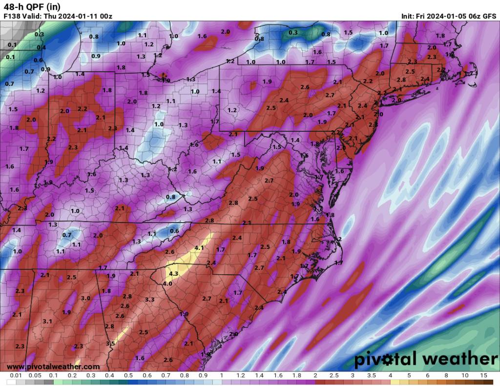
Met1985 replied to The Alchemist's topic in Southeastern States
It's looking like the big impact of the 3rd system will be torrential rainfall but things change every run so who knows. Sent from my SM-G998U using Tapatalk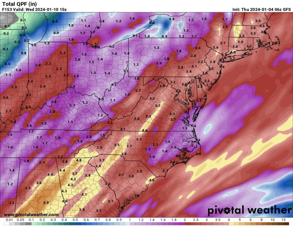
-
2023-2024 Fall/Winter Mountain Thread
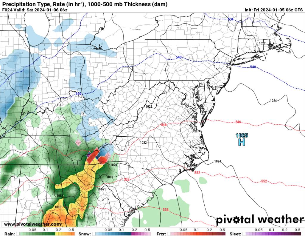
Met1985 replied to The Alchemist's topic in Southeastern States
06z gfs is some snow to ice to rain. Sent from my SM-G998U using Tapatalk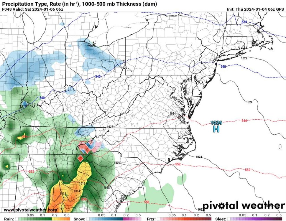
.thumb.jpg.bc6b4b989c067e0065f9c06d3202d78a.jpg)
-
2023-2024 Fall/Winter Mountain Thread
Met1985 replied to The Alchemist's topic in Southeastern States
06z NAM is ice to rain. Sent from my SM-G998U using Tapatalk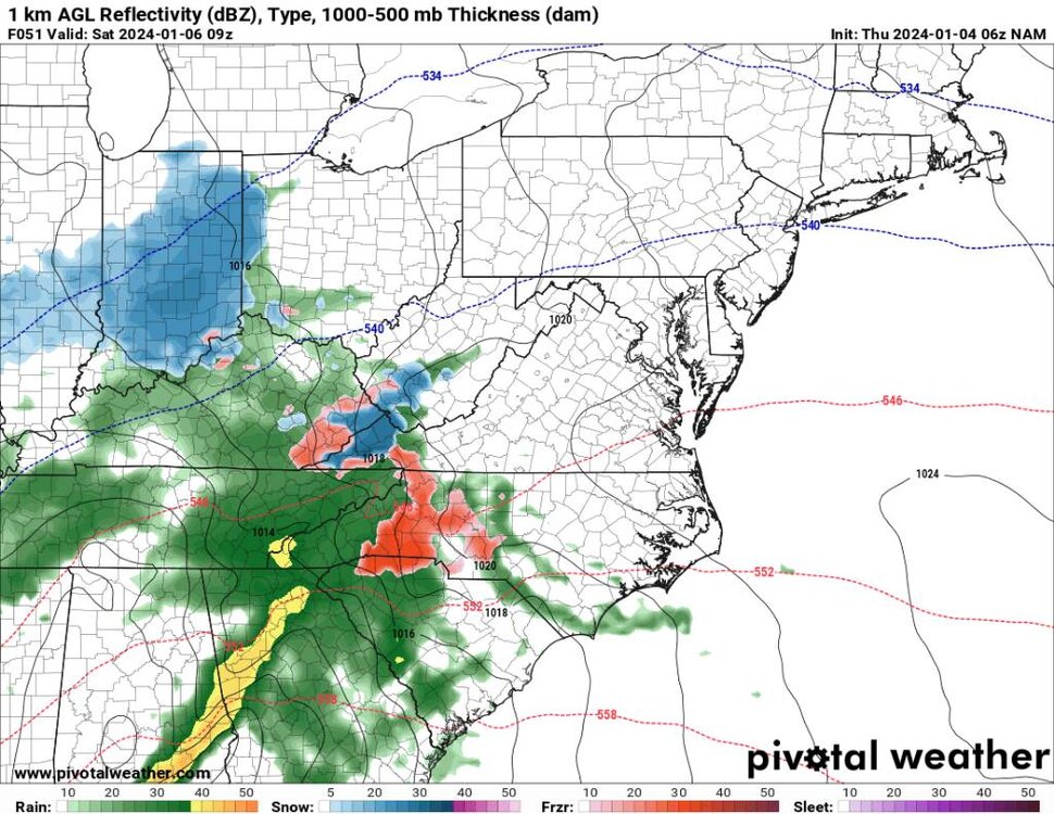
-
2023-2024 Fall/Winter Mountain Thread
Met1985 replied to The Alchemist's topic in Southeastern States
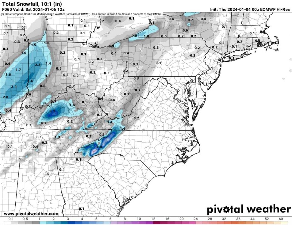
00z euro continues to look wintery. Sent from my SM-G998U using Tapatalk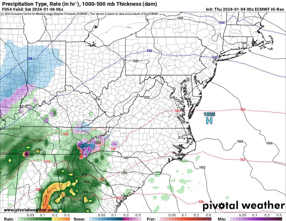
.thumb.jpg.a371c63264c1d57c2d512ca383e49807.jpg)
-
2023-2024 Fall/Winter Mountain Thread
Met1985 replied to The Alchemist's topic in Southeastern States
I can literally smell snow. Them clouds have that milky look to them. -
2023-2024 Fall/Winter Mountain Thread
Met1985 replied to The Alchemist's topic in Southeastern States
Temp went from 40 degrees to 34 in an hour. -
January Medium-Long Range Discussion
Met1985 replied to Holston_River_Rambler's topic in Tennessee Valley
Excellent post Carver. I just made a post over in our mountain thread that even the ensembles we're changing a lot run to run. -
2023-2024 Fall/Winter Mountain Thread
Met1985 replied to The Alchemist's topic in Southeastern States
As wncsnow mentioned NAM coming in cold with a snow to ice scenario now. Sent from my SM-G998U using Tapatalk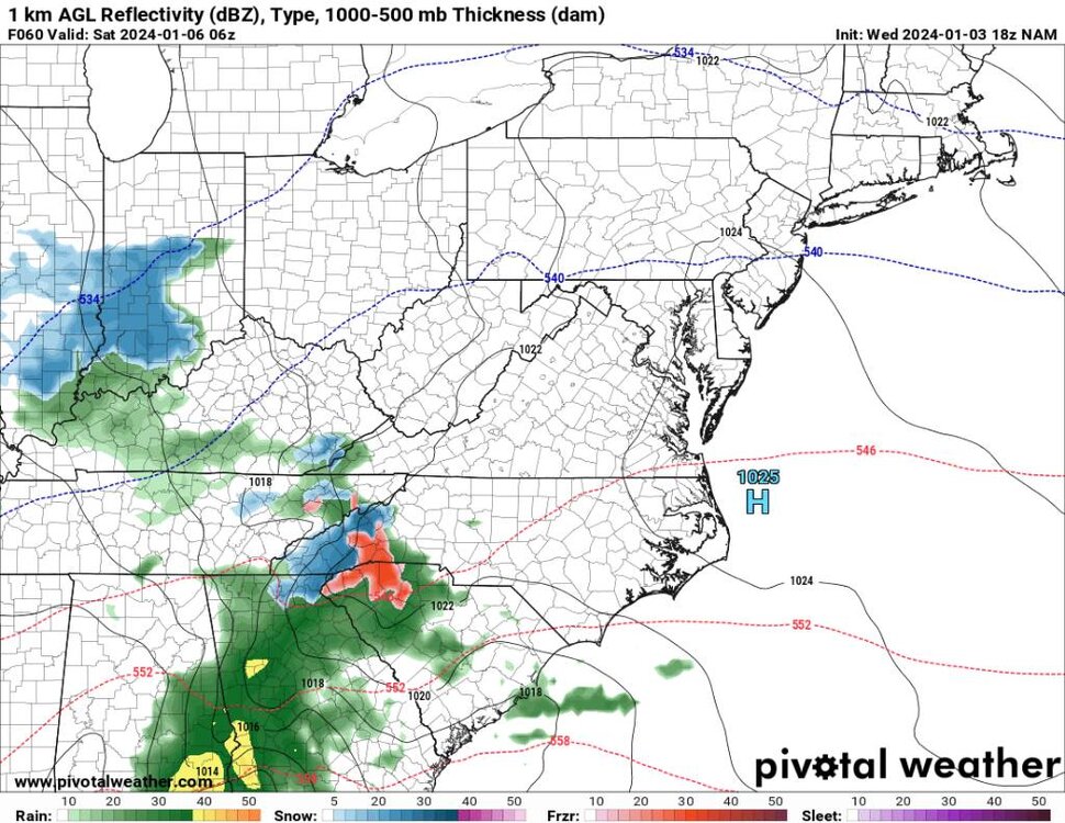
.thumb.jpg.cdd965148b4422c8567473b3034263ae.jpg)
.thumb.jpg.bb6779160b62894995ac8763e361f445.jpg)
-
2023-2024 Fall/Winter Mountain Thread
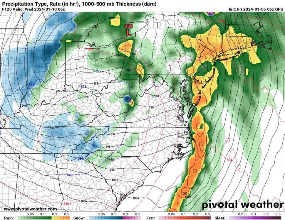
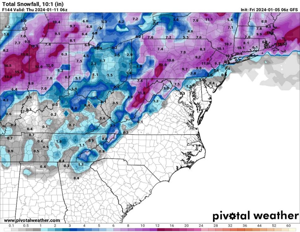
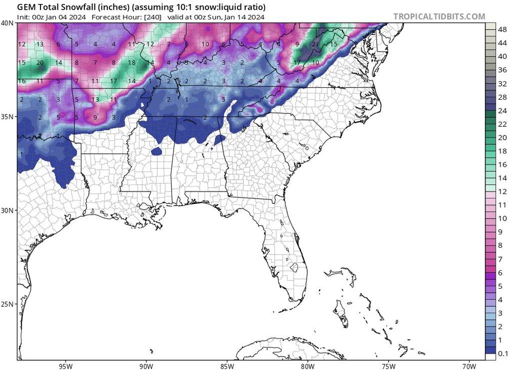
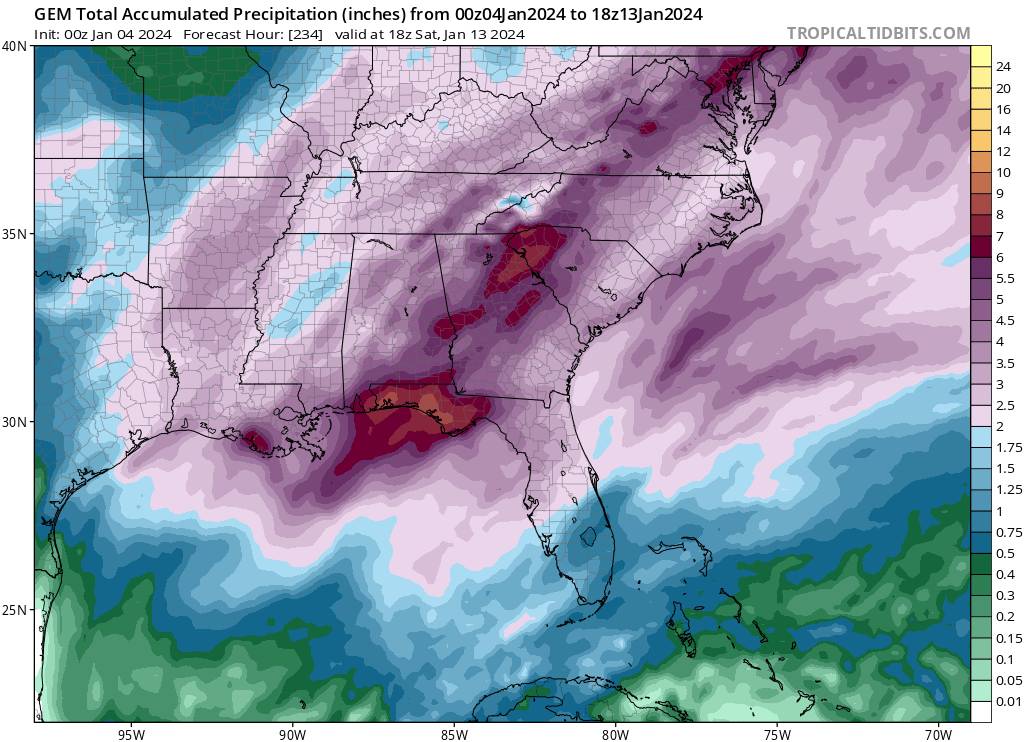
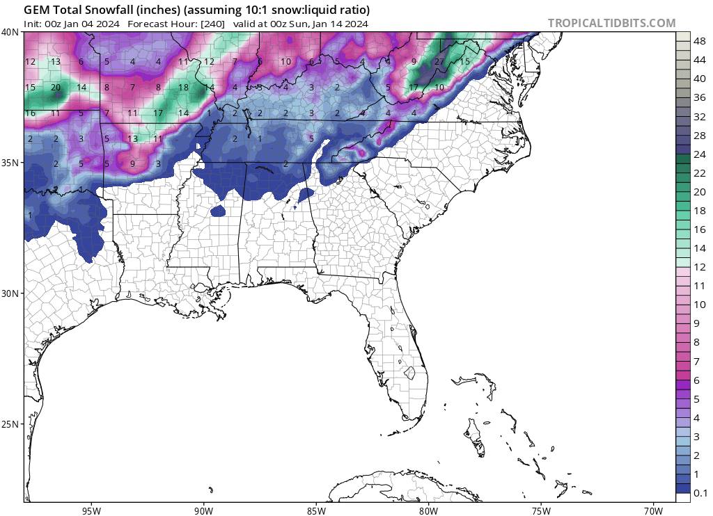
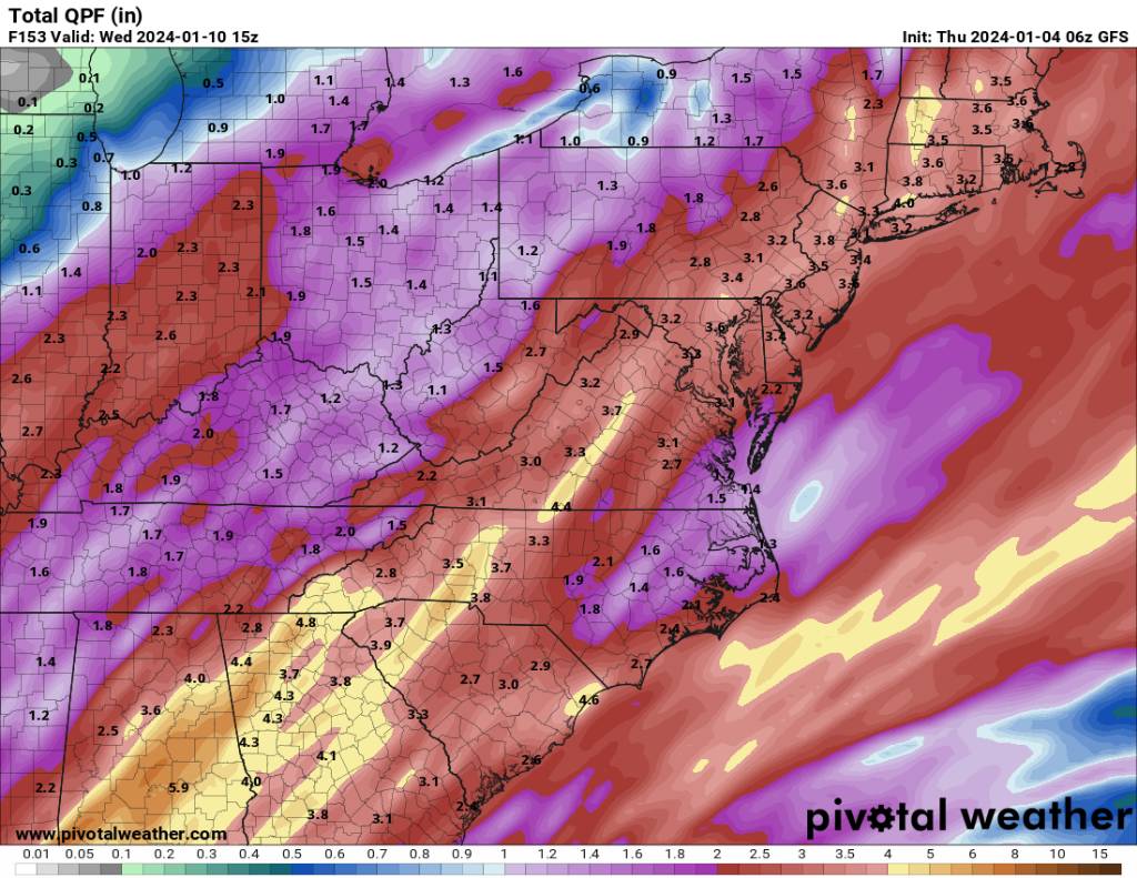
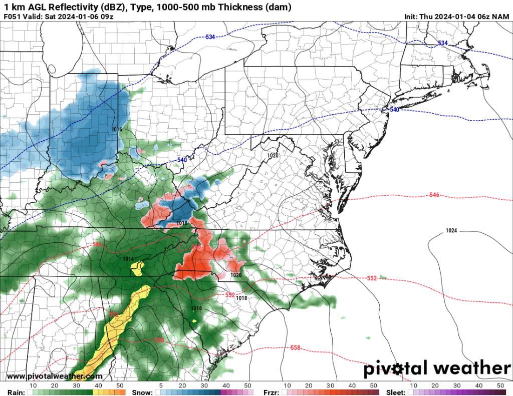
Met1985 replied to The Alchemist's topic in Southeastern States
Thank you! Will do my best. I know we are all on the edge of our seats currently.


.jpg.8428066e13877dc21985667958f01e47.jpg)


.jpg.4312ecf3ecef5f411325d4e55950f2e9.jpg)
.jpg.a43fe2af29e0a0f8b6a6fe42652a4fc4.jpg)
.jpg.14c80e698153f91eab5e9de630eb18da.jpg)
.jpg.3da4cc09e70c567a15a08780098e529a.jpg)


.jpg.5ecea721af0ac39b364f4e550db2983a.jpg)

.jpg.b19a1d057b29177f7482edecb8f821e5.jpg)


.jpg.ec008c3a99fb3dab86b853b66096cc74.jpg)
.jpg.6ce74b355bf701c65692237364f6af5b.jpg)