

Met1985
-
Posts
16,974 -
Joined
-
Last visited
Content Type
Profiles
Blogs
Forums
American Weather
Media Demo
Store
Gallery
Everything posted by Met1985
-
Looks like Wednesday will be prime time for severe weather.
-
Got hammered yesterday and today around noon. Looks like more tonight.
-
Good Lord it looks like it rocking hard down there. The rain forest is definitely making it's way.
-
Yeah looks like an active day.
-
More to come as well.
-
Yes sir! Nice steady rains all day and currently.
-
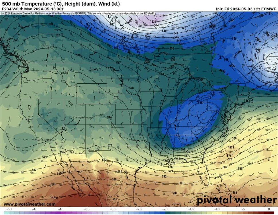
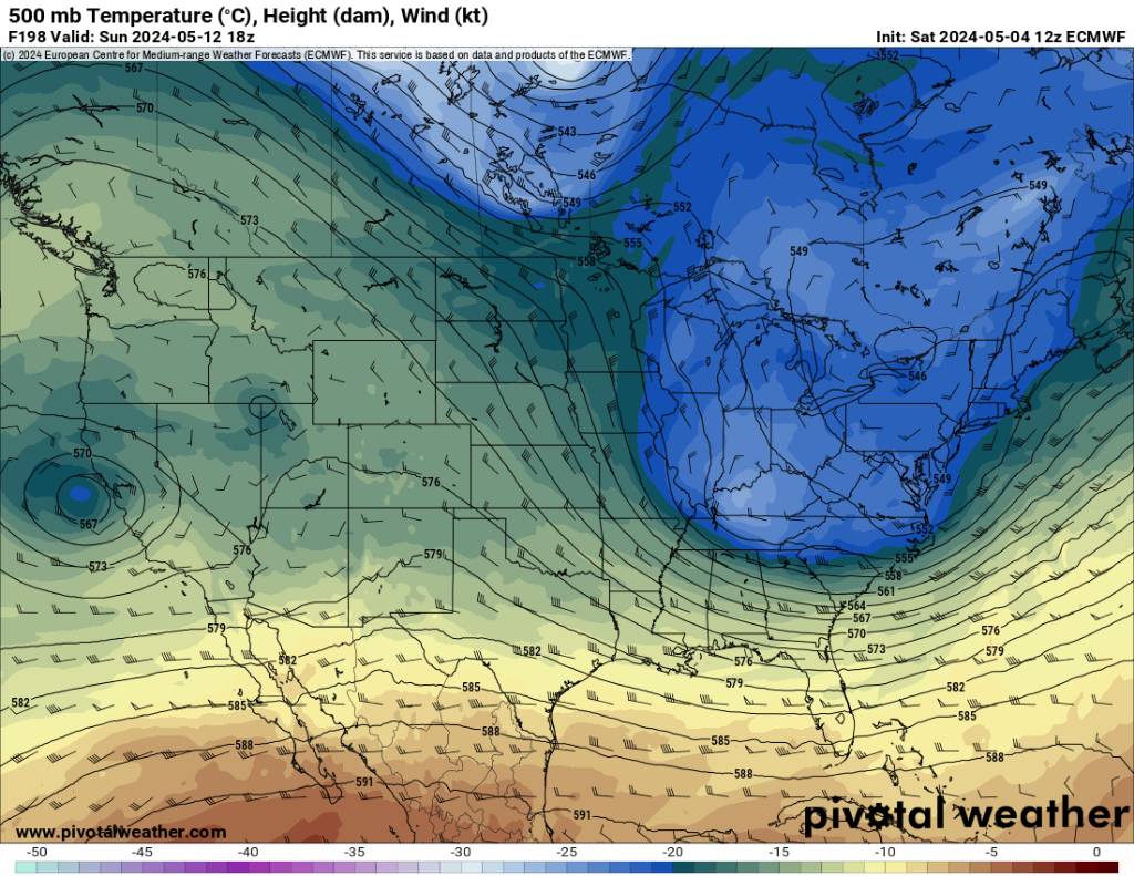
Euro and GFS continue to show this upcoming pattern change.
-
Still looks good for some cold air. Sent from my SM-G998U using Tapatalk

.thumb.jpg.37a04046df18c2f8f83a10e9aeb7384f.jpg)
.thumb.jpg.4f10217636a2b2ebbbb323f1a078f5b2.jpg)
-
Gfs got it too Larry.
-
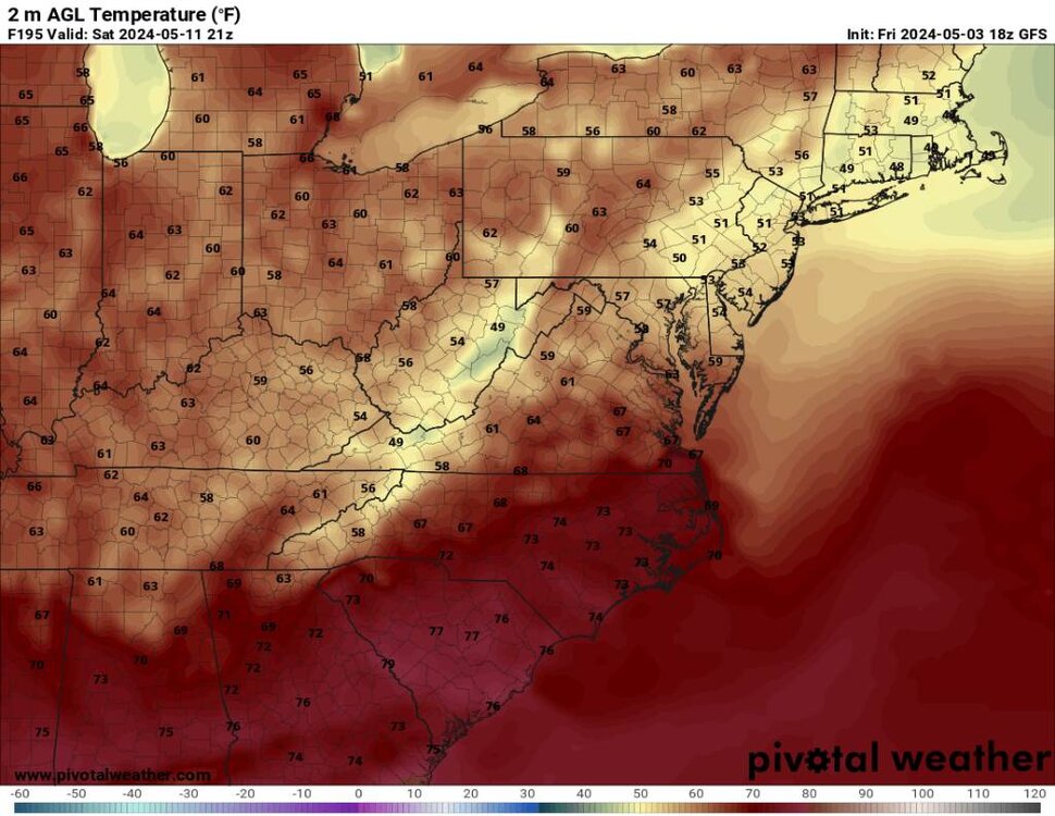
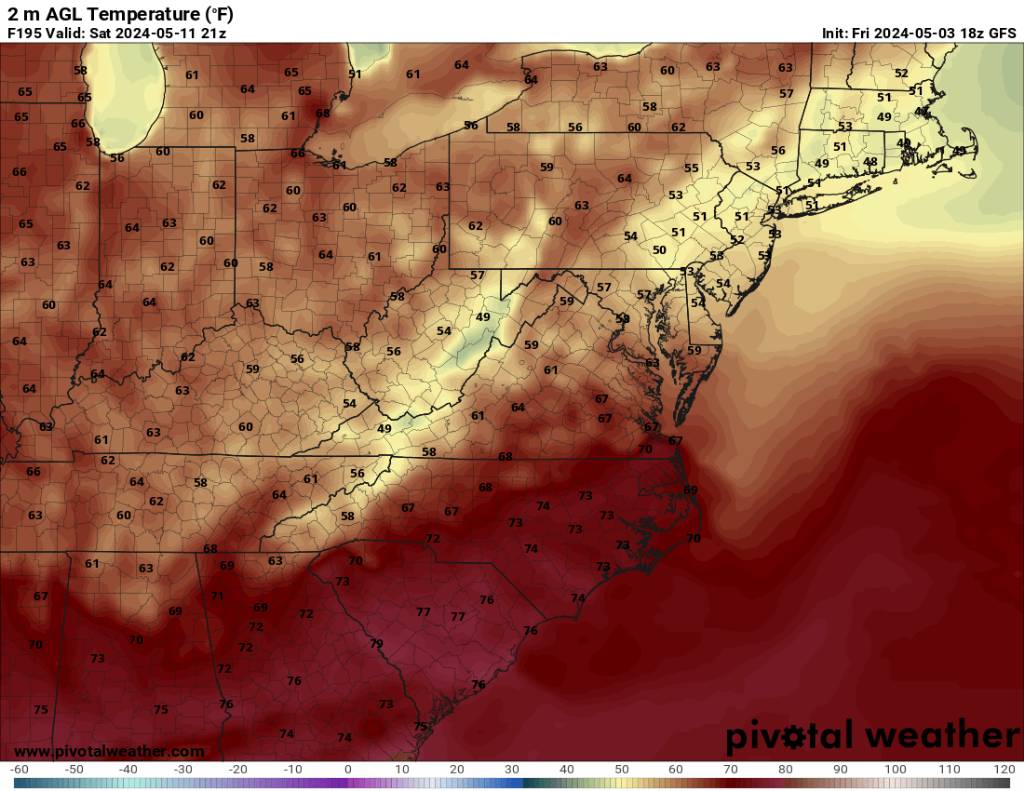
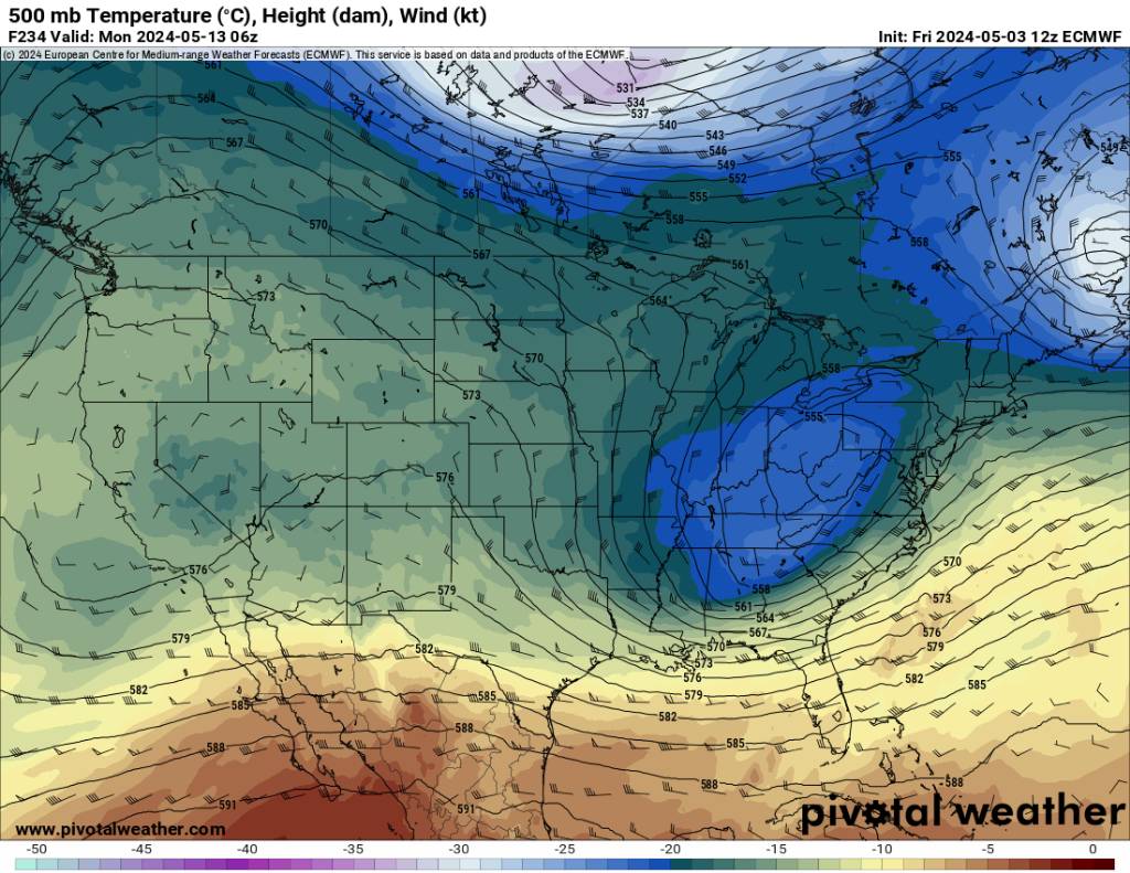
Cold temps for middle of May. Sent from my SM-G998U using Tapatalk
.thumb.jpg.557e0fc0025164f4dcd2f2348f21145e.jpg)
.thumb.jpg.8982c76820f7ab0bba0a8c4f87d02dd0.jpg)
.thumb.jpg.53d384a05400db29e55abe832a9b3738.jpg)
-
Cold blasts. Sent from my SM-G998U using Tapatalk
.thumb.jpg.78f4fc64944ec6a5586aaeddd34fefcc.jpg)
.thumb.jpg.29a730f75cb8c339e351651f862b060a.jpg)
-
Shows an unsettled period both on the gfs and euro.
-
Don't look now but a possible big cold shot in about a week may be coming.
-
Had a super isolated cell roll through Biltmore yesterday afternoon. Literally was hailing on one side and sun out on the other.
-
I've got pea size hail currently in Biltmore with this storm rolling through.
-
Looks like after the beautiful week last week we settle into a muggy stormy pattern. The gfs looks like an unsettled pattern with even some severe lines of storms possibly forming and blowing through here over the next week or so. The gfs has been tons better recently at recognizing the upcoming pattern.
-
This 20 percent chance of rain turned into 100 percent today and still raining.
-
We ended up bottoming out at 27 this morning. Currently 49.
-
A cold 29 frosty degrees this morning at 5 am. Heavy frost this morning.
-
Down to 38 already. Going to be a frosty one in the morning.
-
Yeah not bad for the end of April. Tonight is going to be another cold one.
-
Had a low of 31 with some light frost. Should have been colder but we had cloud cover all night.
-
Temp down to a marvelous 35 degrees! I know it's the middle to end of April but I absolutely love the colder air late in the season.
-
Nice! Only going to get colder.
-
The gfs absolutely nailed the rain today. The Euro had it south of us yesterday and had all of us staying dry.


.jpg.74fce22191a72c48950d3e0a0d7e43db.jpg)
.jpg.f431dbe198976cd2f9e59075d912976c.jpg)
.jpg.dbb37502f87a47be1c13452111612c5f.jpg)
.jpg.2df3b4370aec7cef186aa2d4bec4aeff.jpg)
.jpg.c221869b58e68af0f46cd852382eafd2.jpg)
.jpg.ab085044b489f0a5916463120bb34e7f.jpg)
.jpg.234487ed3bb29f79d7ec4a31a0134c21.jpg)