Met1985
-
Posts
15,283 -
Joined
-
Last visited
Content Type
Profiles
Blogs
Forums
American Weather
Media Demo
Store
Gallery
Everything posted by Met1985
-
Honestly no model has been consistent with this thing. I still believe everything is on the board still.
-
Yeah we have at least 2 to 3 upslope events in the next 10 days.
-
This evening into tonight is going to be crazy with the cold air crashing in. Look for temps to crash bad tomorrow. Flash freeze probably.
-
NW trend is going to jackpot the apps while yall smoke on sleet.
-
Lol that's the old folk lore. Well it's coming.
-
Most models look great for flow snow and look out in the valleys. I think yall get at least a dusting to inch. Sent from my SM-G998U using Tapatalk

.thumb.jpg.7f2094dc62ac1c529ace3fa9a471fcaa.jpg)
-
Even with the rain this morning the snow is still holding strong.
-
Yeah seems like the snow line here is 4k.
-
Yeah still a lot of changes coming with next weeks potential.
-
All kinds of watches and warnings.
-
Ashe-Watauga-Smyth-Grayson- Including the cities of Whitetop, Troutdale, Marion, Boone, Independence, West Jefferson, and Volney 415 AM EST Sat Jan 18 2025 ...WINTER WEATHER ADVISORY IN EFFECT FROM 7 AM SUNDAY TO 7 AM EST MONDAY... * WHAT...Snow expected. Total snow accumulations up to 4 inches. Winds gusting as high as 40 mph. * WHERE...In North Carolina, Ashe and Watauga Counties. In Virginia, Grayson and Smyth Counties. * WHEN...From 7 AM Sunday to 7 AM EST Monday. * IMPACTS...Plan on slippery road conditions. The hazardous conditions could impact the Monday morning commute.
-
Ashe-Alleghany NC-Watauga-Tazewell-Smyth-Bland-Giles-Wythe- Pulaski-Montgomery-Grayson-Carroll-Floyd-Craig-Alleghany VA-Bath- Mercer-Summers-Monroe-Eastern Greenbrier-Western Greenbrier- Including the cities of Marion, Pulaski, Duo, Hinton, Tazewell, Quinwood, Whitetop, Hot Springs, Pearisburg, Union, Flat Top, Blacksburg, West Jefferson, Hix, Troutdale, Radford, Bland, Clifton Forge, Volney, White Sulphur Springs, Lewisburg, Covington, Sparta, Independence, Bluefield, Alderson, Boone, Galax, Floyd, Wytheville, New Castle, and Rainelle 229 PM EST Fri Jan 17 2025 ...EXTREME COLD WATCH IN EFFECT FROM LATE SUNDAY NIGHT THROUGH WEDNESDAY MORNING ALONG AND WEST OF THE BLUE RIDGE... * WHAT...Air temperatures in the single digits to 5 below zero. Dangerously cold wind chills as low as 15 to 20 below possible along and west of the Blue Ridge.
-
Avery- Including the cities of Ingalls, Banner Elk, and Newland 356 AM EST Sat Jan 18 2025 ...WINTER WEATHER ADVISORY IN EFFECT FROM 7 AM SUNDAY TO 7 AM EST MONDAY... * WHAT...Snow expected. Total snow accumulations up to 4 inches. Winds gusting as high as 45 mph. * WHERE...Avery County. * WHEN...From 7 AM Sunday to 7 AM EST Monday. * IMPACTS...The heavy snow will create snow covered roads and produce scattered power outages. The hazardous conditions could impact the Monday morning commute. Gusty winds could bring down tree branches.
-
Madison-Yancey-Mitchell-Haywood- Including the cities of Micaville, Walnut, Allenstand, Luck, Swiss, Waterville, Cruso, Poplar, Cove Creek, Celo, Busick, Hot Springs, Waynesville, Ramseytown, Spruce Pine, Faust, Marshall, Mars Hill, Canton, and Burnsville 356 AM EST Sat Jan 18 2025 ...WINTER STORM WATCH IN EFFECT FROM SUNDAY MORNING THROUGH MONDAY MORNING... * WHAT...Heavy snow possible. Total snow accumulations generally of 1 to 3 inches possible, with 4 to 6 inches in higher elevations mainly above 3500 feet. Winds could gust as high as 45 mph. * WHERE...Haywood, Madison, Mitchell, and Yancey Counties. * WHEN...From Sunday morning through Monday morning. * IMPACTS...The heavy snow will create snow covered roads and produce scattered power outages. The hazardous conditions could impact the Monday morning commute. Gusty winds could bring down tree branches.
-
We've got a mixed bag of sleet, snow, and rain this morning. Kind of a bit of everything.
-
Current temp is at 36 and looking like we start out at a mix before changing over to scattered showers.
-
Yeah that winter I had snow on the ground from December 18th to March. That winter was freaking epic! A snowstorm literally every other weekend. I think even in my area I ended up with close to 80 inches that winter. What a freaking season. It all started December 18th with the synoptic storm then massive flow snow. Had close to 2 feet in my yard.
-
Lol when they melt we snow.
-
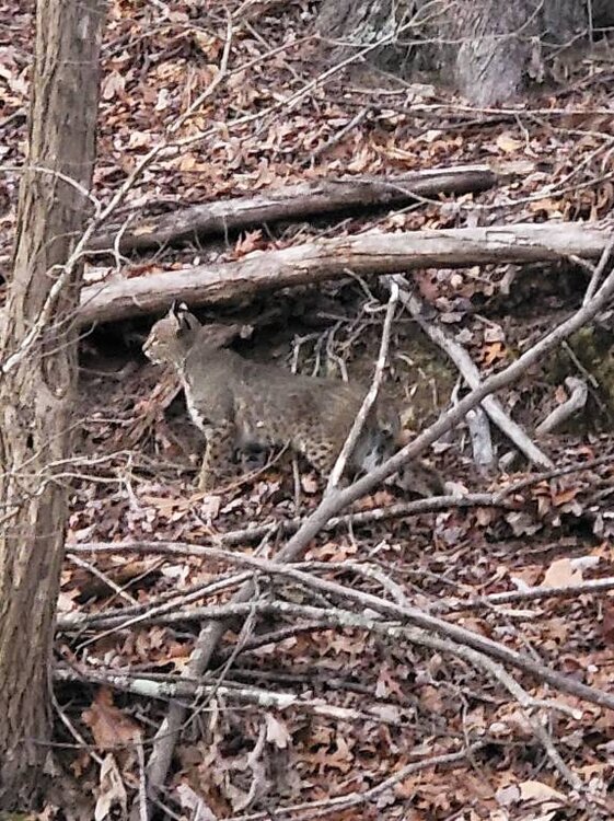
A closer look at the bobcat. Beautiful spots on him. Sent from my SM-G998U using Tapatalk
-
As for the systems next week. We just literally wait and see. Like I said in the main thread yesterday the models are all over the place because of the extremely strong Arctic blast coming in and all the energy.
-
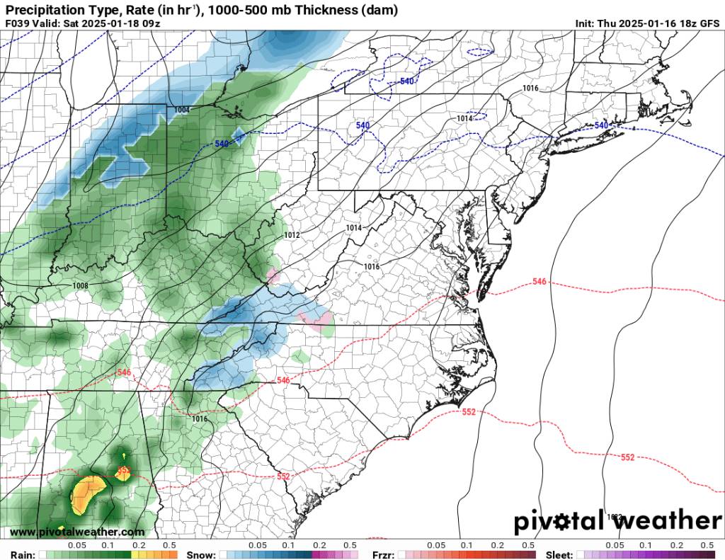
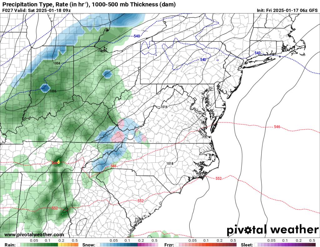
Euro and GFS still showing a nice thump tomorrow morning. The NAM has backed off but we will see. Sent from my SM-G998U using Tapatalk

-
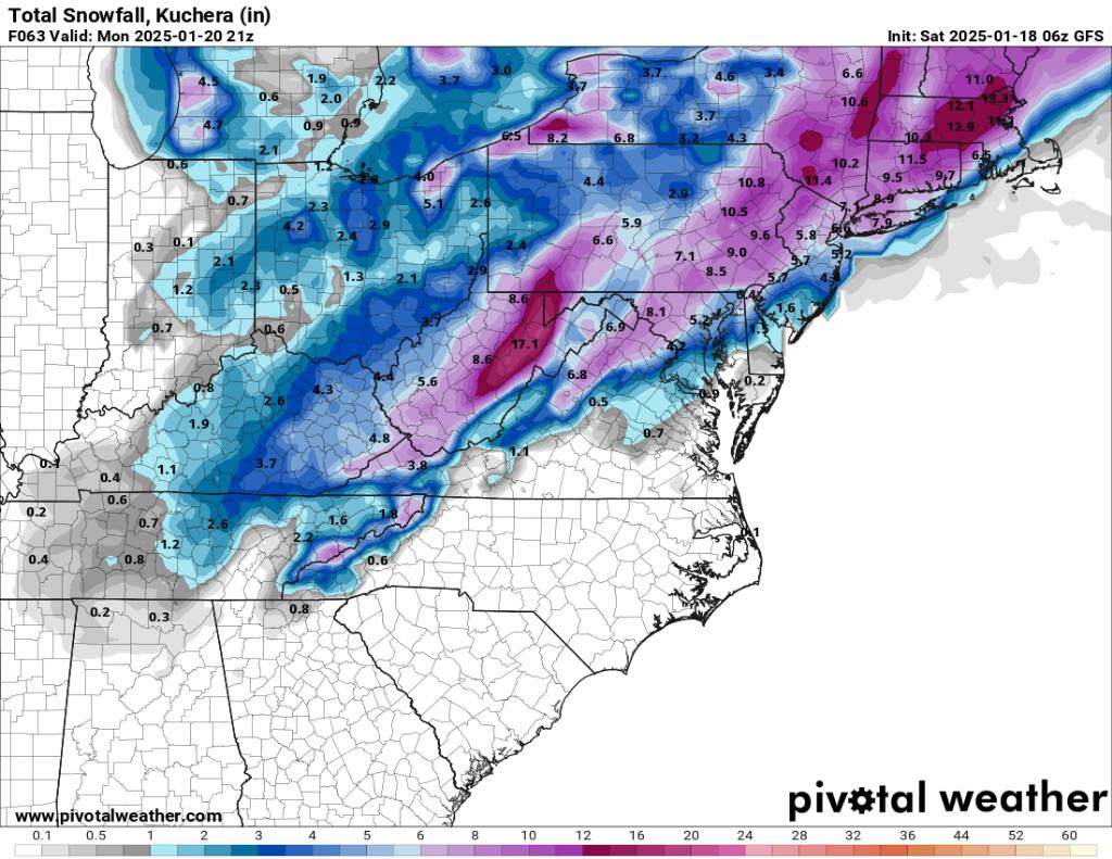
The gfs is really showing a nice setup for flow snow Sunday. A pretty long flow snow as well. Sent from my SM-G998U using Tapatalk
.thumb.jpg.43ee98087155ca5a056d960eb94809b1.jpg)
-
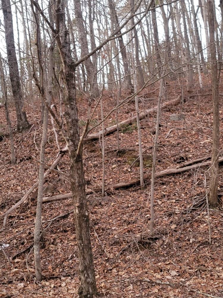
Not weather related but this is extremely rare to see. A beautiful bobcat today up in the mountains. And boy he blends in very well. Sent from my SM-G998U using Tapatalk

-
What happened in the main thread? Lol just trolling. Models are having a rough time.
-
Pretty good consensus that Saturday morning is going to be wintery. Sent from my SM-G998U using Tapatalk
.thumb.jpg.2a810f3f3ad76abf2aa29d3f5ee36d05.jpg)


.jpg.fc9af57b72bee5a39c6a9e320c3741f1.jpg)


.jpg.2d6dc2ad2e51a0155b617c388cfe6f2f.jpg)
.jpg.898020c795aa9feee784b06e2181df7b.jpg)