Met1985
-
Posts
16,960 -
Joined
-
Last visited
Content Type
Profiles
Blogs
Forums
American Weather
Media Demo
Store
Gallery
Everything posted by Met1985
-
Had a nice cool low of 52 degrees.
-
Had a high of 79 and a current temp of 58. Love these low humidity days.
-
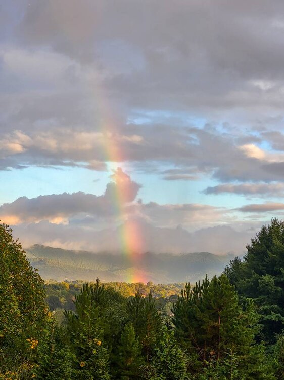
Beautiful rainbow this evening. Sent from my SM-G998U using Tapatalk
-
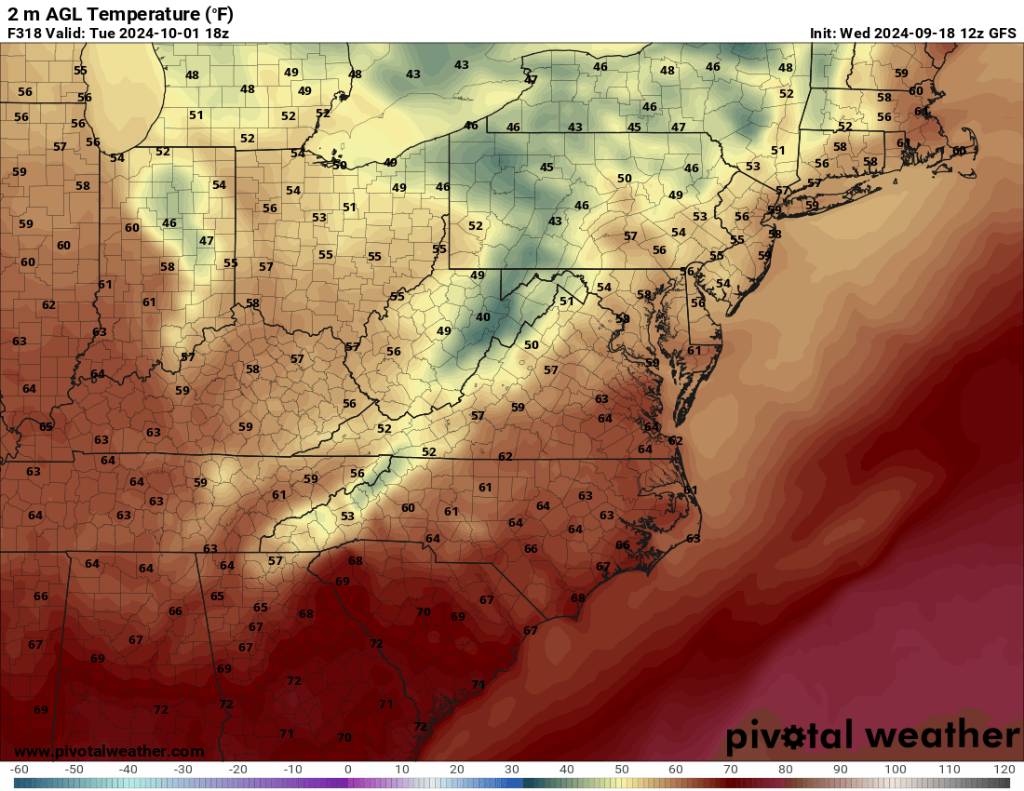
Just for laughs from the 12z gfs. High and low for the first of October. Sent from my SM-G998U using Tapatalk

.thumb.jpg.a14ab4cf0320e2a11c3503dd2e5d7d41.jpg)
-
Yeah I'd say this summer was long. It started early but we had our cool downs and it seems like every time we start into a drought mother nature bails us out like currently. Yeah the start to September has been remarkable. I don't expect to see the 70s until maybe tomorrow. That will make 6 days in a row of not touching 70 plus and having lows in the 50s every morning. Remarkable and refreshing.
-
Picked up another. 05 inches of rain overnight and still foggy and drizzling today currently. That brings my storm total to 1.80 inches which is right on the money from the NWS. This rain was perfect for the soil also.
-
Yeah it's definitely a huge help but without the flooding. Dang near perfect to soak into the ground.
-
Looks like I've squeezed out another .20 inches of rainfall this evening bringing my total to 1.75 inches for the storm.
-
Today has been right out of the middle of Fall. Temps in the 50s, rainy, dense fog, and running 20 plus degrees below normal. I've not hit 70 degrees in 5 days. Amazing for the middle of September.
-
So far today we've picked up an additional .25 inches of rainfall bringing our current total to 1.55 inches. Today's high was a balmy 56 degrees.
-
Light rain all day. Probably picked up a few more tenths in the ol rain guage. This has been exactly what we need to stamp down the growing drought.
-
52 degrees with 1.30 inches of rainfall overnight. Some great rain and still raining.
-
Been pouring the rain all night. Current temp is a cold 53 degrees.
-
Looks like this will rotate through tonight. Sent from my SM-G998U using Tapatalk
-
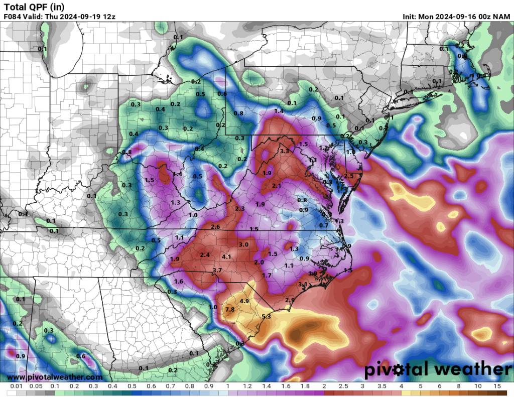
12z NAM really wanting to bring this further south to get everyone some type of beneficial rainfall. Sent from my SM-G998U using Tapatalk
.thumb.jpg.10386bee8be544f37eb1b53e64e2216f.jpg)
-
Clouds already rolling back in this morning after some brief sun.
-
00z euro on board now. Sent from my SM-G998U using Tapatalk

-
The NAM, GFS, and HRRR all showing the system coming through more south which really fans out the precipitation across the mountains. This would be the best scenario.
-
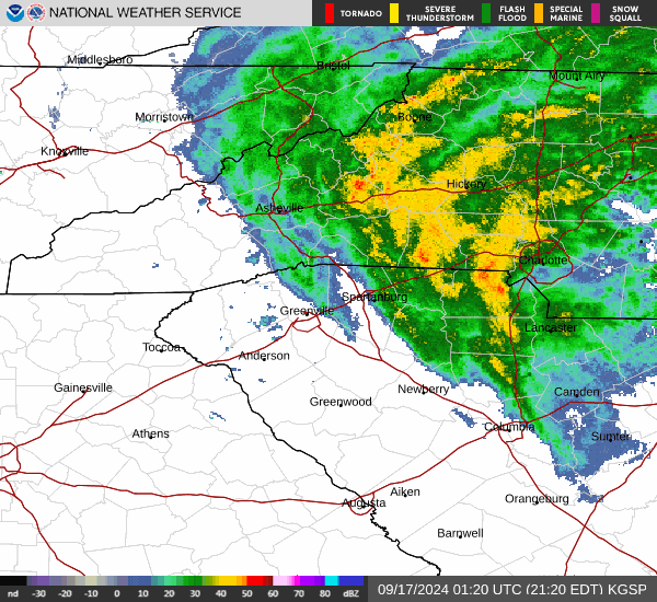
00z HRRR Sent from my SM-G998U using Tapatalk
.thumb.jpg.20d09b645fcc594e3e85c156fec966cb.jpg)
-
00z gfs. Sent from my SM-G998U using Tapatalk
.thumb.jpg.95587e82a98cb4362974db16f7140a18.jpg)
-
This looks really good for most of the area now.
-
Showers starting to break out already.
-
00z NAM. Sent from my SM-G998U using Tapatalk

-
Snow season starting early out west. https://www.usatoday.com/story/news/weather/2024/09/15/snow-advisory-california-earliest-twenty-years/75238962007/
-
Yeah no kidding. Especially yall on that side of the mountain.


.jpg.2aeb55d5306a6bdc98b2946f4297752f.jpg)
.jpg.3c439e6919e5caff1950d05d0c8b595d.jpg)

.jpg.0116d827578a090d975dc7bf4d4d56cb.jpg)
.jpg.1f24bcd60c438774d9d707b081941014.jpg)