
ct_yankee
-
Posts
400 -
Joined
-
Last visited
Content Type
Profiles
Blogs
Forums
American Weather
Media Demo
Store
Gallery
Everything posted by ct_yankee
-
I suspect there's too much cloud debris in southern CT for much intensification, at least near the coast, but you never know. The shear is definitely in place and intensifying, so we'll see. I no longer have much hope for anything really good in HVN area...
-
Obviously some good shear today with all this rotation. You can even see it visually on that satellite animation, which was indeed pretty cool. I foresee a good day, for once.
-
Nice couplet now in CT ESE of Hartford, near... Terramugus? Never heard of it before.
-
The stuff up in NY is the line to watch, or possibly cells forming in front of it. Intense couplet up there now (in central NY)
-
Thanks for posting that. That's pretty interesting. Is it confirmed that it stayed over the river for its entire life?
-
Alas, I avoid facebook like the plague. I expect I'll see the pics elsewhere, eventually. I only asked about it because I couldn't find anything when I did a search right after reading that post. No biggie.
-
Any more info on this? Pics, a link to a story, anything?
-
Marine waterspout warning for that cell out in the sound south of new haven
-
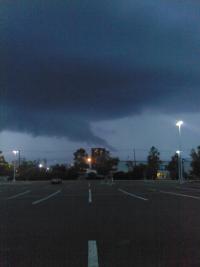
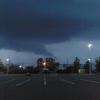
Real nice structure just now in HVN, mothership-ish for sure... Nice RFD shelf, even a cool elevated funnel. Could feel the warm inflow, none of the usual cold outflow gusts, even after the shelf went over. Nice little storm!
-
Looks like initiation near Danbury
-
Nice pic, Wiz. The strongest part of the line now seems to be in CT.
-
Or just higher CAPE and better lapse rates... But maybe terrain also.
-
Noticeably strengthening on last few frames... Seems like western MA may be under the gun, don't know about CT.
-
None of the high resolution models seem to want to keep it going much further, virtually all show it dissipating or splitting up into pieces before it reaches Albany. Looks quite healthy, though, so maybe the models just don't have a handle on this...
-
 I'm not Wiz but that is incorrect, many times you have an RFD with no tornado, and vice versa. There was a theory that correlated tornadogenesis with RFDs, and certain kinds of RFDs in particular, but the latest in detailed computer simulations suggests the RFD is more a consequence of the tornado then a cause (look at Dr. Leigh Orf's work). Edit: Phrased that badly, did not mean to imply tornado causes RFD, as noted the two phenomena occur independently sometimes
 -
SPC page currently has two separate reports from the Cape for the day, indicating two tornadoes. Remarks say one has been confirmed by survey, while the other was radar-indicated but a survey is ongoing. So was this one tornado or two? Obviously there was a lot of straight-line wind damage as well, but I'm curious about the official number for the tor(s). Pretty interesting event, considering mesoanalysis was showing almost no SBCAPE when the tornado touched down.
-
Continuous thunder just south of me...
-
There is something to be said for pretty clouds... Especially when its all you got.
-
Head north. You're much more likely to get spinners near the front, which as everyone has noticed is now well north up near MA border. Also, still a lot of CIN near the coast. I think you'll do better up by HFD.
-
7-19 Severe outbreak MN into upper MI
ct_yankee replied to janetjanet998's topic in Lakes/Ohio Valley
From a chaser stream: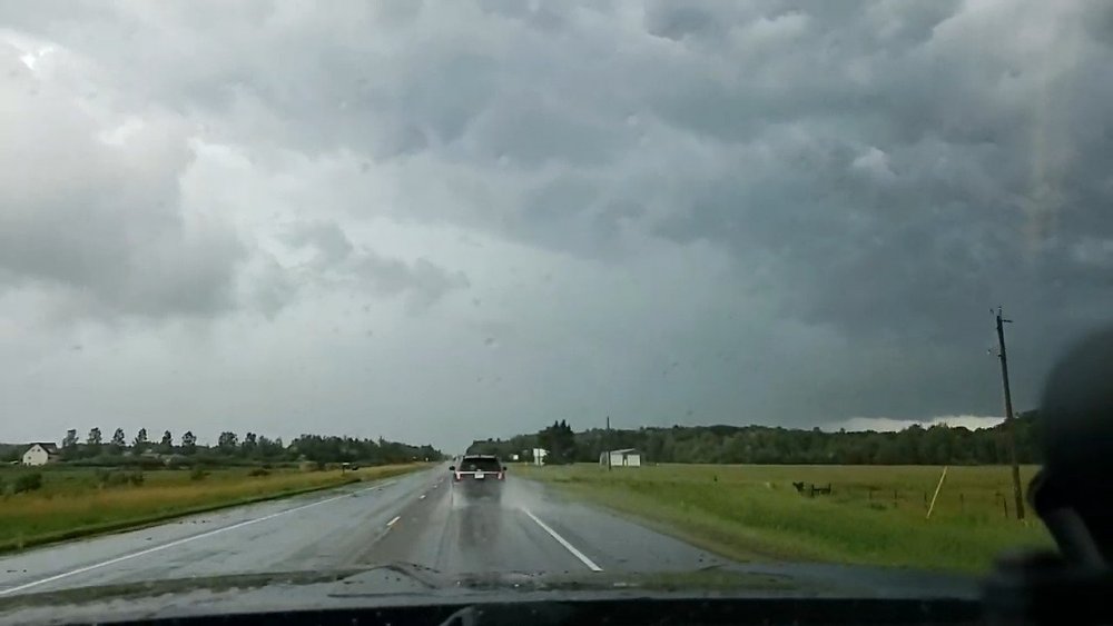
-
Still all snow in HVN, and still insanely heavy, the sleet looks to be confined to southeast portion of the state...
-
This band is easily the fastest accumulating snow I've seen since Nemo. There's a guy shoveling the sidewalk across the street from me and you could literally watch the pavement turn white again behind him... Crazy stuff. Haven't seen any true sleet here in HVN, not yet, although the heavy wet snow does have a kind of "sleety" look to it at times... If we can manage to hold off the taint thru the morning there'll be some insane totals in this region come dawn.

