

RogueWaves
-
Posts
2,430 -
Joined
-
Last visited
Content Type
Profiles
Blogs
Forums
American Weather
Media Demo
Store
Gallery
Everything posted by RogueWaves
-
Absolute whiteout conditions for my morning commute - worst in years for me. About 6" fell at work and the winds were wicked making it brutal after such a mild 2024. Slapped back to reality in NMI.
-

Winter 2024-25 Medium/Long Range Discussion
RogueWaves replied to michsnowfreak's topic in Lakes/Ohio Valley
Yeah, that was tongue-in-cheek due to some even mentioning 13-14 as an analog for this winter which I see has been dragged thru the mud here since I replied, lol. Didn't even know DT was still out there either. This was the sentiment back when I used to follow his site:
-
Winter 2024-25 Medium/Long Range Discussion
RogueWaves replied to michsnowfreak's topic in Lakes/Ohio Valley
And the MJO suddenly not so bullish on a Phase 6 romp. Baby steps.. -
Winter 2024-25 Medium/Long Range Discussion
RogueWaves replied to michsnowfreak's topic in Lakes/Ohio Valley
Can I hold you to that? -
Burst of mod snow and large flakes now - snow globe happening here this morning. Nice little surprise before the mini-torch
-
Winter 2024-25 Medium/Long Range Discussion
RogueWaves replied to michsnowfreak's topic in Lakes/Ohio Valley
Winter continues Saturday: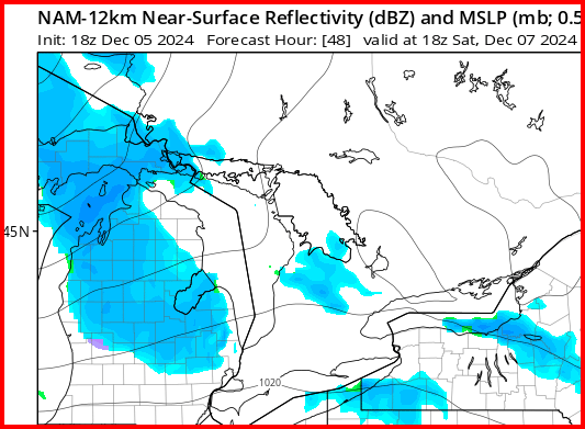
-
Scored 3" in about 90 minutes last evening, then another inch overnight for storm total of 4.2" (had 0.2 WAA in the morning). Took a few days and a busted headline but we joined the NMI plowing party. Almost got stuck this morning the drifting was so bad here.
-
Don't see this much:
-
Whiteout here now! Absolutely dumping and some wind gusts as well. Literally watching my lit snow deer getting deeper in the snow.
-
Crazy - there's like no wind here last I looked
-
GRR Obs
-
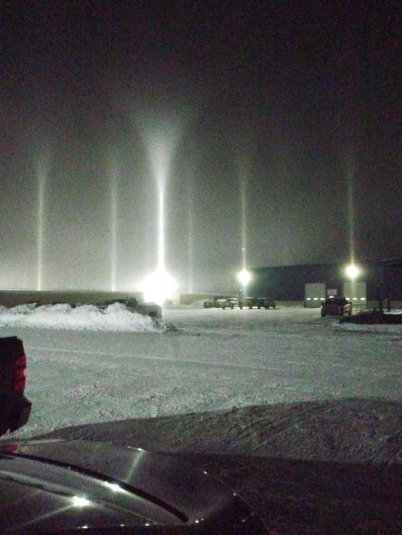
Arriving at work to my first light pillars since 2014 was cool
-
DTX almost sounds stoked for the arctic fropa potential Active winter pattern then sets up for the midweek period as adeepening mid-level shortwave drops out of northern Canada into theupper Great Lakes. Lead ascent arrives over the central Great LakesWednesday morning tied to lobe(s) of vorticity preceding the mainparent trough. Forecast soundings struggle to reach saturation upthrough the DGZ, instead advertising a shallow saturated layer below800mb that resides between 0 to -8C... which could result in pocketsof light freezing drizzle during the morning-early afternoon period.A transition to all snow becomes likely by late afternoon-eveningwith the arrival of the lead cold front that brings the DGZ downinto the still shallow saturated layer. Better accumulating snowchances arrive late evening-overnight Wednesday as the clippermatures into a closed low somewhere near the northern Lake Huronshoreline. The mid-level trough drives directly over SE MI duringthis timeframe further supported by the level exit region of curvedjet streak at the base of the upper trough. Together these provide asignificant boost to ascent along the arctic cold front that will besimultaneously crossing southern lower MI with forecast soundingsfinally show a notable increase in saturation up to 700-650mb.Expectation at this time is for a quick burst of accumulating snowalong the front with local probabilistic guidance showing ratesbetween 0.1-0.25"/hr being most favored. Fast frontal progressionlimits resident time which should keep accumulations to 0.5-1.5".That said, there is convective instability (50-100 J/kg) thatcrosses the DGZ in some forecast soundings which could boost providea boost into higher snowfall rates.Besides the snow potential with this clipper, wind will also be acause of concern. There has been a gradual shift south with the lowtrack within the ECWMF ENS/GEPS (trend not observed within the GEFS)placing it over either the Georgian Bay or towards Sudbury whichleads to a tighter gradient over SE MI. Surge of arctic air resultsin mixing depths increasing to >6kft tapping into these strongerwinds aloft (35-45kts) offering a chance to see wind gusts at thesurface in excess of 40mph. If trends persist with the low trackingcloser to our area, will have to monitor potential for gusts toreach or exceed 45mph (advisory criteria).
-
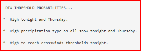
With the amt of snow OTG and not melting beforehand, this clipper brings legit shot at bliz conditions for NWMI Wed night into Thurs. I like the GEM's over all depiction
-
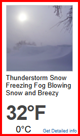
1/2 inch at home. 10-15" at work. Snowy day!
-
November 2024 General Discussion
RogueWaves replied to SchaumburgStormer's topic in Lakes/Ohio Valley
Buffalo stole that headline. -
November 2024 General Discussion
RogueWaves replied to SchaumburgStormer's topic in Lakes/Ohio Valley
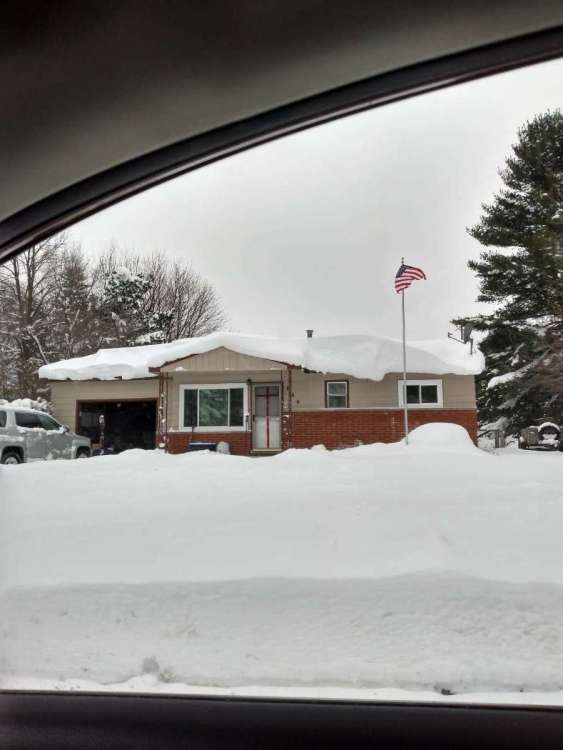
Gaylord had 24.8" (62.99 cm) in 24 hrs for all-time record day of snow fall Must've been fun, even by their standards If your house were in town. Roof drifts - always a sign of good things winter!
-
Lived in S. Bend for winters of 98/99/00/01/02. Five yrs when NW LES events were non-memorable if we even had one? Ofc, super Nino '98 was the first yr with like 72F in Feb. Got Jan of '99 and it's awesome bliz and a roughly 3 wk winter. I think Nov/Dec 2000 was the best period but again, not due to any historic LES events.
-
Winter 2024-25 Medium/Long Range Discussion
RogueWaves replied to michsnowfreak's topic in Lakes/Ohio Valley
So, Feb 2021 with 14" at DTW pretty sure that qualified, just not sure how it was up where you are? I was in Marshall for that one, and it was an intense 10" storm complete with some nice winds. -
Winter 2024-25 Medium/Long Range Discussion
RogueWaves replied to michsnowfreak's topic in Lakes/Ohio Valley
There's no arguing that. Most frustrating thing of my 3 winters in Wayne Cnty. -
Winter 2024-25 Medium/Long Range Discussion
RogueWaves replied to michsnowfreak's topic in Lakes/Ohio Valley
Begs the question "just what's worth flying home for?" I mean, 12+ not too common in Detroit region. -
I think S. Bend's moment looms..
-
Winter 2024-25 Medium/Long Range Discussion
RogueWaves replied to michsnowfreak's topic in Lakes/Ohio Valley
Weren't you in FL during that Feb 2021 storm? -
Winter 2024-25 Medium/Long Range Discussion
RogueWaves replied to michsnowfreak's topic in Lakes/Ohio Valley
Certainly, early in the season climo does NOT favor SEMI. Feb and March do. Still, MSP had their record season couple years back. I don't think they will own the magnet this winter. I think SEMI will do much better than recent winters and certainly better than last year. -
Winter 2024-25 Medium/Long Range Discussion
RogueWaves replied to michsnowfreak's topic in Lakes/Ohio Valley
Yep. DTW south to KTOL were in the jack zone. Typical when such an overwhelmingly cold pattern's in place. That's TOL's best and only real chance so I'm not upset if they score in such a pattern. Iirc, GHD-2 also treated them well.


