RogueWaves
-
Posts
2,430 -
Joined
-
Last visited
Content Type
Profiles
Blogs
Forums
American Weather
Media Demo
Store
Gallery
Everything posted by RogueWaves
-
Somebody would have to be in for an obvious thumping tomorrow night/Sunday morning to get bumped or toggled to a Warning tomorrow pm. East of US23 seems those with the best shot attm.
-
Easy upgrade if warranted. The safe/smart play by GRR and APX
-
NAM beyond 36 hrs is gonna fold at 18z
-
The Nino rocked it up here in (last yr) Jan. Back-2-back majors.
-
Euro and Ukie are crap for that tho..
-
As much as I want the NAM and other SR models that amp this to the NW to be right, it still feels tenuous at best NW of Saginaw Bay line where I'm at.
-
I can see GRR just extending/riding their WWA into round 2. Only upgrading if/when forced to by real-time obs. Safe route to go really
-
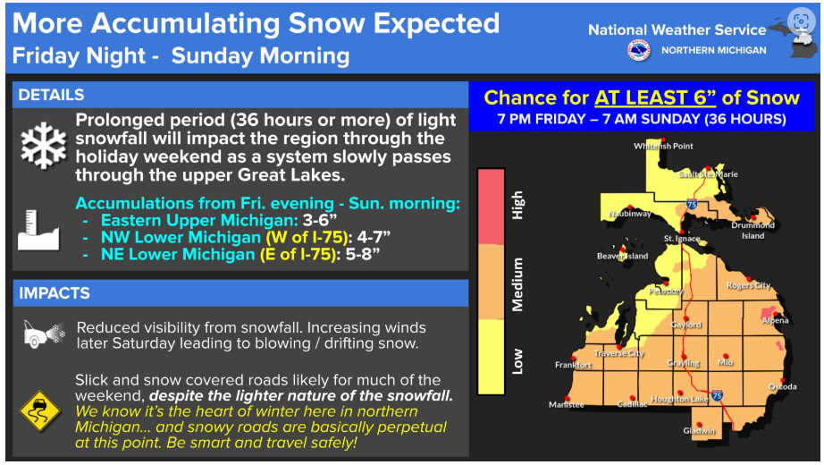
I wanna see some of that! APX with a graphic for 6+ but not mentioning this "storm"
-
Like this?
-
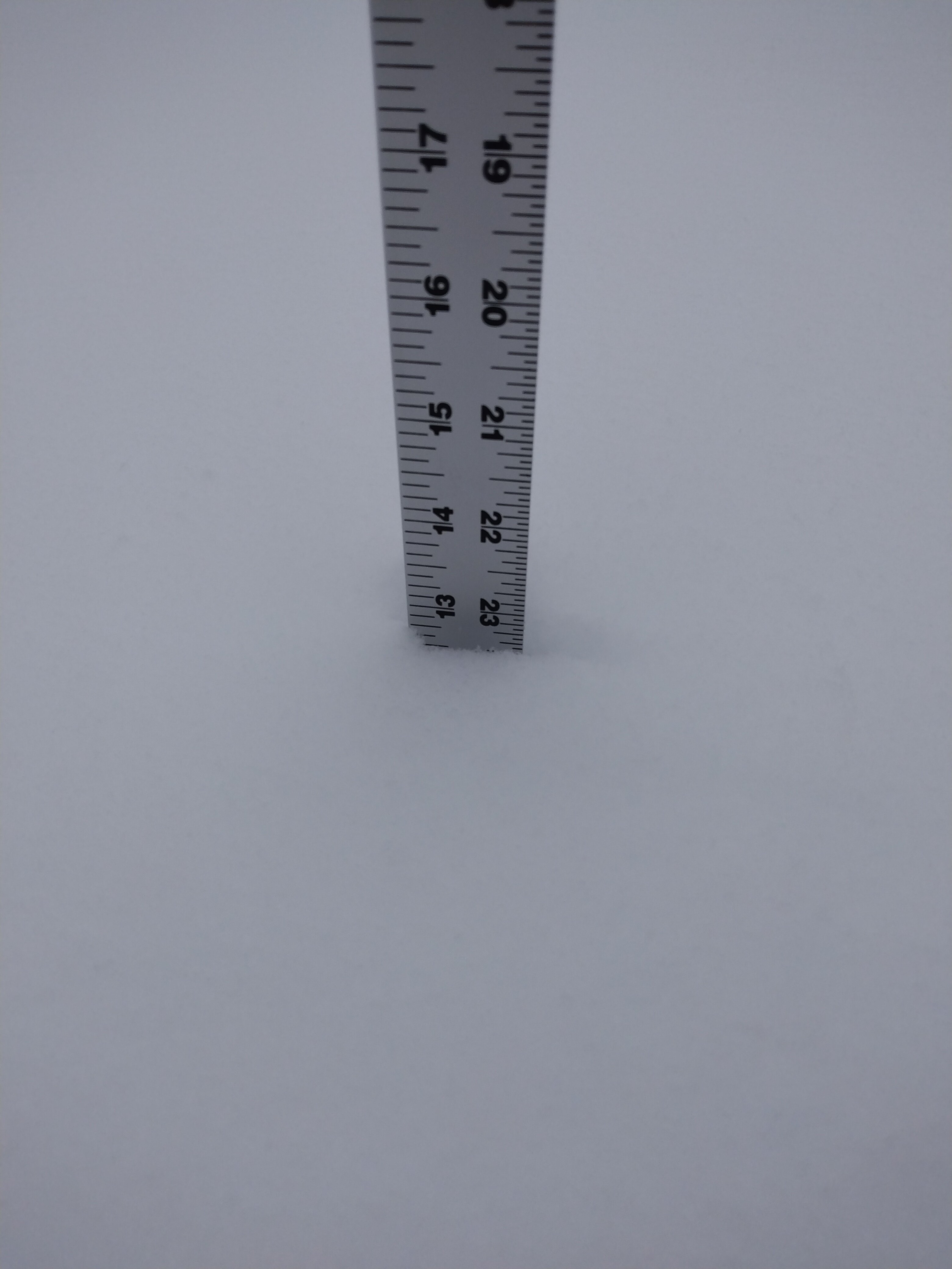
This low-moisture stuff settles quickly. But, deeper we go. Just under 15" in a sheltered spot, 12-13" where the wind gets at it. Not quite as deep as last January but getting closer.
-
6.5" Up here. 13" since Saturday. Will assess depth after work unfortunately it will be dark by then.
-
APX hitting the follow-on winds hard for later Sunday. Their concern is with so much snow depth, whatever falls even 2-3 inches can get visibilities dangerously low in open areas.
-
Could just as easily be sleet signal
-
Same old frustrations with that office for Calhoun cnty Its only slighty less so for me up here. Their northern tier has a 6+ event and they can't produce a map, just a one line statement, lol.
-
That's what I'm thinking. Good-bye CAD and HELLO CAW!
-
When's the last time we had all 4 onboard at this range tho? Seems always one of 'em playing the hold-out lately
-
Yesterday's storm had supposedly "weakened" per models right up til kick-off. In the end the better portrayal played out. Still time for this one to do similar. The more NW it cuts the better that chance imho..
-
Decent? How about 2"/hr lol. That's big for our region. I stopped in Mt. Pleasant about 9:30 and it was still snowing decently and could see the results of the weenie band I'd seen on radar about an hour before. I'd say KMOP had 3+ Preliminary Local Storm Report National Weather Service Grand Rapids MI 906 PM EST Sat Feb 8 2025 ..TIME... ...EVENT... ...CITY LOCATION... ...LAT.LON... ..DATE... ....MAG.... ..COUNTY LOCATION..ST.. ...SOURCE.... ..REMARKS.. 0815 PM Snow Mount Pleasant 43.60N 84.78W 02/08/2025 M3.0 Inch Isabella MI Public Observed in 90 minutes.
-
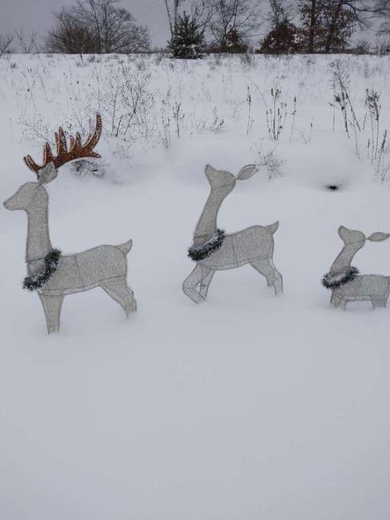
Same score for mby. Had slight unexpected drifting so a couple spots are deeper The snow deer are pretty pleased tbh
-
Traveling south to Jackson. Left about 4 in snow under 1/2 mi vis. Get to Mt. Pleasant and just a smattering and little snow cover. The snow shield does sweep south later like they've had West of us. Snowing here in Jackson too maybe 1/2 inch down here so far. Good luck
-
Euro seems to like Chicago/Lwr Lakes around the 13th. Weenie Alert hoisted
-

Winter 2024-25 Medium/Long Range Discussion
RogueWaves replied to michsnowfreak's topic in Lakes/Ohio Valley
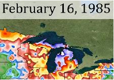
RIght. Like their earlier ref to a similar pattern to 13-14. Have to allow for a possible back-loaded winter as we shake off Nino dust, and hopefully get just enough Nina-esque treatment. My new locale has had better winters to this point, its been so-so tbh but most of NMI already has a decent snowpack going into this stretch and I have an outside chance at 7" this weekend. Even 3-4 would be huge here for this season. I went out of Wayne county on a high note (3/3/23) and I'm glad to have a chance to get buried more often like last January's 18" depth. Only time will tell if BAM's just another hype outlet. Gotta let it play out. My regret is I never made it North in Feb of '85 when those incredible depths happened (Kalkaska with 68"). I was content with a 12" depth and riding my snow machines in 3 to 4 foot drifts where I lived at the time in Genesee Cnty. Hopefully a LOT more of us that have suffered poor winters for several years running get into some much better snows. -
Winter 2024-25 Medium/Long Range Discussion
RogueWaves replied to michsnowfreak's topic in Lakes/Ohio Valley
This result would certainly be akin to that month for my region! 10:1 not fluffed-up Depth: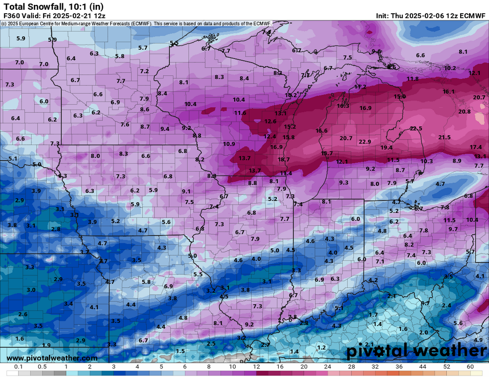
-
Half inch over here as well. The winds this evening are the worst I've seen in months. Lots of blowing across 127 and a snow devil thrown in for fun. Saw drifts in one open area about 4 foot or so. Today's dusting plus Monday's dumping that didn't pack down too tightly gave the winds something to work with up here. Could only imagine if we had these winds with some decent snow falling.
-
I thought your region just scored with Monday's system?