UpStateCAD
-
Posts
292 -
Joined
-
Last visited
Content Type
Profiles
Blogs
Forums
American Weather
Media Demo
Store
Gallery
Everything posted by UpStateCAD
-

February 19-20 Major Winter Storm Threat
UpStateCAD replied to NorthHillsWx's topic in Southeastern States
Larry What area are you referring to? Raleigh? Any temperature maps or p-types to go with the JMA? -
Hey Hickory. You thinking the ice threat could get back to the upstate or ne ga or too early to tell?
-
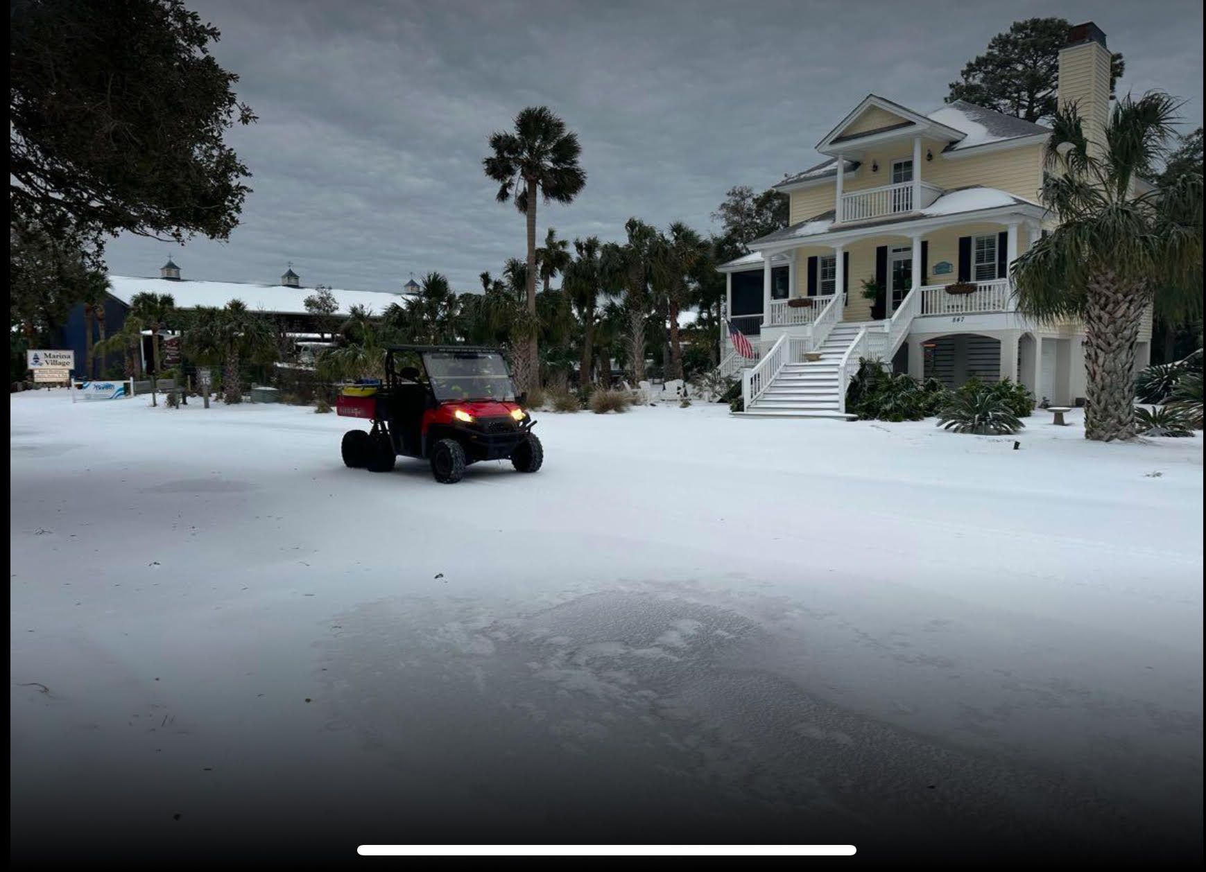
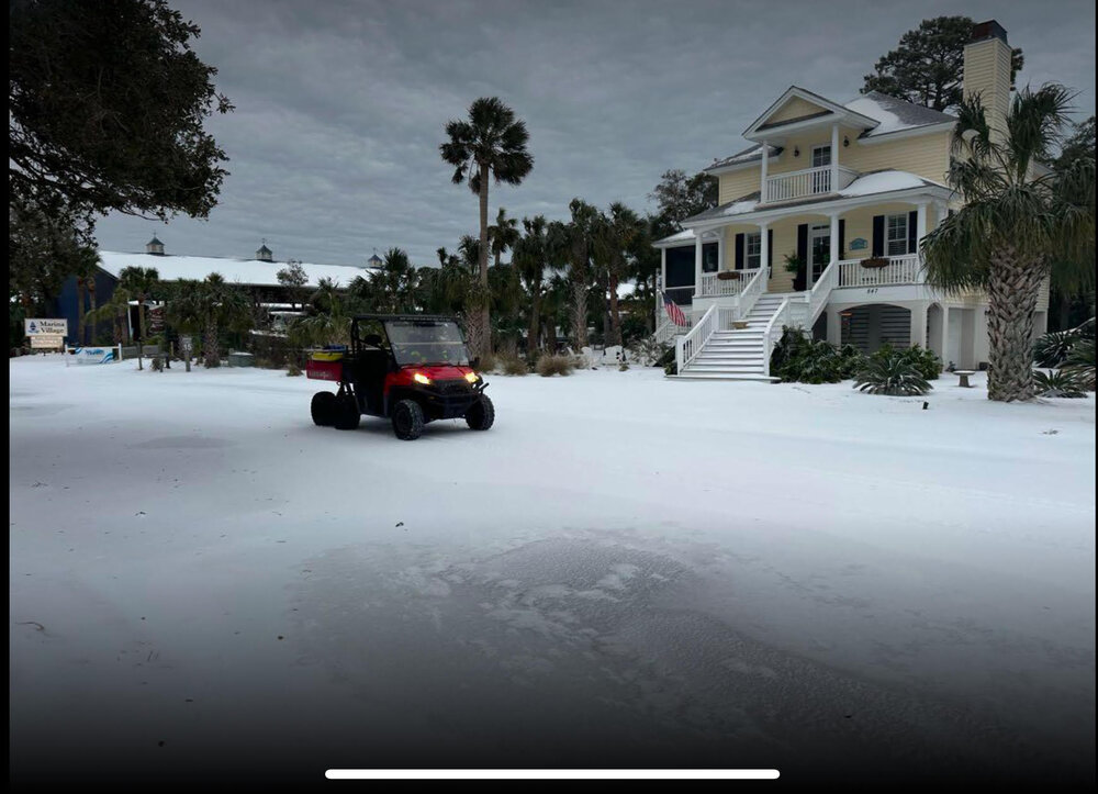
Fripp Island, SC
-
I would think this would be a very nice thump for the upstate into NC.
-
I think ice accumulations are going to end up higher than anticipated in the upstate. Have had light freezing rain for the last 2 to 3 hours. At about 0.1 in per hour. Temps are hovering around 29 F so perfect conditions for accumulation.
-
1/10-11 super awesome winter SE OBS thread
UpStateCAD replied to strongwxnc's topic in Southeastern States
Total bust at GSP. Official snow total so far at the GSP airport is 0.1 inch. Total storm equivalent precip so far is 0.11 inch. Most models were showing between 0.6 and 0.85 inches of precipitation. -
Nope. In Greenville we have barely had enough accumulation to cover hard surfaces. All snow has stopped and have light sleet and freezing rain. Huge bust here but I understand there are several areas nearby that over performed (i.e. Atlanta, Clemson, Abbeville, etc).
-
Take a look at GSP’s Forecast discussion. Sounds like they are not quite sure what to expect either.
-
what's the latest RGEM showing? Chris Justice likes that model for GSP area. HRRR sure has been on to some nice runs as well.
-
sleet
-
But boy have they backed off snow depth. Almost everyone is their forecast areas totals are way down.
-
Good to see you NeGa!!
-
looks a little sparser in the Upstate. Seems to be an increasing minimum here. Have not looked at the projected approach of the system into our area but I guess it could be our old friend Mr Downslope.
-
Mid to Long Range Discussion ~ 2024
UpStateCAD replied to buckeyefan1's topic in Southeastern States
Buckeye Fan.....where are you from? I did as well. 1976-1978. -
2023-2024 Fall/Winter Mountain Thread
UpStateCAD replied to The Alchemist's topic in Southeastern States
Appreciate it franklin -
2023-2024 Fall/Winter Mountain Thread
UpStateCAD replied to The Alchemist's topic in Southeastern States
Where is Soco? Is it near Waterrock Knob west of Waynesville? How much land up there is above 5000 ft? You think it would be the most affordable, high probability snow terrain in NW NC? -
Winter Storm Izzy Obs Thread
UpStateCAD replied to Prismshine Productions's topic in Southeastern States
Power out 1100 customers. Greenville. N Main, Rutherford Rd, N Pleasantburg area. -
Winter Storm Izzy Obs Thread
UpStateCAD replied to Prismshine Productions's topic in Southeastern States
Just measured 5 inches on my deck (N Main) Greenville. Looks like we have finally switched to mainly sleet. GSP had cut my totals to 1.5 in. Score one for the HRRR. -

-
Eric Webb (Met in Charlotte area) on Twitter is all over HRRR trends as well
-
So almost all of the short range models (HRRR, RAP, etc) except the NAM are showing 6+ in for the upstate??
-
Lookout. What’s your experience been with the accuracy of the hrrr regarding thermal profiles? im interested in your take because I know you have been following these icy set up for NE Ga and Upstate for years.
-
Anything but heavy (> 0.5 in) icing.
-
I’ll feel a lot better when the GFS stops showing an Armageddon type ice storm for GSP and CLT. hopefully as the high res models get within range this changes to a raging sleet storm.
-
Thanks. I found that link. I used to have the one you initially posted. Can’t remember what it was. BTW found part of the issue. Big difference between downtown Greenville (KGMU) and GSP 18z unfortunately. Much more ice downtown.