Gravity Wave
-
Posts
1,169 -
Joined
-
Last visited
Content Type
Profiles
Blogs
Forums
American Weather
Media Demo
Store
Gallery
Everything posted by Gravity Wave
-
 Labor Day 1998 and the May 31 - June 2 dual outbreaks earlier that year largely avoided the Philly area apart from some straight line winds from the edge of the derecho. IDK about 1989.
 -
Then there's this, the forward speed is extremely impressive.
-
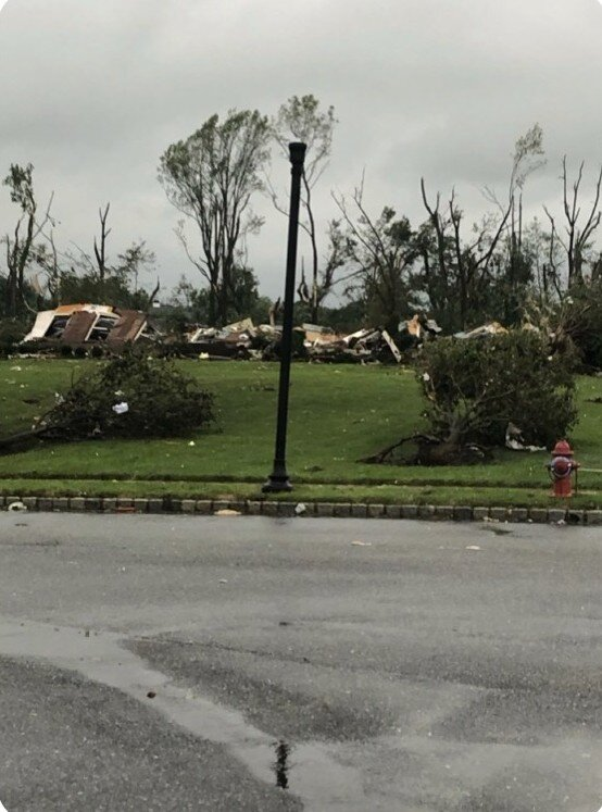
Wild damage photos from the Philly area. EF-4 rating seems possible based on this. Look at the uprooted bush in the foreground!
-
Dumping here, water is pouring off of my upstairs neighbor's balcony, running down the underside to the top of my living room window, and dripping onto my interior windowsill.
-
Pouring outside here, large puddles forming on 2nd Ave.
-
Yeah, the New Hope - Lambertville tornado that fortunately didn't touch down until it had mostly passed the town.
-
The hills south of Allentown top out between 800-1000', compared to the 250-350' elevation of the valley below. They aren't insignificant.
-
The struggles that it had getting its act together earlier today may also have increased landfall intensity by delaying an ERC. We saw this with Michael where there were some signs of a secondary eyewall just beginning to form at landfall after the storm had slowly and unimpressively strengthened before bombing in the last 18 hours. Of course, this is just speculation.
-
Notable East shift on 00z HWRF vs 18Z.
-
Shades of Laura and Michael.
-
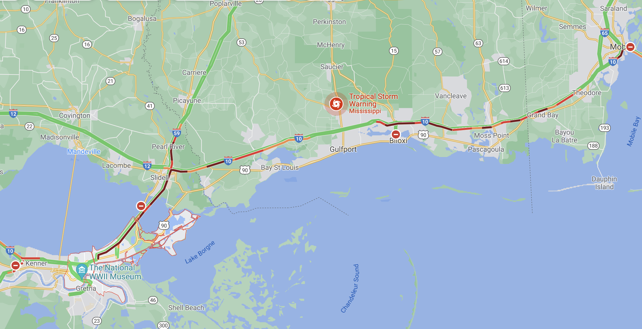
Ignore the strength with the globals at this point, what matters is the track. That shows the right eyewall almost over NO.
-
IIRC Laura also really blew up the evening before its landfall after taking its time getting organized for most of that day.
-
Looks like it.

-
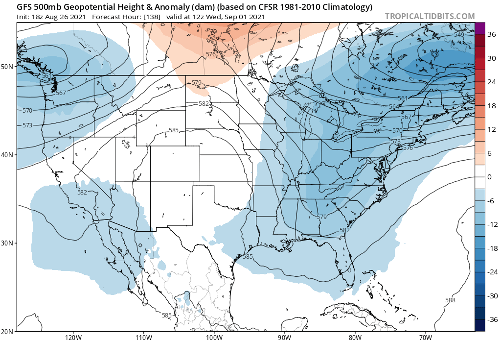
People are understandably focused on the potential landfall impacts but the deepening trough in the East being forecast for midweek could cause some major flooding problems in areas that got hit hard by rains from Fred and Henri.

-
Lee was the worst flooding for NEPA, Central PA and the Southern tier of NY since Agnes in 1972.
- 1,603 replies
-
- 1
-

-
- hurricane gusts
- flooding rains
- (and 2 more)
-
The models struggled with this storm up to the last minute with virtually every aspect other than timing.
- 1,603 replies
-
- 1
-
-
- hurricane gusts
- flooding rains
- (and 2 more)
-
Getting some thunder and lightning with this initial band coming off the ocean.
- 1,603 replies
-
- 1
-
-
- hurricane gusts
- flooding rains
- (and 2 more)
-
HWRF has it at 948 mb on Saturday night lol.
-
Growing up I always thought hurricane landfalls in LI/New England were extremely rare, but history indicates it's more like we're just in an extended drought. The WAR being too overpowering for storms to make landfall north of NC makes some intuitive sense, but we've still seen plenty of classic OTS recurves over the years. I think the more likely explanation is we've just been lucky, and as with all weather luck it's guaranteed to run out sooner or later.
-
Judging by current trends overpopulation is going to stop being a concern for anyone outside of Africa very soon.
-
7 degree gap with KNYC.
-
Very impressive crack of thunder just now, still intermittent lightning.
-
More lightning with this storm than any other this summer for me.