

Cashtown_Coop
-
Posts
3,380 -
Joined
-
Last visited
Content Type
Profiles
Blogs
Forums
American Weather
Media Demo
Store
Gallery
Everything posted by Cashtown_Coop
-
Central PA - Winter 2021/2022
Cashtown_Coop replied to Bubbler86's topic in Upstate New York/Pennsylvania
Lancaster is going to like this run. -
Central PA - Winter 2021/2022
Cashtown_Coop replied to Bubbler86's topic in Upstate New York/Pennsylvania
-
Central PA - Winter 2021/2022
Cashtown_Coop replied to Bubbler86's topic in Upstate New York/Pennsylvania
Nice hit. Guessing .4 qpf 36 it’s headed East. Sweet run -
Central PA - Winter 2021/2022
Cashtown_Coop replied to Bubbler86's topic in Upstate New York/Pennsylvania
Frederick snd Washington counties 2-4” with isolated 6” -
Central PA - Winter 2021/2022
Cashtown_Coop replied to Bubbler86's topic in Upstate New York/Pennsylvania
That was classic. -
Central PA - Winter 2021/2022
Cashtown_Coop replied to Bubbler86's topic in Upstate New York/Pennsylvania
Damn you bub -
Central PA - Winter 2021/2022
Cashtown_Coop replied to Bubbler86's topic in Upstate New York/Pennsylvania
CTP AFD Confidence has increased sufficiently for Advisory issuances for parts of the Laurel Highlands (Somerset County) and the Lower Susq River Valley (Adams, York and Lancaster Counties), where 2 to 4 inches of snow is increasingly likely. Advisories may be expanded to include parts of the SC Mountains with a slight northward wag of the steadiest steadiest snow, but for now 1 to 2 inches appear likely across most of central PA south of I-80, with a coating to 1 inch likely over the north, through Friday morning. Even outside of headlines, the widespread light snow could lead to slippery travel into the Friday morning commute. As the precip moves closer to the near term range, HRRR and RAP models are indicating a slightly earlier onset time around late afternoon across the Laurel Highlands/southwest Alleghenies with snow expanding northeast to the I-80 corridor around 00Z/7PM. Expect period of accumulating snow from Thursday evening through Thursday night. The latest HRRR/RAP suggest the northern tier of CPA could see very little to no snow with a sharp northern precip gradient; while also showing some potential for moderate snowfall rates along the PA/MD border btwn 00-06Z Fri. Temps trend colder Thursday night with fcst minTs in the 15-25F range by daybreak Friday. Winds/gusts from the WNW should also be increasing into Friday morning with +single digit wind chills over the western Alleghenies. Synoptic snow should transition to lake effect snow showers Friday morning. Expect LES to last into Friday night with light to potentially moderate snow accumulation in the favored NW snowbelt. We were keen to increase POPs above NBM in the NW mtns, but later shifts may need to bump up snowfall amounts. Friday will be blustery with 25-35mph wind gusts and below normal highs trending 5 to 10F colder vs. Thursday. Lows will drop into the teens Friday night with winds subsiding by AM Saturday. -
Central PA - Winter 2021/2022
Cashtown_Coop replied to Bubbler86's topic in Upstate New York/Pennsylvania
Snow map would suggest more purple -
Central PA - Winter 2021/2022
Cashtown_Coop replied to Bubbler86's topic in Upstate New York/Pennsylvania
Guess you’ll have to drive to get the purple. I’m guessing this is the most confident counties for now and will add more tomorrow if models hold -
Central PA - Winter 2021/2022
Cashtown_Coop replied to Bubbler86's topic in Upstate New York/Pennsylvania
They went all in -
Central PA - Winter 2021/2022
Cashtown_Coop replied to Bubbler86's topic in Upstate New York/Pennsylvania
Not coming together at 216. -
Central PA - Winter 2021/2022
Cashtown_Coop replied to Bubbler86's topic in Upstate New York/Pennsylvania
Is that a Miller A inbound or hybrid -
Central PA - Winter 2021/2022
Cashtown_Coop replied to Bubbler86's topic in Upstate New York/Pennsylvania
Thanks for the 2m info. Kinda figured but I’m new to the model world -
Central PA - Winter 2021/2022
Cashtown_Coop replied to Bubbler86's topic in Upstate New York/Pennsylvania
Euro is cold run with trough in East with reinforcing cold fronts. Storm brewing at hr 198 as cold retreats -
Central PA - Winter 2021/2022
Cashtown_Coop replied to Bubbler86's topic in Upstate New York/Pennsylvania
What’s best to use for actual ground temps on models. 2m? -
Central PA - Winter 2021/2022
Cashtown_Coop replied to Bubbler86's topic in Upstate New York/Pennsylvania
Agreed. I hunting for qpf. Ratios should be high. Give me .3 to .4 and I’ll be happy -
Central PA - Winter 2021/2022
Cashtown_Coop replied to Bubbler86's topic in Upstate New York/Pennsylvania
Looks ok to me -
Central PA - Winter 2021/2022
Cashtown_Coop replied to Bubbler86's topic in Upstate New York/Pennsylvania
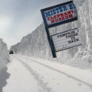
-
Central PA - Winter 2021/2022
Cashtown_Coop replied to Bubbler86's topic in Upstate New York/Pennsylvania
Another pic -
Central PA - Winter 2021/2022
Cashtown_Coop replied to Bubbler86's topic in Upstate New York/Pennsylvania
It never did at my place. Almost had a hoar frost look to it but wasn’t that cold. -
Central PA - Winter 2021/2022
Cashtown_Coop replied to Bubbler86's topic in Upstate New York/Pennsylvania
There’s ice on this side around 1300ft and higher this morning. -
Central PA - Winter 2021/2022
Cashtown_Coop replied to Bubbler86's topic in Upstate New York/Pennsylvania
86, I think both of us would take 3-4” in a heartbeat. Also blowing snow might be a problem with winds gusting 30mph Friday afternoon -
Central PA - Winter 2021/2022
Cashtown_Coop replied to Bubbler86's topic in Upstate New York/Pennsylvania
-
Central PA - Winter 2021/2022
Cashtown_Coop replied to Bubbler86's topic in Upstate New York/Pennsylvania
06Z euro is 0.2 to 0.3” qpf for lsv -
Central PA - Winter 2021/2022
Cashtown_Coop replied to Bubbler86's topic in Upstate New York/Pennsylvania
State is out plowing with 1/2” throwing sparks


