

Cashtown_Coop
-
Posts
3,380 -
Joined
-
Last visited
Content Type
Profiles
Blogs
Forums
American Weather
Media Demo
Store
Gallery
Everything posted by Cashtown_Coop
-
Central PA - Winter 2021/2022
Cashtown_Coop replied to Bubbler86's topic in Upstate New York/Pennsylvania
-
Central PA - Winter 2021/2022
Cashtown_Coop replied to Bubbler86's topic in Upstate New York/Pennsylvania
Frederick and Washington counties have strong wording in warning WHAT...Snow changing to ice. Total snow accumulations of 2 to 4 inches and ice accumulations of one tenth to three tenths of an inch. * WHERE...In Maryland, Washington and Frederick MD Counties. In Virginia, Northern Fauquier and Western Loudoun Counties. * WHEN...From 1 PM Sunday to 7 AM EST Monday. * IMPACTS...Power outages and tree damage are likely due to the ice. Travel could be nearly impossible. The hazardous conditions could impact the morning commute. * ADDITIONAL DETAILS...Snow could fall at 1 to 3 inches per hour for a time late Sunday into Sunday evening, making roads nearly impassable for a time. -
Central PA - Winter 2021/2022
Cashtown_Coop replied to Bubbler86's topic in Upstate New York/Pennsylvania
Friends to the south -
Central PA - Winter 2021/2022
Cashtown_Coop replied to Bubbler86's topic in Upstate New York/Pennsylvania
@MillvilleWx Thanks for the info. Based upon your map, do you think the Catoctins up through South Mountain stand the highest impact with the locally higher ice. 2-4” of snow with .25” or more of ice plus wind would be a high impact event -
Central PA - Winter 2021/2022
Cashtown_Coop replied to Bubbler86's topic in Upstate New York/Pennsylvania
Their snow maps are seamless. Something to watch for sure -
Central PA - Winter 2021/2022
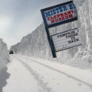
Cashtown_Coop replied to Bubbler86's topic in Upstate New York/Pennsylvania
-
Central PA - Winter 2021/2022
Cashtown_Coop replied to Bubbler86's topic in Upstate New York/Pennsylvania
Just noticed LWX forecasting more ice than CTP. Low dews and wet bulbing holding temps down longer -
Central PA - Winter 2021/2022
Cashtown_Coop replied to Bubbler86's topic in Upstate New York/Pennsylvania
Blizz93 you going with the 10% -
Central PA - Winter 2021/2022
Cashtown_Coop replied to Bubbler86's topic in Upstate New York/Pennsylvania
With the uncertainty, the best move would have been to put all the CWA in a watch. I do believe my county north and east turns into an advisory with warnings from Franklin north and westbound -
Central PA - Winter 2021/2022
Cashtown_Coop replied to Bubbler86's topic in Upstate New York/Pennsylvania
Lighter amounts headed west -
Central PA - Winter 2021/2022
Cashtown_Coop replied to Bubbler86's topic in Upstate New York/Pennsylvania
Those details won’t be figured until game time. -
Central PA - Winter 2021/2022
Cashtown_Coop replied to Bubbler86's topic in Upstate New York/Pennsylvania
This will be the name of my next weather book -
Central PA - Winter 2021/2022
Cashtown_Coop replied to Bubbler86's topic in Upstate New York/Pennsylvania
It is a mby hobby. Good catch lol -
Central PA - Winter 2021/2022
Cashtown_Coop replied to Bubbler86's topic in Upstate New York/Pennsylvania
8 shades in Adams -
Central PA - Winter 2021/2022
Cashtown_Coop replied to Bubbler86's topic in Upstate New York/Pennsylvania
I don’t think nam is right. But it has to be watched. Euro rock steady. -
Central PA - Winter 2021/2022
Cashtown_Coop replied to Bubbler86's topic in Upstate New York/Pennsylvania
Mix to Lake Erie. Ouch. IF LSV can’t have snow, no one can -
Central PA - Winter 2021/2022
Cashtown_Coop replied to Bubbler86's topic in Upstate New York/Pennsylvania
No snow falling in PA -
Central PA - Winter 2021/2022
Cashtown_Coop replied to Bubbler86's topic in Upstate New York/Pennsylvania
Right the name of the game is get as much qpf before we lose the column -
Central PA - Winter 2021/2022
Cashtown_Coop replied to Bubbler86's topic in Upstate New York/Pennsylvania
Is it showing a true Miller B. True thump then a dry slot. If that’s the case I could see 6-10” -
Central PA - Winter 2021/2022
Cashtown_Coop replied to Bubbler86's topic in Upstate New York/Pennsylvania
With the Euro, this is all snow for most before the flip. -
Central PA - Winter 2021/2022
Cashtown_Coop replied to Bubbler86's topic in Upstate New York/Pennsylvania
-
Central PA - Winter 2021/2022
Cashtown_Coop replied to Bubbler86's topic in Upstate New York/Pennsylvania
When did Cashtown become a plot on the map? -
Central PA - Winter 2021/2022
Cashtown_Coop replied to Bubbler86's topic in Upstate New York/Pennsylvania
If we can get .5 qpf in 6 hrs and it’s all snow that would be a winner -
Central PA - Winter 2021/2022
Cashtown_Coop replied to Bubbler86's topic in Upstate New York/Pennsylvania
This is all snow for us Next panel is the flip -
Central PA - Winter 2021/2022
Cashtown_Coop replied to Bubbler86's topic in Upstate New York/Pennsylvania
Ice is south

