

Cashtown_Coop
-
Posts
3,380 -
Joined
-
Last visited
Content Type
Profiles
Blogs
Forums
American Weather
Media Demo
Store
Gallery
Everything posted by Cashtown_Coop
-
Central PA - Winter 2021/2022
Cashtown_Coop replied to Bubbler86's topic in Upstate New York/Pennsylvania
It wouldn’t matter as much moving south because the annual snowfall drops off so much. Minus the smoky mountains why live up higher if all you gain is a windy ridge that doesn’t snow. -
Central PA - Winter 2021/2022
Cashtown_Coop replied to Bubbler86's topic in Upstate New York/Pennsylvania
My sister lives near there and always has more snow than me. Drives me nuts. I’m the one keeping official weather records -
Central PA - Winter 2021/2022
Cashtown_Coop replied to Bubbler86's topic in Upstate New York/Pennsylvania
Elevation by far outweighs latitude for me. I’m actually going to be putting my house for sale soon to move higher up. My goal is at least 1400ft. -
Central PA - Winter 2021/2022
Cashtown_Coop replied to Bubbler86's topic in Upstate New York/Pennsylvania
Big batch going thru Lanco. Only 0.02” here so far. This weekends event drying up as well. -
Central PA - Winter 2021/2022
Cashtown_Coop replied to Bubbler86's topic in Upstate New York/Pennsylvania
Yeah. That was my 10a measure -
Central PA - Winter 2021/2022
Cashtown_Coop replied to Bubbler86's topic in Upstate New York/Pennsylvania
All about the temp drop. A quick 3-5 degrees caused the slush to freeze up -
Central PA - Winter 2021/2022
Cashtown_Coop replied to Bubbler86's topic in Upstate New York/Pennsylvania
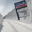
There’s a accident with fatality right by mister Ed’s on Rt 30. Happened around 2:15 -
Central PA - Winter 2021/2022
Cashtown_Coop replied to Bubbler86's topic in Upstate New York/Pennsylvania
I went with 4.8” for the event. Peak wind during the storm was 37 so far. -
Central PA - Winter 2021/2022
Cashtown_Coop replied to Bubbler86's topic in Upstate New York/Pennsylvania
Wind def increasing. Whiteout -
Central PA - Winter 2021/2022
Cashtown_Coop replied to Bubbler86's topic in Upstate New York/Pennsylvania
I was going off MA forum and pns reports. There’s a met in thurmont who always post. I trust his reports -
Central PA - Winter 2021/2022
Cashtown_Coop replied to Bubbler86's topic in Upstate New York/Pennsylvania
I looked too. Mostly 4-5”. Thurmont to Smithsburg area. 7” is def the high end -
Central PA - Winter 2021/2022
Cashtown_Coop replied to Bubbler86's topic in Upstate New York/Pennsylvania
I gotcha. Similar to measuring off a deck, the snow has a dome effect which magnifies the totals. I was told not to measure off the deck even though it makes for a good pic. -
Central PA - Winter 2021/2022
Cashtown_Coop replied to Bubbler86's topic in Upstate New York/Pennsylvania
I’ll have to try that technique next time lol. I measured 3.6” on my official snowboard at 10a -
Central PA - Winter 2021/2022
Cashtown_Coop replied to Bubbler86's topic in Upstate New York/Pennsylvania
@Jns2183 https://weather.cod.edu/satrad/?parms=subregional-Virginias-comp_radar-24-1-100-1&checked=map&colorbar=undefined -
Central PA - Winter 2021/2022
Cashtown_Coop replied to Bubbler86's topic in Upstate New York/Pennsylvania
Looks like the composite radar from the COD site -
Central PA - Winter 2021/2022
Cashtown_Coop replied to Bubbler86's topic in Upstate New York/Pennsylvania
This band is good. Flake size increased and it’s dumping -
Central PA - Winter 2021/2022
Cashtown_Coop replied to Bubbler86's topic in Upstate New York/Pennsylvania
I believe best rates of day are going to be in band forming among 81. Just getting in to it now. -
Central PA - Winter 2021/2022
Cashtown_Coop replied to Bubbler86's topic in Upstate New York/Pennsylvania
4 degrees colder than me. -
Central PA - Winter 2021/2022
Cashtown_Coop replied to Bubbler86's topic in Upstate New York/Pennsylvania
Blizzard Warning just issued for blue ridge mountains south of us -
Central PA - Winter 2021/2022
Cashtown_Coop replied to Bubbler86's topic in Upstate New York/Pennsylvania
This is what came through my phone. Agree that something is wrong with website -
Central PA - Winter 2021/2022
Cashtown_Coop replied to Bubbler86's topic in Upstate New York/Pennsylvania
WINTER STORM WARNING IN EFFECT FROM 5 AM TO 5 PM EST SATURDAY... * WHAT...Heavy snow expected. Total snow accumulations of 4 to 6 inches. Winds gusting as high as 45 mph. * WHERE...Portions of central Pennsylvania. * WHEN...From 5 AM to 5 PM EST Saturday. * IMPACTS...Travel could be very difficult. Areas of blowing snow could significantly reduce visibility. * ADDITIONAL DETAILS...Light rain will start tonight, and turn to snow before sunrise west of I-83, and shortly after sunrise to the east of I-83. The snow will be heaviest between 6 AM EST and 2 PM EST, tapering off in the afternoon. -
Central PA - Winter 2021/2022
Cashtown_Coop replied to Bubbler86's topic in Upstate New York/Pennsylvania
Might sneak out a 20” season somehow -
Central PA - Winter 2021/2022
Cashtown_Coop replied to Bubbler86's topic in Upstate New York/Pennsylvania
What’s the final call for us. 4-8? Or C to 2” -
Central PA - Winter 2021/2022
Cashtown_Coop replied to Bubbler86's topic in Upstate New York/Pennsylvania
They had thundersnow in Arkansas earlier this eve -
Central PA - Winter 2021/2022
Cashtown_Coop replied to Bubbler86's topic in Upstate New York/Pennsylvania
Mowed greens for the first time earlier this week since last December. Can’t control it, but not ideal for getting anything done


