franklin NCwx
-
Posts
8,922 -
Joined
-
Last visited
Content Type
Profiles
Blogs
Forums
American Weather
Media Demo
Store
Gallery
Everything posted by franklin NCwx
-
2019/2020 Mountains and Foothills Fall/Winter Thread.
franklin NCwx replied to Tyler Penland's topic in Southeastern States
From about 12-3 pm Tomorrow the nam has very heavy snow over the southern mtns. Thinking 4-8 should be a good call. -
2019/2020 Mountains and Foothills Fall/Winter Thread.
franklin NCwx replied to Tyler Penland's topic in Southeastern States
-
One More Shot: Feb 20-21 Event
franklin NCwx replied to Tar Heel Snow's topic in Southeastern States
Fixed your post! -
One More Shot: Feb 20-21 Event
franklin NCwx replied to Tar Heel Snow's topic in Southeastern States
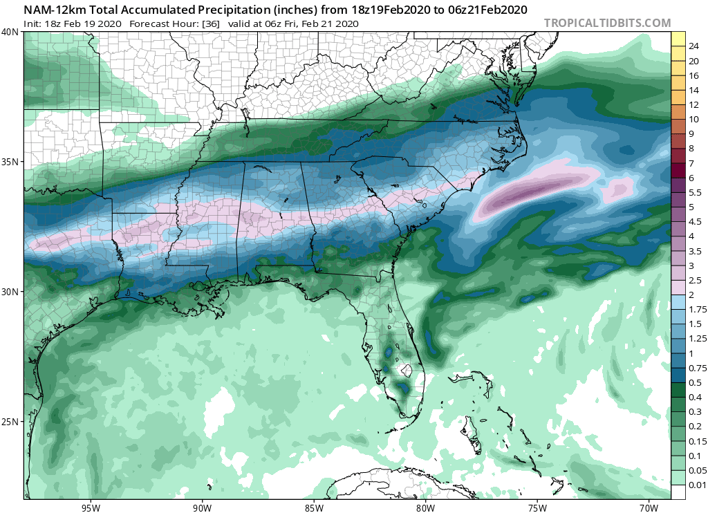
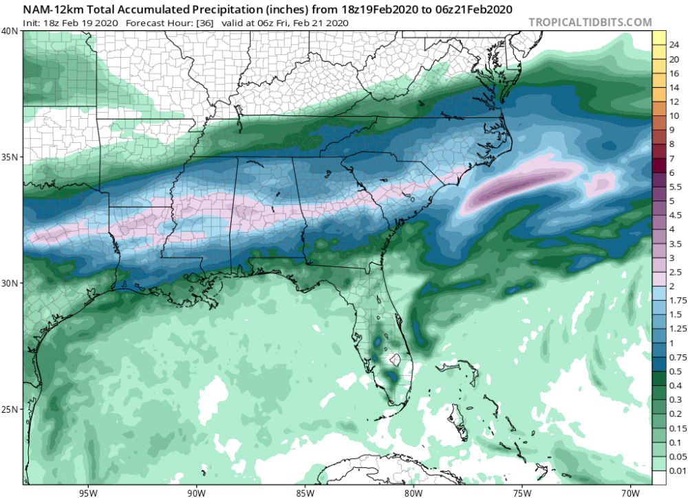
Complete fold to the nam
-
One More Shot: Feb 20-21 Event
franklin NCwx replied to Tar Heel Snow's topic in Southeastern States
Euro now drops several inches in the north ga mtns. -
Southeast Sanitarium - A Place to Vent
franklin NCwx replied to Jonathan's topic in Southeastern States
If I'm chasing 800 miles it's to the Tug for at least 3 feet. -
Southeast Sanitarium - A Place to Vent
franklin NCwx replied to Jonathan's topic in Southeastern States
Lol... why not just drive to the mtns which is a lot closer? Most likely will have the same totals. -
2019/2020 Mountains and Foothills Fall/Winter Thread.
franklin NCwx replied to Tyler Penland's topic in Southeastern States
Rgem bumped qpf totals up. Now has .5 getting into the southern mtns. Probably closer to reality. -
2019/2020 Mountains and Foothills Fall/Winter Thread.
franklin NCwx replied to Tyler Penland's topic in Southeastern States
https://www.spc.noaa.gov/exper/sref/srefplumes/ -
2019/2020 Mountains and Foothills Fall/Winter Thread.
franklin NCwx replied to Tyler Penland's topic in Southeastern States
It's only showing the total qpf for me but it has close to .5 now for Thursday! -
2019/2020 Mountains and Foothills Fall/Winter Thread.
franklin NCwx replied to Tyler Penland's topic in Southeastern States
Big jump in the sref qpf! -
Usually, sometimes they're slow to load.
-
One More Shot: Feb 20-21 Event
franklin NCwx replied to Tar Heel Snow's topic in Southeastern States
-
One More Shot: Feb 20-21 Event
franklin NCwx replied to Tar Heel Snow's topic in Southeastern States
Euro might get caught up during the storm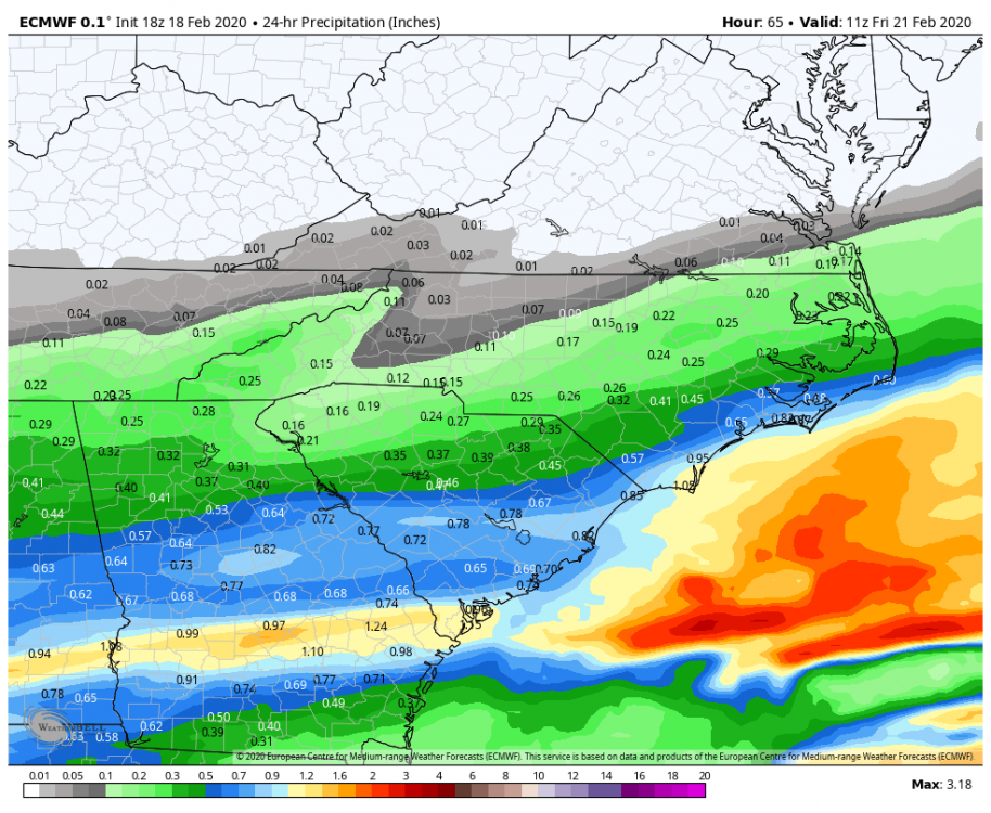
-
One More Shot: Feb 20-21 Event
franklin NCwx replied to Tar Heel Snow's topic in Southeastern States
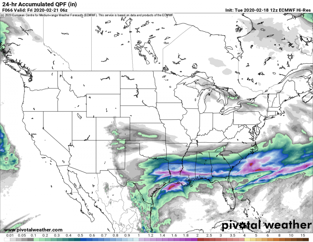
I'm really having a hard time buying the strong warm nose. It's not an amped up storm, the flow aloft is out of the southwest but there is a big high building in the plains at the same time. I'm also not seeing the high qpf numbers associated with such a strong warm nose. -
One More Shot: Feb 20-21 Event
franklin NCwx replied to Tar Heel Snow's topic in Southeastern States
09-10 the euro was the king. Ever since then it's done a subpar job of handling storms in our general area. I know it started to go through several "upgrades" at that time but it has really gone down hill. Can anyone remember the last time the euro won the model war? Reading back on the old threads this is the same situation over and over. -
One More Shot: Feb 20-21 Event
franklin NCwx replied to Tar Heel Snow's topic in Southeastern States
Fixed your post! -
2019/2020 Mountains and Foothills Fall/Winter Thread.
franklin NCwx replied to Tyler Penland's topic in Southeastern States
Most likely waiting for the nws. This is why I quit watching them years ago. Along with the nws forecast. -
One More Shot: Feb 20-21 Event
franklin NCwx replied to Tar Heel Snow's topic in Southeastern States
Nam looks similar to 12z a little slower. -
2019/2020 Mountains and Foothills Fall/Winter Thread.
franklin NCwx replied to Tyler Penland's topic in Southeastern States
Sref mean has jumped up to an inch and a half for Franklin. About the same for Asheville. -
Southeast Sanitarium - A Place to Vent
franklin NCwx replied to Jonathan's topic in Southeastern States
Roll with the nam and rgem. -
Southeast Sanitarium - A Place to Vent
franklin NCwx replied to Jonathan's topic in Southeastern States
I would wait on the wral model first! -
Southeast Sanitarium - A Place to Vent
franklin NCwx replied to Jonathan's topic in Southeastern States
Along with the WRAL forecast. I'm sure sun angle will get mentioned today too. -
Flurries to a light dusting at best for N Ga
-
I thought it would have been a better run just looking at H5 and H7