

HighStakes
-
Posts
4,385 -
Joined
-
Last visited
Content Type
Profiles
Blogs
Forums
American Weather
Media Demo
Store
Gallery
Everything posted by HighStakes
-
1/19 - The Roulette Wheel 29 Black Storm - OBS
HighStakes replied to DDweatherman's topic in Mid Atlantic
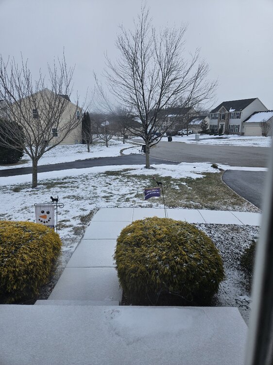
Light snow! -
Nice feeling isn't it. Euphoric. It's hard to get this far. Congrats and enjoy. Nervous energy tonight and tomorrow for us Ravens fans.
-
1/19 - The Roulette Wheel 29 Black Storm - OBS
HighStakes replied to DDweatherman's topic in Mid Atlantic
Most higher elevation weather stations around here are in the mid to upper 30's still and valleys are low 30's. This was expected. We should be 30-32 by 12z. -
Baltimore Washington SB? Improbable but not impossible.
-
1/19 - The Roulette Wheel 29 Black Storm - OBS
HighStakes replied to DDweatherman's topic in Mid Atlantic
4 or 5 would be acceptable but it's time for an overperformer here. Time for a solid 7 or slightly more. -
1/19 - The Roulette Wheel 29 Black Storm - OBS
HighStakes replied to DDweatherman's topic in Mid Atlantic
It's fine. Right in line with Euro's qpf. No worries here! -
1/16: 0.5 Total: 9.0
-
January Medium/Long Range: A snowy January ahead?
HighStakes replied to mappy's topic in Mid Atlantic
This Wednesday deal is showing a qpf. field well north and west from the low pressure center. It wouldn't take much for some light to moderate snows to reach the area. -
Euro is downright frigid after this event for next week.
-
Good bit wetter than 18z. More than noise.
-
Can I get a Winter Storm Watch this afternoon for the potential of 5 or more inches?
-
January Medium/Long Range: A snowy January ahead?
HighStakes replied to mappy's topic in Mid Atlantic
Yes, over 90 inches here in 2014. I believe I recorded 18 or more individual month from December through March. Incredible year. 2010 is the record. 102 inches but I need to go back and double check that. -
Unreal! I'm so close yet so far away. Lol.
-
Nice wintry January day!
-
Not really. Extremely light snow with a brightening sky is not conducive for accumulation on paved surfaces.
-
January Medium/Long Range: A snowy January ahead?
HighStakes replied to mappy's topic in Mid Atlantic
-5 to -7 Wednesday morning on the Euro for central and northern Maryland. That's the coldest temp of any model run so far. -
Steady light snow despite a very unimpressive radar.
-
Light snow for the past couple hours. A bit heavier at the moment.
-
Bottom line is almost every model gives the area some snow Sunday. Details to be fine tuned as always. Models are not backing off or showing any moderationon the Arctic cold as we get closer and in fact it keeps getting stronger and colder. Then a chance at a significant event towards the end of next week. This could be and I emphasize could be a top 5 winter week of all time!
-
Better chance there will be some snow than not albeit light. Usually likes to snow some when there's this type of Arctic intrusion.
-
January Medium/Long Range: A snowy January ahead?
HighStakes replied to mappy's topic in Mid Atlantic
Almost the entire storm was in the teens. Low teens for a long time. That huge High settled Saturday afternoon after the initial burst of snow pushed south. Temps dropped the entire day. By the time the heavy snow started in the very early a.m. of Sunday temps were in the teens then fell several more degrees. Some northern areas got down to 9 or 10 I believe. -
January Medium/Long Range: A snowy January ahead?
HighStakes replied to mappy's topic in Mid Atlantic
Wednesday morning low of 0 and then heavy snow in the evening with temps in the low teens. -
January Medium/Long Range: A snowy January ahead?
HighStakes replied to mappy's topic in Mid Atlantic
-5 Tuesday morning! -
January Medium/Long Range: A snowy January ahead?
HighStakes replied to mappy's topic in Mid Atlantic
This wave has some similarities to the 1/21/2014 event. That wave looked rather weak and kept getting better and stronger right up until game time. Also looked too warm a few days out and forecasts kept trending colder. Ended up with 8-9 inches of cold powder here. Less to the south but I think everyone got a 3-7 event. Temps fells through out the storm as it was warmish the couple days before leading into it. -
Yes the November event had a 2 inch disparity so you are correct about a "missing" inch. I think I missed something because we definitely had several coatings. I'll add in a little extra when we get blasted next week lol.


