Snowstorms
-
Posts
4,126 -
Joined
Content Type
Profiles
Blogs
Forums
American Weather
Media Demo
Store
Gallery
Everything posted by Snowstorms
-
Winter 2020-21 Medium/Long Range Discussion
Snowstorms replied to Hoosier's topic in Lakes/Ohio Valley
I agree we managed to finish above average with ~18" in December 2016. Even last December as warm as it was, we managed to finish near average. Other warm Decembers like 2014 we were able to squeeze in a surprise 7" storm. I mean it's possible to get some snow in an overall warm month if the transient cold shots can be timed right with a developing storm like we saw in Dec 2007. 1988-89 was dry overall and a crappy Nina winter. You're right. Nov 1975/2008 both featured a warm-up. In fact, 1975-76 and 2008-09 were in many ways alike overall. But I don't think this December will be anything like Dec 75 or Dec 08. Not until we start seeing some ridging around Alaska to create a cross polar flow as most of Western Canada looks to be exceptionally warm to start December. -
Winter 2020-21 Medium/Long Range Discussion
Snowstorms replied to Hoosier's topic in Lakes/Ohio Valley
There's nothing I see that would suggest your average cold La Nina December this year. Both the GEFS/EPS are adamant on developing and maintaining the PV around Alaska to begin December. On top of that stratospheric temperatures are near record lows which is not good if you're hoping for a -AO/NAO. One thing that is perplexing is the El Nino flavor to the upcoming pattern. Models have a somewhat active STJ and if we can keep getting some transient cold shots, i.e. Dec 2007, we can cash in. I don't think December will be as warm as Dec 2011, but a blend of Dec 2016, 2007 and 1988 sounds more realistic. Overall, I’m not impressed with the upcoming pattern. The cold air is locked up in the Arctic and Alaska while most of Canada bathes in warmth. Over the last 10-15 years, our winter months have been shrinking. Most of our snow/cold has been occurring over a 3-6-week time frame. Last 4 winters are prime examples. -
Winter 2020-21 Medium/Long Range Discussion
Snowstorms replied to Hoosier's topic in Lakes/Ohio Valley
That's a terrible pattern. PV parked over Alaska with a flat ridge just west of Hawaii. On top of that we got a massive trough over Greenland which is indicative of +AO/NAO. The cold over our region is transient at best driven largely by the +PNA across the PNW. Give's me 2011-12 vibes. -
Might be a glitch in the matrix.
-
Winter 2020-21 Medium/Long Range Discussion
Snowstorms replied to Hoosier's topic in Lakes/Ohio Valley
Quite similar atmospheric and oceanic weather patterns between this year and 1988, also a Nina year. 1988-89 was one of the strongest La Nina's in modern times and also came after two Nino's like this year. However, I don't expect this years La Nina to be similar in magnitude. 1988-89 was a mediocre winter and was fairly dry, which is unusual for our region. -
Winter 2020-21 Medium/Long Range Discussion
Snowstorms replied to Hoosier's topic in Lakes/Ohio Valley
Pretty decent warm-up coming after Nov 3rd for most of the sub-forum which should last till mid-November. Impressive -PNA and +AO means much of the PNW will be below normal and the east above. EPS and GEFS both have a ridge just east of the Aleutians and it seems to stay put through mid-month. Looks like a typical Nina pattern. To put things into perspective, previous La Nina's like 2007, 2008 and 2010 all featured a warm-up in November. -
If you live in the Great Lakes area, the Sun barely comes out in the Fall and Winter lol. Whole lotta vitamin D deficient people in this region.
-
Winter 2020-21 Medium/Long Range Discussion
Snowstorms replied to Hoosier's topic in Lakes/Ohio Valley
07-08 is arguably one of the best winters in the last 30+ years. Apart from snow cover retention and lack of arctic air that 2013-14 featured, it was constantly stormy. I'd be shocked if you’re in the Great Lakes region and don't want a repeat of that winter unless you got rain with every storm. Even parts of the Ohio Valley did well that winter. -
It's been a long year. Everyone, including myself, are tired of Covid. It's been negatively impacting everyone's mental health. We're limited to what we can do due to various restrictions and at the same time, too afraid to do the things that we are allowed to do with the fear we may encounter someone who has the virus.
-
I'm surprised with your preference for warmer weather you're living in the snowbelt haha. But I agree. I honestly thought we'd have an awesome sunny week but it's been gloomy. I suspect it's because the lakes are still running warm even though the air temperature is cold creating more condensation and hence more clouds and mist. 20's are increasingly rare from Nov-Mar in Ontario. We might get the odd one or two in March but that's rare. YYZ has only hit 20C 4 times since 2000. 1980's and 1990's had several but prior to that it was maybe once every few years. Otherwise, our best chance at hitting 20C again is April 2021 so strap in.
-
To be honest, I know some right off the boat. But most of the time I have to google "F to C" just so you guys can understand. I personally like C > F and km/hr > mph but I prefer inches > cm for snow.
-
Was supposed to be sunny today. Instead it's cloudy and dark. On the bright side, hit 70F for the first time this month. Might be our last for the year.
-
939 cases today. Highest yet. Doug Ford just announced all gyms and indoor dining will be temporarily closed for 28 days effective as early as tomorrow. Casinos and convention centers could also close. Practically stage 2 lockdown again. 44% of recent outbreaks in Toronto have been tied to restaurants and other entertainment venues. We’ve been on a steady increase since late August, so this was inevitable.
-
America is doomed. If leaders and politicians are undermining the severity of the virus, the general public will abide and assume it's "okay" too.
-
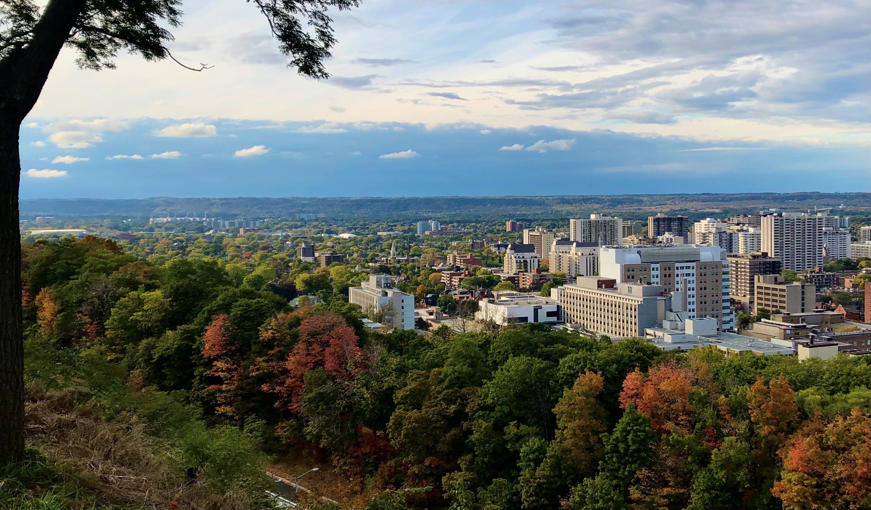
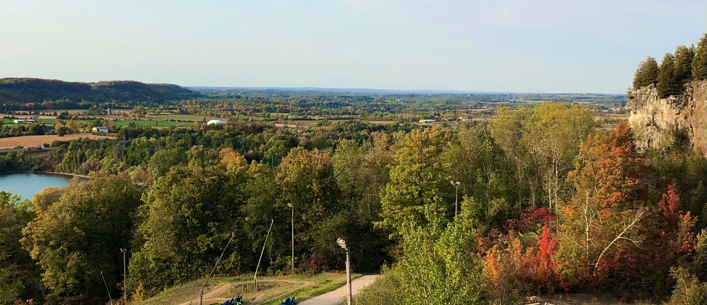
Any mountains from prehistoric times, in what is now called the Canadian Shield, have flattened thanks to erosion and the last ice age in Ontario. Unlike parts of New England all we have are rolling hills everywhere with the occasional high peak like the ones I'm standing on below. Took this shot on Saturday and the one below about 2.5 weeks ago.
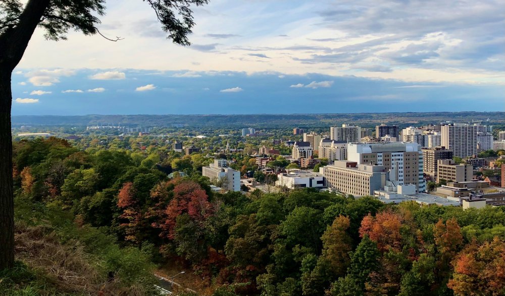
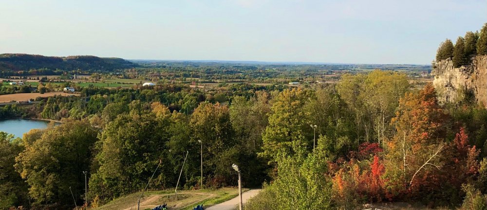
-
Nice. Typical mid-late Fall weather this week with a warming trend by the weekend. It's Thanksgiving this weekend in Canada so definitely looking forward to a stellar long weekend.
-
Upstate NY Banter and General Discussion..
Snowstorms replied to wolfie09's topic in Upstate New York/Pennsylvania
How is upstate NY doing considering you guys are our closest neighbor? Corona cases have been steadily rising here since late August. 732 cases today which is the highest daily count since this pandemic began. No real progression towards a second lockdown yet, however back in the summer they made masks mandatory in all indoor settings. As of now the border remains closed for all non-essential travel. -
There's a good chance this year could be one of the weakest flu seasons on record, in part thanks to Covid. I think another lockdown is quite possible but not to the extent we experienced earlier this year. I think many countries including USA are better managing the situation now compared to Mar/Apr. If anything they might close down certain restaurants, bars and other more crowded indoor spaces to limit the spread. At this point until we have a worldwide vaccine, no lockdown or restrictive measures will curb the spread. Where is the hot spot right now in the USA?
-
700 new cases today in Ontario setting a new single-day high record. 60% of them were in Toronto. After spending most of the summer with <100 cases per day, we've been rising exponentially since late August. Ironically, the province reopened Casino's today. Casinos in Ontario are run by the Ontario Lottery and Gaming Corporation which is a crown corporation owned by the Government. Schools have also resumed, and we've had dozens of cases linked to various schools. I feel as though a second lockdown is coming and could be far worse than anything we experienced back in Spring.
-
Going through this thread, I did not know how hard it is for most of the Mid Atl. to get some decent snow. Granted I would love to experience a blizzard like Jan 2016, Dec 2010 or Feb 2010. We don't get storms like that up this way. It's crazy how many variables need to come together for you guys to get even half decent snow. Up here we prefer La Nina's > El Nino's but that doesn't mean El Nino's are bad either. For example, our snowiest Nov is an El Nino (1940), our snowiest Dec is an El Nino (1951) and our 2nd snowiest Jan is also an El Nino (1966). Our top 2 coldest winters ever (DJF) are also El Nino's (1976-77 and 1969-70). However, our top 3 snowiest winters on record are La Nina's (1937-38, 1949-50 and 2007-08). Records go back to 1937 at the airport. But believe it or not our least snowiest winter on record is a La Nina (2011-12). 2009-10, the golden winter for Mid Atl., ended up as the 2nd least snowiest winter on record here. Two different ENSOs but with the same outcome. We can do pretty good here sometimes regardless of ENSO state. Even 1995-96 we nickeled and dimed our way up to 59" (14" above avg).
-
2019 ENSO
Snowstorms replied to AfewUniversesBelowNormal's topic in Weather Forecasting and Discussion
Latest MEI value is -1.0, which is the same as the previous bi-monthly value. Closest resemblance to this year based solely on the MEI value is 2007. The JA MEI value was already -2.4 back in 2010 as the Nina peaked in the Fall as I noted in my previous post. 1998-99 Nina isn't the greatest analog in my opinion as it came off the heels of a very strong El Nino and were much colder than 1995-96. -
2019 ENSO
Snowstorms replied to AfewUniversesBelowNormal's topic in Weather Forecasting and Discussion
Subsurface anomalies are still relatively cold across much of the ENSO regions with the exception of Nino 4 as you mentioned. However, one thing to keep in mind is that 2007 had similar subsurface anomalies across far western ENSO regions to date. We should see continued trade winds blowing over the ENSO regions with another strong easterly burst coming next week. We'll see what impact that has, but regardless the SOI is now in Nina territory. The MJO is expected to remain weak/inactive as per models so this La Nina will continue to strengthen over the next few weeks. As it stands right now, I suspect this Nina will peak in the winter as did 2007. -
Although we haven't yet reached our minimum sea ice extent/area for the year, winter has started again in northern Canada. https://weather.gc.ca/city/pages/nu-27_metric_e.html Resolute, Nunavut is losing 15 minutes of sunlight per day.
-
2019 ENSO
Snowstorms replied to AfewUniversesBelowNormal's topic in Weather Forecasting and Discussion
Most recent MEI value (JJ) was -1.0 which is borderline moderate La Nina. The new value for JA may come in higher as we've seen more progressive cooling across all ENSO regions through-out this month. Further cooling should continue over the next few weeks as a strong trade wind burst is expected next week esp over western ENSO regions. The new MEI v2 uses 5 variables compared to the old MEI which used 6. I prefer MEI as it takes into consideration all ENSO regions compared to ONI. -
They've made masks mandatory in all indoor settings including apartments and condominiums (public areas). Gyms and fitness centers finally opened up after being closed for nearly 5 months. I believe they're contemplating on keeping that US-Canada border closed until December.