Snowstorms
-
Posts
4,094 -
Joined
Content Type
Profiles
Blogs
Forums
American Weather
Media Demo
Store
Gallery
Everything posted by Snowstorms
-

Autumn/Winter 2019-2020 Banter/Complaint Thread
Snowstorms replied to IWXwx's topic in Lakes/Ohio Valley
The last time we saw a consistently cold and snowy winter from late Nov till March was 2013-14. And can you believe that winter was more than 5 years ago? Other winters since then: 2014-15: Nov, Jan-March 2015-16: Don't get me started 2016-17: Mostly Dec, the rest was just torch city 2017-18: All around decent minus mid Jan and second half of Feb 2018-19: Nov, Jan-early March Prior to 13-14, the only other consistent winters in recent times were 10-11 and 08-09. Ironically all 3 of them were cold neutrals or Nina's. -
Autumn/Winter 2019-2020 Banter/Complaint Thread
Snowstorms replied to IWXwx's topic in Lakes/Ohio Valley
Yeah Worcester has 25.3" this month. Seems like elite territory. It would be for most of us in the Lakes region. -
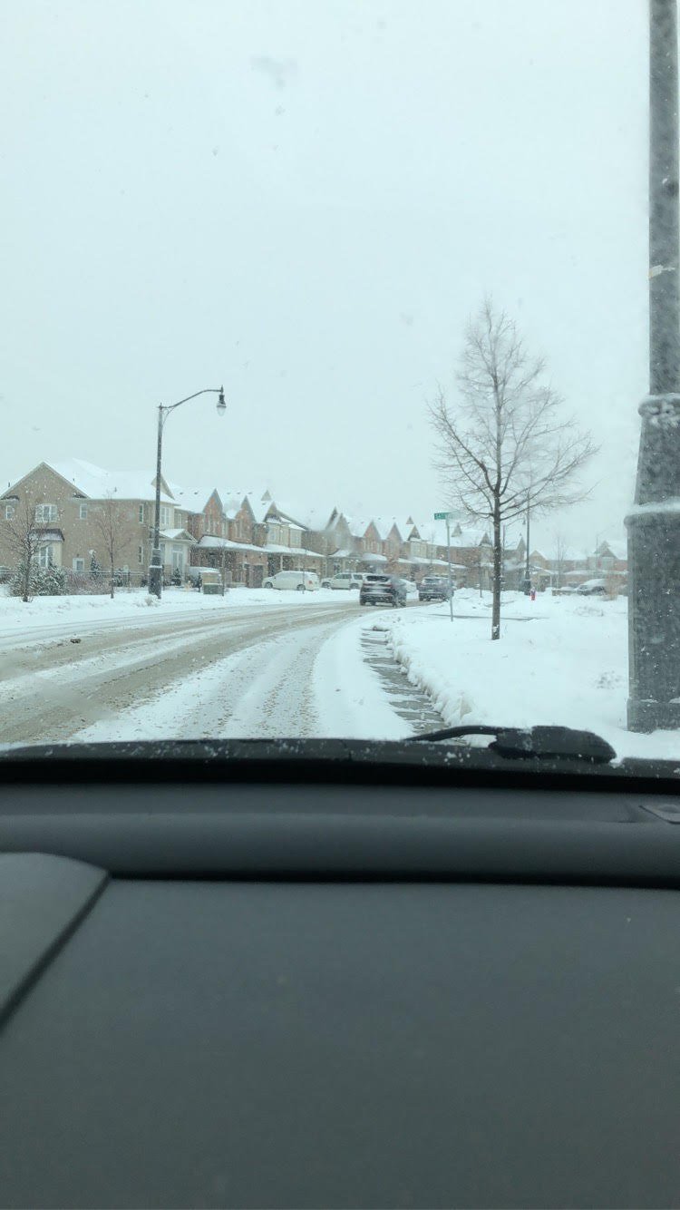
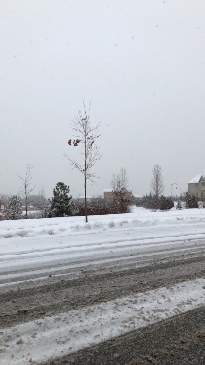
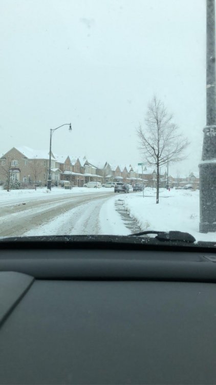
Just measured 2.8" right now. This wasn't picked up by any model btw. It's still snowing so I'd suspect we'll hit 3.0" when all is said and done. A few pics I took about an hour ago, around the Vaughan/Brampton border (5 minutes north of Toronto proper).
-
Autumn/Winter 2019-2020 Banter/Complaint Thread
Snowstorms replied to IWXwx's topic in Lakes/Ohio Valley
I was just scrolling through the New England forum and saw that this December is one of their top snowiest, not the snowiest ever. Some places are around 25-30+" already, lol. As Hoosier said, Nino Decembers are hit or miss unlike Nina's. -
Nice little burst of snow this morning. 1-2" possible across the GTA.
-
Autumn/Winter 2019-2020 Banter/Complaint Thread
Snowstorms replied to IWXwx's topic in Lakes/Ohio Valley
While some of us are dealing with a snowless and uneventful December, parts of the NE and New England are having one of their snowiest Decembers, lol. Quite the contrast. -
Winter 2019-20 Medium/Long Range Discussion
Snowstorms replied to Hoosier's topic in Lakes/Ohio Valley
I think none of us at this point would mind a repeat of the Jan 99 storm. This month would become a distant memory if it happened. -
Autumn/Winter 2019-2020 Banter/Complaint Thread
Snowstorms replied to IWXwx's topic in Lakes/Ohio Valley
The total accumulated precip map looks the same too. Legit not even a clipper or a fantasy 360 hr storm. -
Winter 2019-20 Medium/Long Range Discussion
Snowstorms replied to Hoosier's topic in Lakes/Ohio Valley
That Pacific pattern (jet streak below) gotta change and until it doesn't, we're going to be stuck in this regime. On the bright side, the GEFS is trying to build a ridge around Alaska near the end of December which should hopefully allow for a -EPO to develop. Anything to get out of this storm-less pattern. -
A weak Nina or cold neutral would do good for most of us especially after a +ENSO season. The strong +IOD is definitely playing a role in strengthening the Pacific Jet which is also correlated with +ENSO anomalies. It's been a mediocre month. Hoping for a turn around come January-February. On a side note, would be nice to experience a Nor'easter as the biggest storms up here are usually between 12-16". Cheers!
-
Winter 2019-20 Medium/Long Range Discussion
Snowstorms replied to Hoosier's topic in Lakes/Ohio Valley
Euro still remains storm free past Christmas. -
Winter 2019-20 Medium/Long Range Discussion
Snowstorms replied to Hoosier's topic in Lakes/Ohio Valley
12 years ago today, I remember the infamous winter storm that dropped 8-12+" from SEMI to the GTA. If only we could get a repeat, lol. -
3 of them were Nino's. As history can tell you, Nino December's don't tend to do well after a snowy and cold November. Overall, most Nino winters are usually rockin' by Jan-Feb.
-
Winter 2019-20 Medium/Long Range Discussion
Snowstorms replied to Hoosier's topic in Lakes/Ohio Valley
The entire 12z Euro is zzzzz. -
Same. And not happening, lol. Not a single storm on the models from now until Christmas. Unless the last 5 days of the month are rockin', this is going to turn out to be another crappy December. Gotta hope for a turnaround come January.
-
Euro nailed this tbh. The NAM should just be discontinued. It's not as consistent as it used to be. Onto the next.
-
Autumn/Winter 2019-2020 Banter/Complaint Thread
Snowstorms replied to IWXwx's topic in Lakes/Ohio Valley
I reckon, split flows are more common in Nino's. Then again, shit Decembers have been a common thing in recent years. What matters is Jan-Mar. -
Autumn/Winter 2019-2020 Banter/Complaint Thread
Snowstorms replied to IWXwx's topic in Lakes/Ohio Valley
The storm early next week is looking like a nuisance for some of us and there's legit nothing else between now and Christmas either. I have a feeling this thread will become quite active in the coming days, lol. -
Euro coming in further SE than the NAM. Safe to say this storm is pretty much a write-off for most of us given recent trends. But I'll give it till tonight's 00z runs.
-
The switchover happened a little quicker than I anticipated. Got around 0.5" (1.3cm) so far and its coming down pretty nicely right now. 29cm isn't bad. YYZ is sitting at 38cm. We seem to be on the higher end than most of Ontario, even compared to Ottawa. It's been a very quiet December. Wow, that's nice! I'm assuming for work? Vancouver is one of my fav places in Canada. El Nino's and BC snow don't mix well, but I hope you get atleast one storm this winter. Nice to have you back!
-
I don't remember it being this bad a few years ago. Perhaps it might be somehow correlated with the North Pacific Pattern and the big "warm blob".
-
To expand on what you guys had said, I don't know if EC has incorporated proper sampling data on the CMC or RGEM that far up north. If not, I'd expect alot of back and forth with the models till atleast tomorrow night. I know EC has limited data coverage away from major cities.
-
HRDPS is still quite bullish on snow amounts for the GTA, lol. I don't think any of us will get anymore than an inch. Hows Oakville on the season?
-
Euro south, almost similar to GFS. Storm cancel..
-
I seen that, but I have my doubts. Both HRDPS and Nam keep sfc temps around the freezing mark. I think those around King Road and north have the best chance for accumulating snowfall (>2"). I'm going with Trace to max 1" near the lake.