Snowstorms
-
Posts
4,094 -
Joined
Content Type
Profiles
Blogs
Forums
American Weather
Media Demo
Store
Gallery
Everything posted by Snowstorms
-

Upstate/Eastern New York
Snowstorms replied to BuffaloWeather's topic in Upstate New York/Pennsylvania
The only storm in recent times that I can think of that even comes remotely close to the set-up depicted on the models would be the late Feb 2010 storm. See link below and look at the 500mb maps and Sea Level Pressure maps. http://www.raymondcmartinjr.com/weather/2010/25-Feb-10-NationalRadarImagery.html -
Winter 2020-21 Medium/Long Range Discussion
Snowstorms replied to Hoosier's topic in Lakes/Ohio Valley
Now we got the PNA ridge in 2020. -
Winter 2020-21 Medium/Long Range Discussion
Snowstorms replied to Hoosier's topic in Lakes/Ohio Valley
The leading ridge out ahead of the Low sort of becomes a temporary block (like a West Based -NAO) and the upper level ridge kind of becomes one with the massive PNA ridge out west. That's why it stalls out. Very unusual yeah. -
Winter 2020-21 Medium/Long Range Discussion
Snowstorms replied to Hoosier's topic in Lakes/Ohio Valley
I'll take the Euro about 100-150 miles further east. -
Dec 95 wasn't as nearly as good as the other 3. Only got 13.3" locally which is only slightly above our monthly avg. Whereas we got >25" in Dec 1975, 2007 and 2008.
-
Winter 2020-21 Medium/Long Range Discussion
Snowstorms replied to Hoosier's topic in Lakes/Ohio Valley
The entire thing looks like a mess on the GFS esp that vort map. -
Jan 2009 redux? Albeit the AO was slightly positive that month.
-
November 2020 General Discussion
Snowstorms replied to SchaumburgStormer's topic in Lakes/Ohio Valley
Still got about 3-4" on the ground from the storm on Sunday. Models have about 1-2" tonight across Toronto before the changeover. Closer to 1cm near the Lake. -
Western Canada is torching, Ontario is torching, we're all torching. The entire "source region" is above freezing first week of Dec.
-
November 2020 General Discussion
Snowstorms replied to SchaumburgStormer's topic in Lakes/Ohio Valley
That Nov 1950 storm is YYZ's second largest November storm on record. 12" in a single day and a final total of 15". But I can see why DTW got 6.3". Temps were marginal. Was it a Gulf Low? -
Winter 2020-21 Medium/Long Range Discussion
Snowstorms replied to Hoosier's topic in Lakes/Ohio Valley
The Euro did a 500 mile shift in one run. And they say the GFS is bad. -
Upstate/Eastern New York
Snowstorms replied to BuffaloWeather's topic in Upstate New York/Pennsylvania
As of this morning were at 8.3" for the season. So about 18% of our yearly snowfall. Wish we got more but an east-west wind orientation off Lake Ontario is rare. You guys in Upstate NY get all the fun from Lake Ontario. -
November 2020 General Discussion
Snowstorms replied to SchaumburgStormer's topic in Lakes/Ohio Valley
7.5" at YYZ as of 9:00pm. Unofficially the third largest storm ever recorded at YYZ in November. Out of the top 10, there's been 5 since 1991 including last year. Just measured 8.8" at my house. Some compaction going on as it was heavy wet snow. -
November 2020 General Discussion
Snowstorms replied to SchaumburgStormer's topic in Lakes/Ohio Valley
After all the crap Kitchener went thru in the summer its finally winning eh. -
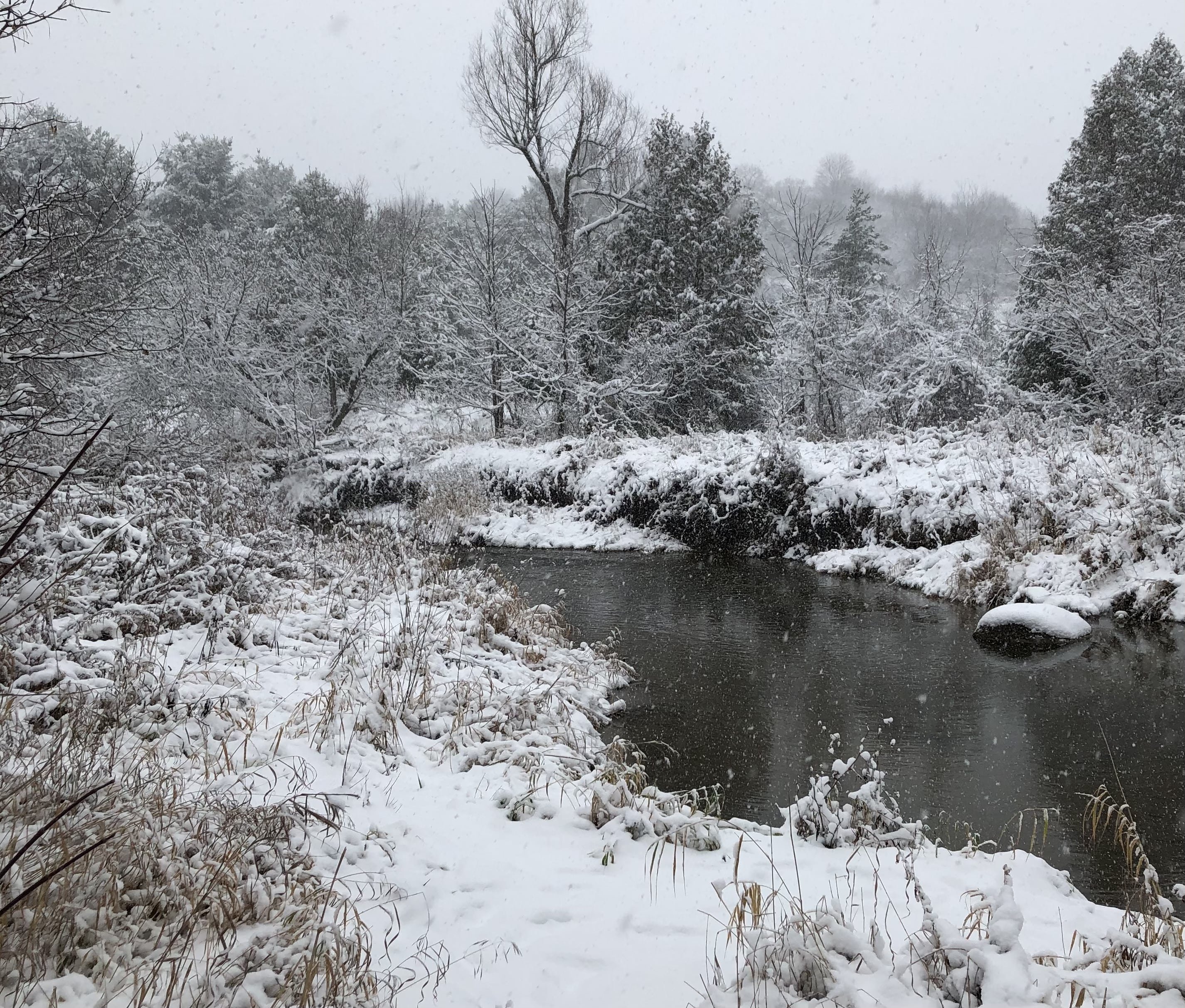
We're getting a nice snowstorm up this way today. Nearing 8" and still snowing steadily.

-
November 2020 General Discussion
Snowstorms replied to SchaumburgStormer's topic in Lakes/Ohio Valley
Yup. Quite the gradient across the area. A lot of areas near the Lake, like yourself, had minimal accumulations but as soon as you went 20km inland, amounts picked up drastically. 19.2cm (7.5") as of 6pm in my area. It'll likely be the third largest November storm ever recorded in a single day at YYZ. Top 2 records are >30cm (12"). Haha. Three back to back snowy Novembers is a big win in my books especially after going 2009-2012, 2015 and 2016 completely snowless. I was doubtful yesterday as we were riding a thin line with the mixing line so close by but thanks to strong dynamic cooling, we lucked out. ~2" is still not bad given the historic warmth we experienced less than 2 weeks ago. I'm sure it's better than that 2009-2012 run for Detroit as well. -
November 2020 General Discussion
Snowstorms replied to SchaumburgStormer's topic in Lakes/Ohio Valley
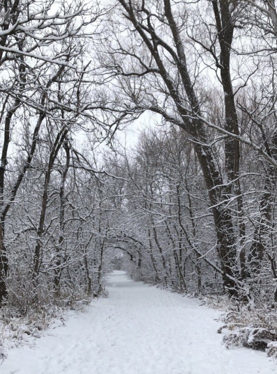
Got out of my house today after a week since I had my wisdom teeth out. Took a couple shots of the snow just north of my house. YYZ is reporting 5.2" as of 4pm. I just measured 6.5" and it's been coming down steadily. Going to make a run for 8" if not more at this rate. What a freaking surprise storm. Let it snow.
-
November 2020 General Discussion
Snowstorms replied to SchaumburgStormer's topic in Lakes/Ohio Valley
Really coming down now. Just measured 2.5" (6.3cm). -
Getting a nice winter storm today. Could end up with a good 4-6" by tonight but it'll melt by mid week. The storm later this month is intriguing. If it pans out, I wouldn't be surprised to see our first widespread lake effect snow outbreak. That would lay down a nice snow pack across the Lakes area.
-
November 2020 General Discussion
Snowstorms replied to SchaumburgStormer's topic in Lakes/Ohio Valley
YYZ currently reporting SN with visibility down to 0.5 miles. Up to 1.5" as of 11:00am in my area and coming down nicely. EC has issued a weather advisory for Toronto calling for upwards of 6" by tonight. -
November 2020 General Discussion
Snowstorms replied to SchaumburgStormer's topic in Lakes/Ohio Valley
I think Kitchener could get 10-15cm. Higher elevation and more dynamic cooling. You'll be in the sweet spot. -
Upstate/Eastern New York
Snowstorms replied to BuffaloWeather's topic in Upstate New York/Pennsylvania
Looks like a Nino if you ask me but it's not a bad look. Very strange given the background moderate La Nina. On the plus side, models have been slowly weakening the AK vortex. Hopefully we can build some ridging up in the Aleutians and get Canada cold later in December. -
November 2020 General Discussion
Snowstorms replied to SchaumburgStormer's topic in Lakes/Ohio Valley
Growing confident for tomorrows event. There seems to be a model wide consensus regarding amounts for Toronto and surrounding areas. Those near the Lake accumulations will likely remain <1" (~3cm). But as you get away from the Lake towards the 401 and further north, accumulations will pick up drastically. As it stands now, I'm going with 2.5" (4-6cm) for Toronto (YYZ) and upwards of 4-6" (10-15cm) for areas in Vaughan, Brampton and further north. If dynamic cooling initiates earlier and quicker, then there's a good chance Toronto could over perform. EC has issued widespread weather statements. 2-4" (5-10cm) for Toronto -
28 day closure. Schools, daycare and liquor stores remain open too. But capacity in the stores open will be reduced to 50% at a time.
-
Toronto going into a lockdown Mon @12:00am. All gyms, fitness centers, restaurants, bars, hair salons, recreational centers, casinos, convention centers and I believe shopping malls are all closing. Only essential stores like grocery stores and department stores will remain open. All restaurants will be offering curb-side pick up or delivery only, no dine-in. We been averaging >1000 cases a day for a few weeks now. When compared to you guys its nothing obviously but 85% of these 1000+ are in the Toronto area. Hopefully other American cities follow through.