andyhb
-
Posts
19,888 -
Joined
-
Last visited
Content Type
Profiles
Blogs
Forums
American Weather
Media Demo
Store
Gallery
Everything posted by andyhb
-
Pretty nasty environment near the warm front in N IN right now.
-
Today and tomorrow look pretty volatile across a fairly large expanse of real estate. Indiana today seems like the best bet for chasing, good recovery going on in behind the earlier line of storms plus winds are staying more backed than the RAP was indicating.
-
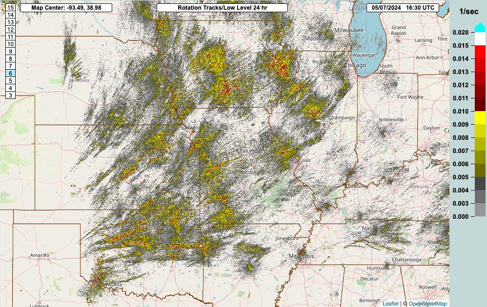
Just going to point out that 9 times out of 10 when you see an MRMS rotation track map like this, you'd be wondering "was that a high risk" or something like that. I believe the processes that happened to cause N/W OK and S KS to underperform occurred on timescales shorter than outlook forecasts are meant to cover. To put it in simpler terms, the high risk was warranted, but it was death by a thousand paper cuts storm morphology wise. That Hennessey OK storm would've dropped an absolutely monstrous tornado had it not been seeded by the storm in behind, resulting in too much precip in the RFD. Other storms looked reasonable early and at one point we had a string of 4-5 discrete/semi-discrete supercells -> i.e. the incipient states of a tornado outbreak, but it seems they took just ever so slightly (perhaps less than an hour) too long to reach the really high theta-e air that was closer to I-40 and, say, US 281. Also the storms that formed in SW OK later were dealing with veered winds near the Pacific cold front and probably were having difficulty not being undercut by the same front. Had they propagated slightly off the front -> yikes.
-
That is a terrifying image.
-
2 fatalities in Barnsdall per scanner.
-
That Barnsdall tornado is high end.
-
Great contribution. I don't know if you want to see the results of a non-linear solution in the parameter space being suggested here.
-
Major tornado south of Robert Lee now. 70 kt VROT.
-
-
Large cone tornado near Robert Lee TX on Reed's live stream.
-
That tornado was ridiculous, and also caused significant damage.
-
Tornado looks imminent heading towards Abilene.
-
Good lord.
-
Also on Freddy McKinney's live stream. 6 of the last 7 days have had tornadoes now.
-
Tornado in progress on the Anson TX supercell and there was one earlier near Ballinger as well.
-

2024 Short/Medium Range Severe Weather Discussion
andyhb replied to Chicago Storm's topic in Lakes/Ohio Valley
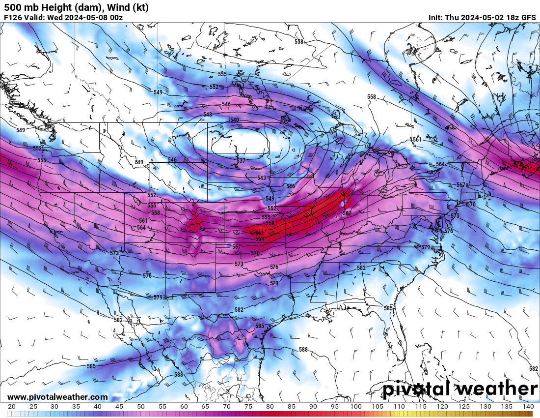
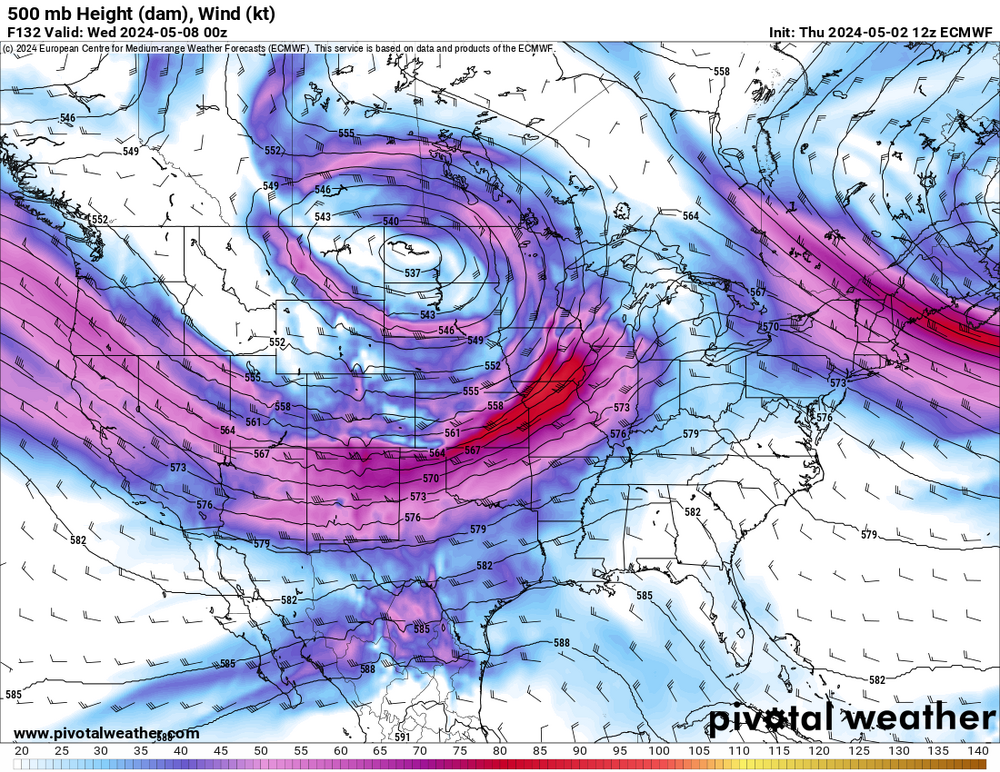
Tuesday has some serious potential pending the convection from Monday. You do not troughs of this magnitude come through in May very often and that secondary jet streak rotating around the southern periphery of the occluded upper low should amplify flow fields considerably with a (potentially) very large and strongly unstable warm sector available.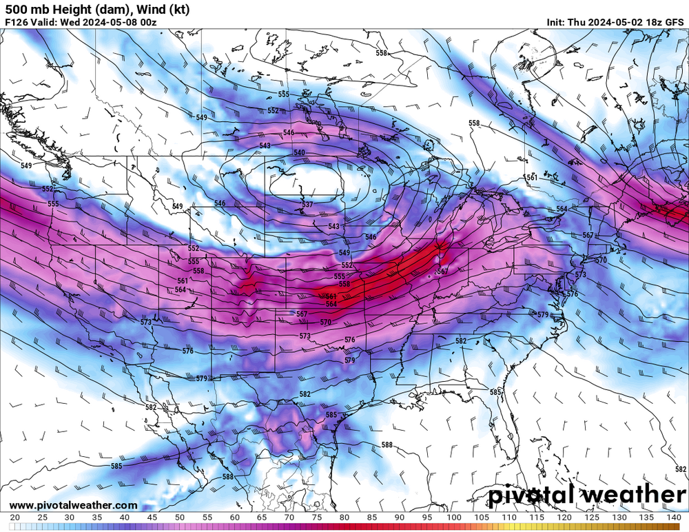
-
12z guidance looks overall pretty dangerous on Monday, especially in KS. Some big time dates popping up in both the Great Plains and Southern Plains sectors of the 12z CIPS analogs. Biggest questions are again going to be related to trough timing (how much does it slow down) and amplitude.
-
Best shots I've seen of the Hollister wedge.
-
And now a major anticyclonic tornado with a very strong TDS just south of the original tornado. This is absolutely insane.
-
Violent tornado east of Hollister, nearly stationary.
-
Big cone tornado on Vermilion.
-
Spectacular tornado near Westmoreland KS right now.
-
2024 Short/Medium Range Severe Weather Discussion
andyhb replied to Chicago Storm's topic in Lakes/Ohio Valley
Fatality confirmed from the Winchester IN tornado from 3/14. -
Sulphur OK tornado rated prelim EF3 by OUN.
-
Okemah got spared. Dickson on the other hand is in very dire straits right now.