andyhb
-
Posts
19,888 -
Joined
-
Last visited
Content Type
Profiles
Blogs
Forums
American Weather
Media Demo
Store
Gallery
Everything posted by andyhb
-
Columbia MO supercell is looking volatile.
-
Got a couple of cells going up SE of Kansas City. Lead shortwave appears to be impinging on the warm sector.
-
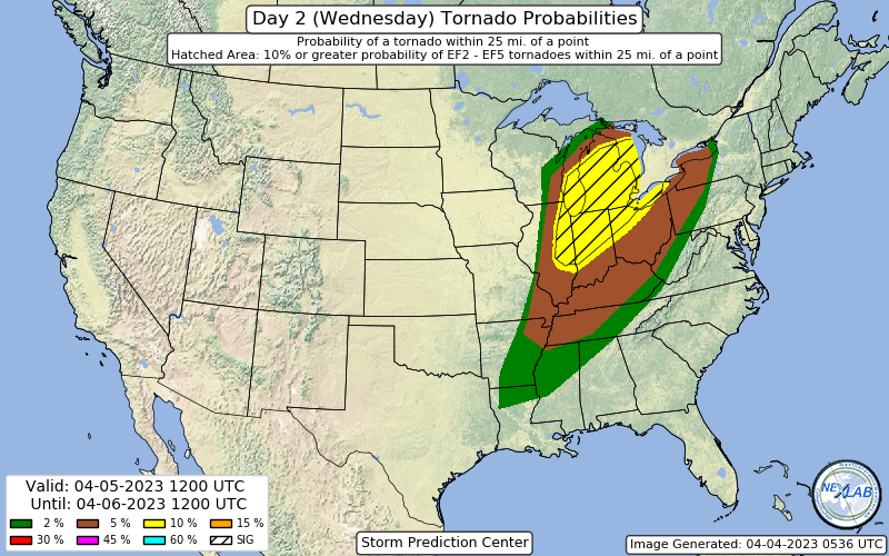
Huge 10% hatched in the latest D2 for Wednesday, including some seriously large population centers. Chicago and east could get very interesting from early on Wednesday.
-
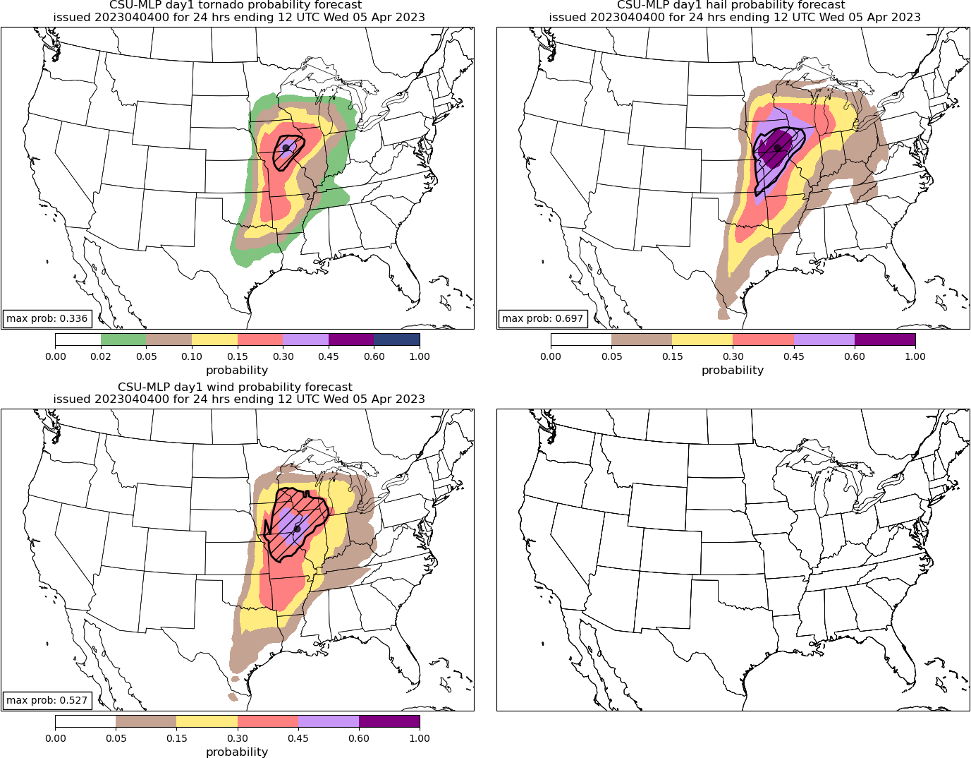
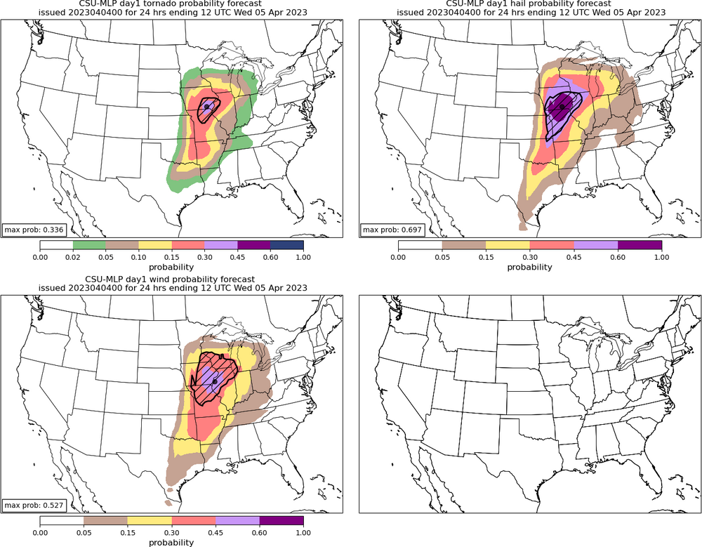
New CSU has a 30% hatched tornado area (high risk equivalent) for the IA/IL/MO triple point region tomorrow. Large 60% hatched hail and 45% hatched wind to accompany it centered on the same area.
-
NSSL WRF also with a monstrous cell tracking from NE MO into W IL in the afternoon. Environment around it is stupidly high end. Edit: ARW too.
-
Re: mixing tomorrow and resultant high LFCs and LCLs on the HRRR.
-
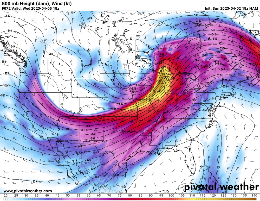
Remains a strong convective signal on the Euro roughly encompassing the current D2 MDT zone, in a highly favorable parameter space.
-
HRRR has problems with LCL heights early in MO, highlighting the concern with mixing (although it tends to be too aggressive with that).
-
Think this one is off timed for the Chicago area. Biggest threat is west on Tuesday, east on Wednesday.
-
That is classic for a significant Great Lakes severe event. Timing/destabilization pending of course.
-
Wednesday has potential to be significant in the Lakes if there’s enough destabilization, 500 mb setup is consistent with some of the bigger early season events in the area.
-
2 additional fatalities in Owen Co. IN.
-
One limiting factor with this may be mixing if we get near the progged high temperatures from some of the models. LCL heights would be an issue.
-

2023 Mid-Atlantic Severe Wx Thread (General Discussion)
andyhb replied to Kmlwx's topic in Mid Atlantic
Reports out of Sussex Co. DE are not good.- 2,785 replies
-
- 3
-

-
- severe
- thunderstorms
- (and 3 more)
-
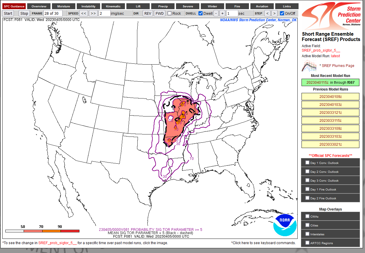
Amazingly high probabilities of STP ≥ 5 over a large area for Tuesday 81 hours out from the 15z SREF. Never seen anything like that at this range.

-
Strong tornado passing very close to the DOX radar right now.
-
HRRR is trying for Mullica Hill part II. Parameter space around that modeled cell is impressive if it does go.
-
That's at 03z and also I have strong doubt that it is going to be 66 degrees at that time given the magnitude of WAA with this trough. NAM tends to be cold biased.
-
Sullivan IN tornado prelim EF3, 155 mph per IND.
-
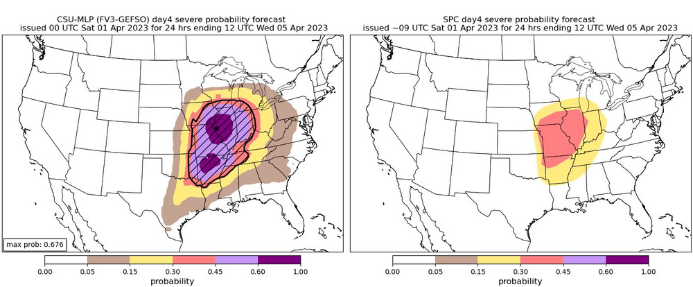
The CSU MLP for Tuesday is absolutely maxed out. Two 60+% areas across AR and closer to the low in MO/IA/IL. First time I’ve seen that.
-
At least 7 dead in McNairy Co. TN from the long tracked tornado last night (the one Fred Gossage was covering). At least 3 dead in Robinson IL and 3 dead in Sullivan IN. 4 dead in Wynne AR.
-
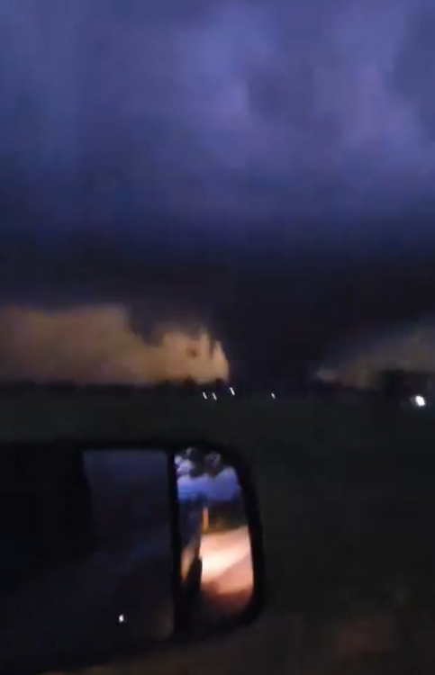
This video is incredible. Deserves more exposure.
-
Another strong tornado in progress near the AL/TN state line north of Hazel Green.
-
2 dead in Sullivan IN per police thus far.
-
Robinson IL tornado from earlier.