andyhb
-
Posts
19,888 -
Joined
-
Last visited
Content Type
Profiles
Blogs
Forums
American Weather
Media Demo
Store
Gallery
Everything posted by andyhb
-

Thursday, July 27, 2023 Severe Weather Potential
andyhb replied to weatherwiz's topic in New England
No EML = no bueno in the Northeast. Banacos and Ekster 2010, all. -
Classic Michigan underperformance... again.
-
Thursday, July 27, 2023 Severe Weather Potential
andyhb replied to weatherwiz's topic in New England
Feel like the low magnitude of deep layer shear and iffy mid-level lapse rates/lack of an EML are going to curb this a fair amount. Would assume messy storm mode. -
2023 Short/Medium Range Severe Weather Discussion
andyhb replied to Chicago Storm's topic in Lakes/Ohio Valley
Easy sig tor in this video. -
2023 Short/Medium Range Severe Weather Discussion
andyhb replied to Chicago Storm's topic in Lakes/Ohio Valley
The larger of the twins out west looked strong from the video. -
2023 Short/Medium Range Severe Weather Discussion
andyhb replied to Chicago Storm's topic in Lakes/Ohio Valley
You sure about that? RAP seems behind on recovery. -
No seriously, what a fucking terrible survey that was after learning more about it. Especially compared to the one from the Didsbury AB tornado from 7/1.
-
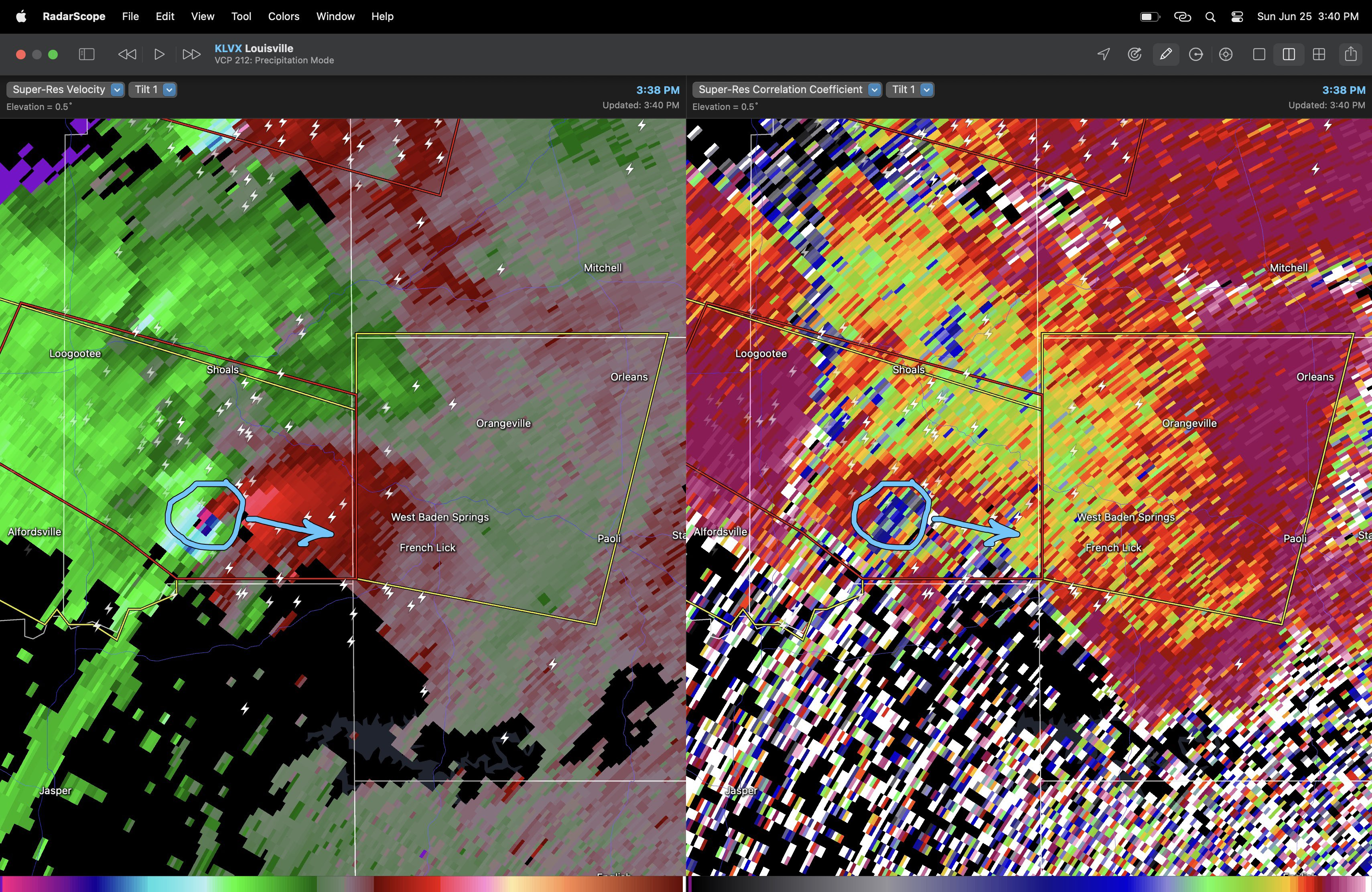
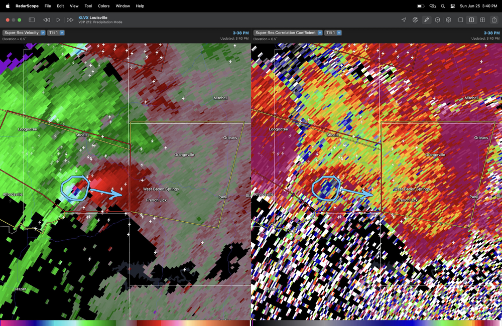
First damage I've seen out of the Shoals IN area.
-
20k feet at least. Can confirm there was never a TORR on it despite the TDS and intense couplet as it moved from the IND to LMK CWAs.
-
That was a hell of a signature from LVX when it was passing south of Shoals. The damage out there is probably significant.
-
Is there any more information from this one? That tornado appeared to be strong-violent based on the intensity of the mesocyclone and the height of the TDS.
-
-
Convective overturning earlier looks to have stabilized the low levels towards Louisville. Might be done for now.
-
Holy hell…
-
Major tornado in progress east of Alfordsville IN.
-
About to be a tornado outbreak in S IN and N KY.
-
TDS Crane IN. Also definitely a tornado in the southern suburbs of Indy.
-
Cell SE of Terre Haute could be a real problem in short order here. Meso is very strong from all area radars.
-
I have... thoughts about this, but it's probably not worth getting into a long debate about again. All I'll say is that if this tornado is rated the same as the Cole OK or Lake City IL EF3s earlier this year, that is a pretty damning indicator of the flaws of the EF-scale and how it is applied.
-
2023 Short/Medium Range Severe Weather Discussion
andyhb replied to Chicago Storm's topic in Lakes/Ohio Valley
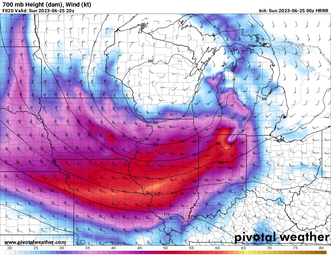
Tomorrow looks pretty impressive to me over Indiana and vicinity. Seems to have the ceiling of a significant regional event given the magnitude of the incoming trough, seasonably strong mid level flow, and potentially favorable storm mode/shear profiles.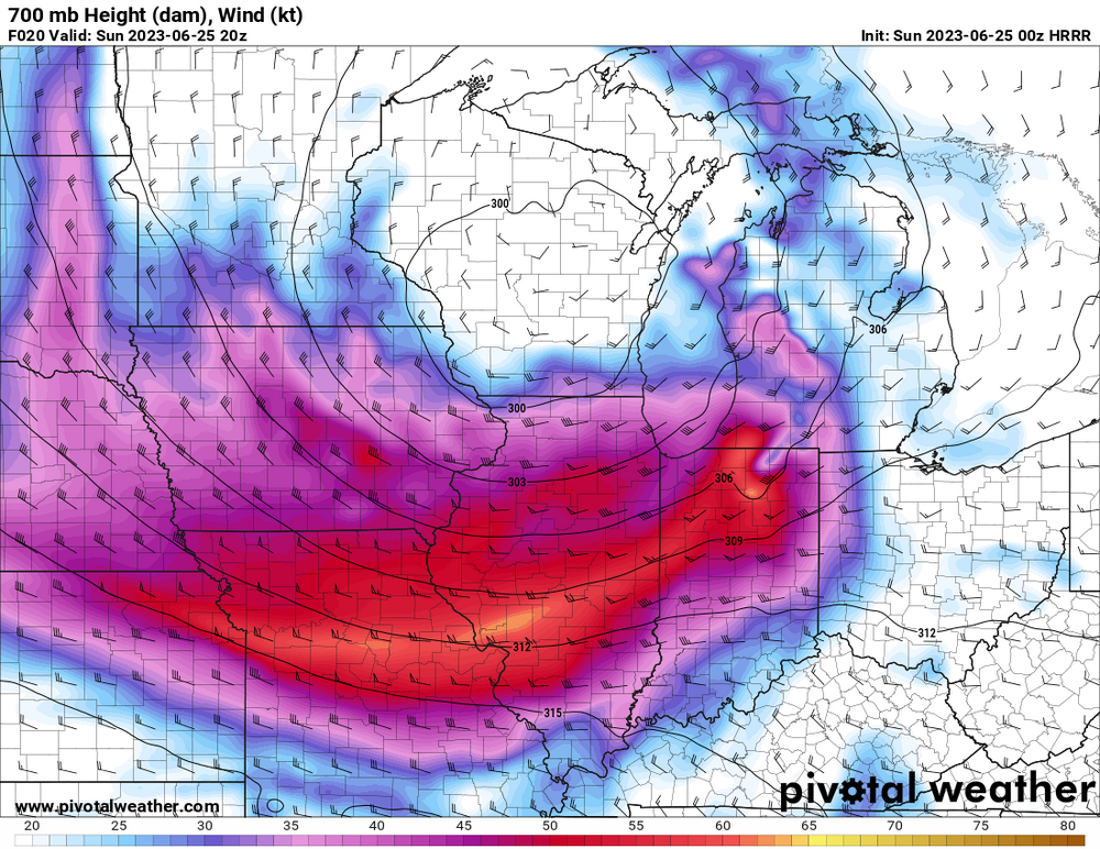
-
Major tornado damage S of Grenada CO from the earlier long-lived tornado that @Quincy was chasing.
-
Significant tornado appears to have impacted the North Antelope Coal Mine near Wright WY earlier with the long-lived supercell that moved through central and NE WY. Appears there are people missing and heavy damage including a train derailment.
-
Large tornado in progress south of Midwest WY (north of Casper). Likely significant.
-
https://www.facebook.com/tim.marshall.505/posts/pfbid02RJKCvrhXebooqJXuRpa5FchsPcWhtV4aS8GbgJS1gXVdyNGf1wCFNCZrZuVpsopl This damage in Matador is crazy.
-
Damage reported in Highlands Ranch via Aaron Rigsby.