-
Posts
5,005 -
Joined
-
Last visited
About turtlehurricane

Profile Information
-
Four Letter Airport Code For Weather Obs (Such as KDCA)
KFLL
-
Gender
Not Telling
-
Location:
Space
Recent Profile Visitors
The recent visitors block is disabled and is not being shown to other users.
-
I’ve been trying to convince my brother in Crawfordville to evacuate. It’s leaning more and more towards directly hitting him. And he only has plywood shutters. Even as much as I love hurricanes, I would evacuate if I didn’t have proper shutters in a situation like this.
-
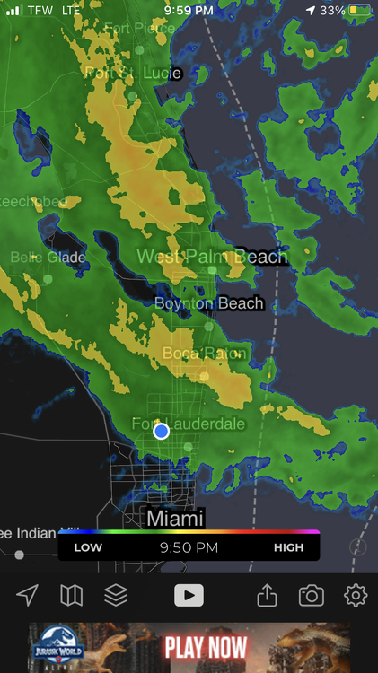
Got some classic post-band stratiform light rain ongoing. Overall I am underwhelmed at the short duration of this event…. Gonna give my wife some Cat 5 loving and get some rest. Then I’ll have a breakfast of champions including eggs, pancakes, sweet potatoes, coffee, Kratom, & Adderall, and I’ll watch the show. This is gonna be an interesting next 12 hours no doubt, and perfect timing so I can go into full storm mode and see the whole thing without it interfering with my daily business responsibilities
-
I think it's very likely to hit Category 4-5 intensity. The waters are just absolutely rocket fuel like never before, which is why the convection has been firing non-stop at full power. -- Also it got past Cuba without disruption and actually got way more organized, so now it has a solid 48 hours to rapidly intensify, when all it needs is 24 hours to hit Cat 4-5.... It's not even the best upper level environment ever. It would take alot of wind shear to stop it from going all the way though. Eye popping out on satellite now. By the morning we will probably have a nice and big drilled-down eye https://weather.cod.edu/satrad/?parms=meso-meso1-13-24-1-50-1&checked=map&colorbar=undefined
-
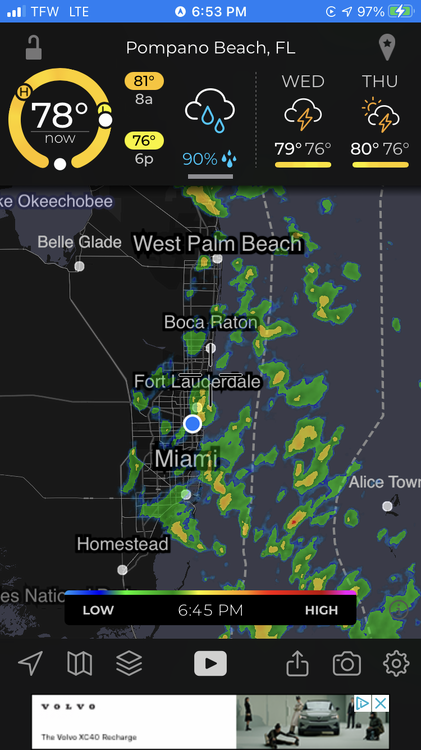
We had some decent flooding rains in Miami today on the outer-edges of Idalia. I think the coming day could be very interesting as the Hurricane makes its closest approach, probably will get alot of strong rain bands across all of Southeast Florida. The WPC forecast via the NHC says 2-4 inches of rain are coming, and NHC says we should see 35 mph gusts during the height of it.... it's just enough that they've been issuing Hurricane Local Statements for the area. Anyone else noticing the trend that's developed, with Idalia circling back and then hitting South Florida from the east in about a week https://moe.met.fsu.edu/cgi-bin/gfstc2.cgi?time=2023082818&field=Sea+Level+Pressure&hour=Animation This happened once before in my life with another TC that I don't remember off the top of my head, and it'll probably be a weak tropical storm at that point, if it happens at all.
-
Yup, this is exactly what it’s reminding me of! The giant primary band has made it here, and this is effectively the eyewall. Conditions are becoming much more intense and sustained very quickly. It appears the most intense part of the hurricane is likely to make it here. It’s sliding through Boca Raton and rapidly heading towards the Broward metro area. Also notably, it smells like the ocean! Literally the same smell as the beach when you’re standing next to breaking waves. It’s really nice
-
I cannot properly describe with words how eery and awe inspiring it is outside right now. Constant wind and rain. I can feel the power in the air, and it is the same look and feel as when we got real hurricanes in the past. Outer bands keep popping up and hitting us, we’re in a zone with extremely exotic dynamics, near the boundary of the inner and outer band zones. The clouds are just roaring along at the speed of a car on the highway
-
This is gonna be such a good day to be a hurricane meteorologist in Southeast Florida. We’re already getting one intense band after the next, and the hurricane will be rapidly getting closer and stronger as the day progresses. I think Cat 3 landfall is quite likely. Conditions are extremely favorable and it will go insane over the Gulf Stream. It could also directly hit the densely populated Southeast Florida metro area. It might even track as far south as Miami. This is not a minimal hurricane situation at all. This is an extremely powerful hurricane in the making.
- 332 replies
-
- 10
-

-

-

-
Outer bands are here. It’s getting wild. I’m out trying to get supplies. Neglected preparations due to work… it was my own choice so I can’t complain…
-
Hurricane Watch here in Broward County Florida!!! It's been so long since we were so deep in the cone and got watches so early. I am beginning to go crazy but will have to save the meteorological analysis for after work.
-
-
The weather here has shifted drastically throughout the past 24 hours. Heavy rain showers coming off the ocean are becoming increasingly frequent, plus it is quite breezy. This whole week is basically gonna be a hurricane situation, and the weather is already setting the mood. Im quite excited to see how this pans out on satellite, it seems to be a hybrid super-storm situation.
-
I feel that this is the one, finally. I’m gonna go crazy.
-
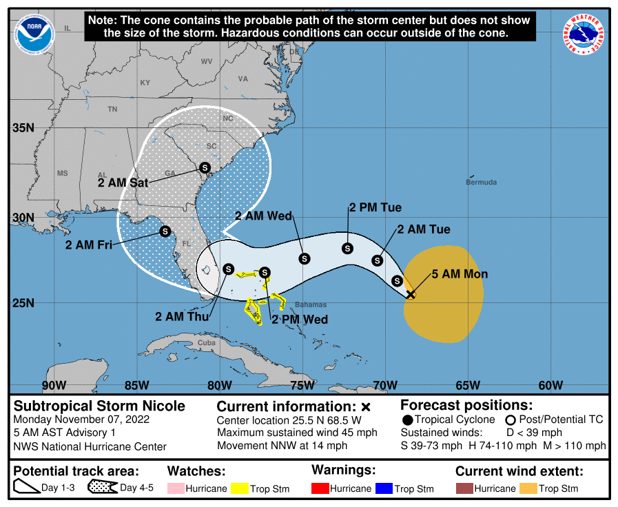
Winds picked up and are blasting against my windows. Simultaneously, temperature and dew point has dropped drastically, and I went outside and it feels like Fall! Ian dragged the 1st cold front of the season down here. likewise, this is not really a tropical cyclone anymore. It’s definitely sub-tropical at this point, and soon to be extra-tropical. Not to be underestimated tho, sub-tropical cyclones like Ian have enormous wind fields.
-
The frictional convergence enhancement is definitely in play. I wish there was a plane in there, likely an unquestionable Cat 5 right now, if we had the data. That eastern jog is bringing the inner region of constant spiral bands (and also this region is the extent of the CDO) very close to the SE FL metro areas. Currently these 'inner bands' extend as far as the Everglades in Broward. I think it'll get here. In the meantime, constant 20-40 mph gusts even without any rain. Further, the weather could get quite crazy in SE FL when this hits land and angular momentum spreads out rapidly. Angular momentum spreading out should come in the form of enhanced spiral band activity. Also, it is a clear and hot day in Cuba, and the CAPE from there is being advected right into South Florida. So although things have been quiet for several hours, I don't think it will be quiet for long here, and this has strong potential to be a memorable hurricane event in SE FL. P.S. I am only 130 miles from the eyewall of a cat 5 hurricane. it's crazy to think about.
-
As I stated earlier, I am not surprised. I did my PHD work on this exact thing. Vorticity-rich air from the coastline/land is feeding into the eyewall. The amount of vorticity generated as hurricane winds collide with land is enormous, and this is tilted up in the eyewall, creating super-charged vortical convective towers. Plus all this happened right at DMAX


