forkyfork
-
Posts
30,803 -
Joined
-
Last visited
Content Type
Profiles
Blogs
Forums
American Weather
Media Demo
Store
Gallery
Everything posted by forkyfork
-
what point are you trying to make
-
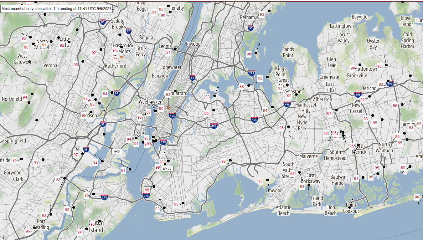
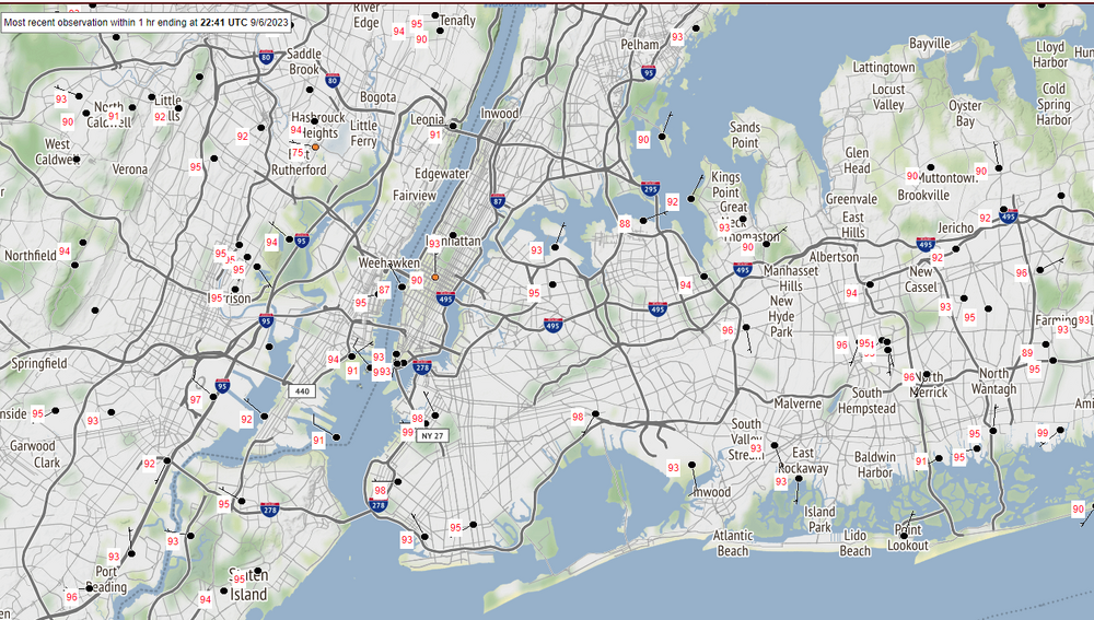
lots of 95+ highs in the city today including two 99s. the park's temps are bullshit, sorry you don't like when people point it out
-

Wake Me Up When September Ends..Obs/Diso
forkyfork replied to 40/70 Benchmark's topic in New England
with a top ten warm july sprinkled in -
Wake Me Up When September Ends..Obs/Diso
forkyfork replied to 40/70 Benchmark's topic in New England
actually moist air contains more heat than dry air -
Wake Me Up When September Ends..Obs/Diso
forkyfork replied to 40/70 Benchmark's topic in New England
is the heat ending tonight?
-
Wake Me Up When September Ends..Obs/Diso
forkyfork replied to 40/70 Benchmark's topic in New England
this is like 2009 without the cold summer part -
what a beautiful morning
-
seaside heights wild mouse carried into central park
-
farmingdale broke a record today but to be fair its period of record is short
-
-
nothing counts as hot anymore
-
record highs at ewr and isp today
-
Extended summer stormlover74 future snow hole banter thread 23
forkyfork replied to BxEngine's topic in New York City Metro
it'll be 97 in october -
team sports
-
this is the hottest us open i've been to
-
day 2 of 90+ with the hottest days to come
-
the most hyped up batch of light showers ever
-
Extended summer stormlover74 future snow hole banter thread 23
forkyfork replied to BxEngine's topic in New York City Metro
has anyone ever dealt with family betrayal? my sister said she hates summer -
going up fast
-
90 at newark
-
i hope the garden gnomes appreciate it
-
visiting my sister in stanhope and the temp is recovering fast
-
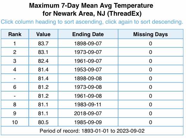
the airport history begins in 1931 so 1898 might have brick building issues
-
credit to @TimB for making this
-
hottest sept week in history?